


Bad Segeberg, Germany
Bad Segeberg is a town of 16,052 people in Schleswig-Holstein, Germany.
Why visit Bad Segeberg
Townapedia lists 28 museums and landmarks, 9 parks and trails, 66 places to eat, 10 places to stay and 7 attractions in and around town.
Highlights include Karl-May-Spiele, Kalkberg Stadium, Lübeck-Segeberger Eisenbahn and Noctalis – Welt der Fledermäuse.
Weather in Bad Segeberg
Forecast from MET Norway (CC BY 4.0). Full forecast
About Bad Segeberg
Bad Segeberg (German: [baːt ˈzeːɡəbɛʁk] ; Low German: Sebarg) is a German town of 16,000 inhabitants, located in the state of Schleswig-Holstein, capital of the district (Kreis) Segeberg. It is situated approximately 50 kilometers (31 mi) northeast of Hamburg, and 25 kilometers (16 mi) west of Lübeck.
From the Wikipedia article Bad Segeberg (this version), under CC BY-SA 4.0.
Travel tips from other travellers: Bad Segeberg on Wikivoyage (CC BY-SA 4.0).
Things to do7


Kalkberg Stadium
Cinema and theater · 0.7 km
Open-air theatre in Bad Segeberg, Germany




Museums and landmarks28

Noctalis – Welt der Fledermäuse
Museum · 0.6 km
Betreiber: Fledermaus-Zentrum GmbH
27 Oberbergstraße, Bad Segeberg
Mo-Fr 09:00-18:00, Sa-Su 10:00-18:00; Oct-Mar: Mo-Fr 09:00-17:00...


Dampf-Bahn-Club Holstein
Monument and historic site · 3.5 km
9 Hamdorfer Weg, Schackendorf
May-Oct: Su[1] 13:00-17:00; Jul: Su[1] 10:00-17:00

Wasserturm
Monument and historic site · 0.7 km
Wasserturm Bad Segeberg


16 more on the map.
Parks, trails and playgrounds9


Aqua Fun Bad Segeberg
Sports field and stadium
12 Theodor-Storm-Straße, Bad Segeberg
"AN FEIERTAGEN GESCHLOSSEN"



Restaurants and cafes66

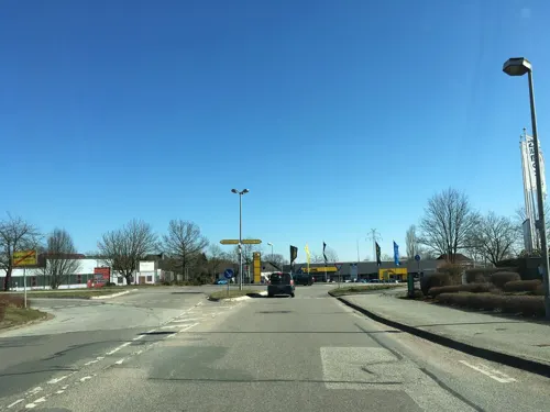
Ristorante Pinocchio
Restaurant · Italian · 1.6 km
26 Jasminstraße, Bad Segeberg
Su- Tu 11:30-14:30, 17:30-22:30; We off; Th-Sa 11:30-14:30, 17:00-22:30

Bäckerei Günther
Bakery
4 Hamburger Straße, Bad Segeberg
Mo-Fr 07:00-18:00; Su 07:30-16:00; Sa 07:00-18:00

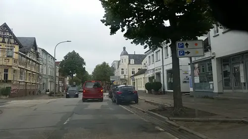
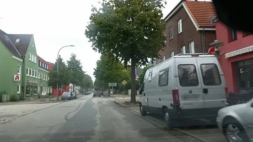
Der Gutschmecker
Restaurant
63 Kurhausstraße, Bad Segeberg
Mo 17:00-23:00, Tu-Fr 11:30-15:00; Tu-Fr 17:00-24:00; Sa-Su 11:30-24:00



54 more on the map.
Where to stay10
Churches and places of worship8
Königreichssaal Jehovas Zeugen
Church · Jehovahs Witness · 1.5 km
2 Konrad-Adenauer-Ring, Bad Segeberg
Neuapostolische Kirche Bad Segeberg
Church · New Apostolic · 1.5 km
2 Klein Niendorfer Weg, Bad Segeberg
Shopping24
Gas and EV charging17
Schools, colleges and libraries12
Berufsbildungszentrum Bad Segeberg
School · 0.6 km
9-11 Theodor-Storm-Straße, Bad Segeberg
Healthcare10
Map of Bad Segeberg
191 places. The map loads OpenStreetMap tiles when you open it.
Getting there and nearby towns
Flugplatz Neumünster (EUM) is the nearest airport with scheduled flights listed in OpenStreetMap, 28 km away.
- Stockelsdorf 23 km east, about 23 min by car
- Bargteheide 23 km south, about 23 min by car
- Lübeck 26 km east, about 26 min by car
- Neumünster 26 km northwest, about 26 min by car
- Kaltenkirchen 26 km southwest, about 26 min by car
- Bad Schwartau 26 km east, about 26 min by car
- Plön 26 km north, about 26 min by car
- Ratekau 28 km east, about 28 min by car
- Eutin 30 km northeast, about 30 min by car
- Norderstedt 33 km southwest, about 33 min by car
Drive times are estimates from straight-line distance, not routes.
Local news
Headlines from INDB.
Reviews, tips and questions
Loading what members have shared...
Sources and licences
- GeoNames (CC BY 4.0): population, coordinates, regions and time zone
- Mapillary (see each image): photos
- OpenStreetMap contributors (ODbL 1.0): places, airports, map data
- Wikidata (CC0 1.0): elevation, founding date, time zone, website, landmarks and historic places
- Wikimedia Commons (see each image): photos
- Wikipedia (CC BY-SA 4.0): overview and history text
Photo credits
- Marktplatz Bad Segeberg 2001, Unknown author, CC BY-SA 3.0
- Kurhausstraße 21 (Bad Segeberg).ajb, Ajepbah, CC BY-SA 3.0
- Bad Segeberg am 26.3.2017 09, Christian Alexander Tietgen, CC BY 4.0
- Bad Segeberg am 26.3.2017 10, Christian Alexander Tietgen, CC BY 4.0
- Bad Segeberg am 26.3.2017 11, Christian Alexander Tietgen, CC BY 4.0
- Kurhausstraße 1 (Bad Segeberg).ajb, Ajepbah, CC BY-SA 3.0
- 23795 Bad Segeberg, Germany - panoramio (28), hh oldman, CC BY 3.0
- Bad Segeberg, Haus Kurhausstraße 1, Dguendel, CC BY 3.0
- 23795 Bad Segeberg, Germany - panoramio (29), hh oldman, CC BY 3.0
- Kurhausstraße 1 (Bad Segeberg).Fassadendetail.ajb, Ajepbah, CC BY-SA 3.0
- Kurhausstraße 1 (Bad Segeberg).Portal.ajb, Ajepbah, CC BY-SA 3.0
- Bad Segeberg, die Gemeinschaftsschule am Seminarweg, Dguendel, CC BY 3.0
- Stolperstein Bad Segeberg Hamburger Straße 9 Cäcilie Heilbronn, Gmbo 2013, CC0
- 23795 Bad Segeberg, Germany - panoramio (44), hh oldman, CC BY 3.0
- Stolpersteinlage Bad Segeberg Hamburger Straße 9, Gmbo 2013, CC0
- Chinarestaurant Shanghai, Hamburger Straße 11, Bad Segeberg, Andreas Geick, CC BY-SA 3.0
- Stolperstein Bad Segeberg Hamburger Straße 13-17 Friederike Levy, Gmbo 2013, CC0
- Stolpersteinlage Bad Segeberg Hamburger Straße 13-17, Gmbo 2013, CC0
- 23795 Bad Segeberg, Germany - panoramio (30), hh oldman, CC BY 3.0
- Kurhausstraße 36 (Bad Segeberg).ajb, Ajepbah, CC BY-SA 3.0
- Kurhausstraße 38 (Bad Segeberg).ajb, Ajepbah, CC BY-SA 3.0
- Kurhausstraße 36 (Bad Segeberg).Hofbebauung.ajb, Ajepbah, CC BY-SA 3.0
- Kirchhof Marienkirche Bad Segeberg 4033, Kresspahl, CC BY-SA 4.0
- Kirchhof Marienkirche Bad Segeberg IMG 4041, Kresspahl, CC BY-SA 4.0
- 23795 Bad Segeberg, Germany - panoramio (21), hh oldman, CC BY 3.0
- Kurhausstraße 36, 38 (Bad Segeberg).ajb, Ajepbah, CC BY-SA 3.0
- Kalkbergarena Winnetou1, Hecki, CC BY-SA 3.0
- Museum Alt-Segeberger Bürgerhaus 2013, Hinrix, CC BY-SA 3.0
- Noctalis BadSegeberg2008, VollwertBIT, CC BY-SA 3.0
- Bad segeberg marienkirche, Thiemo Schuff, CC BY-SA 3.0
- Rantzau-Kapelle in Segeberg, PodracerHH, CC BY-SA 3.0
- Dahlmannschule Bad Segeberg, Ulf Heinsohn, CC BY-SA 4.0
- Bad Segeberg Wasserturm, Oberlausitzerin64, CC BY-SA 4.0
- Rantzau Obelisk, Quoth, CC BY-SA 3.0
- Ihlsee und Ihlwald, Wusel007, CC BY-SA 3.0
- Kalkberg Segeberg, Wusel007, CC BY-SA 3.0
- Segeberg Noctalis, Presse03, CC BY-SA 3.0
- Marienkirche im Schnee, Hinrix, CC BY-SA 4.0
- Ihlsee und Ihlwald Badestelle, Wusel007, CC BY-SA 3.0
- Stolpersteine Kurhausstr 9, Uwe Rohwedder, CC BY-SA 4.0
- Karl-May-Spiele Publikum 2009-08-06, Claas Augner, CC BY-SA 3.0
- Street-level photo, videomapper, CC BY-SA 4.0
- Street-level photo, rasmustravemnd, CC BY-SA 4.0
- Street-level photo, rasmustravemnd, CC BY-SA 4.0
- Street-level photo, smoe, CC BY-SA 4.0
- Street-level photo, Dancingman, CC BY-SA 4.0
- Street-level photo, ade, CC BY-SA 4.0
- Street-level photo, Dancingman, CC BY-SA 4.0
- Street-level photo, tian, CC BY-SA 4.0
- Street-level photo, rasmustravemnd, CC BY-SA 4.0
- Street-level photo, tian, CC BY-SA 4.0
- Street-level photo, rasmustravemnd, CC BY-SA 4.0
- Street-level photo, bowallace, CC BY-SA 4.0
- Street-level photo, ade, CC BY-SA 4.0
- Street-level photo, rasmustravemnd, CC BY-SA 4.0
- Street-level photo, ade, CC BY-SA 4.0
- Street-level photo, videomapper, CC BY-SA 4.0
- Street-level photo, bowallace, CC BY-SA 4.0
- Street-level photo, smoe, CC BY-SA 4.0
- Street-level photo, heetENkoel, CC BY-SA 4.0


Page built November 8, 2026. Spotted a mistake? Tell us or suggest a place.