


Kaltenkirchen, Germany
Kaltenkirchen is a town of 19,747 people in Schleswig-Holstein, Germany.
Why visit Kaltenkirchen
Townapedia lists 4 museums and landmarks, 13 parks and trails, 85 places to eat, 5 places to stay and 1 attraction in and around town.
Highlights include Kattendorfer Hof, HolstenTherme and FUN ARENA.
Weather in Kaltenkirchen
Forecast from MET Norway (CC BY 4.0). Full forecast
About Kaltenkirchen
Kaltenkirchen (German pronunciation: [kaltn̩ˈkɪʁçn̩] ; nicknamed Kaki; Low German: Koldenkarken or Kolenkarken) is a town located 35 km north of Hamburg in Germany. It is part of the Segeberg district, in Schleswig-Holstein. It has about 20,000 inhabitants.
From the Wikipedia article Kaltenkirchen (this version), under CC BY-SA 4.0.
Things to do1
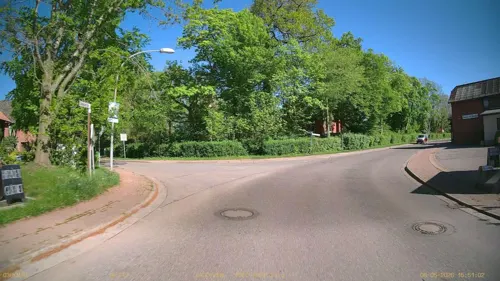
Kattendorfer Hof
Farm and orchard · 4.4 km
Biodynamischer Anbau
1 Dorfstraße, Kattendorf
Tu 12:00-18:00; Fr 08:00-18:00; Sa 08:00-12:00; Su,Mo,We,Th off
Museums and landmarks4

Erschießungen auf dem Todesmarsch Hamburg-Kiel April 1945
Monument and historic site · 3.1 km
Gräberstätte für Kriegsgefangene und KZ-Opfer
Monument and historic site · 4.0 km
Parks, trails and playgrounds13

HolstenTherme
Sports field and stadium · 1.3 km
Su-Th,PH 10:00-22:00; Fr-Sa,PH 10:00-22:30; Dec 31 off




1 more on the map.
Restaurants and cafes85

Akropolis
Restaurant · Greek · 1.1 km
1 Rudolf-Diesel-Straße, Kaltenkirchen
Mo off; Tu-Su 12:00-14:00, 17:00-22:00
Schweinske
Restaurant · Burger, Escalope, German · 3.4 km
4 Gutenbergstraße, Henstedt-Ulzburg
Mo-Su 09:00-22:00
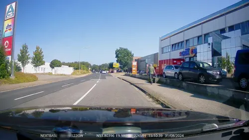
Tackmann Coffee House
Bakery · 3.4 km
4 Gutenbergstraße, Henstedt-Ulzburg
Su 08:00-17:00; Mo-Fr 07:00-17:00

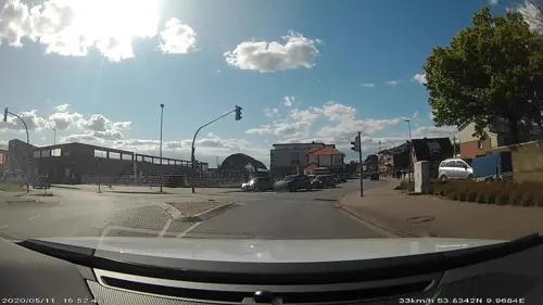
Toán Hoa
Restaurant · Chinese
28 Holstenstraße, Kaltenkirchen
We-Mo 12:00-15:00,18:00-22:00, PH 12:00-15:00; Tu off, PH 18:00-22:00


73 more on the map.
History
First mentioned in the 14th century, it flourished during the Industrial Revolution to accommodate the large number of workers in Hamburg.
During World War II, a temporary airfield protected the northern towns from bombing raids, but during the raids on Hamburg the airfield was destroyed and never rebuilt. Only open fields now remain where it was. A concentration camp was established here from August 1944 to April 1945 as a subcamp to the Neuengamme concentration camp. About 700 prisoners died here.
There was talk of moving the Hamburg Airport to Kaltenkirchen in the 1970s, but this did not materialise.
From the History section of Kaltenkirchen on Wikipedia, under CC BY-SA 4.0.
Where to stay5
Churches and places of worship8
Shopping38
Gas and EV charging33
Schools, colleges and libraries16
Healthcare6
Map of Kaltenkirchen
209 places. The map loads OpenStreetMap tiles when you open it.
Getting there and nearby towns
Hamburg Airport (HAM) is the nearest airport with scheduled flights listed in OpenStreetMap, 22 km away.
- Quickborn 12 km south, about 12 min by car
- Norderstedt 15 km south, about 15 min by car
- Pinneberg 22 km southwest, about 22 min by car
- Tornesch 22 km southwest, about 22 min by car
- Rellingen 22 km southwest, about 22 min by car
- Uetersen 25 km southwest, about 25 min by car
- Neumünster 27 km north, about 27 min by car
- Hamburg 31 km south, about 31 min by car
- Wedel 33 km southwest, about 33 min by car
- Reinbek 40 km southeast, about 40 min by car
Drive times are estimates from straight-line distance, not routes.
Local news
Headlines from INDB.
Reviews, tips and questions
Loading what members have shared...
Sources and licences
- GeoNames (CC BY 4.0): population, coordinates, regions and time zone
- Mapillary (see each image): photos
- OpenStreetMap contributors (ODbL 1.0): places, airports, map data
- Wikidata (CC0 1.0): elevation, founding date, time zone, website
- Wikimedia Commons (see each image): photos
- Wikipedia (CC BY-SA 4.0): overview and history text
Photo credits
- Michaeliskirche (Kaltenkirchen) (12), Selbst, CC BY-SA 3.0
- Heilig Geist (Kaltenkirchen) (43), hh oldman, CC BY 3.0
- Heilig Geist (Kaltenkirchen) (44), hh oldman, CC BY 3.0
- 24568 Kaltenkirchen, Germany - panoramio (46), hh oldman, CC BY 3.0
- 24568 Kaltenkirchen, Germany - panoramio (23), hh oldman, CC BY 3.0
- 24568 Kaltenkirchen, Germany - panoramio (42), hh oldman, CC BY 3.0
- 24568 Kaltenkirchen, Germany - panoramio (41), hh oldman, CC BY 3.0
- 24568 Kaltenkirchen, Germany - panoramio (1), hh oldman, CC BY 3.0
- Gemeinschaft Kaltenkirchen (37), hh oldman, CC BY 3.0
- 24568 Kaltenkirchen, Germany - panoramio (45), hh oldman, CC BY 3.0
- Bf Kaltenkirchen - geo.hlipp.de - 36381, Peter Whatley on geo.hlipp.de, CC BY-SA 2.0
- Kaltenkirchener Bank, PKautz, CC BY-SA 3.0
- 24568 Kaltenkirchen, Germany - panoramio (24), hh oldman, CC BY 3.0
- 24568 Kaltenkirchen, Germany - panoramio (4), hh oldman, CC BY 3.0
- 24568 Kaltenkirchen, Germany - panoramio (7), hh oldman, CC BY 3.0
- 24568 Kaltenkirchen, Germany - panoramio (40), hh oldman, CC BY 3.0
- 24568 Kaltenkirchen, Germany - panoramio (3), hh oldman, CC BY 3.0
- Station car park - Kaltenkirchen station - geo.hlipp.de - 36382, Peter Whatley on geo.hlipp.de, CC BY-SA 2.0
- 24568 Kaltenkirchen, Germany - panoramio (39), hh oldman, CC BY 3.0
- 24568 Kaltenkirchen, Germany - panoramio (8), hh oldman, CC BY 3.0
- 24568 Kaltenkirchen, Germany - panoramio (38), hh oldman, CC BY 3.0
- Kath. Kirche Heilig Geist - panoramio, hh oldman, CC BY 3.0
- Kircheneingang - panoramio (8), hh oldman, CC BY 3.0
- Lidl - panoramio (6), hh oldman, CC BY 3.0
- Henning ^ Nielsen - panoramio, hh oldman, CC BY 3.0
- Hitzefrei - panoramio, hh oldman, CC BY 3.0
- Bücherhalle - panoramio (1), hh oldman, CC BY 3.0
- Der Landbäcker - panoramio, hh oldman, CC BY 3.0
- Der Baum ist ein Naturdenkmal - panoramio, hh oldman, CC BY 3.0
- Naturdenkmal 3-3 , Eiche in der Schulstraße, Bilb 2, Tmhpr, CC BY-SA 3.0
- Naturdenkmal 3-3 , Eiche in der Schulstraße, Bilb 1, Tmhpr, CC BY-SA 3.0
- Naturdenkmal 3-3 , Eiche in der Schulstraße, Bilb 3, Tmhpr, CC BY-SA 3.0
- Naturdenkmal 3-2, Eiche vor dem neuen Rathaus, Bild 3, Tmhpr, CC BY-SA 3.0
- Bücherhalle Eingang - panoramio, hh oldman, CC BY 3.0
- Naturdenkmal 3-2, Eiche vor dem neuen Rathaus, Bild 1, Tmhpr, CC BY-SA 3.0
- Naturdenkmal 3-2, Eiche vor dem neuen Rathaus, Bild 2, Tmhpr, CC BY-SA 3.0
- Feuerstein - panoramio, hh oldman, CC BY 3.0
- Naturdenkmal 3-2, Eiche vor dem neuen Rathaus, Bild 4, Tmhpr, CC BY-SA 3.0
- Naturdenkmal 3-2, Eiche vor dem neuen Rathaus, Bild 5, Tmhpr, CC BY-SA 3.0
- Rückseite des Rathauses - panoramio, hh oldman, CC BY 3.0
- AKN Bahnstation Holstentherme, Gerhard kemme, CC0
- Marktplatz - panoramio (55), hh oldman, CC BY 3.0
- Street-level photo, ruhr11, CC BY-SA 4.0
- Street-level photo, DruideBizeps, CC BY-SA 4.0
- Street-level photo, kgvx, CC BY-SA 4.0
- Street-level photo, Dancingman, CC BY-SA 4.0
- Street-level photo, DruideBizeps, CC BY-SA 4.0
- Street-level photo, saschahaberkorn, CC BY-SA 4.0
- Street-level photo, saschahaberkorn, CC BY-SA 4.0
- Street-level photo, veloroute_hamburg, CC BY-SA 4.0
- Street-level photo, Dancingman, CC BY-SA 4.0
- Street-level photo, Dancingman, CC BY-SA 4.0
- Street-level photo, kgvx, CC BY-SA 4.0
- Street-level photo, DruideBizeps, CC BY-SA 4.0
- Street-level photo, ruhr11, CC BY-SA 4.0
- Street-level photo, ruhr11, CC BY-SA 4.0
- Street-level photo, ruhr11, CC BY-SA 4.0
- Street-level photo, DruideBizeps, CC BY-SA 4.0
- Street-level photo, Dancingman, CC BY-SA 4.0
- Street-level photo, tian, CC BY-SA 4.0
- Street-level photo, ruhr11, CC BY-SA 4.0
- Street-level photo, tian, CC BY-SA 4.0
- Street-level photo, veloroute_hamburg, CC BY-SA 4.0


Page built November 8, 2026. Spotted a mistake? Tell us or suggest a place.