


Bad Dürrenberg, Germany
Bad Dürrenberg is a town of 11,521 people in Saxony-Anhalt, Germany.
Why visit Bad Dürrenberg
Townapedia lists 47 museums and landmarks, 7 parks and trails, 46 places to eat, 7 places to stay and 2 attractions in and around town.
Highlights include Der Bauernladen, Steinkreuz, Museum zur Geschichte der Eisenbahnstrecke Leipzig - Großkorbetha and Plastikpark.
Weather in Bad Dürrenberg
Forecast from MET Norway (CC BY 4.0). Full forecast
About Bad Dürrenberg
Bad Dürrenberg is a spa town in the Saalekreis district, in Saxony-Anhalt, Germany. It is situated on the river Saale, approx. 8 km southeast of Merseburg. It is known for its historic graduation tower (for extracting salt from brine), the largest one in Germany.
From the Wikipedia article Bad Dürrenberg (this version), under CC BY-SA 4.0.
Things to do2

Der Bauernladen
Farm and orchard · 1.4 km
Siedlungsstraße, Bad Dürrenberg
Mo,Tu,Th,Fr 08:00-18:00; We 08:00-11:30,13:00-18:00; Sa...

Museums and landmarks47


Museum zur Geschichte der Eisenbahnstrecke Leipzig - Großkorbetha
Museum · 4.2 km
27 Bahnhofstraße
Jan-Dec: Su 14:00-18:00

Bad Dürrenberg burial
Monument and historic site
Mesolithic burial of a female shaman and an infant

Bauruine der Schleusentreppe Wüsteneutzsch
Monument and historic site · 3.9 km


35 more on the map.
Parks, trails and playgrounds7




Restaurants and cafes46

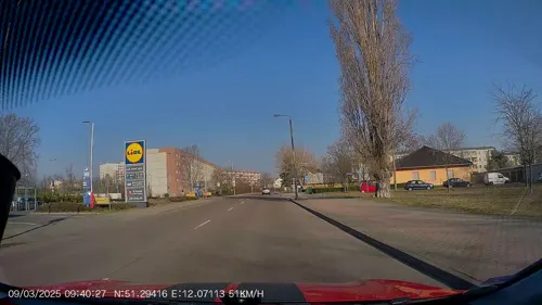
Landhotel Bad Dürrenberg
Restaurant · 1.0 km
6 Weinberg, Bad Dürrenberg
Mo-Sa 17:30-22:00; Su 17:30-21:00
MAXX Restaurant
Restaurant · German, Regional · 4.6 km
41A Spergauer Straße
We-Fr 11:30-14:00, 17:00-23:00; Sa 11:30-23:00; Su 11:30-14:30
Neptunklause
Restaurant · German, Seasonal · 1.3 km
8 Am Persebach, Bad Dürrenberg
Apr-Oct: Tu-Fr 11:00-17:00, Sa-Su 11:00-19:00; PH 11:00-19:00;...
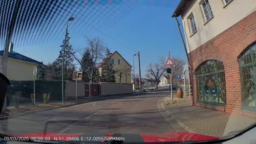
Zur Linde
Restaurant · Regional · 2.8 km
21 Straße zur Linde, Leuna
Tu-Su 11:00-21:00; PH 11:00-16:00; Mo off
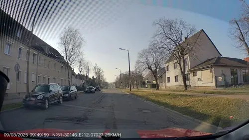
Bambus
Restaurant · Sushi, Vietnamese · 4.2 km
3 Rathausstraße
Tu-Su 10:30-21:30


Meteora
Restaurant · Greek · 3.7 km
2 Kreypauer Straße, Leuna
Mo 17:00-22:00, Tu-Sa 11:00-14:00, 17:00-24:00; Su 11:00-14:00, 17:00-22:00
34 more on the map.
Where to stay7
Churches and places of worship15
Shopping12
Gas and EV charging7
Schools, colleges and libraries12
Johann-Gottfried-Borlach Gemeinschaftsschule Bad Dürrenberg
School · 0.7 km
18 August-Bebel-Straße, Bad Dürrenberg
Healthcare4
Map of Bad Dürrenberg
159 places. The map loads OpenStreetMap tiles when you open it.
Getting there and nearby towns
Leipzig/Halle Airport (LEJ) is the nearest airport with scheduled flights listed in OpenStreetMap, 18 km away.
- Merseburg 8 km northwest, about 8 min by car
- Markranstädt 11 km east, about 11 min by car
- Weißenfels 12 km southwest, about 12 min by car
- Schkeuditz 16 km northeast, about 16 min by car
- Halle (Saale) 22 km north, about 22 min by car
- Markkleeberg 21 km east, about 21 min by car
- Leipzig 22 km east, about 22 min by car
- Naumburg 24 km southwest, about 24 min by car
- Zeitz 28 km south, about 28 min by car
- Taucha 31 km east, about 31 min by car
Drive times are estimates from straight-line distance, not routes.
Local news
Headlines from INDB.
Reviews, tips and questions
Loading what members have shared...
Sources and licences
- GeoNames (CC BY 4.0): population, coordinates, regions and time zone
- Mapillary (see each image): photos
- OpenStreetMap contributors (ODbL 1.0): places, airports, map data
- Wikidata (CC0 1.0): elevation, founding date, time zone, website, landmarks and historic places
- Wikimedia Commons (see each image): photos
- Wikipedia (CC BY-SA 4.0): overview and history text
Photo credits
- Saale-012, Bronstein, CC BY-SA 3.0
- Bad Dürrenberg, Pflegeheim des Arbeiter-Samariter-Bundes, Dguendel, CC BY 3.0
- Bad Dürrenberg, townscape, Dguendel, CC BY 3.0
- Bad Dürrenberg, the new water tower, Dguendel, CC BY 3.0
- Bad Dürrenberg, the old water tower, image 2, Dguendel, CC BY 3.0
- Bad Dürrenberg, Fährstraße 21, 23, Alter Fährhof, M_H.DE, CC BY-SA 4.0
- Bad Dürrenberg, Hauptstraße 37, ehemaliges Postamt, M_H.DE, CC BY-SA 4.0
- Bad Dürrenberg, Gärtnerei in der Lutherstraße, Dguendel, CC BY 3.0
- Bad Dürrenberg, the restaurant "Kurparkgaststätte", Dguendel, CC BY 3.0
- Bad Dürrenberg, Apothekerberg 20, M_H.DE, CC BY-SA 4.0
- Bad Dürrenberg, der "Grieche im Kurpark", Dguendel, CC BY 4.0
- Bad Dürrenberg, LAGA 2024, Blütenstrauch, Dguendel, CC BY 4.0
- Bad Dürrenberg, Wirtschaftsgebäude Apothekerberg 20, Dguendel, CC BY 4.0
- Bad Dürrenberg, Landesgartenschau 2024 (03), Catatine, CC0
- Bad Dürrenberg, memorial of the battle in 933, Dguendel, CC BY 3.0
- Gradierwerk und Saline Bad Dürrenberg Nahaufnahme 2014, Cmuelle8, CC0
- Bad Dürrenberg, LAGA 2024, Bild 1, Dguendel, CC BY 4.0
- Bad Dürrenberg, im Kurpark-2, Dguendel, CC BY 4.0
- Bad Dürrenberg, LAGA 2024, Salzsiederei, Dguendel, CC BY 4.0
- Bad Dürrenberg, das Haus des Volkes, Dguendel, CC BY 3.0
- Bad Dürrenberg, the aviary, Dguendel, CC BY 3.0
- Bad Dürrenberg, das Gradierwerk-1, Dguendel, CC BY 3.0
- Bad Dürrenberg, the palm house and the aviary, Dguendel, CC BY 3.0
- Bad Dürrenberg, LAGA 2024, Klatschmohn, Dguendel, CC BY 4.0
- Bad Dürrenberg, Kurpark 2017, die Blumenuhr, Dguendel, CC BY 4.0
- Bad Dürrenberg, LAGA 2024, Rose-2, Dguendel, CC BY 4.0
- Bad Dürrenberg, Apothekerberg 20 (02), M_H.DE, CC BY-SA 4.0
- Bad Dürrenberg, LAGA 2024, Rose-1, Dguendel, CC BY 4.0
- Bad Dürrenberg, Blick vom Kurpark zum Borlachturm, Dguendel, CC BY 3.0
- Bad Dürrenberg, in der Heimatstube, Dguendel, CC BY 4.0
- Bad Dürrenberg, Heimatstube, Buffet, Dguendel, CC BY 4.0
- Bad Dürrenberg, Heimatstube, bügeln und mangeln, Dguendel, CC BY 4.0
- Bad Dürrenberg, Heimatstube, Buffet, Bild 2, Dguendel, CC BY 4.0
- Bad Dürrenberg, Heimatstube, gedeckter Tisch, Dguendel, CC BY 4.0
- LeunaPlastikpark20, Jwaller, CC BY-SA 3.0
- Kirche Rössen, Olaf Meister, CC BY-SA 4.0
- Kriegerdenkmal Leuna2, Olaf Meister, CC BY-SA 4.0
- Kriegerdenkmal Großkorbetha, Mhandschug, CC0
- Kleinkorbetha, Kriegerdenkmal 01, Catatine, CC0
- Kirche-Großkorbetha, Tnemtsoni, CC BY-SA 3.0
- DaspigKirche2, Jwaller, CC BY-SA 3.0
- Leuna Kirche, Joeb07, CC BY 3.0
- GöhlitzschKirche1, Jwaller, CC BY-SA 3.0
- Wüsteneutzsch, Kriegerdenkmal, Catatine, CC0
- Kriegerdenkmal Bad Dürrenberg, Giorno2, CC BY-SA 4.0
- Bad Duerrenberg St Bonifatius, Doris Antony , Berlin, CC BY-SA 4.0
- Kirchfaehrendorf Steinkreuz, Radler59, CC BY-SA 3.0
- Bad-Dürrenberg--Laurentiuskirche, Dguendel, CC BY-SA 3.0
- VestaKirche2, Jwaller, CC BY-SA 3.0
- Kleinkorbetha (Weißenfels), the village church, Dguendel, CC BY 3.0
- Kirche-Kreypau, Tnemtsoni, CC BY-SA 3.0
- Leuna Wüsteneutzsch - Dorfstraße Wüsteneutzsch - Schleusenruine 03 ies, Frank Vincentz, CC BY-SA 3.0
- Wengelsdorf, Kriegerdenkmal 01, Catatine, CC0
- Leuna Christkoenigskirche, Radler59 ( talk ), CC BY-SA 4.0
- Kirche-Spergau, Tnemtsoni, CC BY-SA 3.0
- Kleinkorbetha Kirche, Radler59 ( talk ), CC BY-SA 4.0
- Bad Dürrenberg, im Kurpark-3, Dguendel, CC BY 4.0
- Street-level photo, AR88, CC BY-SA 4.0
- Street-level photo, AR88, CC BY-SA 4.0
- Street-level photo, AR88, CC BY-SA 4.0
- Street-level photo, AR88, CC BY-SA 4.0
- Street-level photo, AR88, CC BY-SA 4.0
- Street-level photo, natura, CC BY-SA 4.0
- Street-level photo, natura, CC BY-SA 4.0
- Street-level photo, AR88, CC BY-SA 4.0
- Street-level photo, natura, CC BY-SA 4.0
- Street-level photo, natura, CC BY-SA 4.0
- Street-level photo, natura, CC BY-SA 4.0
- Street-level photo, changchun1, CC BY-SA 4.0
- Street-level photo, changchun1, CC BY-SA 4.0
- Street-level photo, changchun1, CC BY-SA 4.0
- Street-level photo, zugnomade, CC BY-SA 4.0


Page built November 8, 2026. Spotted a mistake? Tell us or suggest a place.