


Why visit Weißenfels
Townapedia lists 138 museums and landmarks, 30 parks and trails, 104 places to eat, 17 places to stay and 15 attractions in and around town.
Highlights include Kulturhaus der Stadt Weißenfels, Bergfried, Bismarckturm Weißenfels and Schloss Burgwerben.
Weather in Weißenfels
Forecast from MET Norway (CC BY 4.0). Full forecast
About Weißenfels
Weißenfels (German pronunciation: [ˈvaɪsn̩ˌfɛls] ; often written in English as Weissenfels) is the largest city of the Burgenlandkreis district, in southern Saxony-Anhalt, central Germany. It is situated on the river Saale, approximately 30 km (20 mi) south of Halle.
From the Wikipedia article Weißenfels (this version), under CC BY-SA 4.0.
Photos of Weißenfels


Things to do15






3 more on the map.
Museums and landmarks138


Schloss Burgwerben
Monument and historic site · 2.6 km
Rittergut Burgwerben, Weinstraße 8 in Weißenfels OT Burgwerben
8 Weinstraße, Weißenfels
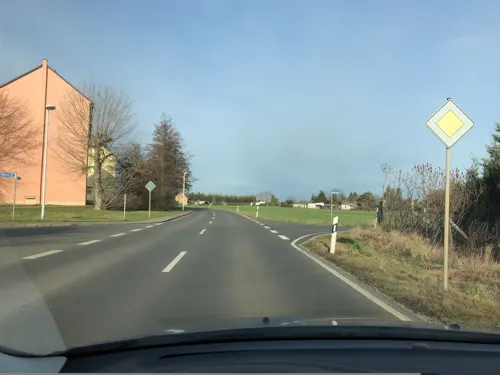


Preußischer Ganzmeilenstein
Monument and historic site · 7.5 km
Preußischer Ganzmeilenobelisk an der B91 zwischen Weißenfels und Zeitz, restauriert keine Sitzbänke mehr



Hermine Flamm, geb. Fleischer
Monument and historic site · 1.3 km
Stolperstein für Hermine Flamm, geb. Fleischer

Frankleben hoard
Monument and historic site · 11.3 km
Archaeological site in Germany
126 more on the map.
Parks, trails and playgrounds30





18 more on the map.
Restaurants and cafes104
Bootshaus
Restaurant · Regional · 1.6 km
23 Beuditz-Vorstadt, Weißenfels
Tu-Fr 15:00-22:00; Sa 11:00-22:00; Su 11:00-21:00; PH 11:00-21:00
Restaurant "Schöne Aussicht"
Restaurant · German · 2.8 km
1 Naumburger Landstraße, Weißenfels
Mo 16:00-22:00; Tu-Fr 11:00-22:00; Sa 11:00+; Su,PH 11:00-21:00
Saaleperle
Restaurant · Regional · 3.1 km
5 Erdmann-Neumeister-Platz, Weißenfels
Su 11:00-17:00; Th 16:00-21:00


Zum deutschen Kaiser
Restaurant · German · 5.5 km
Hunde erlaubt
31 Rudolf-Breitscheid-Straße, Weißenfels
Tu 17:00-22:00; Fr,Sa 17:00-24:00
MissPepper
Restaurant · Burger · 3.9 km
41 Hallesche Straße, Lützen
Mo-Th,Su 08:00-24:00; Fr-Sa 08:00-01:00
Athos
Restaurant · Greek · 0.8 km
24 Markwerbener Straße, Weißenfels
Tu-Th 17:00-23:00; Fr-Su 11:30-14:00,17:00-24:00
92 more on the map.
History
Perhaps the first mention of the area, before the city itself was founded occurred in 806 CE, when Charles the Younger (Karl der Jüngere), King of the Franks, fought and killed two West Slavic Knezy (princes) nearby: duke Miliduch of the Sorbs and Nessyta (possibly also a Sorbian leader). Miliduch had led a Sorbian invasion of Austrasia.
The settlement arose around a castle on a ford crossing the Saale and received municipal rights in 1185. During the Thirty Years' War, the town was badly damaged and the population fell from 2200 to 960. On 7 November 1632 the body of King Gustavus Adolphus of Sweden was first laid out at Weißenfels after he had been killed the day before at the Battle of Lützen.
Shortly afterwards however, the town took a steep rise in importance, when Duke Augustus, a scion of the Saxon House of Wettin, established the Duchy of Saxe-Weissenfels in 1656 and chose Weißenfels as his residence and as the capital of the duchy. Since 1638 Augustus had served as the Protestant administrator of the Magdeburg archbishopric, which, according to the 1648 Peace of Westphalia would be finally secularised to Brandenburg-Prussia upon his death.
Read more of the history
Augustus therefore from 1660 onward erected the Baroque Neu-Augustusburg Castle on a hill in Weißenfels as the seat of his ducal successors. Completed in 1680 it became the duchy's administrative as well as cultural centre until its dissolution in 1746. Composers like Johann Philipp Krieger and Georg Philipp Telemann worked here, the actress Friederike Caroline Neuber made her first appearances at Weißenfels. In 1702 Johann Sebastian Bach's application for the position of the organist in Sangerhausen (belonging to Weißenfels) failed, because the Duke of Saxe-Weissenfels preferred the—rediscovered in 2010—composer Johann Augustin Kobelius. In 1713 Johann Sebastian Bach dedicated his cantata Was mir behagt, ist nur die muntre Jagd, BWV 208 to Duke Christian of Saxe-Weissenfels.
The Lutheran theologian Erdmann Neumeister from 1704 on served as a deacon at the ducal palace's Trinity Chapel. Its pipe organ completed in 1673 has 22 stops. According to John Mainwaring, Duke Johann Adolf I of Saxe-Weissenfels himself discovered the musical talent of George Frideric Handel, when he heard the son of his physician Georg Händel playing on the organ. Bach wrote the Toccata and Fugue in F major (BWV 540) for it.
With the extinction of the Wettin Saxe-Weissenfels line in 1746, the town fell back to the Saxon Electorate and after the 1815 Congress of Vienna to the Prussian Province of Saxony. From 1816 on it was the capital of the Weißenfels district until its dissolution in 2007.
By 1900 Weissenfels was one of the largest shoe manufacturing centres in Germany with 64 factories employing some 3,200 people.
In the First World War, Reserve Infantry Regiment No. 66, which was stationed in Weißenfels, Naumburg and Altenburg, served on the Western Front, with casualties of 134 officers and 2472 other ranks killed. A war memorial featuring a huddled man was unveiled in Weissenfels in 1925, it has since been extensively damaged.
During the Weimar Republic period, city elections heavily favoured the Communist Party (KPD) and the Social Democrats (SPD). In September 1932 Weissenfels’ shoe workers went on strike for 10 days, later joined by construction workers, against wage cuts and the emergency decrees of the Papen Government. In January 1933 an “Anti-Fascist Action” rally was held in the Volkshaus, supported by the KPD, SPD and the Reichbanner (an SPD self protection group against the Nazi brownshirts), and a KPD led “united front” demonstration against the Nazis was held in the market square – the last public rally before opposition to the Nazi regime was suppressed in March.
In city council elections of March 1933 the votes cast for both the KPD and SPD were little changed from previously, but the Nazi vote increased hugely. With the four elected Communist Deputies being interned and not able to take their seats, the Nazis took control of the council. At the same time the first Nazi rallies were held in the town: a police, SA and SS parade in the castle in early March 1933 and an SA rally in the Market Square later in the month.
Under the Nazis, while the Gestapo were headquartered in the city in a house appropriated from a Jewish cattle dealer, the main police station remained in Neu-Augustusburg Castle, which also became the local Gestapo internment facility. The internment camp population grew to around 180 prisoners, primarily communists and SPD members. At this time the Nazis were keen to emphasise the ‘protective custody’ and political reeducation nature of the camp and local newspapers reported on the Weissenfels camp regularly. Between June and August 1933 the majority of detainees were transferred to the Lichtenburg concentration camp, although the castle continued to be used as a protective custody facility, including later for members of the Jewish community. Reinhard Schramm, Ich will lieben: die Juden in Weissenfels, Bohlau 2001.
In 1933 there were 165 Jews living in the city but picketing of Jewish owned shops and the forced ‘aryanisation’ of Jewish businesses, and the events of Kristallnacht led to many emigrating. Deportations began in 1940 and 38 Jewish residents of Weissenfels were murdered in the Holocaust [Amtsblatt_2019_Nummer_13]. 34 Stolperstein have been laid in the town to commemorate local Jewish victims of the Nazi regime.
From the History section of Weißenfels on Wikipedia, under CC BY-SA 4.0.
More about Weißenfels
Economy
Since the 19th century industrialisation, shoe manufacture was Weißenfels' primary industry, until 1991 when the last factory shut down. Since then, the food processing industry has grown significantly. The main companies are:
Tönnies Fleischwerk, Europe's third biggest meat group, runs one of its three meat-processing plants in Weißenfels
Mitteldeutsche Erfrischungsgetränke, the third largest mineral water company of Germany, has its seat in Weißenfels. Its brands include Leißlinger Mineralwasser and Saskia-Quelle.
The town has access to the A9 at the Weißenfels junction, near the interchange with the A38. Weißenfels station is a stop on the Thuringian Railway line from Halle to Erfurt/Jena.
From the Wikipedia article Weißenfels, under CC BY-SA 4.0.
Notable people from Weißenfels
 Tim Tscharnkecross-country skierPhoto: Iso76, CC BY-SA 3.0
 BalthasarLandgrave of Thuringia (1336-1406)Photo: Moritz von Schwind, Public domain
 Johann Adolf II, Duke of Saxe-WeissenfelsDuke of Saxe-WeissenfelsPhoto: Antoine Pesne, Public domain
 Christian of Saxe-WeissenfelsDuke of Saxe-Weissenfels (1682-1736)Photo: Attributed to Martin Bernigeroth, Public domain
 Horst P. HorstGerman-American photographer (1906–1999)Photo: Rochester Institute of Technology, Public domain
 Hermann LoewGerman entomologist (1807–1879)Photo: Unknown author, Public domain
- Gerard TichySpanish actor (1920-1992)
- Sophie of Saxe-Weissenfels2 Aug 1684 - 6 May 1752
- Johanna Magdalene of Saxe-WeissenfelsDuchess consort of Courland (1708-1760)
- Gesine WaltherEast German sprinter (born 1962)
- Jutta PlochEast German rower
- Nick ProschwitzGerman footballer
Born in Weißenfels, according to Wikidata (CC0). Each name links to its Wikipedia article.
Where to stay17
Churches and places of worship55
Shopping32
Gas and EV charging12
S. Hildebrandt Technische Gase
Gas station · 1.4 km
24 b Schlachthofstraße, Weißenfels
Schools, colleges and libraries17
Healthcare13
Asklepios MVZ Sachsen-Anhalt D-Arzt und Chirurgie
Hospital · 0.7 km
4 Kleine Deichstraße, Weißenfels
Map of Weißenfels
250 places. The map loads OpenStreetMap tiles when you open it.
Getting there and nearby towns
Leipzig/Halle Airport (LEJ) is the nearest airport with scheduled flights listed in OpenStreetMap, 31 km away.
- Naumburg 12 km southwest, about 12 min by car
- Bad Dürrenberg 12 km northeast, about 12 min by car
- Merseburg 17 km north, about 17 min by car
- Zeitz 21 km southeast, about 21 min by car
- Markranstädt 21 km northeast, about 21 min by car
- Eisenberg 26 km south, about 26 min by car
- Schkeuditz 28 km northeast, about 28 min by car
- Markkleeberg 29 km east, about 29 min by car
- Halle (Saale) 31 km north, about 31 min by car
- Leipzig 32 km northeast, about 32 min by car
Drive times are estimates from straight-line distance, not routes.
Towns near Weißenfels


Keep exploring
Local news
Headlines from INDB.
Reviews, tips and questions
Loading what members have shared...
Sources and licences
- GeoNames (CC BY 4.0): population, coordinates, regions and time zone
- Mapillary (see each image): photos
- OpenStreetMap contributors (ODbL 1.0): places, airports, map data
- Wikidata (CC0 1.0): elevation, founding date, time zone, website, landmarks and historic places
- Wikimedia Commons (see each image): photos
- Wikipedia (CC BY-SA 4.0): overview and history text
Photo credits
- Weissenfels Luftbild, Ralf-Rainer Hoffmann / SCHAU! Multimedia, Public domain
- WeißenfelsPassageJK, Jwaller, CC BY-SA 3.0
- WeißenfelsReliefJüdenstr, Jwaller, CC BY-SA 3.0
- Weißenfels, Haus Jüdenstraße 43, Dguendel, CC BY 3.0
- WeißenfelsGoldenerRing, Jwaller, CC BY-SA 3.0
- Weißenfels, Haus Jüdenstraße 33, Dguendel, CC BY-SA 4.0
- Weißenfels, das Postamt, Dguendel, CC BY-SA 4.0
- Weißenfels, die Saalstraße, Dguendel, CC BY 3.0
- Weißenfels, the Jüdenstraße, Dguendel, CC BY 3.0
- Weißenfels, Haus Jüdenstraße 27, Dguendel, CC BY 3.0
- Weißenfels, Haus Jüdenstraße 25, Dguendel, CC BY-SA 4.0
- Weißenfels, Haus Jüdenstraße 21 und Stadtbrunnen, Dguendel, CC BY-SA 4.0
- Weißenfels, der Stadtbrunnen (Detail)-1, Dguendel, CC BY 3.0
- Weißenfels, der Stadtbrunnen (Detail)-2, Dguendel, CC BY 3.0
- WeißenfelsJüdenstr19P, Jwaller, CC BY-SA 3.0
- Weißenfels, Haus Jüdenstraße 18, Dguendel, CC BY-SA 4.0
- Weißenfels, die Häuser Jüdenstraße 12 und 14, Dguendel, CC BY-SA 4.0
- Weißenfels, Häuserzeile in der Jüdenstraße, Dguendel, CC BY 3.0
- Weißenfels jüdengasse19 tür, Z thomas, CC BY-SA 3.0
- Jüdenstraße 14-28 (Weißenfels) - Ansicht Straßenzug, Cookroach, CC BY-SA 4.0
- Weißenfels, die Villa Friedrichsstraße 12, Dguendel, CC BY-SA 4.0
- Weißenfels, die Jüdenstraße, Dguendel, CC BY 3.0
- Stolperstein Karlick, Lina (Weißenfels), Cookroach, CC BY-SA 4.0
- Stolperstein Karlick, Lina (Weißenfels) cropped, Cookroach, CC BY-SA 4.0
- Stolperstein Karlick, Lina vor Jüdenstraße (Weißenfels), Cookroach, CC BY-SA 4.0
- Jüdenstraße 16 (Weißenfels) - Lage Stolperstein für Lina Karlick, Cookroach, CC BY-SA 4.0
- Goethegym2, Martin G. Wimmer, CC BY-SA 3.0
- Großkaynaer See, Bergbaufolgelandschaft, Catatine, CC0
- Weissenfels Kirche, Joeb07, CC BY 3.0
- LobitzschDorfplatz, Jwaller, CC BY-SA 3.0
- Weissenfels Katholische Kirche, Joeb07, CC BY 3.0
- Nikolaistraße 51 Weißenfels 20180817 003, Tilman2007, CC BY-SA 4.0
- EulauKircheNO, Jwaller, CC BY-SA 3.0
- WeißenfelsKulturhaus, Jwaller, CC BY-SA 3.0
- Burgwerben Rittergut Schloss-01, Radler59 ( talk ), CC BY-SA 4.0
- Nessa Preussischer Ganzmeilenobelisk-03, Radler59, CC BY-SA 3.0
- Kirche-Markröhlitz, Tnemtsoni, CC BY-SA 3.0
- Taucha Weißenfels 2Kirche, Geolina163, CC BY-SA 3.0
- SelauStGeorg5, Jwaller, CC BY-SA 3.0
- Dehlitz (Saale) Kirche, Goerdten at German Wikipedia, CC BY-SA 3.0
- UnternessaKirche4, Jwaller, CC BY-SA 3.0
- Klosterkirche Langendorf2, Chris06, CC0
- GranschützKirche1, Jwaller, CC BY-SA 3.0
- GoseckKirche1, Jwaller, CC BY-SA 3.0
- Rittergut-Dehlitz, Tnemtsoni, CC BY-SA 3.0
- Schönburg-Saale Burg-Bergfried 20220720 153058, Rigorius, CC BY-SA 4.0
- Turm-Weißenfels, Tnemtsoni, CC BY-SA 3.0
- Burgwerben Rittergut Schloss, Radler59 ( talk ), CC BY-SA 4.0
- GröbitzHH3, Jwaller, CC BY-SA 4.0
- Goseck-Burgschänke Schloss Goseck 20220719 161623, Rigorius, CC BY-SA 4.0
- WSF Marienkirche, Radler59 ( talk ), CC BY-SA 4.0
- Burgwerben Kirche, Radler59 ( talk ), CC BY-SA 4.0
- Igelsberg-Saaletal, Jwaller, CC BY-SA 3.0
- Dehlitz (Saale), Altes Rittergut, Infotafel Friedrich II, Catatine, CC0
- Street-level photo, natura, CC BY-SA 4.0
- Street-level photo, natura, CC BY-SA 4.0
- Street-level photo, bejotel, CC BY-SA 4.0
- Street-level photo, natura, CC BY-SA 4.0
- Street-level photo, bejotel, CC BY-SA 4.0
- Street-level photo, AR88, CC BY-SA 4.0
- Street-level photo, changchun1, CC BY-SA 4.0
- Street-level photo, AR88, CC BY-SA 4.0
- Street-level photo, natura, CC BY-SA 4.0
- Street-level photo, bejotel, CC BY-SA 4.0
- Street-level photo, changchun1, CC BY-SA 4.0
- Street-level photo, bejotel, CC BY-SA 4.0


Page built November 9, 2026. Spotted a mistake? Tell us or suggest a place.