


Bad Friedrichshall, Germany
Bad Friedrichshall is a town of 19,853 people in Baden-Wurttemberg, Germany.
Why visit Bad Friedrichshall
Townapedia lists 61 museums and landmarks, 37 parks and trails, 154 places to eat, 29 places to stay and 13 attractions in and around town.
Highlights include Bad Friedrichshall, Bad Wimpfen, Deutsches Zweirad-Museum Neckarsulm and Stadtmuseum.
Weather in Bad Friedrichshall
Forecast from MET Norway (CC BY 4.0). Full forecast
About Bad Friedrichshall
Bad Friedrichshall (German: [baːt ˈfʁiːdʁɪçshal] ) is a town in the district of Heilbronn in Baden-Württemberg in southern Germany. It is situated at the confluences of the Jagst and of the Kocher into the Neckar, some 10 kilometres (6 mi) north of Heilbronn. Bad Friedrichshall arose by the connection of Kochendorf and Jagstfeld in 1933, and is famous for its salt mine.
From the Wikipedia article Bad Friedrichshall (this version), under CC BY-SA 4.0.
Things to do13
Bad Friedrichshall
Monument and historic site
Municipality in Germany

Bad Wimpfen
Monument and historic site · 3.9 km
Town in Heilbronn District, Stuttgart Government Region, Baden-Württemberg (Kraichgau), Germany


Kreatief Probenzentrum
Cinema and theater · 4.4 km
Hier entstehen aus kreativen Ideen "kreatiefe" Shows für den legendäre OPEN-AIR-SOMMER beim Schützenhaus Neckarsulm
39 Neckargartacher Straße, Neckarsulm


Sommerers Hofladen
Farm and orchard · 2.8 km
24 Herzog-Magnus-Straße, Untereisesheim
Mo,Tu,Th 09:00-12:30,16:00-18:00; We off; Fr...


1 more on the map.
Museums and landmarks61

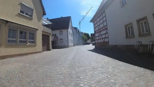


Tourist Information
Monument and historic site · 4.0 km
45 Hauptstraße, Bad Wimpfen
Mo-Fr 10:00-12:00,14:00-17:00


Greckenschloss
Monument and historic site · 0.7 km
2 Lindenweg, Bad Friedrichshall

Malteser Hilfsdienst
Monument and historic site · 2.9 km
4 Lindenplatz, Bad Wimpfen

Obere Ölmühle
Monument and historic site · 3.9 km
15 Neutorstraße, Bad Wimpfen
49 more on the map.
Parks, trails and playgrounds37

Solebad
Sports field and stadium · 4.4 km
16 Osterbergstraße, Bad Wimpfen
Tu-Sa 07:00-21:00; Su 08:00-17:00

Motorbootclub Mittlerer Neckar
Marina and boat launch · 4.5 km


Historische Gärten
Park · 3.9 km
Wimpfen am Berg, Burgstaffel Flstnr. 603, 604. Erhaltenswerte Grün- und Freifläche innerhalb der Gesamtanlage gem. § 19 DSchG.

25 more on the map.
Restaurants and cafes154

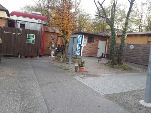
Biergarten Saline
Restaurant · German · 1.4 km
5 Saline, Bad Friedrichshall
Su-Th 11:00-23:00; Fr-Sa 11:00-00:00

An der Linde
Restaurant · German · 3.8 km
11 Stuttgarter Straße, Neckarsulm
Mo-Fr 12:00-13:30, 18:00-21:30
Anker's Restaurant
Restaurant · Italian · 2.8 km
18 Corneliastraße, Bad Wimpfen
Tu-Fr 11:30-14:00, 17:00-22:00; Sa 17:00-22:00; Su 11:30-21:00
Arte Bianca Pizzaservice Neckarsulm
Restaurant · Italian · 3.2 km
38 Kochendorfer Straße
Th-Su 17:30-22:00
Bella Capri
Restaurant · Italian · 3.8 km
7 Stuttgarter Straße, Neckarsulm
Tu-Su 11:30-14:30,17:00-23:30
Besenwirtschaft Wörner
Restaurant · Regional · 2.9 km
21 Würzburger Straße, Bad Friedrichshall
Mo-Sa 16:00+; Su,PH 11:00+
Bollwerk Lounge
Restaurant · International · 3.6 km
1 Carl-Ulrich-Straße, Bad Wimpfen
Su, Tu-Th 17:00-23:00; Fr-Sa 17:00-02:00


Café Anna Blume
Cafe · German, Breakfast, Coffee Shop · 4.0 km
1 Apothekergasse, Bad Wimpfen
Su 10:00-18:00; Mo,Th-Sa 09:00-18:00
142 more on the map.
History
Bad Friedrichshall arose in 1933 by the combination of Kochendorf and Jagstfeld. Its name Friedrichshall is derived from the term Bad for a brine and salt-works in Jagstfeld, named after Frederick I of Württemberg in 1818. The term Hall is a common term in the area related to salt industry.
From the History section of Bad Friedrichshall on Wikipedia, under CC BY-SA 4.0.
Where to stay29
Churches and places of worship37
Russisch-Orthodoxe Gemeinde des Hl. Johannes von Shanghai
Church · Russian Orthodox · 3.7 km
2 Brahmsweg, Neckarsulm
Auferstehungskirche
Church · Roman Catholic · 2.0 km
1 Badstraße, Bad Friedrichshall
Cornelienkirche
Church · Protestant · 2.3 km
32 Jagstfelder Weg, Bad Wimpfen
Shopping38
Gas and EV charging11
Schools, colleges and libraries27
Healthcare14
Map of Bad Friedrichshall
250 places. The map loads OpenStreetMap tiles when you open it.
Getting there and nearby towns
City-Airport Mannheim (MHG) is the nearest airport with scheduled flights listed in OpenStreetMap, 58 km away.
- Heilbronn 10 km south, about 10 min by car
- Weinsberg 10 km southeast, about 10 min by car
- Wiesloch 38 km west, about 38 min by car
- Walldürn 41 km north, about 41 min by car
- Winnenden 42 km south, about 42 min by car
- Walldorf 43 km west, about 43 min by car
- Heidelberg 43 km northwest, about 43 min by car
- Waiblingen 45 km south, about 45 min by car
- Stuttgart 50 km south, about 50 min by car
- Pforzheim 54 km southwest, about 54 min by car
Drive times are estimates from straight-line distance, not routes.
Local news
Headlines from INDB.
Reviews, tips and questions
Loading what members have shared...
Sources and licences
- GeoNames (CC BY 4.0): population, coordinates, regions and time zone
- Mapillary (see each image): photos
- OpenStreetMap contributors (ODbL 1.0): places, airports, map data
- Wikidata (CC0 1.0): elevation, founding date, time zone, website, landmarks and historic places
- Wikimedia Commons (see each image): photos
- Wikipedia (CC BY-SA 4.0): overview and history text
Photo credits
- Kocher bei Bad Friedrichshall - panoramio, qwesy qwesy, CC BY 3.0
- Sebastianskirche in Bad Friedrichshall - panoramio, qwesy qwesy, CC BY 3.0
- Gästehaus Max ^ Moritz in Bad Friedrichshall - panoramio, qwesy qwesy, CC BY 3.0
- Bad Wimpfen - Altstadt - 2017-09-17 18-22-59, Photographs by Radosław Drożdżewski (User:Zwiadowca21), CC BY-SA 4.0
- Kochendorf-greckenschloss, p.schmelzle, CC BY-SA 2.5
- Neckarsulm-ZweiradMuseum-Innenhof, Joachim Köhler, CC BY-SA 3.0
- Bad Wimpfen Spital Jan 2014 001, Peter Schmelzle, CC BY-SA 3.0
- Neckarsulm-AudiForum-vonSueden-061118, Joachim Köhler, CC BY-SA 3.0
- Jagstfeld-kathkirche-2008, Schmelzle, CC BY-SA 3.0
- Wimpfen-cornel-2008, peter schmelzle, CC BY-SA 3.0
- Wimpfen-dominikaner2008, peter schmelzle, CC BY-SA 3.0
- FvA-Gymnasium 0, Sarang, Public domain
- Neckarsulm-Frauenkirche-AussenAnsicht, Joachim Köhler, CC BY-SA 3.0
- Obereisesheim Mauritiuskirche01, Joachim Köhler, CC BY-SA 3.0
- Neckarsulm - Scheuerberg - Ansicht aus WSW im Oktober (1), Roman Eisele, CC BY-SA 4.0
- Bad Wimpfen Gymnasium Jan 2014 005, Peter Schmelzle, CC BY-SA 3.0
- Jagstfeld-erloeserkirche, peter schmelzle, CC BY-SA 3.0
- FSSPX-BFH3, sarang, CC0
- BFH Mennonite churchE, sarang, Public domain
- Wimpfen-Stift-Lindenplatz4, Peter Schmelzle, CC BY-SA 3.0
- NSU-Amorbach-EvangelKirche, Joachim Köhler, CC BY-SA 3.0
- Untereisesheim-kath-kirche, p.schmelzle, CC BY-SA 2.5
- Neckarsulm-Obereisesheim-Christuskirche, Joachim Köhler, CC BY-SA 3.0
- Bad Wimpfen BW 01, Berthold Werner, CC BY-SA 3.0
- Oedheim Christuskirche 20080323, K. Jähne, CC BY-SA 3.0
- Stolperstein für Adolf Baer (Bad Wimpfen), Christian Michelides, CC BY-SA 4.0
- Scheuerberg Aussichtspunkt, RolfRoemmele, CC BY-SA 3.0
- Wimpfen-palasarkaden2008, peter schmelzle, CC BY-SA 3.0
- Stolperstein Bad Wimpfen Marktrain 6 Adolf Baer, Gmbo 2013, CC0
- Stolperstein für Friederike Mannheimer (Bad Wimpfen), Christian Michelides, CC BY-SA 4.0
- Stolperstein Bad Wimpfen Schiedstraße 18 Manfred Pfeifer, Gmbo 2013, CC0
- Wimpfen-steinhaus2008, peter schmelzle, CC BY-SA 3.0
- Eingangsbereich des Deutschen Zweirad- und NSU-Museums, Zweiradmuseum Neckarsulm, CC BY-SA 4.0
- BW-badwimpfen-spitalhof, Bgabel, CC BY-SA 3.0
- Bad Wimpfen Neutorstraße 15 Jan 2014 001, Peter Schmelzle, CC BY-SA 3.0
- Black Swans, Timo Haberl, CC BY 3.0
- BFH-Kochendorf Bf Nord 20080727, K. Jähne, CC BY-SA 3.0
- BFH Hengstenberg, Sarang, Public domain
- Kochendorf Muehlkanal 225 IMG 20241006 1117 mod, Karlunun, CC0
- KoRail 열차승차권, 사랑, Public domain
- Street-level photo, teddy73, CC BY-SA 4.0
- Street-level photo, changchun1, CC BY-SA 4.0
- Street-level photo, changchun1, CC BY-SA 4.0
- Street-level photo, teddy73, CC BY-SA 4.0
- Street-level photo, teddy73, CC BY-SA 4.0
- Street-level photo, teddy73, CC BY-SA 4.0
- Street-level photo, changchun1, CC BY-SA 4.0
- Street-level photo, teddy73, CC BY-SA 4.0
- Street-level photo, changchun1, CC BY-SA 4.0
- Street-level photo, teddy73, CC BY-SA 4.0
- Street-level photo, changchun1, CC BY-SA 4.0
- Street-level photo, teddy73, CC BY-SA 4.0
- Street-level photo, teddy73, CC BY-SA 4.0
- Street-level photo, teddy73, CC BY-SA 4.0
- Street-level photo, teddy73, CC BY-SA 4.0
- Street-level photo, teddy73, CC BY-SA 4.0
- Street-level photo, teddy73, CC BY-SA 4.0
- Street-level photo, changchun1, CC BY-SA 4.0
- Street-level photo, teddy73, CC BY-SA 4.0


Page built November 8, 2026. Spotted a mistake? Tell us or suggest a place.