


Bad Gandersheim, Germany
Bad Gandersheim is a town of 11,099 people in Lower Saxony, Germany.
Why visit Bad Gandersheim
Townapedia lists 62 museums and landmarks, 14 parks and trails, 45 places to eat, 3 places to stay and 46 attractions in and around town.
Highlights include Biohof Berner, Haus & Hofladen, Kloster Brunshausen and Weltbühne Heckenbeck.
Weather in Bad Gandersheim
Forecast from MET Norway (CC BY 4.0). Full forecast
About Bad Gandersheim
Bad Gandersheim (German pronunciation: [baːt ˈɡandɐshaɪm] ; Eastphalian: Ganderssen) is a town in southern Lower Saxony, Germany, located in the district of Northeim. As of December 2020, it had a population of 9,492.
From the Wikipedia article Bad Gandersheim (this version), under CC BY-SA 4.0.
Travel tips from other travellers: Bad Gandersheim on Wikivoyage (CC BY-SA 4.0).
Things to do46

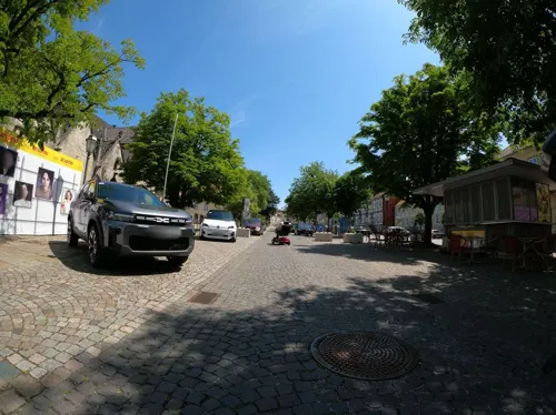
Kartenzentrale der Domfestspiele
Cinema and theater
12 Stiftsfreiheit, Bad Gandersheim
Mo-Fr 09:00-13:00,14:00-17:00


34 more on the map.
Museums and landmarks62


Weltbühne Heckenbeck
Museum · 4.4 km
11 Kreuzstraße, Bad Gandersheim
Tu 10:00-13:00; We 09:00-12:00; PH off

Battle at the Harzhorn
Monument and historic site · 7.0 km
235 battle between Roman and Germanic troops (c.235)
Wilhelm-Busch-Haus
Museum · 7.6 km
7 Pastor-Nöldeke-Weg, Seesen
Mar 01-Oct 31: Th-Su 15:00-17:00; Nov 01-Feb 28: Sa,Su 14:00-16:00
Atelier und Skulpturengarten Dietlind Petzold
Museum · 4.5 km
Atelier, Ausstellungsräume, Skulpturengarten
7 Kreuzstraße



50 more on the map.
Parks, trails and playgrounds14



2 more on the map.
Restaurants and cafes45

Adria Balkangrill & Steaks
Restaurant · Fish, Ice Cream, Grill, Coffee Shop, Balkan, Greek
9 Neustadt
Mo,Tu,Th,Fr 17:00-22:00; Sa,Su 11:30-14:30,17:00-22:00
Artemis
Restaurant · Greek · 6.8 km
28 Gehrenrode, Bad Gandersheim
Tu-Su 17:00-23:00; Fr-Su 12:00-14:30
Auszeit
Restaurant · Pizza, Burger, Pasta, Barbecue · 1.7 km
12 Braunschweiger Straße, Bad Gandersheim
Tu-Fr 17:00-22:00; Sa,Su 11:00-22:00

Bauernhof-Eis & Ferienwohnungen, Ebeling
Cafe · Ice Cream · 2.7 km
40 Wolperode, Bad Gandersheim
May 01-Sep 15: Mo-Sa 14:00-21:00, May 01-Sep 15: Su 11:00-21:00;...
Gasthof zum Bergstübchen
Restaurant · Regional · 7.8 km
1 Am Bäckerberg, Seesen
Mo-Su 16:00-23:00; Tu off
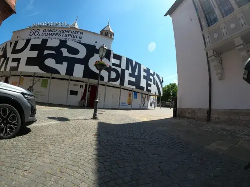
Köhler's Brasserie Jedermann
Restaurant · French
2 Fronhof, Bad Gandersheim
Tu-Fr 16:00-24:00, Sa 11:30-24:00; Mo off, Su,PH 11:30-21:00
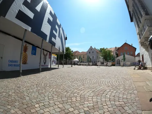
Osteria d' Antonio
Restaurant · Pizza, Noodles
3 Fronhof
Fr-Tu,PH 17:30-22:30, Su 11:30-14:30; We,Th off
Restaurant Zum Keglerheim
Restaurant · German
5 Tennisplatzweg, Bad Gandersheim
Mo-Th 12:00-24:00; Fr 16:00-24:00; Sa 12:00-24:00
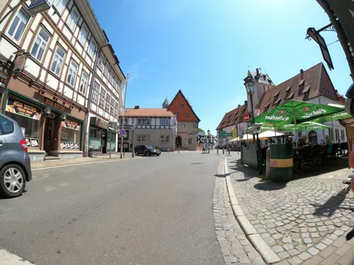


Zur Ecke / Napoli
Restaurant · Italian
3 Markt, Bad Gandersheim
Mo-Tu,Th 10:00-14:30,17:00-23:00; Fr 11:00-14:00,17:00-01:00; Sa...
Kurhotel Waldschlößchen
Restaurant · German · 1.1 km
13 Dr.-Heinrich-Jasper-Straße, Bad Gandersheim
We,Th 17:00-18:00+; Fr 15:00-18:00+; Sa,Su 11:00-18:00+
Köhler's Landgasthaus
Restaurant · German · 3.8 km
18 Rük, Bad Gandersheim
Sa 18:00+; PH,Su 11:30-14:00
33 more on the map.
History
The town dates back to 852, when Gandersheim Abbey, a house of secular canonesses, was created in nearby Brunshausen by Liudolf, Duke of Saxony and his wife Oda. The first abbey church (German: Stiftskirche) in the town proper was begun in 856. In 990 the abbey received the market and tax rights. During the 10th century, Gandersheim was one of the most important towns of Saxony; the first German poet Hrosvit (Roswitha) lived and worked here until 973. In 1159 Gandersheim was first mentioned as a town.
When a mineral spring was discovered in 1240, Pope Gregory IX initiated the erection of the Holy Spirit hospital. Around 1330, the Dukes of Brunswick built a castle as a secular counterbalance to the abbey church. This building serves today as the magistrates' court and youth correctional facility.
In the late 19th century, the town began to become known for the curative powers of its mineral springs, and in 1932 Gandersheim received the official right to call itself a spa town, thus Bad Gandersheim, on account of these springs.
In the summer of 1926 there was a three-day "Roswitha Memorial Celebration in 1000-year old Gandersheim". This was the first time the medieval author was used as a symbolic figure for the town. Similar celebrations took place in 1930 and 1933; these had clear national-socialist themes: "German Culture" versus "Jewish-Communist Decadence."
From the History section of Bad Gandersheim on Wikipedia, under CC BY-SA 4.0.
Where to stay3
Boardinghouse Kurpark Quartier
Motel and hotel · 1.0 km
2 Dr.-Heinrich-Jasper-Straße, Bad Gandersheim
Churches and places of worship41
Dorfkirche Seboldshausen
Church · Lutheran · 2.6 km
4 Eternastraße, Bad Gandersheim
Kapelle Hachenhausen
Church · Lutheran · 4.2 km
Hachenhausen, Bad Gandersheim
St. Cäcilie
Church · Lutheran · 6.9 km
31 Gehrenrode, Bad Gandersheim
Shopping13
Gas and EV charging3
Schools, colleges and libraries9
Healthcare7
VITREA Roswithaklinik Bad Gandersheim
Hospital · 0.9 km
2a Dr.-Heinrich-Jasper-Straße, Bad Gandersheim
Map of Bad Gandersheim
243 places. The map loads OpenStreetMap tiles when you open it.
Getting there and nearby towns
Forschungsflughafen Braunschweig-Wolfsburg (BWE) is the nearest airport with scheduled flights listed in OpenStreetMap, 62 km away.
- Bockenem 17 km northeast, about 17 min by car
- Hildesheim 31 km north, about 31 min by car
- Salzhemmendorf 37 km northwest, about 37 min by car
- Göttingen 38 km south, about 38 min by car
- Salzgitter 41 km northeast, about 41 min by car
- Braunschweig 56 km northeast, about 56 min by car
- Wendeburg 57 km northeast, about 57 min by car
- Hannover 59 km north, about 59 min by car
- Witzenhausen 60 km south, about 1 h by car
- Hofgeismar 61 km southwest, about 1 h by car
Drive times are estimates from straight-line distance, not routes.
Local news
Headlines from INDB.
Reviews, tips and questions
Loading what members have shared...
Sources and licences
- GeoNames (CC BY 4.0): population, coordinates, regions and time zone
- Mapillary (see each image): photos
- OpenStreetMap contributors (ODbL 1.0): places, airports, map data
- Wikidata (CC0 1.0): elevation, founding date, time zone, website, landmarks and historic places
- Wikimedia Commons (see each image): photos
- Wikipedia (CC BY-SA 4.0): overview and history text
Photo credits
- Bad Gandersheim Marktplatz 284-85-d, Pedelecs, CC BY-SA 3.0
- 00 1456 Stiftskirche Bad Gandersheim, W. Bulach, CC BY-SA 4.0
- Bushaltestelle Domänenhof, 1, Bad Gandersheim, Landkreis Northeim, GeorgDerReisende, CC BY-SA 4.0
- Bad Gandersheim, Germany - panoramio (5), Dewi König, CC BY-SA 3.0
- 00 7482 Bad Gandersheim - Stift Gandersheim, W. Bulach, CC BY-SA 4.0
- Bad Gandersheim, Germany - panoramio (4), Dewi König, CC BY-SA 3.0
- 00 7469 Bad Gandersheim, W. Bulach, CC BY-SA 4.0
- Steinweg 37581 Bad Gandersheim - panoramio, Dewi König, CC BY-SA 3.0
- 00 7463 Bad Gandersheim, W. Bulach, CC BY-SA 4.0
- Bad Gandersheim, Germany - panoramio, Dewi König, CC BY-SA 3.0
- 00 7479 Bad Gandersheim, W. Bulach, CC BY-SA 4.0
- Markt 37581 Bad Gandersheim - panoramio, Dewi König, CC BY-SA 3.0
- 00 7460 Bad Gandersheim - Stift Gandersheim, W. Bulach, CC BY-SA 4.0
- Bad Gandersheim, Germany - panoramio (1), Dewi König, CC BY-SA 3.0
- GAN - Westportal der Stiftskirche Bad Gandersheim - davor Festspieltribune, Sipalius, CC BY-SA 4.0
- Über den Dächern der Stadt « Bad Gandersheim ( DOM ) - panoramio, Dewi König, CC BY-SA 3.0
- Bad Gandersheim Altstadt - panoramio, Dewi König, CC BY-SA 3.0
- Stiftskirche (Dom) Bad Gandersheim - panoramio, Dewi König, CC BY-SA 3.0
- Stiftskirche (Dom) Bad Gandersheim (evangelische Kirche) - panoramio, Dewi König, CC BY-SA 3.0
- Das Stift Gandersheim (aus dem die heutige Stadt Bad Gandersheim in Niedersachsen hervorgegangen ist) wurde 852 vom Sachsenherzog Liudolf, dem Stammvater und Namensgeber der Liudolfinger, gegründet -..., Dewi König, CC BY-SA 3.0
- 00 245 Stiftskirche Bad Gandersheim, W. Bulach, CC BY-SA 4.0
- 00 7450 Bad Gandersheim - Stift Gandersheim, W. Bulach, CC BY-SA 4.0
- 00 7451 Bad Gandersheim - Stift Gandersheim, W. Bulach, CC BY-SA 4.0
- 00 7442 Bad Gandersheim - Stift Gandersheim, W. Bulach, CC BY-SA 4.0
- Harzhorn Ausgrabungsbereich, Axel Hindemith, CC BY 3.0
- Wohlenstein Bergfried Seite, User Axel Hindemith on de.wikipedia, Public domain
- Seboldshausen, Werner Buzan, CC BY-SA 4.0
- Weissenwasserkirche, Máel Milscothach, CC BY-SA 4.0
- Georgskirche (Bad Gandersheim) Außenansicht, BauerT007, CC BY-SA 3.0
- Kloster Brunshausen Klosterhof, Axel Hindemith, CC BY 3.0
- 2021-08-04 150144 Seesen Bilderlahe St. Michael, Tim Rademacher, CC BY-SA 4.0
- Kreiensenholzminden, Pimvantend, CC BY-SA 3.0
- BadGandersheim-Amtsgericht1-Bubo cropped, Bubo, CC BY-SA 3.0
- Gehrenrode Kirche, Axel Hindemith, CC BY-SA 3.0
- Hachenhausen, FrankBothe, CC BY-SA 3.0
- Olxen - Panorama, flamenc, CC BY-SA 3.0
- Heckenbeck Kirche und Kriegerdenkmal, Norrkuvoq, CC BY-SA 4.0
- Kreiensen Friedenskirche, TeWeBs, CC BY-SA 4.0
- Harzhorn Grabungsschnitt von unten 1, Axel Hindemith, CC BY 3.0
- Stiftsfreiheit 1, Stiftskirche Bad Gandersheim 20171222 011, Tilman2007, CC BY-SA 4.0
- 2021-08-04 125517 Bad Gandersheim Clusberg Denkmal, Tim Rademacher, CC BY-SA 4.0
- Street-level photo, Langfahrer, CC BY-SA 4.0
- Street-level photo, Langfahrer, CC BY-SA 4.0
- Street-level photo, Langfahrer, CC BY-SA 4.0
- Street-level photo, Langfahrer, CC BY-SA 4.0
- Street-level photo, Langfahrer, CC BY-SA 4.0
- Street-level photo, Langfahrer, CC BY-SA 4.0
- Street-level photo, Langfahrer, CC BY-SA 4.0
- Street-level photo, Langfahrer, CC BY-SA 4.0
- Street-level photo, Langfahrer, CC BY-SA 4.0
- Street-level photo, Langfahrer, CC BY-SA 4.0
- Street-level photo, Langfahrer, CC BY-SA 4.0
- Street-level photo, Langfahrer, CC BY-SA 4.0
- Street-level photo, saschahaberkorn, CC BY-SA 4.0
- Street-level photo, thetornado76, CC BY-SA 4.0


Page built November 8, 2026. Spotted a mistake? Tell us or suggest a place.