


Weil der Stadt, Germany
Weil der Stadt is a town of 19,338 people in Baden-Wurttemberg, Germany, founded in 1201.
Why visit Weil der Stadt
Townapedia lists 61 museums and landmarks, 69 parks and trails, 137 places to eat, 12 places to stay and 22 attractions in and around town.
Highlights include Kinocenter, Kulisse, Geburtshaus Johannes Kepler;Kepler-Museum and Stadtmuseum.
Weather in Weil der Stadt
Forecast from MET Norway (CC BY 4.0). Full forecast
About Weil der Stadt
Weil der Stadt (German pronunciation: [ˈvaɪl deːɐ̯ ˈʃtat]) is a town of about 19,000 inhabitants in the Stuttgart Region of the German state of Baden-Württemberg. It is about 30 km (19 mi) west of Stuttgart city centre, in the valley of the River Würm, and is often called the "Gate to the Black Forest".
From the Wikipedia article Weil der Stadt (this version), under CC BY-SA 4.0.
Things to do22

Kinocenter
Cinema and theater
21 Badtorstraße, Weil der Stadt
"Kassenöffnung 30 Min Vor Vorstellungsbeginn"


Eierlädle
Farm and orchard · 3.5 km
5/1 Schöckengasse, Renningen
Tu,Th,Fr,Sa 09:30-11:00, Th 17:00-18:00

Festhalle Stegwiesen - Stegwiesenhalle
Cinema and theater · 4.8 km
Stegwiesenhalle - bestuhlte Veranstaltungen bis max. 470 Besuchende
Forchenhof
Farm and orchard · 4.0 km
Frische Eier und Nudeln ab Hof
10 more on the map.
Museums and landmarks61

Geburtshaus Johannes Kepler;Kepler-Museum
Museum
Geburtshaus von Johannes Kepler
2 Keplergasse, Weil der Stadt
Sa 14:00-16:00; Su 14:00-17:00


Blumhardt-Gedenkstätte
Museum · 5.5 km
Inschrift: Wohnhaus der Gottliebin Dittus, die in 2-jährigem Glaubens- und Gebetskampf (1842-1843) durch Pfarrer Johann Christoph...
3 Blumhardtstraße, Bad Liebenzell
Su[1]14:30-17:00


Bahnhof Weil der Stadt
Monument and historic site · 0.6 km
Historisches Empfangsgebäude
1 Bahnhofstraße, Weil der Stadt
Kunsthaus Brandner
Museum
6 Mäuerlesgang, Weil der Stadt
Mo,Tu,Th,Fr 09:00-12:00,15:00-18:00; Sa 09:00-12:30

Klösterle
Monument and historic site
11 Kapuzinerberg, Weil der Stadt

49 more on the map.
Parks, trails and playgrounds69


Kappelwiesen-Beim Roten Brunnen-Salzwiesen
Hiking and trails · 1.9 km





Grafenauer Hallenbädle
Sports field and stadium · 5.0 km
14 Bergstraße, Grafenau
off

57 more on the map.
Restaurants and cafes137
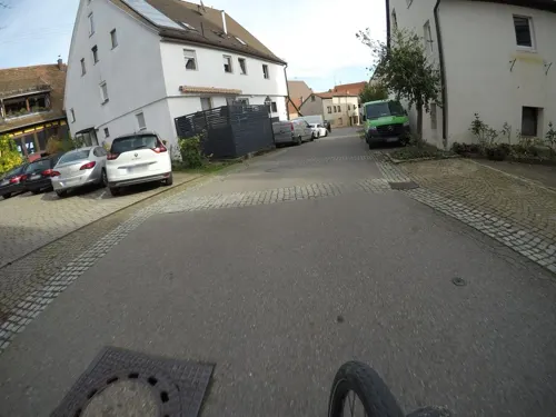
Landgasthof1610
Restaurant · Regional · 2.7 km
6 Kirchgrabenstraße, Weil der Stadt
Tu-Fr,Su 12:00-14:00, Tu-Fr 17:00-21:00, Sa 17:00-21:00; Mo off
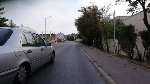
Diefenbach
Cafe · 0.8 km
12 Josef-Beyerle-Straße, Weil der Stadt
Mo-Fr 06:00-18:00; Sa 06:00-17:00; Su 07:30-17:00
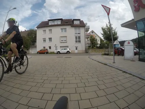
Eiscafe & Pizzeria Paradiso
Cafe · Italian · 4.7 km
Dätzinger Straße, Grafenau
Tu-Su 11:00-21:00; Mo off
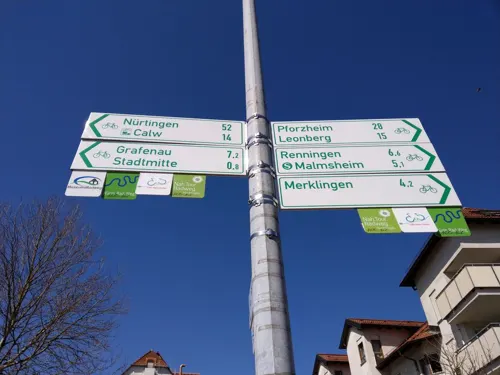
Fukiheian
Restaurant · Asian
1 Schießrainweg, Weil der Stadt
Mo-Fr 11:00-15:00,17:00-21:30; Sa,Su 11:30-22:00
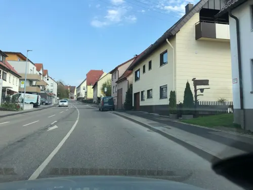
Gasthaus Monbachtal
Restaurant · Regional · 5.5 km
10 Weil der Städter Straße, Bad Liebenzell
Mo,Tu off; We-Sa 16:00+; Su,PH 11:00+
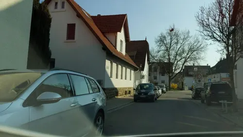
Gasthof Ochsen
Restaurant · German · 5.2 km
10 Lange Straße, Renningen
Th,Fr,Su-Tu 11:30-14:00, Th-Tu 17:30-21:00; We off
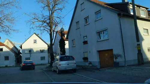


Kastra
Restaurant · Greek · 5.3 km
43 Leonberger Straße, Renningen
Mo,We-Sa 17:00-22:30; Su,PH 11:30-22:00

Le's - Appetit auf Reis
Restaurant · Asian
19 Badtorstraße, Weil der Stadt
Mo-Fr 12:00-14:30,17:00-21:00
Restaurant D'Arena am Sportplatz
Restaurant · Italian · 5.5 km
17 Jahnstraße, Grafenau
We-Fr 16:30-22:00; Sa-Su 11:30-14:30, 16:30-21:30; PH off
Schwaben Schänke Da Angelo
Restaurant · Italian · 4.6 km
45 Weil der Städter Straße, Renningen
Tu-Fr 11:30-14:00, 17:15-21:30; Sa 17:15-21:30; Su, PH...

Wenninger Hof
Bar and pub · Sausage, Salad, Flammkuchen, Ice Cream, German · 5.0 km
Im Winter geschlossen
1 Wenninger Höfe, Grafenau
Su,PH 12:00-21:00; We-Sa 16:00-21:00
Adler Da Pino
Restaurant · Italian · 5.0 km
14 Hauptstraße, Renningen
We-Mo 11:30-14:00,17:00-22:00; Tu off
125 more on the map.
History
The village of Wile was first mentioned in 1075, and described as the property of the famous abbey of Hirsau. Weil der Stadt became a Free Imperial City in 1272, but had existed for centuries before as an important trading place. In 1294 Augustinian monks would become established in the town.
The city was completely destroyed during the Thirty Years' War in 1648 but was subsequently rebuilt, and is still dominated by buildings from this period. The city's fortifications have survived largely intact, with city walls, gates, and several towers.
Weil der Stadt is best known as the birthplace of the astronomer Johannes Kepler (1571–1630), and it bears the unofficial title of Keplerstadt, or Kepler town. Another famous son is the Protestant reformer Johannes Brenz (1499–1570). Due to its surroundings and attractive cityscape, dominated by the church steeple of St. Peter and Paul, Weil der Stadt is a popular destination for excursions in the Stuttgart region.
From the History section of Weil der Stadt on Wikipedia, under CC BY-SA 4.0.
Where to stay12
Churches and places of worship32
Neuapostolische Kirche
Church · New Apostolic · 4.8 km
56 Dätzinger Straße, Grafenau
Ostelsheimer Kirche
Church · Protestant · 3.0 km
Kirchgasse, Ostelsheim
St. Leonhard
Church · Roman Catholic · 3.7 km
1 Kirchstraße, Grafenau
Shopping35
Gas and EV charging10
Schools, colleges and libraries28
Healthcare6
Map of Weil der Stadt
250 places. The map loads OpenStreetMap tiles when you open it.
Getting there and nearby towns
Manfred Rommel Airport Stuttgart (STR) is the nearest airport with scheduled flights listed in OpenStreetMap, 26 km away.
- Wildberg 17 km southwest, about 17 min by car
- Pforzheim 20 km northwest, about 20 min by car
- Weil im Schönbuch 20 km southeast, about 20 min by car
- Stuttgart 23 km east, about 23 min by car
- Reutlingen 38 km southeast, about 38 min by car
- Wendlingen am Neckar 38 km east, about 38 min by car
- Winnenden 41 km east, about 41 min by car
- Wernau 40 km east, about 40 min by car
- Karlsruhe 45 km northwest, about 45 min by car
- Heilbronn 50 km northeast, about 50 min by car
Drive times are estimates from straight-line distance, not routes.
Local news
Headlines from INDB.
Reviews, tips and questions
Loading what members have shared...
Sources and licences
- GeoNames (CC BY 4.0): population, coordinates, regions and time zone
- Mapillary (see each image): photos
- OpenStreetMap contributors (ODbL 1.0): places, airports, map data
- Wikidata (CC0 1.0): elevation, founding date, time zone, website
- Wikimedia Commons (see each image): photos
- Wikipedia (CC BY-SA 4.0): overview and history text
Photo credits
- Luftbildarchiv Erich Merkler - Weil der Stadt - 1983 - N 1-96 T 1 Nr. 507, Erich Merkler, CC BY 3.0
- Weil der Stadt - Altstadt - St. Peter und Paul - Ansicht von Süden an Winternachmittag, Roman Eisele, CC BY-SA 4.0
- Weil der Stadt mit katholischer Stadtkirche St. Peter und Paul, dreigeschliffene, netzgewölbte spätgotische Hallenkirche von 1492 - panoramio, qwesy qwesy, CC BY 3.0
- Landappbw 1131753 1817 Marktplatz Weil der Stadt, Till Spiegel, CC0
- Weil der Stadt - Altstadt - St. Peter und Paul - Chorraum - Decke senkrecht, Roman Eisele, CC BY-SA 4.0
- Weil der Stadt - Altstadt - St. Peter und Paul - Weihnachtskrippe 2016 - andächtiges Schaf, Roman Eisele, CC BY-SA 4.0
- Weil der Stadt - Altstadt - St. Peter und Paul - Weihnachtskrippe 2016 - König, Roman Eisele, CC BY-SA 4.0
- Weil der Stadt - Altstadt - St. Peter und Paul - Kanzel gesamt, Roman Eisele, CC BY-SA 4.0
- Weil der Stadt - Altstadt - St. Peter und Paul - Kanzel Mittelteil, Roman Eisele, CC BY-SA 4.0
- Weil der Stadt - Altstadt - St. Peter und Paul - Innenansicht mit Blick zum Altar, Roman Eisele, CC BY-SA 4.0
- Weil der Stadt - Altstadt - St. Peter und Paul - Kanzel Putti mit Bibelzitat, Roman Eisele, CC BY-SA 4.0
- Weil der Stadt - Altstadt - St. Peter und Paul - Weihnachtskrippe 2016 - Maria, Kind und Ochse, Roman Eisele, CC BY-SA 4.0
- Innenansicht Sankt Peter und Paul Weil der Stadt02052023 2, Zavijava2, CC BY-SA 3.0
- Weil der Stadt - Altstadt - St. Peter und Paul - Kirchenschiff - Decke senkrecht, Roman Eisele, CC BY-SA 4.0
- Denkmal des Astronomen und Mathematikers Johannes Kepler , geboren 27.12.1571, Weil der Stadt , verstorben 15.11.1630, Regensburg), August von Kreling, 1870 - panoramio, qwesy qwesy, CC BY 3.0
- Fasching Post Weil der Stadt 2011, Superwind, CC0
- Innenansicht Sankt Peter und Paul Weil der Stadt02052023 1, Zavijava2, CC BY-SA 3.0
- Landappbw 1131752 1817 Marktplatz Weil der Stadt, Till Spiegel, CC0
- Fasnetsumzug Weil der Stadt 02032013 4, Zavijava2, CC BY-SA 3.0
- Die ersten fünf Jahre seines Lebens verbrachte Johannes Kepler in Weil der Stadt. - panoramio, Qwesy, CC BY 3.0
- Katholische Stadtkirche St. Peter und Paul in Weil der Stadt, dreigeschliffene, netzgewölbte spätgotische Hallenkirche von 1492 - panoramio (2), qwesy qwesy, CC BY 3.0
- Radwegweiser in Weil der Stadt, 5R-MFT, CC BY-SA 4.0
- Katholische Stadtkirche St. Peter und Paul in Weil der Stadt, dreigeschliffene, netzgewölbte spätgotische Hallenkirche von 1492 - panoramio (1), qwesy qwesy, CC BY 3.0
- Katholische Stadtkirche St. Peter und Paul in Weil der Stadt, dreigeschliffene, netzgewölbte spätgotische Hallenkirche von 1492 - panoramio, qwesy qwesy, CC BY 3.0
- Klostergarten in Weil der Stadt - panoramio, qwesy qwesy, CC BY 3.0
- Fasnetsumzug Weil der Stadt 2015 3, Zavijava2, CC BY-SA 3.0
- Bäckerei Konditorei Renz in Weil der Stadt - panoramio, qwesy qwesy, CC BY 3.0
- Kannenbrunnen in Weil der Stadt (72307), 5R-MFT, CC BY-SA 4.0
- Kannenbrunnen in Weil der Stadt, 5R-MFT, CC BY-SA 4.0
- Stadtpfarrkirche Weil der Stadt19022019, Zonk43, CC BY-SA 3.0
- Fasnetparty Weil der Stadt 03032013, Zavijava2, CC BY-SA 3.0
- Bahnhof Weil der Stadt, Baron2105, CC BY-SA 3.0
- Würmtal zwischen Aidlingen und Dätzingen 02, Rainer M. Ritz, CC BY-SA 3.0
- Naturschutzgebiet Mittelberg bei Weil der Stadt - panoramio, qwesy qwesy, CC BY 3.0
- WdSt-PeterundPaul, No machine-readable author provided. MarkusHagenlocher assumed (based on copyright claims)., CC BY-SA 3.0
- Johannes-Brenz-Kirche (Weil der Stadt) Ansicht, Bodo Kubrak, CC BY-SA 4.0
- Plan Hörnle und Geißberg, H. Sellmoene, CC BY-SA 4.0
- NSG Merklinger Ried - Blick nach Merklingen, Friedi13, CC BY-SA 4.0
- NSG Kappelwiesen-Beim Roten Brunnen-Salzwiesen - Ufergehölz Talackerbach, Friedi13, CC BY-SA 4.0
- NSG Würmaue am Heuberg - Gesamtansicht, Friedi13, CC BY-SA 4.0
- NSG Simmozheimer Wald - Kiefernbestand und Magerwiese, Friedi13, CC BY-SA 4.0
- Schwarzwald-Schwäbische-Alb-Allgäu-Weg (HW5) - panoramio (8), qwesy qwesy, CC BY 3.0
- St. Johannes der Täufer Döffingen 13, Giftzwerg 88, CC BY-SA 3.0
- Neuapostolische Kirche Döffingen 07, Giftzwerg 88, CC BY-SA 3.0
- Gemeinschaftsschule Döffingen 01, Giftzwerg 88, CC BY-SA 3.0
- Evangelische Germanuskirche und Rathaus in Malmsheim - panoramio, qwesy qwesy, CC BY 3.0
- Edeka in Döffingen 03, Giftzwerg 88, CC BY-SA 3.0
- Blumhardtkirche, Samuel Friedrich Klein, CC BY-SA 4.0
- Kapuzinerberg 11 Weil der Stadt 20220625 0435, Tilman2007, CC BY-SA 4.0
- Kapuzinerberg 1 Weil der Stadt 20220625 0444, Tilman2007, CC BY-SA 4.0
- Marktplatz 14, 12 Weil der Stadt 20220625 0039 (cropped), Tilman2007, CC BY-SA 4.0
- Stuttgarter Straße 68, Sailerutrm Weil der Stadt 20220625 0328, Tilman2007, CC BY-SA 4.0
- Pfarrgasse8 Weil der Stadt, Silesia711, CC BY-SA 4.0
- Stuttgarter Straße 62 Weil der Stadt 20220625 0354, Tilman2007, CC BY-SA 4.0
- Leonhardskirche Dätzingen, Samuel Friedrich Klein, CC BY-SA 4.0
- Ostelsheim, Kirche, Samuel Friedrich Klein, CC BY-SA 4.0
- Keplerhaus Weil der Stadt, Memorino, CC BY-SA 3.0
- Biergarten (Wochenendbetrieb) Kuppelzen - panoramio, qwesy qwesy, CC BY 3.0
- Street-level photo, mfa, CC BY-SA 4.0
- Street-level photo, 5rmft, CC BY-SA 4.0
- Street-level photo, plexi32, CC BY-SA 4.0
- Street-level photo, plexi32, CC BY-SA 4.0
- Street-level photo, deleted_user, CC BY-SA 4.0
- Street-level photo, deleted_user, CC BY-SA 4.0
- Street-level photo, stefan005, CC BY-SA 4.0
- Street-level photo, michelm16, CC BY-SA 4.0
- Street-level photo, mfa, CC BY-SA 4.0
- Street-level photo, mfa, CC BY-SA 4.0
- Street-level photo, michelm16, CC BY-SA 4.0
- Street-level photo, mfa, CC BY-SA 4.0
- Street-level photo, michelm16, CC BY-SA 4.0
- Street-level photo, ramap, CC BY-SA 4.0
- Street-level photo, ramap, CC BY-SA 4.0
- Street-level photo, blind, CC BY-SA 4.0
- Street-level photo, deleted_user, CC BY-SA 4.0
- Street-level photo, deleted_user, CC BY-SA 4.0
- Street-level photo, radius_proxy_de, CC BY-SA 4.0
- Street-level photo, stefan005, CC BY-SA 4.0
- Street-level photo, deleted_user, CC BY-SA 4.0
- Street-level photo, radius_proxy_de, CC BY-SA 4.0
- Street-level photo, mfa, CC BY-SA 4.0
- Street-level photo, mfa, CC BY-SA 4.0


,_August_von_Kreling,_1870_-_panoramio.jpg)


Page built November 8, 2026. Spotted a mistake? Tell us or suggest a place.