


Bad Waldsee, Germany
Bad Waldsee is a town of 19,840 people in Baden-Wurttemberg, Germany.
Why visit Bad Waldsee
Townapedia lists 37 museums and landmarks, 28 parks and trails, 100 places to eat, 10 places to stay and 15 attractions in and around town.
Highlights include Seenema, Stadthalle, Erwin Hymer Museum and Museum im Kornhaus.
Weather in Bad Waldsee
Forecast from MET Norway (CC BY 4.0). Full forecast
About Bad Waldsee
Bad Waldsee (German pronunciation: [baːt ˈvaltˌzeː] ) is a town in Upper Swabia in Baden-Württemberg, Germany. It is part of the district of Ravensburg. It is situated 20 km south of Biberach an der Riß, and 20 km northeast of Ravensburg. The town has a historic old city with landmarks and pedestrian zone.
From the Wikipedia article Bad Waldsee (this version), under CC BY-SA 4.0.
Things to do15





3 more on the map.
Museums and landmarks37

Erwin Hymer Museum
Museum · 1.8 km
7 Robert-Bosch-Straße, Bad Waldsee
Mo-Su 10:00-18:00; Th 10:00-21:00

Fasnet- und Ölmühlenmuseum
Museum
Open every 2 weeks on wednesdays
8 Bleichestraße, Bad Waldsee
We 14:30-18:00



25 more on the map.
Parks, trails and playgrounds28






Kneipp-Kräutergarten
Park · 0.8 km
Seit 17 Jahren unterhält der Kneippverein Bad Waldsee einen Heilkräutergarten mitten im Bad Waldseer Kurgebiet, in dem mehr als hundert...


16 more on the map.
Restaurants and cafes100
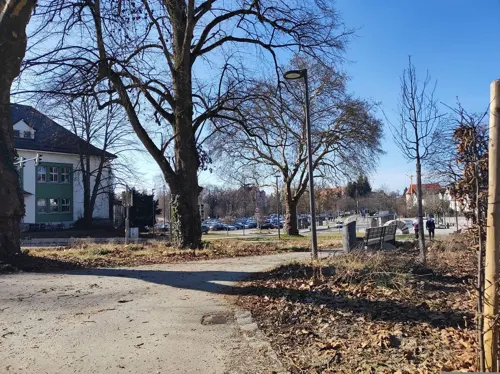
Amadeus
Restaurant · Burger, Hot Dog
23 Ravensburger Straße, Bad Waldsee
Mo-Th 00:00-01:00,11:00-14:00,17:00-24:00; Fr...
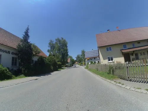
Gasthof Engel
Restaurant · 6.1 km
Freundliches Landgasthaus mit kleinem Biergarten. Leckere schwäbische Küche und gutes Bier (Landzüngle von Härle).
24 Dorfstraße, Bad Wurzach
Fr,Sa,Su 17:00+
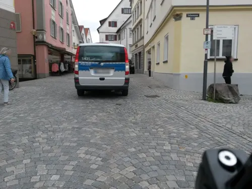
Gasthof Kreuz
Restaurant · Regional
1 Gut-Betha-Platz, Bad Waldsee
We-Su 12:00-14:00; Tu-Sa 17:00-23:00
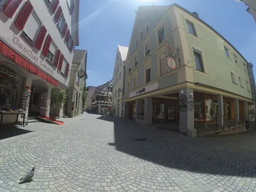
Grüner Baum
Restaurant · Regional
34 Hauptstraße, Bad Waldsee
We-Su 11:30-15:00,17:00-21:00; Mo,Tu off

Hotel-Gasthaus Adler
Restaurant · German · 3.7 km
15 Bundesstraße, Bad Waldsee
Tu-Sa 17:00-23:00; Su,Mo off
Landgasthof Kreuz
Restaurant · Regional · 3.1 km
3, Bad Waldsee
Mo-Th 17:00-21:30; Su 11:30-21:30; Fr,Sa off

Caravano
Restaurant · International · 1.8 km
7 Robert-Bosch-Straße, Bad Waldsee
Tu-Su 10:00-18:00; Mo off
Gasthaus Stern
Restaurant · Regional · 4.7 km
2 Kümmerazhofer Straße, Bad Waldsee
Tu 17:00-22:00; We,Th 11:30-13:45,17:00-22:00; Fr,Sa...
Gaststätte zur Versteigerungshalle
Restaurant · Regional · 2.0 km
12 Hopfenweiler, Bad Waldsee
Mo-Sa 11:30-14:30; Su,PH 11:00-15:00; We off


La Palma
Restaurant · Italian
28 Hittisweilerstraße, Bad Waldsee
We-Mo 11:30-13:30, 17:00-21:30, Tu off
88 more on the map.
History
Waldsee was first documented in 926 in the Weissenburger Codex, which mentions the destruction caused by the Hungarians during their invasion of southern Germany. It says "In Walahsé a royal estate was destroyed by the heathens. All it has left is two lots of farmland, 60 carts of hay, a mill and a church." The town was granted city-rights in 1298. Authority over the city was exercised by the "Lords of Waldsee", a title the city soon sold to the Habsburg Duke of Austria. However, in 1386 the House of Habsburg pledged the city of Waldsee to the steward Johann von Waldburg.
In 1406 the pledge lordship (Pfandherrschaft) of Waldburg was renewed, when the city of Waldsee, together with the towns of Mengen, Riedlingen, Munderkingen and Saulgau, were finally sold off by the House of Habsburg. From this time these cities have been known together as the "fünf Donaustädte" (Five Danube Towns). The House of Waldburg stayed in control of the towns until Napoleon established a new European order through war and politics, which made Waldsee part of the Kingdom of Württemberg in 1806. In 1807 Waldsee was elevated the status of township, and the city grew in prominence during this period.
From the History section of Bad Waldsee on Wikipedia, under CC BY-SA 4.0.
Where to stay10
Churches and places of worship42
Kapelle St. Leonhard
Church · Roman Catholic · 3.7 km
1 Kirchweg, Bad Waldsee
Kapelle zur Heiligen Familie
Church · Roman Catholic · 8.6 km
6 Schussenrieder Straße, Ingoldingen
St. Johannes
Church · Roman Catholic · 5.3 km
2 Burgweiherstraße, Bad Waldsee
St. Nikolaus
Church · Roman Catholic · 5.9 km
2 Gräbelgasse, Bad Wurzach
St. Pankratius
Church · Roman Catholic · 7.6 km
8 Waldseer Straße, Ingoldingen
St. Philippus und Jacobus
Church · Roman Catholic · 7.9 km
22 Ravensburger Straße, Bergatreute
Shopping22
Gas and EV charging9
Schools, colleges and libraries15
Healthcare9
Map of Bad Waldsee
250 places. The map loads OpenStreetMap tiles when you open it.
Getting there and nearby towns
Friedrichshafen Airport (FDH) is the nearest airport with scheduled flights listed in OpenStreetMap, 33 km away.
- Bad Wurzach 11 km east, about 11 min by car
- Weingarten 15 km southwest, about 15 min by car
- Ravensburg 19 km southwest, about 19 min by car
- Biberach an der Riß 19 km north, about 19 min by car
- Bad Saulgau 22 km northwest, about 22 min by car
- Meckenbeuren 28 km southwest, about 28 min by car
- Tettnang 31 km southwest, about 31 min by car
- Riedlingen 33 km northwest, about 33 min by car
- Friedrichshafen 36 km southwest, about 36 min by car
- Laupheim 35 km north, about 35 min by car
Drive times are estimates from straight-line distance, not routes.
Local news
Headlines from INDB.
Reviews, tips and questions
Loading what members have shared...
Sources and licences
- GeoNames (CC BY 4.0): population, coordinates, regions and time zone
- Mapillary (see each image): photos
- OpenStreetMap contributors (ODbL 1.0): places, airports, map data
- Wikidata (CC0 1.0): elevation, founding date, time zone, website
- Wikimedia Commons (see each image): photos
- Wikipedia (CC BY-SA 4.0): overview and history text
Photo credits
- BadWaldseeStadtsee, Ssch, CC BY-SA 3.0
- Stiftskirche Bad Waldsee 02, Helmlechner, CC0
- City Bad Waldsee, Novalis Digit, CC BY 3.0
- Hochstatt 5, Bad Waldsee, Helmlechner, CC0
- Hauptstraße 26 (Bad Waldsee), Richard Mayer, CC BY 3.0
- Hauptstraße Bad Waldsee - panoramio (1), Richard Mayer, CC BY 3.0
- Hl. Geist-Spital Bad Waldsee 01, Helmlechner, CC0
- Hauptstraße 37, Bad Waldsee, Helmlechner, CC0
- Bad Waldsee-manhole cover-01ASD, Asurnipal, CC BY-SA 4.0
- Hauptstraße 14, Bad Waldsee, Helmlechner, CC0
- Hl. Geist-Spital Bad Waldsee 03, Helmlechner, CC0
- Hl. Geist-Spital Bad Waldsee 02, Helmlechner, CC0
- Rathaus Bad Waldsee 01, Helmlechner, CC0
- Wireless Metropolitan Area Network Bad Waldsee, Offenbacherjung, CC BY-SA 4.0
- Carl Partin Bad Waldsee - panoramio, Richard Mayer, CC BY 3.0
- Bad Waldsee - panoramio (4), Richard Mayer, CC BY 3.0
- Hauptstraße Bad Waldsee 01, Helmlechner, CC0
- Bad Waldsee - panoramio (3), Richard Mayer, CC BY 3.0
- Pumptrack Bad Waldsee, Thomas-2801, CC BY-SA 4.0
- Beckersche Apotheke in Bad Waldsee, Offenbacherjung, CC BY-SA 4.0
- Hauptstraße 58, Bad Waldsee, Helmlechner, CC0
- Stiftskirche Bad Waldsee 01, Helmlechner, CC0
- Wurzacher Tor Bad Waldsee 02, Helmlechner, CC0
- Portal Bad Waldsee - panoramio, Richard Mayer, CC BY 3.0
- Bad Waldsee - panoramio (2), Richard Mayer, CC BY 3.0
- Hauptstraße Bad Waldsee - panoramio, Richard Mayer, CC BY 3.0
- Hauptstraße Bad Waldsee 02, Helmlechner, CC0
- Hauptstraße 63 (Bad Waldsee), Richard Mayer, CC BY 3.0
- Hauptstraße 61 (Bad Waldsee), Richard Mayer, CC BY 3.0
- Bad Waldsee Hauptstraße - panoramio, Richard Mayer, CC BY 3.0
- Bad Waldsee- Gut-Betha-Platz- Polizeibehörde stellt Ordnungswidrigkeit fest 6.9.2018, Jivee Blau, CC BY-SA 4.0
- Bad Waldsee- Gut-Betha-Platz- Polizeibehörde dokumentiert Ordnungswidrigkeit 6.9.2018, Jivee Blau, CC BY-SA 4.0
- Bad Waldsee-MER hypercharger 300-CCS combo 2-HYC 300-02ASD, Asurnipal, CC BY-SA 4.0
- Bad Waldsee-MER hypercharger 300-CCS combo 2-HYC 300-01ASD, Asurnipal, CC BY-SA 4.0
- Burgrest Neuwaldsee, McSearch, Public domain
- Erwin-Hymer-Museum 2012 by-RaBoe 2, © Ra Boe / Wikipedia, CC BY-SA 3.0 de
- Bad Waldsee, Wallfahrtskapelle St. Sebastian 20250825-4B3A0084, Thomas-2801, CC BY-SA 4.0
- Bad Waldsee - Stiftskirche St. Peter und Paul, Franzfoto, CC BY-SA 3.0
- Bad Waldsee-Castle Waldsee (frontside)-01ASD, Asurnipal, CC BY-SA 4.0
- NSG 4.308 Brunnenholzried-Bannwald 2024-3, NorbertWLang, CC0
- NSG Mauchenmühle, der große See, Thomas-2801, CC BY-SA 4.0
- D-BW-RV-Aulendorf - Haslacher Weiher 001, ANKAWÜ, CC BY-SA 4.0
- Gaisbeuren Kapelle 1, Photo: Andreas Praefcke, CC BY 3.0
- HaidgauStNikolaus 2021-09, Mussklprozz, CC BY-SA 4.0
- Ziegelbach 5, Richard Mayer, CC BY-SA 3.0
- Kapelle zur Heiligen Familie Wattenweiler 02, Johanna Heumann, CC BY-SA 4.0
- St. Pankratius Winterstettendorf, Johanna Heumann, CC BY-SA 4.0
- Bad Waldsee - Michelwinnaden - Kirche v N, Flodur63, CC BY-SA 4.0
- Marienkapelle Graben bei Bad Waldsee, Thomas-2801, CC BY-SA 4.0
- 20260806 093314 HDR, Harald Hetzner, CC0
- Bad Waldsee Stiftskirche Fassade, Photo: Andreas Praefcke, CC BY 3.0
- Bergatreute Pfarrkirche außen, Photo: Andreas Praefcke, CC BY 3.0
- NSG-BW-RV-4.013 Rohrsee-KL1, KlaraLang, CC BY-SA 3.0
- Street-level photo, ray66, CC BY-SA 4.0
- Street-level photo, msdess, CC BY-SA 4.0
- Street-level photo, rausk, CC BY-SA 4.0
- Street-level photo, derzornigemarkus, CC BY-SA 4.0
- Street-level photo, ray66, CC BY-SA 4.0
- Street-level photo, rausk, CC BY-SA 4.0
- Street-level photo, rausk, CC BY-SA 4.0
- Street-level photo, derzornigemarkus, CC BY-SA 4.0
- Street-level photo, msdess, CC BY-SA 4.0
- Street-level photo, mapnerd_dk, CC BY-SA 4.0
- Street-level photo, mapnerd_dk, CC BY-SA 4.0
- Street-level photo, rausk, CC BY-SA 4.0
- Street-level photo, rausk, CC BY-SA 4.0
- Street-level photo, mammi71, CC BY-SA 4.0
- Street-level photo, rausk, CC BY-SA 4.0
- Street-level photo, rausk, CC BY-SA 4.0
- Street-level photo, ray66, CC BY-SA 4.0
- Street-level photo, rausk, CC BY-SA 4.0
- Street-level photo, rausk, CC BY-SA 4.0
- Street-level photo, rausk, CC BY-SA 4.0
- Street-level photo, rausk, CC BY-SA 4.0
- Street-level photo, rausk, CC BY-SA 4.0
- Street-level photo, rausk, CC BY-SA 4.0
- Street-level photo, rausk, CC BY-SA 4.0


Page built November 8, 2026. Spotted a mistake? Tell us or suggest a place.