


Why visit Bad Wildungen
Townapedia lists 66 museums and landmarks, 35 parks and trails, 140 places to eat, 62 places to stay and 120 attractions in and around town.
Highlights include Aussichtsturm Homberg, Dr. Marc-Turm, Ederseebahn-Radweg and Museum Schloss Friedrichstein.
Weather in Bad Wildungen
Forecast from MET Norway (CC BY 4.0). Full forecast
About Bad Wildungen
Bad Wildungen (German pronunciation: [baːt ˈvɪldʊŋən] ) is a state-run spa and a small town in Waldeck-Frankenberg district in Hesse, Germany. It is located on the German Timber-Frame Road.
From the Wikipedia article Bad Wildungen (this version), under CC BY-SA 4.0.
Things to do120





108 more on the map.
Museums and landmarks66
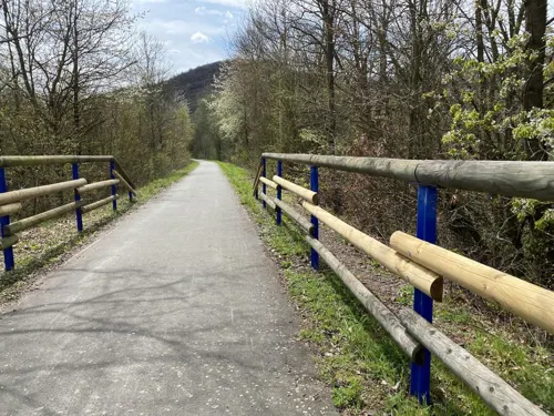

Museum Schloss Friedrichstein
Museum · 0.6 km
Apr-Oct: Tu-Su,PH 10:00-17:00, Nov-Mar: Fr-Su,PH 10:00-17:00

Heimatmuseum Bad Zwesten
Museum · 8.2 km
2 Ringstraße, Bad Zwesten
"Jeden 1. Donnerstag und 3. Sonntag im Monat von 15:00 bis 16:30...



Wüstegarten
Monument and historic site · 11.8 km
Mountain in Hesse, Germany

Herrenhaus Betzigerode
Monument and historic site · 6.6 km
13 Ziergartenstraße, Bad Zwesten

Schloss Friedrichstein
Monument and historic site · 0.6 km
23 Schloßstraße, Bad Wildungen
54 more on the map.
Parks, trails and playgrounds35

Kellerwald-Edersee National Park
Park · 10.2 km
National park in Hesse, Germany

Ederauen zwischen Bergheim und Wega
Hiking and trails · 4.2 km
Flussabschnitt der Eder mit den angrenzenden Uferbereichen, zwischen den Orten Bergheim und Wega.


Krautwiese am Wesebach
Hiking and trails · 5.0 km
Durch Kiesabbau entstandene Teichfläche mit Gehölzen und Grünland westlich der Mündung des Wesebachs in die Eder.


Schlämmteiche bei Geismar
Hiking and trails · 8.0 km
Flusslauf der Eder mit Teichen und Wald, südlich von Geismar, westlich von Fritzlar.

Schwimmkaute bei Mehlen
Hiking and trails · 5.2 km
Durch Kiesabbau entstandene Teichfläche mit umgebenden Gehölzen östlich von Mehlen.

Stausee von Affoldern
Hiking and trails · 6.2 km
Künstlicher See im Lauf der Eder mit Insel und den angrenzenden Uferbereichen, Teil des Nationalparks Kellerwald-Edersee, westlich von Affoldern.

Unter der Haardt
Hiking and trails · 6.1 km
Flusslauf der Eder mit ehemaligen Kiessbagger- und Fischteichen, Auenwald und Grünland, nordöstlich von Mandern.

Zechsteinhänge bei Lieschensruh
Hiking and trails · 6.8 km
Magerrasen und Gehölze auf Zechstein nordwestlich von Lieschensruh (Siedlungsteil von Mehlen). Das NSG besteht aus 4 Flächen, die...

23 more on the map.
Restaurants and cafes140

Brauhaus Bad Wildungen
Bar and pub · Burger, German · 2.0 km
2 Frankenberger Straße, Bad Wildungen
PH 12:00-15:00; We,Fr 18:00-22:00; Sa 12:00-22:00; Su 12:00-20:00

Terra Mia
Restaurant · Italian · 8.0 km
Ristorante Pizzeria Steakhouse
7 Kasseler Straße, Bad Zwesten
Mo, We-Sa 17:00-22:00; Su 11:30-14:30, 17:00-22:00; Tu off
Café Land und Leute
Restaurant · Regional · 7.6 km
56 Birkenweg, Fritzlar
Sa 14:00-18:00; Su 10:00-18:00
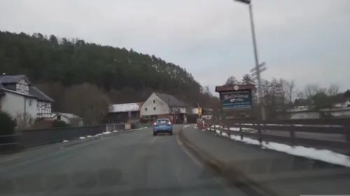
Das Waffelhaus
Cafe · Waffle · 1.8 km
67 Bilsteinstraße, Bad Wildungen
Tu-Fr 12:00-20:00; Sa 11:30-20:00; Su 11:00-20:00; Mo off
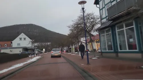
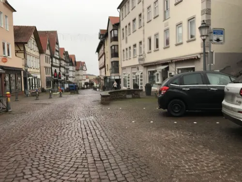
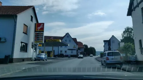
Gasthaus Zorn
Restaurant · Regional · 4.4 km
7 Edertalstraße, Edertal
Tu-Th 17:00+; Fr-Su 11:00+; Mo off
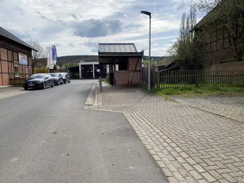
Gaststätte Koppenretscher Wirt
Restaurant · Regional · 3.9 km
14 Vor der Linde, Bad Wildungen
We,Th 16:00+; Fr,Sa 15:00+; Su 11:00+; Mo,Tu off
Heustübl
Restaurant · Indian · 3.5 km
40 Wildunger Straße, Bad Wildungen
Tu-Fr 17:00-22:00; Sa,Su 11:00-14:30,17:00-22:00; Mo off
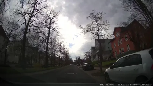


Hotel Allee Schlößchen
Restaurant · Regional · 0.6 km
11 Brunnenallee, Bad Wildungen
Tu 11:00-18:00; We-Sa 11:00-21:00; Su 11:00-18:00; Mo off
Landgasthaus Zum Urfftal
Restaurant · German · 8.2 km
43 Im Urfftal, Bad Wildungen
Th-Sa 18:00+; Su 11:00-22:00; Mo-We off
128 more on the map.
History
Bad Wildungen's first documentary mention came about 800 AD from the Hersfeld Monastery's goods directory under the Latin name "villa Wildungun". This place lay in the Wilde Valley, east of today's main town. About 1200, a castle was built by the Thuringian Landgraves, around which Alt-Wildungen ("High Wildungen") (from lat. altus = high) developed. In 1242, Nieder-Wildungen ("Lower Wildungen"), which had been founded on the hill facing the castle, was granted town rights. From 1263, the castle and the two Wildungen towns were owned by the Counts – later Princes – of Waldeck, who only abdicated after the First World War (see Principality of Waldeck). In 1358, the two Wildungen towns were mentioned.
In 1906, the town of Nieder-Wildungen was given the new name Bad Wildungen because of its bath. In 1940, Bad Wildungen was given the title of "Preußisches Staatsbad" ("Prussian State Bath").
According to the documentary "The End of the War in Colour", Bad Wildungen was one of the rare smattering of German towns that survived WWII relatively unscathed.
From the History section of Bad Wildungen on Wikipedia, under CC BY-SA 4.0.
Where to stay62
Churches and places of worship47
Shopping28
Gas and EV charging10
Schools, colleges and libraries15
Healthcare19
Asklepios Fachklinik Fürstenhof Bad Wildungen
Clinic and pharmacy · 1.2 km
39 Brunnenallee, Bad Wildungen
Reinhardshausen-Apotheke
Clinic and pharmacy · 3.3 km
1 Hauptstraße, Bad Wildungen
Map of Bad Wildungen
250 places. The map loads OpenStreetMap tiles when you open it.
Getting there and nearby towns
Fritzlar Air Base (FRZ) is the nearest airport with scheduled flights listed in OpenStreetMap, 11 km away.
- Fritzlar 11 km east, about 11 min by car
- Borken 14 km southeast, about 14 min by car
- Felsberg 21 km east, about 21 min by car
- Schwalmstadt 22 km south, about 22 min by car
- Wolfhagen 23 km north, about 23 min by car
- Frankenberg 24 km west, about 24 min by car
- Korbach 25 km northwest, about 25 min by car
- Melsungen 30 km east, about 30 min by car
- Lohfelden 33 km northeast, about 33 min by car
- Kassel 34 km northeast, about 34 min by car
Drive times are estimates from straight-line distance, not routes.
Local news
Headlines from INDB.
Reviews, tips and questions
Loading what members have shared...
Sources and licences
- GeoNames (CC BY 4.0): population, coordinates, regions and time zone
- Mapillary (see each image): photos
- OpenStreetMap contributors (ODbL 1.0): places, airports, map data
- Wikidata (CC0 1.0): elevation, founding date, time zone, website, landmarks and historic places
- Wikimedia Commons (see each image): photos
- Wikipedia (CC BY-SA 4.0): overview and history text
Photo credits
- BadWildungen-Panorama1-Asio, Asio otus, CC BY-SA 3.0
- Brunnenstraße 29, 3, Bad Wildungen, Landkreis Waldeck-Frankenberg, GeorgDerReisende, CC BY-SA 4.0
- Brunnenstraße 27, 4, Bad Wildungen, Landkreis Waldeck-Frankenberg, GeorgDerReisende, CC BY-SA 4.0
- Brunnenstraße, 2, Bad Wildungen, Landkreis Waldeck-Frankenberg, GeorgDerReisende, CC BY-SA 4.0
- Am Markt, 1, Bad Wildungen, Landkreis Waldeck-Frankenberg, GeorgDerReisende, CC BY-SA 4.0
- Lindenstraße, 3, Bad Wildungen, Landkreis Waldeck-Frankenberg, GeorgDerReisende, CC BY-SA 4.0
- Waisengasse 1, 1, Bad Wildungen, Landkreis Waldeck-Frankenberg, GeorgDerReisende, CC BY-SA 4.0
- Marktbrunnen Bad Wildungen 1, Gerd Fahrenhorst, CC BY 4.0
- Marktbrunnen Bad Wildungen 2, Gerd Fahrenhorst, CC BY 4.0
- Marktkump mit Brunnenmännchen, Bad Wildungen 1, Gerd Fahrenhorst, CC BY 4.0
- Marktkump mit Brunnenmännchen, Bad Wildungen 2, Gerd Fahrenhorst, CC BY 4.0
- Stolpersteinlage Waisengasse 1, 1, Bad Wildungen, Landkreis Waldeck-Frankenberg, GeorgDerReisende, CC BY-SA 4.0
- Stolperstein Ricka Höxter, 1, Waisengasse 1, Bad Wildungen, Landkreis Waldeck-Frankenberg, GeorgDerReisende, CC BY-SA 4.0
- Bad Wildungen 12, ErwinMeier, CC BY-SA 4.0
- Stolpersteine Friedel Rothschild Bad Wildungen, Clemensfranz, CC BY-SA 3.0
- Stolpersteine Rosel Grüneberg Bad Wildungen, Clemensfranz, CC BY-SA 3.0
- Stolpersteine Guido Willinger BAd Wildungen, Clemensfranz, CC BY-SA 3.0
- Stolpersteine Hildegard Bachenheimer Bad Wildungen, Clemensfranz, CC BY-SA 3.0
- Stolpersteine Ricka Höxter Bad Wildungen, Clemensfranz, CC BY-SA 3.0
- Lindenstraße 1, 1, Bad Wildungen, Landkreis Waldeck-Frankenberg, GeorgDerReisende, CC BY-SA 4.0
- Bad Wildungen Zentrum fd, Friedhelm Dröge, CC BY-SA 4.0
- Brunnenstraße 22, 1, Bad Wildungen, Landkreis Waldeck-Frankenberg, GeorgDerReisende, CC BY-SA 4.0
- Lindenstraße, 4, Bad Wildungen, Landkreis Waldeck-Frankenberg, GeorgDerReisende, CC BY-SA 4.0
- Alter Hof, 2, Bad Wildungen, Landkreis Waldeck-Frankenberg, GeorgDerReisende, CC BY-SA 4.0
- Bushaltestelle Marktplatz, 1, Bad Wildungen, Landkreis Waldeck-Frankenberg, GeorgDerReisende, CC BY-SA 4.0
- Lindenstraße 4, 1, Bad Wildungen, Landkreis Waldeck-Frankenberg, GeorgDerReisende, CC BY-SA 4.0
- Stolpersteine Auguste Mannheimer Bad Wildungen, Clemensfranz, CC BY-SA 3.0
- Hinterstraße 23, 1, Bad Wildungen, Landkreis Waldeck-Frankenberg, GeorgDerReisende, CC BY-SA 4.0
- Stolpersteine Helene Berger Bad Wildungen, Clemensfranz, CC BY-SA 3.0
- Stolpersteine Hertha Amalie Frank Bad Wildungen, Clemensfranz, CC BY-SA 3.0
- Hinterstraße 25, 1, Bad Wildungen, Landkreis Waldeck-Frankenberg, GeorgDerReisende, CC BY-SA 4.0
- Stolpersteinlage, Lindenstraße 1, 1, Bad Wildungen, Landkreis Waldeck-Frankenberg, GeorgDerReisende, CC BY-SA 4.0
- Waisengasse, 1, Bad Wildungen, Landkreis Waldeck-Frankenberg, GeorgDerReisende, CC BY-SA 4.0
- Hinterstraße, 1, Bad Wildungen, Landkreis Waldeck-Frankenberg, GeorgDerReisende, CC BY-SA 4.0
- Hinterstraße 27 + 29, 1, Bad Wildungen, Landkreis Waldeck-Frankenberg, GeorgDerReisende, CC BY-SA 4.0
- Lindenstraße 3, 1, Bad Wildungen, Landkreis Waldeck-Frankenberg, GeorgDerReisende, CC BY-SA 4.0
- Stolpersteine Meta Hammerschlag Bad Wildungen, Clemensfranz, CC BY-SA 3.0
- Notstraße, 1, Bad Wildungen, Landkreis Waldeck-Frankenberg, GeorgDerReisende, CC BY-SA 4.0
- Hinterstraße 37, 1, Bad Wildungen, Landkreis Waldeck-Frankenberg, GeorgDerReisende, CC BY-SA 4.0
- Bad Wildungen Stadtkirche fd, Friedhelm Dröge, CC BY-SA 4.0
- 135 3570 Büraburg, JGALoewi, CC BY-SA 3.0
- Wüstegarten von Osten, Jörg Braukmann, CC BY-SA 4.0
- Kellerwald Ringelsberg 001, Antiope05411, CC BY-SA 3.0
- Bueraberg Fritzlar, Hubert Berberich ( HubiB ), CC BY-SA 3.0
- Bergfreiheit HE Kirche, AxelHH at German Wikipedia, Public domain
- BadWildungenBraunau-Kirche1-Bubo, Bubo, CC BY-SA 3.0
- Bad Wildungen ev Stadtkirche, Einwildunger, CC BY-SA 3.0
- Holzfachschule Bad Wildungen, Clemensfranz, CC BY-SA 3.0
- Altwildungen Schloss Friedrichstein Eingang, Clemensfranz, CC BY-SA 3.0
- Bad Zwesten Schloss, Axel Hindemith, Public domain
- Christkönig Kirche Reinhardshausen Bad Wildungen, Clemensfranz, CC BY-SA 3.0
- Betzigerode Herrenhaus, Cosal, CC BY-SA 4.0
- Bilstein von Turm Homberg (Bad Wildungen), Gliwi, CC BY-SA 4.0
- Bad wildungen aussichtsturm homberg ds wv 04 2010, Dirk Schmidt (Celsius auf Wikivoyage), CC BY-SA 3.0
- NSG 1635009 Ederauen zwischen Bergheim und Wega 2022-06-10 b, Baummapper, CC BY-SA 3.0 de
- NSG 1635058 Krautwiese am Wesebach 2022-03-24 c, Baummapper, CC BY-SA 3.0 de
- NSG 1634023 Schlämmteiche bei Geismar 2020-03-08 g, Baummapper, CC BY-SA 3.0 de
- NSG 1635056 Schwimmkaute bei Mehlen 2022-03-24 b, Baummapper, CC BY-SA 3.0 de
- NSG 1635007 Stausee von Affoldern 2022-06-12 b, Baummapper, CC BY-SA 3.0 de
- NSG 1635010, Unter der Haardt, 7, Mandern, Bad Wildungen, Landkreis Waldeck-Frankenberg, GeorgDerReisende, CC BY-SA 4.0
- ZechsteinhängebeiLieschensruh2, Visaswises, CC BY-SA 4.0
- Martinskirche Bergheim 2022-03-24 c, Baummapper, CC BY-SA 3.0 de
- Heimarshausen - Kirche 2021-04-25 a, Baummapper, CC BY-SA 3.0 de
- AuenbergKellerwald, Shawn Steinfeger, CC0
- Dr.-Marc-Turm 01, Jkü, CC BY-SA 3.0
- Street-level photo, troher15, CC BY-SA 4.0
- Street-level photo, troher15, CC BY-SA 4.0
- Street-level photo, changchun1, CC BY-SA 4.0
- Street-level photo, rb41, CC BY-SA 4.0
- Street-level photo, chuck, CC BY-SA 4.0
- Street-level photo, chuck, CC BY-SA 4.0
- Street-level photo, troher15, CC BY-SA 4.0
- Street-level photo, chuck, CC BY-SA 4.0
- Street-level photo, chuck, CC BY-SA 4.0
- Street-level photo, rb41, CC BY-SA 4.0
- Street-level photo, changchun1, CC BY-SA 4.0
- Street-level photo, changchun1, CC BY-SA 4.0
- Street-level photo, rb41, CC BY-SA 4.0
- Street-level photo, changchun1, CC BY-SA 4.0
- Street-level photo, schmidt91, CC BY-SA 4.0
- Street-level photo, troher15, CC BY-SA 4.0
- Street-level photo, changchun1, CC BY-SA 4.0
- Street-level photo, schmidt91, CC BY-SA 4.0
- Street-level photo, countzero5, CC BY-SA 4.0
- Street-level photo, flugyflay, CC BY-SA 4.0
- Street-level photo, TechniPorter, CC BY-SA 4.0


Page built November 8, 2026. Spotted a mistake? Tell us or suggest a place.