


Lohfelden, Germany
Lohfelden is a town of 13,825 people in Hesse, Germany, founded in 1941.
Why visit Lohfelden
Townapedia lists 17 museums and landmarks, 40 parks and trails, 71 places to eat, 14 places to stay and 4 attractions in and around town.
Highlights include Ottoneum, Staatstheater Kassel, Hessisches Kutschen- und Wagenmuseum and Messinghof.
Weather in Lohfelden
Forecast from MET Norway (CC BY 4.0). Full forecast
About Lohfelden
Lohfelden is a municipality in the district of Kassel, in Hesse, Germany. It is situated 6 km southeast of Kassel. It has three parts Crumbach, Ochshausen and the former independent Vollmarshausen.
From the Wikipedia article Lohfelden (this version), under CC BY-SA 4.0.
Things to do4

Ottoneum
Cinema and theater · 5.7 km
Museum and former theatre in Kassel, Germany

Staatstheater Kassel
Cinema and theater · 5.6 km
Theatre and opera house in Kassel, Germany


Museums and landmarks17

Hessisches Kutschen- und Wagenmuseum
Museum · 0.6 km
4 Im Teichhof, Lohfelden
Su[1] 15:00-17:00 || "sowie nach Vereinbarung"




Strecke 78
Monument and historic site · 2.8 km
Reichsautobahn Strecke 78, Kassel-Eisenach
Schalke-Haus
Monument and historic site · 2.2 km
Dach ist in Vereinsfarben und mit S04 Logo eingedeckt
5 more on the map.
Parks, trails and playgrounds40
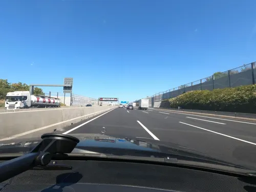
Freibad Lohfelden
Sports field and stadium · 1.8 km
9 Waldauer Weg, Lohfelden
Tu-Fr 08:30-20:30; Sa,Su 08:30-18:00

Urbaner Waldgarten Wahlebach
Park · 3.5 km
Hier entsteht unter Anleitung der Stadt Kassel und der Beteiligung interessierter Bürger*innen ein urbaner Waldgarten. Jeder kann sich...


Vollmarshäuser Teiche
Hiking and trails · 3.1 km
Laubwald mit Feuchtgebiet und Feuchtwiese, ca. 500 m nordöstlich des Ortsrandes von Vollmarshausen in der Gemeinde Lohfelden.

Waldauer Kiesteiche
Hiking and trails · 3.3 km
Wasserflächen mit Uferbereich der Fulda am südlichen Stadtrand von Kassel und in der Gemeinde Fuldabrück, im Landkreis Kassel.
ForstFeldGarten
Park · 3.3 km
Urban garden, community garden, 7000qm, Permaculture Forest Garden
23 Steinigkstraße, Kassel


Mehrzweckhalle Lohfelden
Sports field and stadium · 1.4 km
51a Lange Straße, Lohfelden
Sporthalle
Sports field and stadium · 2.3 km
10a Kurt-Schumacher-Straße, Lohfelden
28 more on the map.
Restaurants and cafes71

Zum Rüssel
Restaurant · German · 0.8 km
Autohof
1 Alexander-von-Humboldt-Straße, Lohfelden
Mo-Su 07:00-24:00
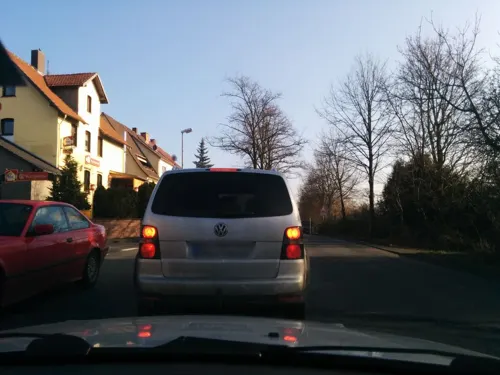
Birkenhof
Restaurant · Steak House · 2.0 km
2 Eschweger Straße, Lohfelden
Tu-Sa 17:30-23:00; Su 11:30-14:00,17:30-23:00
Bürgerhaus Bergshausen
Restaurant · Regional · 2.5 km
11-13 Am Bürgerhaus, Fuldabrück
17:00+; Su 11:00-14:00,17:00+; Mo off
Fährmann
Restaurant · German, Regional · 2.5 km
4 Lindenstraße, Fuldabrück
Fr-Sa 14:00-19:00; Su 12:00-18:00
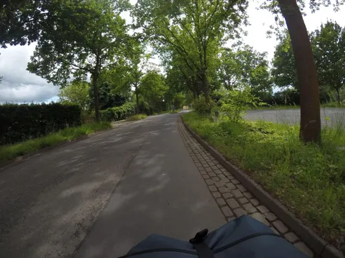
Hessischer Hof
Restaurant · Austrian · 2.6 km
4 Kasseler Straße, Kassel
Mo,Tu 11:00-21:00; Th-Sa 11:00-21:00; Su 11:00-18:00
Rizzorante Al Ponte
Restaurant · Italian, Pizza · 2.4 km
15 Uferstraße, Fuldabrück
Tu-Su 18:00-24:00; Mo off
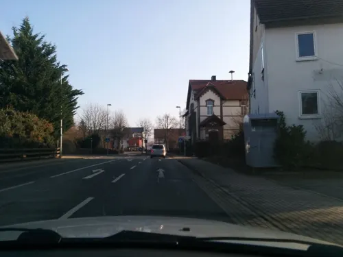


Typisch Indisch
Restaurant · Indian · 1.9 km
19 Ochshäuser Dorfstraße, Lohfelden
Mo-Su 12:00-14:30, 17:30-22:00
Weinstube Spengler
Restaurant · German, Regional, International · 2.6 km
33 Kasseler Straße, Fuldabrück
Th-Mo 18:00-23:00
Zur Söhrebahn
Restaurant · Regional · 3.8 km
19 Kasseler Straße, Söhrewald
Mo off; Tu-Fr 16:00-01:00, Sa 17:00-01:00, Su 10:30-14:00,17:00-23:00

Chinarestaurant Mulan
Restaurant · Chinese · 1.6 km
Tu-Fr 11:30-15:00, 17:00-22:00; Sa, Su 11:30-22:00
59 more on the map.
History
The monastery of St. Alban in Mainz received rights in Crumbach in the 14th and 15th century.
The farmers in the three villages were mostly part-time farmers and since the beginning of the 19th century they had workshops in which they produced parts for the new industries of Kassel. The Brothers Grimm visited the three villages in the 1820s, a drawing by Ludwig Emil Grimm from 1821 shows the late summer in Crumbach, another drawing the church of Vollmarshausen. Around 1850 many people were employed regularly in the industries of Kassel, in 1912 the Söhrebahn-rail as a connection to the town was built.
A new settlement (called "Die Siedlung") between the villages Crumbach and Ochsenhausen was planned in 1919 and realized partially in the late 1930s by the architect Hannsgeorg Oechler. The architecture combines elements of a garden town with some neoclassic citations. On 1 June 1941, merged the two communities Crumbach and Ochsenhausen to the new community of Lohfelden. In the area of the municipality, at the former airfield Kassel-Waldau stood the aircraft industry Fieseler, known for the construction of the Fieseler Storch. The factory was badly damaged in World War II and never rebuilt, while the village of Vollmarshausen remained completely undamaged.
From the History section of Lohfelden on Wikipedia, under CC BY-SA 4.0.
Where to stay14
Churches and places of worship14
Ev. Kirche Dennhausen
Church · Protestant · 3.5 km
11 Kirchstraße, Fuldabrück
Autobahnkapelle "Licht auf dem Weg"
Church · Catholic · 0.7 km
1 Alexander-von-Humboldt-Straße, Lohfelden
Ev. Kirche Vollmarshausen
Church · Protestant · 2.1 km
4 Vollmarshäuser Straße, Lohfelden
Shopping24
Gas and EV charging18
Shell Lohfeldener Rüssel
Gas station · 0.7 km
1 Alexander-von-Humboldt-Straße, Lohfelden
Schools, colleges and libraries18
Bundesbildungszentrum des Zimmerer- und Ausbaugewerbes
School · 3.0 km
4 Werner-Heisenberg-Straße, Kassel
Healthcare9
Neue Apotheke zum Rathaus
Clinic and pharmacy · 1.4 km
49 Lange Straße, Lohfelden
Map of Lohfelden
229 places. The map loads OpenStreetMap tiles when you open it.
Getting there and nearby towns
Kassel Airport (KSF) is the nearest airport with scheduled flights listed in OpenStreetMap, 20 km away.
- Kassel 6 km northwest, about 6 min by car
- Melsungen 15 km south, about 15 min by car
- Witzenhausen 24 km east, about 24 min by car
- Wolfhagen 26 km west, about 26 min by car
- Rotenburg an der Fulda 33 km southeast, about 33 min by car
- Göttingen 41 km northeast, about 41 min by car
- Schlitz 66 km south, about 1 h by car
- Paderborn 74 km northwest, about 1 h 15 min by car
- Reiskirchen 89 km southwest, about 1 h 30 min by car
- Schotten 90 km south, about 1 h 30 min by car
Drive times are estimates from straight-line distance, not routes.
Local news
Headlines from INDB.
Reviews, tips and questions
Loading what members have shared...
Sources and licences
- GeoNames (CC BY 4.0): population, coordinates, regions and time zone
- Mapillary (see each image): photos
- OpenStreetMap contributors (ODbL 1.0): places, airports, map data
- Wikidata (CC0 1.0): elevation, founding date, time zone, website, landmarks and historic places
- Wikimedia Commons (see each image): photos
- Wikipedia (CC BY-SA 4.0): overview and history text
Photo credits
- Ehemaliges-rathaus, ChristosV, CC BY-SA 3.0
- Vorsterstraße 6, 1, Crumbach, Lohfelden, Landkreis Kassel, GeorgDerReisende, CC BY-SA 4.0
- Wälzebachstraße 6, 1, Crumbach, Lohfelden, Landkreis Kassel, GeorgDerReisende, CC BY-SA 4.0
- Vorsterstraße 25, 1, Crumbach, Lohfelden, Landkreis Kassel, GeorgDerReisende, CC BY-SA 4.0
- Vorsterstraße 2, 1, Crumbach, Lohfelden, Landkreis Kassel, GeorgDerReisende, CC BY-SA 4.0
- Evangelische Kirche, 5, Kirchweg 5, Crumbach, Lohfelden, Landkreis Kassel, GeorgDerReisende, CC BY-SA 4.0
- Stichelweg 5, 3, Crumbach, Lohfelden, Landkreis Kassel, GeorgDerReisende, CC BY-SA 4.0
- Stichelweg 9, 1, Crumbach, Lohfelden, Landkreis Kassel, GeorgDerReisende, CC BY-SA 4.0
- Stichelweg 7, 1, Crumbach, Lohfelden, Landkreis Kassel, GeorgDerReisende, CC BY-SA 4.0
- Vorsterstraße 23, 1, Crumbach, Lohfelden, Landkreis Kassel, GeorgDerReisende, CC BY-SA 4.0
- Bushaltestelle Salzpfad, 1, Crumbach, Lohfelden, Landkreis Kassel, GeorgDerReisende, CC BY-SA 4.0
- Bushaltestelle Salzpfad, 2, Crumbach, Lohfelden, Landkreis Kassel, GeorgDerReisende, CC BY-SA 4.0
- Vorsterstraße 21, 1, Crumbach, Lohfelden, Landkreis Kassel, GeorgDerReisende, CC BY-SA 4.0
- Vorsterstraße 19, 1, Crumbach, Lohfelden, Landkreis Kassel, GeorgDerReisende, CC BY-SA 4.0
- Brückenstraße 11, 1, Crumbach, Lohfelden, Landkreis Kassel, GeorgDerReisende, CC BY-SA 4.0
- Vorsterstraße 17, 1, Crumbach, Lohfelden, Landkreis Kassel, GeorgDerReisende, CC BY-SA 4.0
- Brückenstraße 9, 1, Crumbach, Lohfelden, Landkreis Kassel, GeorgDerReisende, CC BY-SA 4.0
- Im Alten Teich 1, 2, Crumbach, Lohfelden, Landkreis Kassel, GeorgDerReisende, CC BY-SA 4.0
- Wälzebachstraße 2, 1, Crumbach, Lohfelden, Landkreis Kassel, GeorgDerReisende, CC BY-SA 4.0
- Fahrweg 1, 1, Crumbach, Lohfelden, Landkreis Kassel, GeorgDerReisende, CC BY-SA 4.0
- Kirchweg 8, 3, Crumbach, Lohfelden, Landkreis Kassel, GeorgDerReisende, CC BY-SA 4.0
- Kirchweg 10, 3, Crumbach, Lohfelden, Landkreis Kassel, GeorgDerReisende, CC BY-SA 4.0
- Bachstraße 42, 1, Crumbach, Lohfelden, Landkreis Kassel, GeorgDerReisende, CC BY-SA 4.0
- Wälzebachstraße 1, 1, Crumbach, Lohfelden, Landkreis Kassel, GeorgDerReisende, CC BY-SA 4.0
- Wälzebachstraße 4, 1, Crumbach, Lohfelden, Landkreis Kassel, GeorgDerReisende, CC BY-SA 4.0
- Fahrweg 1, 2, Crumbach, Lohfelden, Landkreis Kassel, GeorgDerReisende, CC BY-SA 4.0
- Im Alten Teich 1, 1, Crumbach, Lohfelden, Landkreis Kassel, GeorgDerReisende, CC BY-SA 4.0
- Im Alten Teich 1, 3, Crumbach, Lohfelden, Landkreis Kassel, GeorgDerReisende, CC BY-SA 4.0
- Bachstraße 31, 1, Crumbach, Lohfelden, Landkreis Kassel, GeorgDerReisende, CC BY-SA 4.0
- Evangelische Kirche, 4, Kirchweg 5, Crumbach, Lohfelden, Landkreis Kassel, GeorgDerReisende, CC BY-SA 4.0
- Vorsterstraße 15, 1, Crumbach, Lohfelden, Landkreis Kassel, GeorgDerReisende, CC BY-SA 4.0
- Bachstraße 29, 1, Crumbach, Lohfelden, Landkreis Kassel, GeorgDerReisende, CC BY-SA 4.0
- Kirchweg 14, 3, Crumbach, Lohfelden, Landkreis Kassel, GeorgDerReisende, CC BY-SA 4.0
- Brückenstraße, 1, Crumbach, Lohfelden, Landkreis Kassel, GeorgDerReisende, CC BY-SA 4.0
- Kirchweg 12 + 14, 3, Crumbach, Lohfelden, Landkreis Kassel, GeorgDerReisende, CC BY-SA 4.0
- Kirchweg 12, 5, Crumbach, Lohfelden, Landkreis Kassel, GeorgDerReisende, CC BY-SA 4.0
- Kirchweg 12, 4, Crumbach, Lohfelden, Landkreis Kassel, GeorgDerReisende, CC BY-SA 4.0
- Fahrweg 2, 3, Crumbach, Lohfelden, Landkreis Kassel, GeorgDerReisende, CC BY-SA 4.0
- Im Alten Teich 3, 1, Crumbach, Lohfelden, Landkreis Kassel, GeorgDerReisende, CC BY-SA 4.0
- Im Alten Teich 5, 3, Crumbach, Lohfelden, Landkreis Kassel, GeorgDerReisende, CC BY-SA 4.0
- 18-09-19-Kassel-DJI 0096, Ralf Roletschek, GFDL 1.2
- Hessisches landesmuseum kassel, User Hafenbar on de.wikipedia, CC BY-SA 3.0
- 18-09-27-Kassel-RalfR-DJI 0377, Ralf Roletschek, GFDL 1.2
- Kassel Karlskirche, Eistreter, CC BY-SA 3.0
- St. Bonifatius (Kassel), St._Bonifatius_Kassel.JPG : Paddy2706 derivative work: Rabanus Flavus, CC BY-SA 3.0
- 2020 06 02 Glaskasten Foto Uni Kasselq, Mönch K36, CC BY-SA 4.0
- Messinghof Kassel Gießereiflügel, Albert Gronau, Kassel sent permission to User EvaK on de.wikipedia, CC BY-SA 3.0
- Crumbach-kirche, ChristosV, CC BY-SA 3.0
- Lohfelden ochshausen-kirche-02, ChristosV, CC BY-SA 3.0
- Kirche, 2, Dennhausen, Fuldabrück, Landkreis Kassel, GeorgDerReisende, CC BY-SA 4.0
- Söhre-Schule Lohfelden von Vorne, Marlon5775, CC BY 4.0
- Bergshausen, Hessischer Meilenstein, Manfred Schröter, Berga, CC BY-SA 4.0
- NSG 1633012 Vollmarshäuser Teiche 2017-11-04 a, Baummapper, CC BY-SA 3.0 de
- NSG 1611007 Waldauer Kiesteiche 2017-09-23 c, Baummapper, CC BY-SA 3.0 de
- Naturdenkmal Kassel 611.059 2019-10-11 c, Baummapper, CC BY-SA 3.0 de
- Papin Denkmal Ottoneum Kassel, Eva K., CC BY 2.5
- Museum Fridericianum Kassel, Leafnode, CC BY-SA 3.0
- Kassel, Neue Galerie, Dguendel, CC BY 3.0
- Street-level photo, chuck, CC BY-SA 4.0
- Street-level photo, gisjam, CC BY-SA 4.0
- Street-level photo, gisjam, CC BY-SA 4.0
- Street-level photo, mfa, CC BY-SA 4.0
- Street-level photo, poxonline, CC BY-SA 4.0
- Street-level photo, saschahaberkorn, CC BY-SA 4.0
- Street-level photo, saschahaberkorn, CC BY-SA 4.0
- Street-level photo, groxxer, CC BY-SA 4.0
- Street-level photo, mfa, CC BY-SA 4.0
- Street-level photo, groxxer, CC BY-SA 4.0
- Street-level photo, poxonline, CC BY-SA 4.0
- Street-level photo, thetornado76, CC BY-SA 4.0
- Street-level photo, schmidt91, CC BY-SA 4.0
- Street-level photo, thetornado76, CC BY-SA 4.0
- Street-level photo, thetornado76, CC BY-SA 4.0


Page built November 8, 2026. Spotted a mistake? Tell us or suggest a place.