


Bietigheim-Bissingen, Germany
Bietigheim-Bissingen is a town of 43,556 people in Baden-Wurttemberg, Germany.
Why visit Bietigheim-Bissingen
Townapedia lists 93 museums and landmarks, 99 parks and trails, 193 places to eat, 13 places to stay and 22 attractions in and around town.
Highlights include Naturfundus Hofladen, Bietigheim Enz Valley Viaduct, Hornmoldhaus and Museumsbunker Ro 1.
Weather in Bietigheim-Bissingen
Forecast from MET Norway (CC BY 4.0). Full forecast
About Bietigheim-Bissingen
Bietigheim-Bissingen (German pronunciation: [ˈbiːtɪçhaɪm ˈbɪsɪŋən] or [ˈbiːtɪk-] ; locally: Biedge-Bissenge) is the second-largest town in the district of Ludwigsburg, Baden-Württemberg, Germany with 42,515 inhabitants in 2007. It is situated on the river Enz and the river Metter, close to its confluence with the Neckar, about 19 km north of Stuttgart, and 20 km south of Heilbronn.
From the Wikipedia article Bietigheim-Bissingen (this version), under CC BY-SA 4.0.
Travel tips from other travellers: Bietigheim-Bissingen on Wikivoyage (CC BY-SA 4.0).
Things to do22

Naturfundus Hofladen
Farm and orchard · 2.9 km
Honig aus Bietigheim. Leckeres Querbeet, vom Hof und drumherum, alles selbstgemacht. Walnussöl - auch Lohnpressung. Samstags Brot,...
5/4 Lettengrube, Bietigheim-Bissingen
Tu 16:30-18:00; Th 15:00-19:00; Sa 10:30-14:00

Bietigheim Enz Valley Viaduct
Bridge · 1.5 km
Railway bridge in Germany

Schlosstheater Ludwigsburg
Cinema and theater · 7.6 km
Theater of Ludwigsburg Palace in Ludwisgburg, Germany
Christians Freilandeier
Farm and orchard · 2.8 km
Eier, Nudeln, Eis
24/7



10 more on the map.
Museums and landmarks93

Hornmoldhaus
Museum · 1.8 km
57 Hauptstraße, Bietigheim-Bissingen
We-Fr 13:45-17:45; Sa,Su,PH 10:45-17:45


Stadtmuseum
Museum · 4.2 km
29 Oberriexinger Straße, Sachsenheim
Tu,Su 14:00-18:00

Wasserschloss Sachsenheim
Monument and historic site · 4.1 km
5 Äußerer Schloßhof, Sachsenheim
Mo-Fr 08:00-12:00; Tu 16:30-18:30; Th 14:00-16:00


81 more on the map.
Parks, trails and playgrounds99

EgeTrans Arena
Sports field and stadium · 0.8 km
Der sichtbare Name am Objekt hat keinen Bindestrich, in der Presse wird der Bindestrich verwendet.
40 Schwarzwaldstraße, Bietigheim-Bissingen

Bad am Viadukt
Sports field and stadium · 1.6 km
26 Holzgartenstraße
Oct-Apr: Tu,We,Fr 10:30-22:00; Oct-Apr: Th 06:00-22:00; Oct-Apr:...
Freibad Asperg
Sports field and stadium · 4.2 km
2 Altachstraße, Asperg
May,Aug,Sep Tu-Fr 09:00-19:30; May,Aug,Sep Sa,Su,PH 08:00-19:30;...



Badepark Ellental
Sports field and stadium · 0.7 km
Mo-Th 09:00-21:00, Fr 06:00-21:00, Sa,Su,PH 08:00-02:00

Eichrain
Playground · 3.8 km
Apr 1-Oct 31 Mo-Sa 08:00-20:00; Apr 1-Oct 31 Su 10:00-20:00; Apr...
87 more on the map.
Restaurants and cafes193

Flohberghaus
Restaurant · Spanish · 4.1 km
7 Am Rotenacker Wald, Markgröningen
Tu-Fr 17:00-00:00; Sa 12:00-00:00; Su 10:00-22:00
Kallisto
Restaurant · Greek · 4.1 km
Vereinsheim in der Steingrube
1 Steingrube, Sachsenheim
Mo-Fr 16:00-23:00; Sa,Su,PH 10:00-23:00
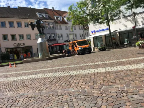
Kronenstuben
Restaurant · German · 2.0 km
5 Kronenplatz, Bietigheim-Bissingen
We-Sa 12:00-14:30,18:00-23:00; Su 12:00-14:30,17:30-22:00
Leibspeise
Restaurant · German · 4.3 km
Familiengeführtes Lokal mit traditionell schwäbischen Gerichten aus überwiegend regionalen Zutaten
21 Monrepos, Ludwigsburg
Mo-Su 11:30-22:00
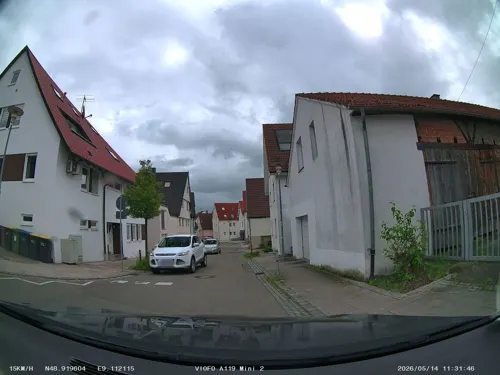
Schnitzelfabrik
Restaurant · German · 2.7 km
5 Bietigheimer Straße, Tamm
Mo-Tu 11:00-23:00; Th-Su 11:00-23:00; We off
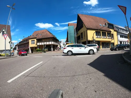
eco
Restaurant · German · 4.3 km
Bio Gaststätte & Catering in Sachsenheim – natürlich . regional . nachhaltig
2 Lammstraße, Sachsenheim
We-Sa 17:30-21:00; Su 11:30-15:00, 17:00-20:00; Th 11:30-14:30
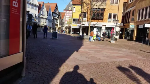
Agora Cafe Weinbar
Cafe · Coffee Shop, Greek · 1.9 km
26 Hauptstraße, Bietigheim-Bissingen
Su,Mo 10:00-21:30; We-Sa 10:00-23:00
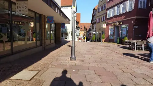
Alpha Restaurant
Restaurant · Oriental · 1.9 km
2 Schieringerstraße, Bietigheim-Bissingen
Mo-Th,Su 09:00-22:00; Fr,Sa 09:00-23:00

Café Mosh
Cafe · Coffee & Brunch, Cafe · 1.8 km
62 Hauptstraße, Bietigheim-Bissingen
Su - Th 10:00-22:00;Fr, Sa 10:00 - 23:00
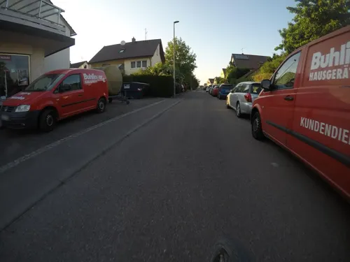


Da Alfonso
Restaurant · Italian · 2.4 km
50 Friedrichstraße, Tamm
Mo-Fr 11:00-14:00,17:00-23:00; Sa 17:00-23:00; Su...
Estia
Restaurant · 4.3 km
Griechische Fisch- und Fleischspezialitäten
10 Von-König-Straße
Mo, We-Su 11:30-14:00, 17:30-22:00
181 more on the map.
History
The name is first recorded in 789 in Medieval Latin as Budic-heim, although settlements that benefitted from the favorable location by a natural ford indicate there were people likely much earlier. The Collegium Matisonensium, a community of Roman estate owners on the banks of the Metter River, was documented until the 3rd century AD. Burial grounds from the 5th to 7th centuries also point to settlements of the Alamanni in what is now the town's district. Towards the end of the 18th century Bietigheim saw during the beginning of the industrialisation an improvement of the living conditions and an increase in population. The 1806 furnished Oberamt Bietigheim was in 1810, however, dissolved again: the city and its official municipalities were integrated in the Oberamt Besigheim. After Bietigheim was connected mid-19th century to the railway network and the city experienced a real breakthrough and a sustained recovery. At the end of the 19th century there were 3,800 inhabitants. In 1938, Bietigheim came to the new Ludwigsburg (district).
A branch of the Nazi Party was in Bietigheim since 1928. Until 1933, this was with 51 members relatively small. After the Nazi seizure of power there were 181 new entrants. By the end of the Nazi regime finally were 939 party members in Bietigheim, representing 10.4 percent of the total population in 1945.
From the History section of Bietigheim-Bissingen on Wikipedia, under CC BY-SA 4.0.
Where to stay13
Churches and places of worship35
Evangelische Stadtkirche
Church · Protestant · 4.2 km
20 Obere Straße, Sachsenheim
Kilianskirche
Church · Protestant · 1.6 km
7 Kirchstraße, Bietigheim-Bissingen
Neuapostolische Kirche – Italienische Gemeinde
Church · New Apostolic · 2.7 km
23 Bismarckstraße, Tamm
Shopping52
Gas and EV charging17
Schools, colleges and libraries28
Berufliches Schulzentrum Bietigheim-Bissingen
School · 0.9 km
10-12 Fischerpfad, Bietigheim-Bissingen
Evangelisches Lichtenstern-Gymnasium
School · Protestant · 3.6 km
34 Ludwigsburger Straße, Sachsenheim
Otto-Rombach-Bücherei (Stadtbücherei)
Library · 1.9 km
19 Hauptstraße, Bietigheim-Bissingen
Healthcare14
Schiller-Apotheke im Sand
Clinic and pharmacy · 2.2 km
17 Großingersheimer Straße, Bietigheim-Bissingen
Apotheke im Aurain
Clinic and pharmacy · 1.6 km
58 Stuttgarter Straße, Bietigheim-Bissingen
Map of Bietigheim-Bissingen
250 places. The map loads OpenStreetMap tiles when you open it.
Getting there and nearby towns
Manfred Rommel Airport Stuttgart (STR) is the nearest airport with scheduled flights listed in OpenStreetMap, 29 km away.
- Tamm 3 km south, about 3 min by car
- Markgröningen 5 km southwest, about 5 min by car
- Freiberg am Neckar 6 km east, about 6 min by car
- Möglingen 6 km south, about 6 min by car
- Ludwigsburg 8 km southeast, about 8 min by car
- Schwieberdingen 8 km southwest, about 8 min by car
- Kornwestheim 10 km southeast, about 10 min by car
- Marbach am Neckar 10 km east, about 10 min by car
- Vaihingen an der Enz 12 km west, about 12 min by car
- Steinheim an der Murr 12 km east, about 12 min by car
Drive times are estimates from straight-line distance, not routes.
Local news
Headlines from INDB.
Reviews, tips and questions
Loading what members have shared...
Sources and licences
- GeoNames (CC BY 4.0): population, coordinates, regions and time zone
- Mapillary (see each image): photos
- OpenStreetMap contributors (ODbL 1.0): places, airports, map data
- Wikidata (CC0 1.0): elevation, founding date, time zone, website, landmarks and historic places
- Wikimedia Commons (see each image): photos
- Wikipedia (CC BY-SA 4.0): overview and history text
Photo credits
- Bietigheim-Bissingen, Rathaus, Ĝù dis-le-moi / Ĝù at German Wikipedia, Public domain
- Bietigheim-Bissingen Museumsbunker Eingaenge 20070701, K. Jähne, CC BY-SA 3.0
- Berufliches Schulzentrum - Bietigheim-Bissingen - geo.hlipp.de - 22798, K-H Lipp on geo.hlipp.de, CC BY-SA 2.0
- Bietigheim-Bissingen - Bietigheim - Enztal - Enzviadukt über Enz - Ansicht von Süden (1), Roman Eisele, CC BY-SA 4.0
- Bietigheim-Bissingen - panoramio, qwesy qwesy, CC BY 3.0
- Ludwigsburg Palace December 2018, Alexander Migl, CC BY-SA 4.0
- AfrikahausFreiberg, Mussklprozz, CC BY-SA 3.0
- BeihingenAmanduskirche, Mussklprozz, CC BY-SA 3.0
- AkademieDarstellendeKunstLudwigsburg, Mussklprozz, CC BY-SA 3.0
- Filmakademie Ludwigsburg DSC 3579, Ludwigs Unbürger, CC BY-SA 4.0
- Aerial image of the Bietigheim Viaduct (view from the southeast), Carsten Steger, CC BY-SA 4.0
- Aerial image of the Hohenasperg fortress, Carsten Steger, CC BY-SA 4.0
- Naturschutzwengert im NSG Leudelsbachtal, P. Fendrich, CC BY 3.0
- EgeTrans Arena 2012-12-26 steelers players jubilates with fans, Undeviginti, CC BY 3.0
- Bietigheim Eishalle, Björn Láczay from Moosburg, Germany, CC BY 2.0
- Michaelskirche-Metterzimmern, Peter weyrich, Public domain
- Bietigheim-Giebel des Hornmoldhauses, SteveK, CC BY 2.5
- KilianskircheBissingenWestansicht, Mussklprozz, CC BY-SA 3.0
- Sachsenheim 2012-04 by-RaBoe-83, © Ra Boe / Wikipedia - Create the proper attribution for your usage by clicking on this button! This file is licensed under the Creative Commons Attribution-Share Alike 3.0 Germany license...., CC BY-SA 3.0 de
- Bietigheim-Schloss-2018 MTh 5910, ( MTheiler ), CC BY-SA 4.0
- Bartholomäus kirche tamm, Derhuebiii, CC BY-SA 3.0
- Asperg-Michaelskirche2012, Peter Schmelzle, CC BY-SA 3.0
- 04 Obere Straße 20, Großsachsenheim, Stadtkirche, Südseite, R.kaelcke, CC BY-SA 4.0
- Bi-Bi- Brunnen-1-07, Kamahele, CC BY-SA 3.0
- Bietigheim-Bissingen, Laurentiuskirche, Ĝù dis-le-moi 00:01, 1. Jul. 2008 (CEST), Public domain
- Kleinsachsenheim, W. G.,, Public domain
- Bi-Bi Viadukt, Ĝù dis-le-moi 00:15, 1. Jul. 2008 (CEST), Public domain
- Karte Neckar-Enz-Stellung, K. Jähne, Public domain
- KilianskircheBissingenSuedostansicht, Mussklprozz, CC BY-SA 3.0
- Lage NSG Leudelsbachtal vereinfacht, nur annaehernd, OpenStreetMap contributors and Pilettes, CC BY-SA 2.0
- 01 EgeTrans Arena, Lutz H, CC BY 2.0 de
- Bietigheimer-Schloss, Button1952, CC BY-SA 4.0
- Stolperstein Lydia Mack Bi-Bi Backhausstrasse 3 20170903, rolf_acker, CC BY-SA 4.0
- Karl Schmidt-Rottluff, Tuseck, CC0
- Wechselkröte 21-8-2013 -1, Michael Linnenbach, CC BY-SA 4.0
- Bietigheim Termination Tower1, Zonk43, Public domain
- Stolze Amselmutter mit Regenwürmer, Walter Geck, CC BY-SA 4.0
- Amselmutter mit Regenwürmer, Walter Geck, CC BY-SA 4.0
- Amselmutter Nahrungskette Regenwürmer, Walter Geck, CC BY-SA 4.0
- 05704-Bissingen-1905-Verschiedene Stadtansichten-Brück & Sohn Kunstverlag, Brück & Sohn Kunstverlag Meißen, CC0
- Asperg - Hohenasperg - Wälle - Blick vom Turm Hügelsburg auf Ostwall und Zeughaus (1), Roman Eisele, CC BY-SA 4.0
- Street-level photo, plexi32, CC BY-SA 4.0
- Street-level photo, changchun1, CC BY-SA 4.0
- Street-level photo, soulcover, CC BY-SA 4.0
- Street-level photo, 20jakob09, CC BY-SA 4.0
- Street-level photo, bct, CC BY-SA 4.0
- Street-level photo, derzornigemarkus, CC BY-SA 4.0
- Street-level photo, changchun1, CC BY-SA 4.0
- Street-level photo, changchun1, CC BY-SA 4.0
- Street-level photo, changchun1, CC BY-SA 4.0
- Street-level photo, plexi32, CC BY-SA 4.0
- Street-level photo, mfa, CC BY-SA 4.0
- Street-level photo, electria, CC BY-SA 4.0
- Street-level photo, mfa, CC BY-SA 4.0
- Street-level photo, changchun1, CC BY-SA 4.0
- Street-level photo, plexi32, CC BY-SA 4.0
- Street-level photo, slabby, CC BY-SA 4.0
- Street-level photo, Viator_Invisibilis, CC BY-SA 4.0
- Street-level photo, mfa, CC BY-SA 4.0


Page built November 8, 2026. Spotted a mistake? Tell us or suggest a place.