


Bitterfeld-Wolfen, Germany
Bitterfeld
Bitterfeld-Wolfen is a town of 36,592 people in Saxony-Anhalt, Germany.
Why visit Bitterfeld-Wolfen
Townapedia lists 49 museums and landmarks, 23 parks and trails, 108 places to eat, 11 places to stay and 11 attractions in and around town.
Highlights include Pegelturm, Bitterfelder Bogen, Kreismuseum and Kriegerdenkmal für die Gefallenen des 1. Weltkrieges.
Weather in Bitterfeld-Wolfen
Forecast from MET Norway (CC BY 4.0). Full forecast
About Bitterfeld-Wolfen
Bitterfeld (German pronunciation: [ˈbɪtɐfɛlt] ) is a town in the district of Anhalt-Bitterfeld, Saxony-Anhalt, Germany. Since 1 July 2007 it has been part of the town of Bitterfeld-Wolfen. It is situated approximately 25 km south of Dessau, and 30 km northeast of Halle (Saale).
From the Wikipedia article Bitterfeld (this version), under CC BY-SA 4.0.
Things to do11


Bitterfelder Bogen
Monument and historic site · 0.9 km
Lookout point in the form of a steel arch bridge



Tiergehege Bitterfeld
Zoo and aquarium · 0.8 km
Mo-Fr 07:00-18:00; Sa,Su 09:00-18:00

Museums and landmarks49


Kriegerdenkmal für die Gefallenen des 1. Weltkrieges
Monument and historic site · 4.0 km

Denkmal 1914-1918
Monument and historic site · 4.1 km
Kriegerdenkmal zu Ehren der im Ersten Weltkrieg

Ehrenmal sowjetische Widerstandskämpfer
Monument and historic site · 2.8 km
Mahnmal für sechs sowjetischen Wiederstandskämpfer die an dieser Stelle von den Faschisten ermordet worden.

Lüftungsturm
Monument and historic site · 1.5 km
Lüftungsturm auf dem Gelände der Chemie AG, Gebäude 232, Zörbiger Straße in Bitterfeld
Zörbiger Straße, Bitterfeld-Wolfen


Wasserturm
Monument and historic site · 4.6 km
Wasserturm, Wasserturmstraße im Gelände der ehemaligen Farbenfabrik, Chemiepark Bitterfeld-Wolfen, Gebäude Nr. 24.15.0 in Greppin.


Dükerturm
Monument and historic site · 3.4 km
Düker der Braunkohlengrube Theodor zum Kraftwerk Süd an der B 100 Hallische Straße Ecke Oekostraße in Holzweißig
Schloss Muldenstein
Monument and historic site · 4.7 km
1 Am Alten Kloster, Muldestausee
37 more on the map.
Parks, trails and playgrounds23
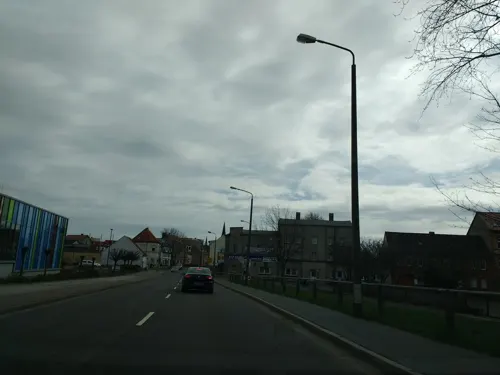
Sportbad „Heinz Deininger“ Bitterfeld
Sports field and stadium
25 Dürener Straße, Bitterfeld-Wolfen
Mo 13:00-18:00; We-Fr 13:00-21:00; Sa 10:00-21:00; Su 10:00-20:00




11 more on the map.
Restaurants and cafes108

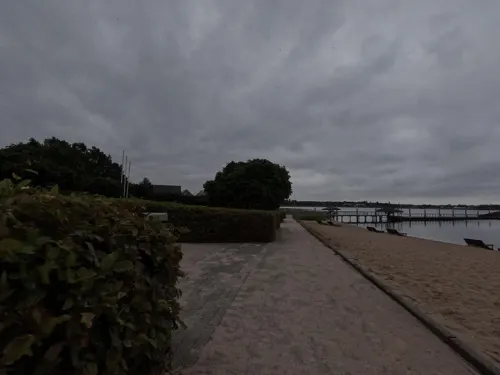
Eiscafe am Pegelturm
Cafe · Ice Cream · 2.7 km
2 Bernsteinpromenade, Muldestausee
May-Sep Mo-Sa 12:00-18:00, May-Sep Su 11:00-18:00; Apr,Oct Sa,Su...
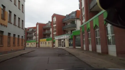
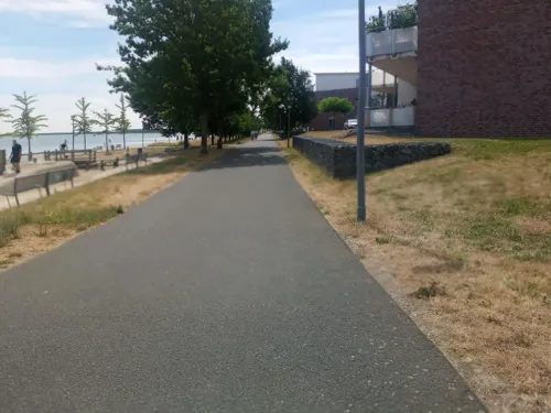
Restaurant Heimathafen
Restaurant · German · 0.9 km
5 Am Leineufer, Bitterfeld-Wolfen
Apr-Oct: Mo-Sa 11:00-22:00, Su 11:00-20:00; Th off; Nov-Mar: Fr-Sa...
Restaurant Treibgut
Restaurant · Regional · 1.5 km
24 Niemegker Straße, Bitterfeld-Wolfen
Mo, We-Fr 12:00-14:30, 17:00-21:00; Sa 12:00-21:00; Su 12:00-20:00
Seensucht
Restaurant · Regional · 2.4 km
6 Seepromenade, Bitterfeld-Wolfen
Mo-Tu off; We-Su 09:00-22:00
Toscana
Restaurant · Italian, Pizza · 0.9 km
1 Am Leineufer, Bitterfeld-Wolfen
Tu-Fr 17:00-22:00; Sa,Su 11:00-22:00
Zum Ratskeller
Restaurant · Indian, Italian, German · 2.9 km
1 Rathausstraße, Bitterfeld-Wolfen
Tu,We,Fr,Sa 17:00-22:00; Th,Su,PH 11:00-14:00,17:00-22:00; Mo off

Athen
Restaurant · Greek · 3.0 km
12 Franzstraße, Bitterfeld-Wolfen
Mo 16:00-23:00; Tu off; We-Th 11:30-14:30,17:00-23:00; Fr-Su...
B-Fresh Restaurant
Restaurant · Sushi, Japanese, Vietnamese, Salad, Noodle, Fish · 2.4 km
132 Straße des Friedens, Bitterfeld-Wolfen
Tu-Sa 11:00-15:00,16:30-22:00; Su,PH 12:00-21:30; Mo off
Steakhouse "El Rancho"
Restaurant · Mexican
67 Walther-Rathenau-Straße, Bitterfeld-Wolfen
Mo-Su 16:30-22:00
96 more on the map.
History
The name Bitterfeld most likely comes from the Middle High German words bitter and Feld and so means "boggy land".
Bitterfeld was built by a colony of Flemish immigrants in 1153. The first documentary mention is from 1224. It was captured by the landgrave of Meissen in 1476, and belonged thenceforth to Saxony, until it was ceded to Prussia in 1815.
By 1900, Bitterfeld station was an important junction of the Berlin–Halle and the Magdeburg–Leipzig railways. The population at that time was 11,839; it manufactured drainpipes, paper roofing, and machinery, and had sawmills. There were also several coal mines in the vicinity. Owing to its pleasant situation and accessibility, it became a favoured residence of businessmen of Leipzig and Halle.
During the East German (GDR) era, it gained notoriety for its chemical industry complex which caused remarkably severe pollution, even by GDR standards. On 24 April 1959, it also was a scene for the Bitterfeld Conference, locally known as the "Bitterfelder Weg". This conference sought to connect the working class with the artists of the day to form a socialist national culture.
In the 21st century Bitterfeld is still an industrial town and it stages the annual United Metal Maniacs metal festival.
The former brown-coal open cast mine of Goitzsche, south-east of Bitterfeld, is a source of numerous fossils in Bitterfeld amber.
From the History section of Bitterfeld on Wikipedia, under CC BY-SA 4.0.
Notable people from Bitterfeld-Wolfen
- Leonhard KaupischGerman general (1878–1945)
- Erwin Ding-SchulerGerman surgeon (1912-1945)
- Rudolf KobertGerman pharmacologist (1854–1918)
- Konrad Victor SchneiderGerman professor
- Helmut RenschlerGerman officer and Knight's Cross recipients
Born in Bitterfeld-Wolfen, according to Wikidata (CC0). Each name links to its Wikipedia article.
Where to stay11
Hotel und Restaurant Bitterfelder Hof
Motel and hotel · 1.9 km
47 Zörbiger Straße, Bitterfeld-Wolfen
Churches and places of worship13
Heilig Geist
Church · Roman Catholic · 3.0 km
58 Wolfener Straße, Bitterfeld-Wolfen
Bauermeister-Gedächtniskirche Deutsche Grube
Church · Protestant · 1.9 km
Ignatz-Stroof-Straße, Bitterfeld-Wolfen
Shopping25
Gas and EV charging9
Schools, colleges and libraries23
Bildungszentrum Bitterfeld-Wolfen e.V.
School · 4.9 km
6 Saarstraße, Bitterfeld-Wolfen
Grundschule „Geschwister Scholl“
School · 3.2 km
32 Neue Straße, Bitterfeld-Wolfen
Healthcare10
Sittig Apotheke
Clinic and pharmacy · 4.5 km
1a Platz des Friedens, Sandersdorf-Brehna
Map of Bitterfeld-Wolfen
250 places. The map loads OpenStreetMap tiles when you open it.
Getting there and nearby towns
Leipzig/Halle Airport (LEJ) is the nearest airport with scheduled flights listed in OpenStreetMap, 23 km away.
- Wolfen 6 km northwest, about 6 min by car
- Delitzsch 11 km south, about 11 min by car
- Gräfenhainichen 15 km northeast, about 15 min by car
- Dessau 25 km north, about 25 min by car
- Schkeuditz 26 km south, about 26 min by car
- Eilenburg 28 km southeast, about 28 min by car
- Halle (Saale) 29 km southwest, about 29 min by car
- Köthen 28 km northwest, about 28 min by car
- Taucha 29 km southeast, about 29 min by car
- Leipzig 32 km south, about 32 min by car
Drive times are estimates from straight-line distance, not routes.
Towns near Bitterfeld-Wolfen


Keep exploring
Local news
Headlines from INDB.
Reviews, tips and questions
Loading what members have shared...
Sources and licences
- GeoNames (CC BY 4.0): population, coordinates, regions and time zone
- Mapillary (see each image): photos
- OpenStreetMap contributors (ODbL 1.0): places, airports, map data
- Wikidata (CC0 1.0): elevation, founding date, time zone, website, landmarks and historic places
- Wikimedia Commons (see each image): photos
- Wikipedia (CC BY-SA 4.0): overview and history text
Photo credits
- Bitterfeld, Joeb07, CC BY 3.0
- Pontons und Pegelturm Goitzschesee, Assenmacher, CC BY-SA 3.0
- Villa am Bernsteinsee, Muesse, CC BY 3.0
- Binnengärtenstraße 17 (Bitterfeld), Olaf Meister, CC BY-SA 4.0
- FriedersdorfKirche2, Jwaller, CC BY-SA 3.0
- Wehrkirche-Holzweißig, Tnemtsoni, CC BY-SA 3.0
- Muldenstein Kirche, Radler59, CC BY-SA 4.0
- EvKirche-Sandersdorf, Tnemtsoni, CC BY-SA 3.0
- Evang-Greppin, Tnemtsoni, CC BY-SA 3.0
- Kath-Greppin, Tnemtsoni, CC BY-SA 3.0
- Kath-Holzweißig, Tnemtsoni, CC BY-SA 3.0
- Bitterfeld Bahnhofstraße Hotel Kaiserhof Sanierung von Bahnhofsplatz, Hallogen, CC BY-SA 4.0
- Walther-Rathenau-Straße 67 Hotel Central 2016, Clemensfranz, CC BY-SA 4.0
- Pouch amphitheatre, Doris Antony , Berlin, CC BY-SA 4.0
- Sandersdorf,Denkmal 1914-18, M_H.DE, CC BY-SA 3.0
- Sandersdorf,Zscherndorf Gefallenendenkmal 1914-18, M_H.DE, CC BY-SA 3.0
- Bitterfeld-Wolfen,Ehrenmal, M_H.DE, CC BY-SA 3.0
- Bitterfeld Lueftungsturm, Radler59, CC BY-SA 3.0
- Gedenkstein-niemegk, lutzto, CC BY-SA 3.0
- BTFLangeBank, Jwaller, CC BY-SA 3.0
- Friedersdorf (Mulde), Technisches Denkmal Dampfspeicherlokomotive, M_H.DE, CC BY-SA 3.0
- Sandersdorf, Kath. Kirche St. Marien, M_H.DE, CC BY-SA 3.0
- Bitterfeld Kirchplatz St Antonius-01, Radler59 ( talk ), CC BY-SA 4.0
- Friedersdorf (Mulde), Evangelische Kirche, M_H.DE, CC BY-SA 3.0
- Bitterfeld,Bauermeister-Gedächtniskirche,Deutsche Grube, M_H.DE, CC BY-SA 3.0
- Bitterfeld Markt 8 Stadtapotheke, Radler59 ( talk ), CC BY-SA 4.0
- Bitterfelder Bogen-3-Rampe, Muck, CC BY-SA 4.0
- Muldensteiner Berg,(Steinberg), Bunker, M_H.DE, CC BY 3.0
- Kreismuseum Bitterfeld, Kirchplatz 3, M_H.DE, CC BY-SA 4.0
- Greppin ehem Farbenfabrik Wasserturm-01, Radler59, CC BY-SA 4.0
- Street-level photo, saschahaberkorn, CC BY-SA 4.0
- Street-level photo, dheike, CC BY-SA 4.0
- Street-level photo, natura, CC BY-SA 4.0
- Street-level photo, natura, CC BY-SA 4.0
- Street-level photo, msdess, CC BY-SA 4.0
- Street-level photo, natura, CC BY-SA 4.0
- Street-level photo, lothi_r, CC BY-SA 4.0
- Street-level photo, natura, CC BY-SA 4.0
- Street-level photo, msdess, CC BY-SA 4.0
- Street-level photo, msdess, CC BY-SA 4.0
- Street-level photo, natura, CC BY-SA 4.0
- Street-level photo, natura, CC BY-SA 4.0
- Street-level photo, thetornado76, CC BY-SA 4.0
- Street-level photo, dheike, CC BY-SA 4.0
- Street-level photo, jenki, CC BY-SA 4.0
- Street-level photo, dheike, CC BY-SA 4.0
- Street-level photo, saschahaberkorn, CC BY-SA 4.0
- Street-level photo, saschahaberkorn, CC BY-SA 4.0
- Street-level photo, bejotel, CC BY-SA 4.0
- Street-level photo, dsmm, CC BY-SA 4.0


Page built November 9, 2026. Spotted a mistake? Tell us or suggest a place.