


Why visit Borna
Townapedia lists 76 museums and landmarks, 21 parks and trails, 78 places to eat, 11 places to stay and 10 attractions in and around town.
Highlights include Hofladen Wermsdorfer Fisch, Der krumme Damm, Wohngebäude and Stadtkulturhaus Borna.
Weather in Borna
Forecast from MET Norway (CC BY 4.0). Full forecast
About Borna
Borna (German pronunciation: [ˈbɔʁna] ) is a town in Saxony, Germany, capital of the Leipzig district. It is situated approximately 30 km southeast of Leipzig city. It has approx. 20,000 inhabitants.
From the Wikipedia article Borna, Leipzig (this version), under CC BY-SA 4.0.
Things to do10

Hofladen Wermsdorfer Fisch
Farm and orchard · 5.9 km
5 Gemeinschaftsstraße, Rötha
Mo-Fr 08:00-16:00; Sa 09:00-12:00; Su,PH off




Museums and landmarks76




Herrenhaus Zedtlitz
Monument and historic site · 2.3 km
8 Wyhraaue, Borna

Kursächsische Postmeilensäule
Monument and historic site
Kursächsische Postmeilensäule-Halbmeilensäule Nr. 42 in Borna


Berta Rose, geb.Stieglitz
Monument and historic site
Stolperstein für Berta Rose, geb.Stieglitz


64 more on the map.
Parks, trails and playgrounds21

Schwimmhalle Jahnbad Borna
Sports field and stadium · 0.8 km
29 Deutzener Straße, Borna
Mo,Tu 14:00-21:30; We 07:00-10:30,15:00-21:30; Fr 16:00-21:30;...


Kleines Klettergerüst mit Sandkasten
Playground · 6.2 km
10 Schleenhainer Straße, Neukieritzsch
24/7


Park an der Pferdekoppel
Park · 6.2 km
10 Schleenhainer Straße, Neukieritzsch
24/7

9 more on the map.
Restaurants and cafes78
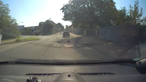
Asia Wok & Sushi
Restaurant · Asian, Sushi, Vietnamese · 0.6 km
64 Leipziger Straße, Borna
Tu-Su,PH 11:00-15:00,17:00-22:30; Mo off

Café 1880 bei Schusters
Cafe · 0.8 km
Hunde erlaubt
21 Röthaer Straße, Borna
We-Su,PH 13:00-18:00; Mo,Tu off

Gasthof "Zur Bauernstube" Wyhra
Restaurant · Regional · 5.3 km
8 Eschefelder Straße, Borna
We-Sa 11:00-14:00,17:00+; Su,PH 10:00-14:00,17:00+; Mo,Tu off
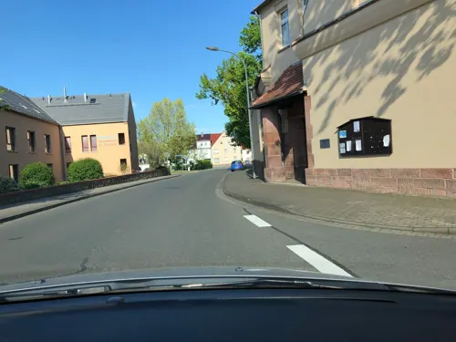
Gasthof & Pension "Zur Erholung"
Restaurant · German · 6.3 km
9 Forststraße, Regis-Breitingen
Mo-Fr,Su,PH 11:00-13:30,17:00+, Sa 17:00+
Gasthof + Pension Thräna
Restaurant · Regional · 6.2 km
3 Weststraße, Borna
Tu 11:00-14:00; We-Fr 11:00-14:00,17:00-21:00; Sa 11:00+; Su,PH...
Gaststätte „Glück Auf“
Restaurant · German · 0.8 km
30 Deutzener Straße, Borna
Tu-Fr 16:00-23:00; Sa 15:00-23:00; Su,PH 11:00-15:00; Mo off
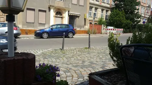
Landgasthaus "Bubendorfer Hof"
Restaurant · German · 6.0 km
15 Alte Straße, Frohburg
Th,Fr 11:00-14:00,17:00+; Sa,Su,PH 11:00+; Mo,Tu,We off
Pizzeria Pinocchio
Restaurant · Pizza
14 Roßmarktsche Straße, Borna
Tu-Fr 11:00-14:00,17:00-22:00; Sa,Su,PH 16:00-22:00; Mo off


Priya Pizzaservice
Restaurant · Pizza
30 Bahnhofstraße, Borna
Mo-Fr 11:00-14:00,17:00-22:30; Sa,Su,PH 15:00-22:30
66 more on the map.
Where to stay11
Churches and places of worship24
Shopping26
Gas and EV charging9
Schools, colleges and libraries16
Healthcare8
Map of Borna
250 places. The map loads OpenStreetMap tiles when you open it.
Getting there and nearby towns
Leipzig-Altenburg Airport (AOC) is the nearest airport with scheduled flights listed in OpenStreetMap, 16 km away.
- Markkleeberg 19 km northwest, about 19 min by car
- Grimma 20 km northeast, about 20 min by car
- Leipzig 25 km north, about 25 min by car
- Zeitz 26 km west, about 26 min by car
- Penig 26 km southeast, about 26 min by car
- Markranstädt 28 km northwest, about 28 min by car
- Taucha 29 km north, about 29 min by car
- Meerane 31 km south, about 31 min by car
- Wurzen 32 km northeast, about 32 min by car
- Burgstädt 32 km southeast, about 32 min by car
Drive times are estimates from straight-line distance, not routes.
Local news
Headlines from INDB.
Reviews, tips and questions
Loading what members have shared...
Sources and licences
- GeoNames (CC BY 4.0): population, coordinates, regions and time zone
- Mapillary (see each image): photos
- OpenStreetMap contributors (ODbL 1.0): places, airports, map data
- Wikidata (CC0 1.0): elevation, founding date, time zone, website
- Wikimedia Commons (see each image): photos
- Wikipedia (CC BY-SA 4.0): overview and history text
Photo credits
- Bornaer Rathaus, Ronnsen, CC BY-SA 3.0
- Bahnstrecke Neukieritzsch–Chemnitz bei der Straßenüberführung Burgstädter Straße (Göritzhain) (1), Aagnverglaser, CC BY-SA 4.0
- Emmauskirche Borna, Ronnsen, CC BY-SA 3.0
- Gymnasium Am Breiten Teich, BornaerBubi, CC BY-SA 3.0
- Halde Trages Ostseite, Geisler Martin, CC BY-SA 3.0
- Borna-Jan-2012 050, Sebastian Poster, CC BY-SA 3.0
- BornaKunigunden2, Jwaller, CC BY-SA 3.0
- Borna Kursaechs Halbmeilensaeule-1, Radler59, CC BY-SA 3.0
- EulaKirche3, Jwaller, CC BY-SA 3.0
- ZedlitzKirche1, Jwaller, CC BY-SA 3.0
- BreitingenKirche2, Jwaller, CC BY-SA 3.0
- GroßzössenKirche2, Jwaller, CC BY-SA 3.0
- KahnsdorfKirche, Jwaller, CC BY-SA 3.0
- Borna Kulturhaus, Joeb07, CC BY 3.0
- Wyhra Museum, Geisler Martin, CC BY-SA 3.0
- Wyhratalviadukt, Tnemtsoni, CC BY-SA 3.0
- Schloß Zedtlitz 2018, Uwe Nitschke, CC BY-SA 4.0
- Stolperstein Rose, Berta, Frupa, CC BY-SA 4.0
- Stolperstein Rose, Calet Karl, Frupa, CC BY-SA 4.0
- Stolperstein Rose, Heinz Erich, Frupa, CC BY-SA 4.0
- Bockwitzaussicht, Tnemtsoni, CC BY-SA 3.0
- Emmauskirche Borna 02, H.Helmlechner, CC BY-SA 4.0
- Schloss Zedtlitz 1840, F. Heise, Public domain
- Borna, Dinterdenkmal und Dinterschule, Dguendel, CC BY 4.0
- Borna Steinkreuz-1, Radler59, CC BY-SA 3.0
- Street-level photo, dsmm, CC BY-SA 4.0
- Street-level photo, flormeow26, CC BY-SA 4.0
- Street-level photo, dl7auq, CC BY-SA 4.0
- Street-level photo, csl_doebeln, CC BY-SA 4.0
- Street-level photo, dsmm, CC BY-SA 4.0
- Street-level photo, poxonline, CC BY-SA 4.0
- Street-level photo, flormeow26, CC BY-SA 4.0
- Street-level photo, bejotel, CC BY-SA 4.0
- Street-level photo, poxonline, CC BY-SA 4.0
- Street-level photo, bejotel, CC BY-SA 4.0
- Street-level photo, kopra, CC BY-SA 4.0
- Street-level photo, dsmm, CC BY-SA 4.0
- Street-level photo, dsmm, CC BY-SA 4.0
- Street-level photo, flormeow26, CC BY-SA 4.0
- Street-level photo, dl7auq, CC BY-SA 4.0
- Street-level photo, flormeow26, CC BY-SA 4.0
- Street-level photo, poxonline, CC BY-SA 4.0
- Street-level photo, bejotel, CC BY-SA 4.0
- Street-level photo, kopra, CC BY-SA 4.0
- Street-level photo, bejotel, CC BY-SA 4.0
- Street-level photo, kopra, CC BY-SA 4.0
- Street-level photo, kopra, CC BY-SA 4.0


Page built November 8, 2026. Spotted a mistake? Tell us or suggest a place.