


Why visit Bramsche
Townapedia lists 86 museums and landmarks, 119 parks and trails, 121 places to eat, 21 places to stay and 43 attractions in and around town.
Highlights include Biolandhof Kruse, Hofladen Hoppe, Windmühle Lechtingen and Museum Industriekultur Osnabrück.
Weather in Bramsche
Forecast from MET Norway (CC BY 4.0). Full forecast
About Bramsche
Bramsche (German pronunciation: [ˈbʁamʃə]) is a town in the district of Osnabrück, Lower Saxony, Germany. It is about 20 kilometres (12 miles) north of Osnabrück, at 52°24′N 7°59′E. Population is 30,952 (2018).
From the Wikipedia article Bramsche (this version), under CC BY-SA 4.0.
Things to do43

Biolandhof Kruse
Farm and orchard · 2.6 km
19 Wiechmanns Ecke, Bramsche
Tu 09:00-13:00, 15:00-18:00; We-Fr 15:00-18:30; Sa 09:00-13:00
Hofladen Hoppe
Farm and orchard · 7.6 km
30a Dorfstraße, Bramsche
Mo-Su 09:00-19:00

Hofladen an der Wabe
Farm and orchard · 10.7 km
8 Zum Gruthügel, Wallenhorst
Mo-Th 07:30-16:00, Fr 07:30-12:30


31 more on the map.
Museums and landmarks86

Windmühle Lechtingen
Monument and historic site · 8.6 km
41 Mühlenstraße, Wallenhorst
Su[1] 10:00-12:00; Nov-Mar: off

Museum Industriekultur Osnabrück
Museum · 10.7 km
50a Süberweg, Osnabrück
Sa,Su 10:00-18:00; Tu 10:00-14:00; We-Fr 10:00-17:00


Varusschlacht im Osnabrücker Land - Museum und Park Kalkriese
Museum · 10.4 km
69 Venner Straße, Bramsche
Apr-Oct Mo-Su 10:00-18:00; Nov-Mar Tu-Su 10:00-17:00

Kloster Malgarten
Museum · 5.7 km
Ehemaliges Benediktinerinnenkloster, gegründet 1175 in Essen/Oldenburg, nach Brand 1194 nach Malgarten verlegt. Säkularisierung 1803,...
2a Am Kloster, Bramsche

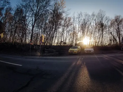
Museum für feldspurige Industriebahnen Osnabrück-Piesberg
Museum · 10.6 km
180 Fürstenauer Weg, Osnabrück


Piesberger Gesellschaftshaus
Monument and historic site · 10.9 km
1 Glückaufstraße, Osnabrück
"Je nach aktuellem Programm, siehe Homepage."


Großsteingrab Westerkappeln
Monument and historic site · 8.5 km
Reste des zerstörten Großsteingrab, noch drei Findlinge in der Böschung. Ursprünglicher Standort war, wo jetzt das Gebäude Bramscher...

Kloster Lage der Franziskaner-Minoriten
Monument and historic site · 10.4 km
Kommendegebäude der Kommende Lage
6 Lage, Rieste
74 more on the map.
Parks, trails and playgrounds119

Alfsee StrandArena
Beach · 9.0 km
Erwachsene 4 EUR 4-17, Schüler, Studenten 3 EUR
May-Jun 13:00-18:00; Jul-Aug 10:00-18:00; easter -1 week-easter +1...


Bullermeck Alfsee
Playground · 8.4 km
11 Barlager Straße
15:00-19:00; SH,Sa-Su 10:00-14:00; PH unknown "Weihnachten und...




107 more on the map.
Restaurants and cafes121

Hotel Restaurant Welling
Restaurant · 9.2 km
31 Lindenstraße, Neuenkirchen
Fr,Sa 18:00+; Su 17:00-21:30
Ratsstuben Wersen
Restaurant · Burger, Regional · 10.8 km
Veranstaltungshaus & Catering
17 Westerkappelner Straße, Lotte
Tu-Su 17:00+; Su 11:30+ || "Sonntags ab 11.30 Mittagsbuffet und...
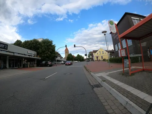
Anmol Indisches Restaurant - Wallenhorst
Restaurant · Indian · 7.0 km
138 Hollager Straße, Wallenhorst
Mo,We-Sa 11:30-14:00,17:00-23:00; Tu off; Su 12:00-22:30
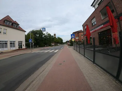
Bäckerei Justus
Bakery · 2.1 km
54 Lutterdamm, Bramsche
Mo-Fr 05:30-18:00; Sa 05:30-17:00; Su 08:00-17:00
Hof Hawighorst
Restaurant · Regional · 8.7 km
24 Brockhauser Straße, Wallenhorst
"Based on seasonal conditions"
La Piazza
Restaurant · Italian · 10.9 km
2 Rathausplatz, Lotte
Mo,Th 17:30-22:00; Tu off; We,Su 12:00-14:30,17:30-22:00; Fr-Sa 17:30-22:30
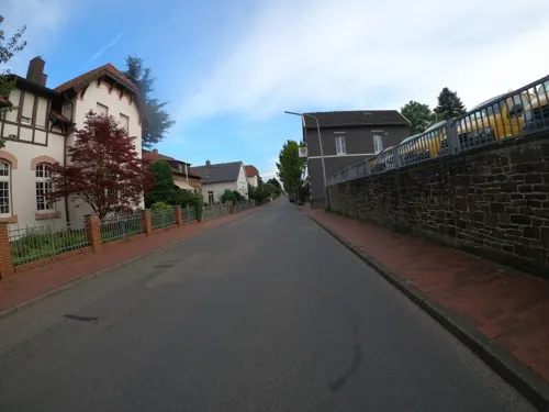
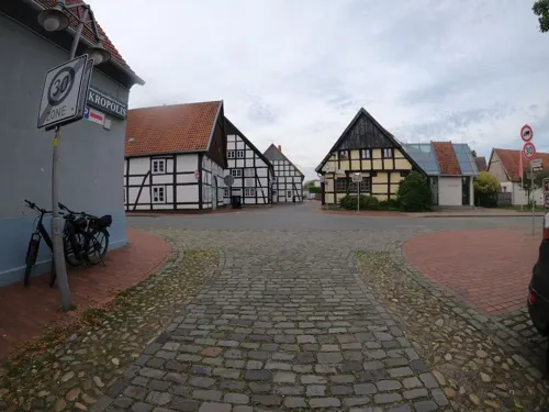
Restaurant Akropolis
Restaurant · Greek
1 Hemker Straße, Bramsche
Tu-Th 17:30-23:00; Fr,Sa 18:00-24:00; PH,Su 12:00-14:30,17:00-22:00
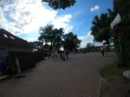


Restaurant FeinGeist
Restaurant · German, Regional · 8.7 km
4 Am Campingpark, Rieste
Mo-We 17:30-21:30; Th,Fr 14:30-21:30; Sa,Su 14:30-21:30
Restaurant Yummy
Restaurant · Chinese · 0.6 km
64 Hemker Straße, Bramsche
Tu-Su 12:00-14:30,17:30-22:30
Ristorante-Pizzaria Da Pino
Restaurant · Italian, Pizza · 2.8 km
13 Grenzstraße, Bramsche
Mo,We-Su 12:00-14:00,17:30-23:00; Sa 17:30-23:00
109 more on the map.
Where to stay21
Churches and places of worship31
Alte St.-Alexander-Kirche
Church · Catholic · 6.6 km
Zur Alten Kirche, Wallenhorst
St.-Alexander-Kirche
Church · Roman Catholic · 7.2 km
1 Kirchplatz, Wallenhorst
Shopping35
Gas and EV charging22
Ladenetz Station Wallenhorst
EV charging · 7.2 km
Alter Pyer Kirchweg, Wallenhorst
Schools, colleges and libraries27
Healthcare16
Map of Bramsche
250 places. The map loads OpenStreetMap tiles when you open it.
Getting there and nearby towns
Münster Osnabrück Airport (FMO) is the nearest airport with scheduled flights listed in OpenStreetMap, 36 km away.
- Wallenhorst 7 km southeast, about 7 min by car
- Westerkappeln 12 km southwest, about 12 min by car
- Lotte 15 km south, about 15 min by car
- Osnabrück 16 km south, about 16 min by car
- Mettingen 16 km southwest, about 16 min by car
- Recke 18 km west, about 18 min by car
- Hasbergen 19 km south, about 19 min by car
- Damme 20 km northeast, about 20 min by car
- Georgsmarienhütte 23 km south, about 23 min by car
- Lengerich 26 km south, about 26 min by car
Drive times are estimates from straight-line distance, not routes.
Local news
Headlines from INDB.
Reviews, tips and questions
Loading what members have shared...
Sources and licences
- GeoNames (CC BY 4.0): population, coordinates, regions and time zone
- Mapillary (see each image): photos
- OpenStreetMap contributors (ODbL 1.0): places, airports, map data
- Wikidata (CC0 1.0): elevation, founding date, time zone, website, landmarks and historic places
- Wikimedia Commons (see each image): photos
- Wikipedia (CC BY-SA 4.0): overview and history text
Photo credits
- HbfBramschemitZugbeiNacht, Rudko, CC0
- Hirsch-Apotheke, Münsterstraße Bramsche, Gerd Fahrenhorst, CC BY 4.0
- Bramsche - Tuchmachermuseum 01, Basotxerri, CC BY-SA 4.0
- Stadtbücherei Bramsche, Gerd Fahrenhorst, CC BY 4.0
- Bramsche-08-95, Lok82008, CC BY-SA 3.0
- Skulpturen Bahnhofsvorplatz Bramsche, Gerd Fahrenhorst, CC BY 4.0
- Bramsche-bf-08-95, Lok82008, CC BY-SA 3.0
- Skulpturen am Bahnhof Bramsche, Gerd Fahrenhorst, CC BY 4.0
- Bramsche Münsterstr. 19, Corradox, CC BY 4.0
- Gebäudegruppe Münsterstraße in Bramsche, Gerd Fahrenhorst, CC BY 4.0
- Geldlotte Bramsche 4, Gerd Fahrenhorst, CC BY 4.0
- Geldlotte Bramsche 3, Gerd Fahrenhorst, CC BY 4.0
- Geldlotte Bramsche 2, Gerd Fahrenhorst, CC BY 4.0
- Volksbank in Bramsche, Gerd Fahrenhorst, CC BY 4.0
- Geldlotte Bramsche 1, Gerd Fahrenhorst, CC BY 4.0
- St.-Martin Bramsche-3788, Creosoph, CC0
- Bramsche, die Sankt Martinus Kirche IMG 7328 2020-08-09 15.54, Michielverbeek, CC BY-SA 4.0
- Höhenmarke Bramsche, Ulrich Kulle, CC BY-SA 4.0
- Höhenmarke Bramsche Kirche Turm, Ulrich Kulle, CC BY-SA 4.0
- Große Straße 43, Bramsche, Gerd Fahrenhorst, CC BY 4.0
- St.-Martin Bramsche-3786, Creosoph, CC0
- St.-Martin Hochaltar Bramsche-3792, Creosoph, CC0
- St.-Martin Innenansicht Bramsche-3789, Creosoph, CC0
- St.-Martin Hochaltar Bramsche-3795, Creosoph, CC0
- Bramsche Kuhstraße 9, Corradox, CC BY 4.0
- Bramsche Destroyed Ukrainian car, Corradox, CC BY 4.0
- Brunnenskulptur Bramsche 1, Gerd Fahrenhorst, CC BY 4.0
- Brunnenskulptur Bramsche 2, Gerd Fahrenhorst, CC BY 4.0
- Bramsche - Tuchmachermuseum 02, Basotxerri, CC BY-SA 4.0
- Brunnenskulptur Bramsche 3, Gerd Fahrenhorst, CC BY 4.0
- Bramsche - Hasewiesen 01, Basotxerri, CC BY-SA 4.0
- Bramsche - Hasewiesen 02, Basotxerri, CC BY-SA 4.0
- Gipfelkreuz Kalkrieser-Berg (Schmittenhöhe), Grugerio, CC BY-SA 3.0
- WallenhorstAlteStAlexanderkirche, MrsMyer, CC BY-SA 3.0
- Niedersachsen, Osnabrück, Museum Industriekultur NIK 9334, -- Nightflyer ( talk ) 18:51, 20 April 2016 (UTC), CC BY-SA 4.0
- Piesberg Blick zum Penter Knapp, Ramsch, CC BY-SA 4.0
- Wersen, Kirche 1, Rauenstein, Public domain
- Feldungelsee suedufer, Jens Mattke, CC BY-SA 3.0
- 01 Lechtinger Mühle - Mühlenfest 2016 - Länge 8.033694 Breite 52.341068, Balkonhuf, CC BY-SA 4.0
- WallenhorstNeueStAlexanderkirche, MrsMyer, CC BY-SA 3.0
- Rulle helmichsteine 06, Sail over, CC BY-SA 3.0
- Bramsche malgarten kloster 03, Sail over, CC BY-SA 3.0
- All the finds from the excavations at Kalkriese, Museum und Park Kalkriese, Germany (9703011758), Carole Raddato from FRANKFURT, Germany, CC BY-SA 2.0
- Piesberg Osnabrück 13.10.2017, Adl252, CC BY-SA 4.0
- St Laurentius Neuenkirchen 1-2, St_Laurentius_Neuenkirchen_1.jpg : J.-H. Janßen derivative work: Rabanus Flavus ( talk ), CC BY-SA 3.0
- Balkum WM Riesau 1, Corradox, CC BY-SA 3.0
- St. Johannis (Bramsche), Ramsch, CC BY-SA 4.0
- Emmauskapelle in Rieste seitlich, Ramsch, CC BY-SA 4.0
- Seeste Schachsel 01, Jan-Herm Janßen, CC BY-SA 4.0
- Heilig-Geist-Kirche (Bramsche), Ramsch, CC BY-SA 4.0
- St. Josef (Hollage), Ramsch, CC BY-SA 4.0
- Piesberger Gesellschaftshaus 5-2017, N9713, CC BY-SA 4.0
- Seeste Naturschutzgebiet Bramegge 01, Jan-Herm Janßen, CC BY-SA 4.0
- Halen Naturschutzgebiet Deipe Briaeke 01, Jan-Herm Janßen, CC BY-SA 4.0
- Duesterdieker Niederung 04, J.-H. Janßen, CC BY-SA 3.0
- Westerkappeln Naturschutzgebiet Haler Feld Vogelpohl 02, Jan-Herm Janßen, CC BY-SA 4.0
- Halen Naturschutzgebiet Haseniederung 06, Jan-Herm Janßen, CC BY-SA 4.0
- Naturschutzgebiet Seester Feld 04, J.-H. Janßen, CC BY-SA 3.0
- Sloopsteine 01, Jan-Herm Janßen, CC BY-SA 4.0
- Kloster Rulle 18, Daniel Brockpähler, CC BY-SA 3.0
- Grosssteingrab Westerkappeln, Marcin-Janek, CC0
- Larberger Egge, Ramsch, CC BY-SA 4.0
- Street-level photo, VIA_KK, CC BY-SA 4.0
- Street-level photo, VIA_KK, CC BY-SA 4.0
- Street-level photo, VIA_KK, CC BY-SA 4.0
- Street-level photo, VIA_KK, CC BY-SA 4.0
- Street-level photo, VIA_KK, CC BY-SA 4.0
- Street-level photo, thetornado76, CC BY-SA 4.0
- Street-level photo, VIA_KK, CC BY-SA 4.0
- Street-level photo, VIA_KK, CC BY-SA 4.0
- Street-level photo, VIA_KK, CC BY-SA 4.0
- Street-level photo, VIA_KK, CC BY-SA 4.0
- Street-level photo, GlitchHunter, CC BY-SA 4.0
- Street-level photo, camdrive2000, CC BY-SA 4.0
- Street-level photo, VIA_KK, CC BY-SA 4.0
- Street-level photo, VIA_KK, CC BY-SA 4.0
- Street-level photo, VIA_KK, CC BY-SA 4.0
- Street-level photo, VIA_KK, CC BY-SA 4.0
- Street-level photo, VIA_KK, CC BY-SA 4.0
- Street-level photo, VIA_KK, CC BY-SA 4.0
- Street-level photo, rainerup, CC BY-SA 4.0
- Street-level photo, VIA_KK, CC BY-SA 4.0
- Street-level photo, moenk, CC BY-SA 4.0
- Street-level photo, moenk, CC BY-SA 4.0
- Street-level photo, thetornado76, CC BY-SA 4.0


Page built November 8, 2026. Spotted a mistake? Tell us or suggest a place.