


Why visit Wallenhorst
Townapedia lists 73 museums and landmarks, 89 parks and trails, 71 places to eat, 6 places to stay and 28 attractions in and around town.
Highlights include Biolandhof Kruse, Gut Honeburg, Windmühle Lechtingen and Museum Industriekultur Osnabrück.
Weather in Wallenhorst
Forecast from MET Norway (CC BY 4.0). Full forecast
About Wallenhorst
Wallenhorst (German pronunciation: [ˈvalənhɔʁst]) is a municipality in the district of Osnabrück, in Lower Saxony, Germany. It is situated in the Wiehengebirge, approx. 10 km north of Osnabrück.
From the Wikipedia article Wallenhorst (this version), under CC BY-SA 4.0.
Things to do28

Biolandhof Kruse
Farm and orchard · 4.7 km
19 Wiechmanns Ecke, Bramsche
Tu 09:00-13:00, 15:00-18:00; We-Fr 15:00-18:30; Sa 09:00-13:00


Theater Osnabrück
Cinema and theater · 8.4 km
Multi-discipline theater in Osnabrück, Germany

Hofladen an der Wabe
Farm and orchard · 3.5 km
8 Zum Gruthügel, Wallenhorst
Mo-Th 07:30-16:00, Fr 07:30-12:30


Hofladen Hawighorst
Farm and orchard · 4.0 km
24 Brockhauser Straße, Wallenhorst
16 more on the map.
Museums and landmarks73

Windmühle Lechtingen
Monument and historic site · 1.5 km
41 Mühlenstraße, Wallenhorst
Su[1] 10:00-12:00; Nov-Mar: off

Museum Industriekultur Osnabrück
Museum · 3.9 km
50a Süberweg, Osnabrück
Sa,Su 10:00-18:00; Tu 10:00-14:00; We-Fr 10:00-17:00



K.A.F.F. e.V.
Museum · 6.0 km
Das K.A.F.F. ist seit 2017 eine Art Keimzelle auf dem Areal am Osnabrücker Hafen, auf dem sich gerade vielerlei Akteur*innen aus dem...
3a Am Speicher, Osnabrück
Mo 19:00-22:00
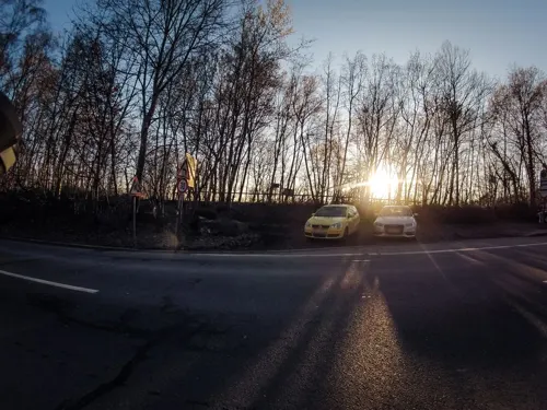
Museum für feldspurige Industriebahnen Osnabrück-Piesberg
Museum · 3.9 km
180 Fürstenauer Weg, Osnabrück

Wittekindsburg
Monument and historic site · 5.3 km
Ruinen einer frühmittelalterlichen Burganlage mit Haupt- und Vorburg

Felix Nussbaum Haus
Museum · 8.4 km
Museum dedicated to Felix Nussbaum in Osnabrück, Germany




61 more on the map.
Parks, trails and playgrounds89






Osnabrücker Motor-Yacht-Club e.V.
Marina and boat launch · 4.4 km

Katharinaschule
Playground
Spielplatz der Grundschule, außerhalb der Schulzeiten ist der Spielplatz öffentlich nutzbar
77 more on the map.
Restaurants and cafes71
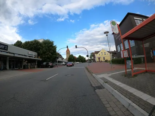
Anmol Indisches Restaurant - Wallenhorst
Restaurant · Indian · 3.0 km
138 Hollager Straße, Wallenhorst
Mo,We-Sa 11:30-14:00,17:00-23:00; Tu off; Su 12:00-22:30

Hof Hawighorst
Restaurant · Regional · 4.0 km
24 Brockhauser Straße, Wallenhorst
"Based on seasonal conditions"
Bäckerei-Konditorei Remke
Bakery · 6.0 km
12a Meyers Tannen, Bramsche
Mo-Fr 06:30-18:30; Sa 06:30-16:00; Su 07:00-11:00
Pizzeria La Trattoria
Restaurant · 5.4 km
8 Venner Straße, Bramsche
Tu-Sa 12:00-14:30, 17:30-22:30; Su 12:00-14:30, 17:00-22:00
Zur Mühle
Restaurant · 5.3 km
4 Nettetal, Wallenhorst
Mo-Fr 15:00-22:00; Sa 13:00-22:00; Su 11:00-22:00
Zur alten Eversburg
Restaurant · 4.8 km
43 Die Eversburg, Osnabrück
Apr-Sep We-Fr,PH 15:00-23:00, Sa,Su 11:00-23:00; Oct-Mar We-Sa,PH...

boni Kaffeerösterei
Cafe · Coffee Shop · 5.8 km
6 Netter Platz, Osnabrück
Mo-Th 08:00-16:30; Fr 08:00-15:00


59 more on the map.
Where to stay6
Churches and places of worship23
Alte St.-Alexander-Kirche
Church · Catholic · 0.6 km
Zur Alten Kirche, Wallenhorst
Basharat Mosque
Place of worship · Ahmadiyya · 5.5 km
104a Atterstraße, Osnabrück
St.-Alexander-Kirche
Church · Roman Catholic
1 Kirchplatz, Wallenhorst
Shopping19
Gas and EV charging16
Schools, colleges and libraries27
Angelaschule Osnabrück
School · Roman Catholic · 5.7 km
41a Bramstraße, Osnabrück
Healthcare10
Map of Wallenhorst
250 places. The map loads OpenStreetMap tiles when you open it.
Getting there and nearby towns
Münster Osnabrück Airport (FMO) is the nearest airport with scheduled flights listed in OpenStreetMap, 33 km away.
- Osnabrück 9 km south, about 9 min by car
- Westerkappeln 10 km west, about 10 min by car
- Hasbergen 13 km south, about 13 min by car
- Hilter 25 km south, about 25 min by car
- Werther 41 km southeast, about 41 min by car
- Warendorf 44 km south, about 44 min by car
- Bielefeld 50 km southeast, about 50 min by car
- Münster 51 km southwest, about 51 min by car
- Emstek 55 km north, about 55 min by car
- Wietmarschen 63 km west, about 1 h by car
Drive times are estimates from straight-line distance, not routes.
Local news
Headlines from INDB.
Reviews, tips and questions
Loading what members have shared...
Sources and licences
- GeoNames (CC BY 4.0): population, coordinates, regions and time zone
- Mapillary (see each image): photos
- OpenStreetMap contributors (ODbL 1.0): places, airports, map data
- Wikidata (CC0 1.0): elevation, founding date, time zone, website, landmarks and historic places
- Wikimedia Commons (see each image): photos
- Wikipedia (CC BY-SA 4.0): overview and history text
Photo credits
- WallenhorstNeueStAlexanderkirche, MrsMyer, CC BY-SA 3.0
- NivellementWallenhorst, Roland Mattern ( Roland1952 ), CC BY-SA 3.0
- WallenhorstTaufsteinStAlexanderkirche, MrsMyer, CC BY-SA 3.0
- Info Tafel Höhenfestpunkt St. Alexander Wallenhorst, Klalanda, CC BY-SA 4.0
- WallenhorstAnnakapelle, E. S. Myer, CC BY-SA 3.0
- Hexenstein in Wallenhorst, Megalithicguy, CC BY-SA 4.0
- WallenhorstAlteStAlexanderkircheTreppe, MrsMyer, CC BY-SA 3.0
- WallenhorstAltStAlexanderKanzel, E. S. Myer, CC BY-SA 3.0
- WallenhorstAlteStAlexanderkircheInschrift, E. S. Myer, CC BY-SA 3.0
- Osnabrueck Theater 13, J.-H. Janßen, CC BY-SA 4.0
- FelixNussbaumHaus, Studio Daniel Libeskind, CC BY 3.0
- Gipfelkreuz Kalkrieser-Berg (Schmittenhöhe), Grugerio, CC BY-SA 3.0
- OSStKatharinen, MrsMyer, CC BY-SA 3.0
- St. Marien Osnabrueck, Garitzko, Public domain
- Osnabrück Dom Westseite, Tebdi, CC BY-SA 3.0
- Neuer Graben-Schloss Osnabrueck, Jens-Olaf Walter, CC BY 2.0
- WallenhorstAlteStAlexanderkirche, MrsMyer, CC BY-SA 3.0
- Niedersachsen, Osnabrück, Museum Industriekultur NIK 9334, -- Nightflyer ( talk ) 18:51, 20 April 2016 (UTC), CC BY-SA 4.0
- Piesberg Blick zum Penter Knapp, Ramsch, CC BY-SA 4.0
- Os karlsteine 04, Sail over, CC BY-SA 3.0
- 01 Lechtinger Mühle - Mühlenfest 2016 - Länge 8.033694 Breite 52.341068, Balkonhuf, CC BY-SA 4.0
- Rulle helmichsteine 06, Sail over, CC BY-SA 3.0
- Os oestringer steine ii 01, Sail over, CC BY-SA 3.0
- Piesberg Osnabrück 13.10.2017, Adl252, CC BY-SA 4.0
- Wittekindsburg rundturm 04, Sail over, CC BY-SA 3.0
- Nettebad Osnabrück Südseite, N9713, CC BY-SA 4.0
- St. Josef (Hollage), Ramsch, CC BY-SA 4.0
- Das Herrenhaus der Honeburg von Südwesten, Castritus, CC BY-SA 4.0
- Paul-Gerhardt-Kirche OS, Jojeska, CC0
- Römerbrücke Osnabrück 2017-08-06 (1), N9713, CC BY-SA 4.0
- Halen Naturschutzgebiet Deipe Briaeke 01, Jan-Herm Janßen, CC BY-SA 4.0
- Halen Naturschutzgebiet Haseniederung 06, Jan-Herm Janßen, CC BY-SA 4.0
- Osnabrück Eversburg Kapelle, Tebdi, CC BY-SA 3.0
- Kloster Rulle 18, Daniel Brockpähler, CC BY-SA 3.0
- Haseschacht, Berklas processed the version created by Ramsch on 12:20, 2. Nov. 2007 (CET), CC BY-SA 3.0
- Feuerwehr Opel Blitz vor der Windmühle, WML49134, CC BY 3.0
- Römerbrücke Eversburg Ostseite, N9713, CC BY-SA 4.0
- 36VoS 22 Pfefferrahmschnitzel Kroketten Wiechers, Grueslayer, CC BY-SA 4.0
- 36VoS 08 Räuberschnitzel Kroketten Wiechers, Grueslayer, CC BY-SA 4.0
- St Alexander Nivellementpunkt ks01, Kreuzschnabel, CC BY-SA 3.0
- Baracke 35 OS fern, N9713, CC BY-SA 4.0
- Street-level photo, VIA_KK, CC BY-SA 4.0
- Street-level photo, thetornado76, CC BY-SA 4.0
- Street-level photo, GlitchHunter, CC BY-SA 4.0
- Street-level photo, VIA_KK, CC BY-SA 4.0
- Street-level photo, thetornado76, CC BY-SA 4.0
- Street-level photo, rainerup, CC BY-SA 4.0
- Street-level photo, zuse, CC BY-SA 4.0
- Street-level photo, GlitchHunter, CC BY-SA 4.0
- Street-level photo, VIA_KK, CC BY-SA 4.0
- Street-level photo, thetornado76, CC BY-SA 4.0
- Street-level photo, VIA_KK, CC BY-SA 4.0


Page built November 8, 2026. Spotted a mistake? Tell us or suggest a place.