


Westerkappeln, Germany
Westerkappeln is a town of 11,397 people in North Rhine-Westphalia, Germany.
Why visit Westerkappeln
Townapedia lists 37 museums and landmarks, 49 parks and trails, 77 places to eat, 9 places to stay and 15 attractions in and around town.
Highlights include Gabelin, Hagenberg, Baracke 35 and Traktorenmuseum.
Weather in Westerkappeln
Forecast from MET Norway (CC BY 4.0). Full forecast
About Westerkappeln
Westerkappeln is a municipality in the district of Steinfurt, in North Rhine-Westphalia, Germany. It is situated approximately 15 km north-west of Osnabrück.
From the Wikipedia article Westerkappeln (this version), under CC BY-SA 4.0.
Things to do15




Hofladen Hawighorst
Farm and orchard · 6.4 km
24 Brockhauser Straße, Wallenhorst

3 more on the map.
Museums and landmarks37

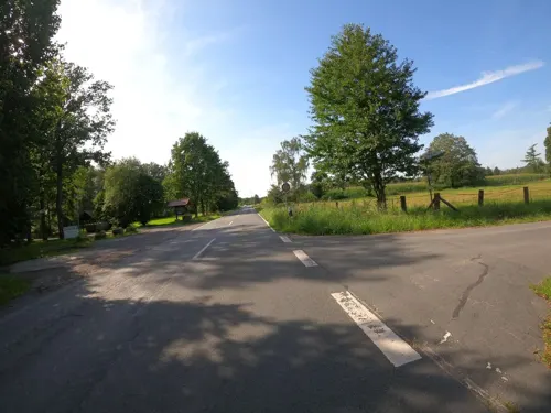
Traktorenmuseum
Museum · 3.6 km
20 Lotter Straße, Westerkappeln
Apr-Oct: Fr 14:00-18:00; Sa,Su 10:00-18:00; PH 10:00-18:00 ||...

Dr. Feodor Block
Monument and historic site
Stolpersteine Bernhardine Block, Dr. Feodor Block, Dr. Gertrud Block, Dr. Hildegard Block

Dr. Gertrud Block
Monument and historic site
Stolpersteine Bernhardine Block, Dr. Feodor Block, Dr. Gertrud Block, Dr. Hildegard Block


Großsteingrab Westerkappeln
Monument and historic site · 4.3 km
Reste des zerstörten Großsteingrab, noch drei Findlinge in der Böschung. Ursprünglicher Standort war, wo jetzt das Gebäude Bramscher...


Lilly Reinhaus geb. Stern
Monument and historic site
4 Große Straße, Westerkappeln




25 more on the map.
Parks, trails and playgrounds49




37 more on the map.
Restaurants and cafes77

Ratsstuben Wersen
Restaurant · Burger, Regional · 4.3 km
Veranstaltungshaus & Catering
17 Westerkappelner Straße, Lotte
Tu-Su 17:00+; Su 11:30+ || "Sonntags ab 11.30 Mittagsbuffet und...
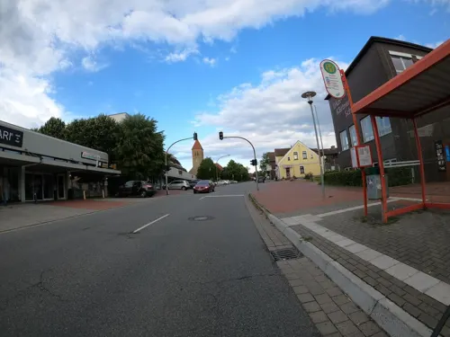
Anmol Indisches Restaurant - Wallenhorst
Restaurant · Indian · 7.3 km
138 Hollager Straße, Wallenhorst
Mo,We-Sa 11:30-14:00,17:00-23:00; Tu off; Su 12:00-22:30
Hof Hawighorst
Restaurant · Regional · 6.4 km
24 Brockhauser Straße, Wallenhorst
"Based on seasonal conditions"
La Piazza
Restaurant · Italian · 4.3 km
2 Rathausplatz, Lotte
Mo,Th 17:30-22:00; Tu off; We,Su 12:00-14:30,17:30-22:00; Fr-Sa 17:30-22:30
Landgasthaus Kemken
Restaurant · German · 7.6 km
37 Osnabrücker Straße, Tecklenburg
Mo-Tu off;We-Th 14:30-22:00;Fr-Su 10:00-22:00
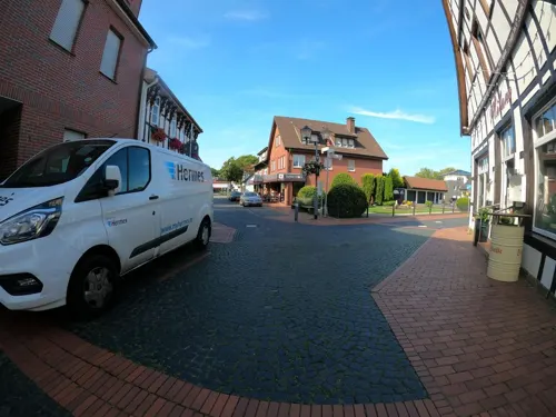
Bäckerei Josef Remke
Bakery · 6.3 km
20 Westerkappelner Straße, Mettingen
Mo-Fr 06:30-19:00; Sa 06:30-16:00

Coppenrath & Wiese Werksverkauf
Bakery · 5.0 km
2 Zum Attersee, Osnabrück
Mo-Fr 09:30-18:00; Sa 08:00-14:30
Justus...der Brotbäcker
Bakery
5 Heerstraße, Westerkappeln
Mo-Sa 06:00-21:00; Su 08:00-11:30,14:30-16:00
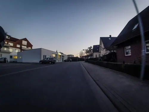


Café-Restaurant Birkenhof
Restaurant · Regional, International, Coffee Shop · 6.2 km
16 Industriestraße, Westerkappeln
65 more on the map.
Where to stay9
Churches and places of worship15
Shopping27
Gas and EV charging17
Schools, colleges and libraries22
Healthcare9
Map of Westerkappeln
250 places. The map loads OpenStreetMap tiles when you open it.
Getting there and nearby towns
Münster Osnabrück Airport (FMO) is the nearest airport with scheduled flights listed in OpenStreetMap, 24 km away.
- Hasbergen 10 km southeast, about 10 min by car
- Osnabrück 13 km east, about 13 min by car
- Hilter 27 km southeast, about 27 min by car
- Münster 43 km southwest, about 43 min by car
- Bielefeld 55 km southeast, about 55 min by car
- Wietmarschen 55 km northwest, about 55 min by car
- Emstek 61 km north, about 1 h by car
- Neuenhaus 65 km west, about 1 h by car
- Hamm 71 km south, about 1 h 15 min by car
- Wildeshausen 75 km northeast, about 1 h 15 min by car
Drive times are estimates from straight-line distance, not routes.
Local news
Headlines from INDB.
Reviews, tips and questions
Loading what members have shared...
Sources and licences
- GeoNames (CC BY 4.0): population, coordinates, regions and time zone
- Mapillary (see each image): photos
- OpenStreetMap contributors (ODbL 1.0): places, airports, map data
- Wikidata (CC0 1.0): elevation, founding date, time zone, website, landmarks and historic places
- Wikimedia Commons (see each image): photos
- Wikipedia (CC BY-SA 4.0): overview and history text
Photo credits
- Westerkappeln Stolperstein Ernst Reinhaus 01, Gunter Demnig / Jan-Herm Janßen, CC0
- Westerkappeln Stolperstein Lilly Reinhaus 01, Gunter Demnig / Jan-Herm Janßen, CC0
- Westerkappeln Stolperstein Martha Reinhaus 01, J.-H. Janßen, CC0
- Westerkappeln Stolperstein Walter Reinhaus 01, Gunter Demnig / Jan-Herm Janßen, CC0
- Westerkappeln Moonlightshopping 2013 Milano 01, J.-H. Janßen, CC BY-SA 3.0
- Westerkappeln Moonlightshopping 2013 Bahnhofstrasse 9 01, J.-H. Janßen, CC BY-SA 3.0
- Westerkappeln Moonlightshopping 2013 05, J.-H. Janßen, CC BY-SA 3.0
- Westerkappeln Moonlightshopping 2013 04, J.-H. Janßen, CC BY-SA 3.0
- Westerkappeln Moonlightshopping 2013 02, J.-H. Janßen, CC BY-SA 3.0
- Westerkappeln Moonlightshopping 2013 Volkshochschule 01, J.-H. Janßen, CC BY-SA 3.0
- Westerkappeln Moonlightshopping 2013 03, J.-H. Janßen, CC BY-SA 3.0
- Westerkappeln Moonlightshopping 2013 Mr Magicfire 06, J.-H. Janßen, CC BY-SA 3.0
- Westerkappeln Moonlightshopping 2013 Mr Magicfire 01, J.-H. Janßen, CC BY-SA 3.0
- Westerkappeln Moonlightshopping 2013 Mr Magicfire 02, J.-H. Janßen, CC BY-SA 3.0
- Westerkappeln Moonlightshopping 2013 Mr Magicfire 09, J.-H. Janßen, CC BY-SA 3.0
- Westerkappeln Moonlightshopping 2013 Mr Magicfire 08, J.-H. Janßen, CC BY-SA 3.0
- Westerkappeln Moonlightshopping 2013 Mr Magicfire 07, J.-H. Janßen, CC BY-SA 3.0
- Westerkappeln Moonlightshopping 2013 Mr Magicfire 05, J.-H. Janßen, CC BY-SA 3.0
- Westerkappeln Evangelische Stadtkirche 16, J.-H. Janßen, CC BY-SA 3.0
- Westerkappeln Evangelische Stadtkirche 12, J.-H. Janßen, CC BY-SA 3.0
- Westerkappeln Evangelische Stadtkirche 14, J.-H. Janßen, CC BY-SA 3.0
- Westerkappeln Evangelische Stadtkirche Erntedank 02, J.-H. Janßen, CC BY-SA 3.0
- Westerkappeln Evangelische Stadtkirche Erntedank 01, J.-H. Janßen, CC BY-SA 3.0
- Westerkappeln Stolpersteine Reinhaus 01, J.-H. Janßen, CC0
- Westerkappeln Kirchplatz Umgestaltung 02, J.-H. Janßen, CC BY-SA 3.0
- StadtkircheWesterkappeln, Alexander Jonas, Public domain
- Evangelische Stadtkirche Westerkappeln 05, J.-H. Janßen, CC BY-SA 3.0
- Evangelische Stadtkirche Westerkappeln 06, J.-H. Janßen, CC BY-SA 3.0
- Westerkappeln Kirchplatz Umgestaltung 04, J.-H. Janßen, CC BY-SA 3.0
- Westerkappeln Kirchplatz Umgestaltung 01, J.-H. Janßen, CC BY-SA 3.0
- Westerkappeln Stadtkirche 09, J.-H. Janßen, CC BY-SA 3.0
- Westerkappeln Stadtkirche 07, J.-H. Janßen, CC BY-SA 3.0
- Evangelische Stadtkirche Westerkappeln 07, J.-H. Janßen, CC BY-SA 3.0
- Westerkappeln Stadtkirche 10, J.-H. Janßen, CC BY-SA 3.0
- Maimarkt Westerkappeln 2013 03, J.-H. Janßen, CC BY-SA 3.0
- Evangelische Stadtkirche Westerkappeln 02, J.-H. Janßen, CC BY-SA 3.0
- Westerkappeln Stadtkirche 08, J.-H. Janßen, CC BY-SA 3.0
- Maimarkt Westerkappeln 2013 01, J.-H. Janßen, CC BY-SA 3.0
- Evangelische Stadtkirche Westerkappeln 01, J.-H. Janßen, CC BY-SA 3.0
- PGW-Arena, Rolf Grundke, CC BY-SA 3.0
- Comenius Kolleg Mettingen 1, J.-H. Janßen, CC BY-SA 3.0
- Ibbenbürener Bergplatte vom Ballon aus, Ramsch, CC BY-SA 3.0
- Mettingen Evangelische Kirche 08, J.-H. Janßen, CC BY-SA 3.0
- Evangelische Kirche Lotte 10, Jan-Herm Janßen, CC BY-SA 3.0
- Wersen, Kirche 1, Rauenstein, Public domain
- St Agatha Kirche Mettingen 06, J.-H. Janßen, CC BY-SA 3.0
- Seeste Schachsel 01, Jan-Herm Janßen, CC BY-SA 4.0
- St. Josef (Hollage), Ramsch, CC BY-SA 4.0
- Mettingen Georgshof Georgseiche 06, Jan-Herm Janßen, CC BY-SA 4.0
- Haus Kappeln in Westerkappeln von Westen, Castritus, CC BY-SA 4.0
- Osnabrück - Atter - Gut Leye 05, Basotxerri, CC BY-SA 4.0
- Westerkappeln Stolpersteine Feodor Block 01, Gunter Demnig / Jan-Herm Janßen, CC0
- Westerkappeln Stolpersteine Gertrud Block 01, Gunter Demnig / Jan-Herm Janßen, CC0
- Westerkappeln Stolpersteine Bernhardine Block 01, Gunter Demnig / Jan-Herm Janßen, CC0
- Seeste Naturschutzgebiet Bramegge 01, Jan-Herm Janßen, CC BY-SA 4.0
- Halen Naturschutzgebiet Deipe Briaeke 01, Jan-Herm Janßen, CC BY-SA 4.0
- Naturschutzgebiet Dieckwiesen 03, Jan-Herm Janßen, CC BY-SA 4.0
- Duesterdieker Niederung 04, J.-H. Janßen, CC BY-SA 3.0
- Westerkappeln Naturschutzgebiet Haler Feld Vogelpohl 02, Jan-Herm Janßen, CC BY-SA 4.0
- Halen Naturschutzgebiet Haseniederung 06, Jan-Herm Janßen, CC BY-SA 4.0
- Osterledde Permer Stollen 01, J.-H. Janßen, CC BY-SA 4.0
- Mettingen Naturschutzgebiet Rote Brook 06, J.-H. Janßen, CC BY-SA 3.0
- Naturschutzgebiet Seester Feld 04, J.-H. Janßen, CC BY-SA 3.0
- Sloopsteine 01, Jan-Herm Janßen, CC BY-SA 4.0
- Ibbenbueren Christuskirche 06, Jan-Herm Janßen, CC BY-SA 4.0
- Grosssteingrab Westerkappeln, Marcin-Janek, CC0
- Baracke 35 OS fern, N9713, CC BY-SA 4.0
- Street-level photo, VIA_KK, CC BY-SA 4.0
- Street-level photo, VIA_KK, CC BY-SA 4.0
- Street-level photo, bct, CC BY-SA 4.0
- Street-level photo, natebus, CC BY-SA 4.0
- Street-level photo, Hightower-, CC BY-SA 4.0
- Street-level photo, VIA_KK, CC BY-SA 4.0
- Street-level photo, bct, CC BY-SA 4.0
- Street-level photo, VIA_KK, CC BY-SA 4.0
- Street-level photo, GlitchHunter, CC BY-SA 4.0
- Street-level photo, derlipper, CC BY-SA 4.0
- Street-level photo, bct, CC BY-SA 4.0
- Street-level photo, GlitchHunter, CC BY-SA 4.0
- Street-level photo, GlitchHunter, CC BY-SA 4.0
- Street-level photo, VIA_KK, CC BY-SA 4.0
- Street-level photo, GlitchHunter, CC BY-SA 4.0
- Street-level photo, bct, CC BY-SA 4.0
- Street-level photo, bct, CC BY-SA 4.0


Page built November 8, 2026. Spotted a mistake? Tell us or suggest a place.