


Why visit Dietfurt
Townapedia lists 66 museums and landmarks, 12 parks and trails, 53 places to eat, 9 places to stay and 30 attractions in and around town.
Highlights include Arzberg, Sonnenpusterei, Ludwig-Donau-Main-Kanal and Ludwig-Donau-Main-Kanal.
Weather in Dietfurt
Forecast from MET Norway (CC BY 4.0). Full forecast
About Dietfurt
Dietfurt an der Altmühl (officially Dietfurt a.d. Altmühl, German pronunciation: [ˈdiːtˌfʊʁt ʔan deːɐ̯ ˈʔaltˌmyːl] , lit. 'Dietfurt on the Altmühl'), commonly known as Dietfurt, is a town in the district of Neumarkt in Bavaria, Germany. The town is situated on the river Altmühl, and is 38 km west of Regensburg, 30 km north of Ingolstadt, and is located 364 meters above sea level.
From the Wikipedia article Dietfurt (this version), under CC BY-SA 4.0.
Things to do30





18 more on the map.
Museums and landmarks66


Stein.Wasser.Höhle - Jurahausensemble Obermühle
Museum · 2.7 km
3 Obermühlenweg, Dietfurt an der Altmühl
Mo-Su 09:00-17:00


Martersäule
Monument and historic site · Catholic · 4.9 km
Wappen: Fisch und Hufeisen


54 more on the map.
Parks, trails and playgrounds12







Restaurants and cafes53
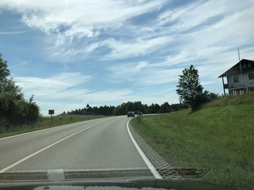
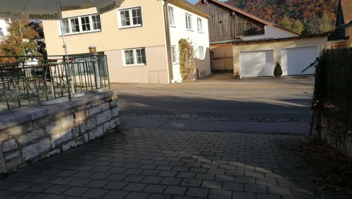
Zum Schlosswirt
Restaurant · Regional · 2.3 km
14 Beilngrieser Straße, Dietfurt an der Altmühl
We-Fr 14:00-22:00; Sa,Su,PH 11:00-22:00

China-Restaurant 7-Täler
Restaurant · Chinese · 0.6 km
21 Mallerstetter Straße, Dietfurt an der Altmühl
Th-Tu 10:30-14:30, 17:00-22:30
Gasthaus zum Himmelreich
Restaurant · Bavarian · 5.7 km
1 Thanner Straße, Riedenburg
We-Sa 14:00+; Su 11:00+
Gasthof zum Lehnerwirt
Restaurant · German · 5.8 km
10 Marktplatz, Breitenbrunn
Mo,Tu,Th,Fr 11:00+; Su 10:00+
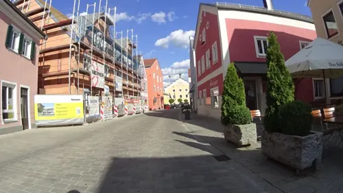
Hotel und Gasthof "Zum Bräu-Toni"
Restaurant · Regional
4 Hauptstraße, Dietfurt an der Altmühl
Tu-Su 07:30+; Mo 16:00+
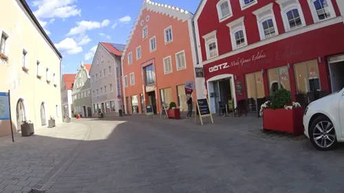

Café im Holzhaus
Cafe · 4.0 km
3, Dietfurt an der Altmühl
May-Sep: Th-Su,PH 14:00+; Oct-Apr: Sa-Su 14:00+ || "nach Vereinbarung"
Eiscafe Valentina
Ice cream
23 Hauptstraße, Dietfurt an der Altmühl
Mar-Sep Mo-Su 10:00-22:30; Feb,Oct We-Mo 10:00-20:00; Nov-Jan off
Gasthof Meier "Zu den drei Heiligen"
Restaurant · Regional · 1.1 km
11 Griesstetter Straße, Dietfurt an der Altmühl


41 more on the map.
Where to stay9
Max und Maria Bunzel
Motel and hotel · 0.9 km
20 Wildensteiner Weg, Dietfurt an der Altmühl
Churches and places of worship47
St. Ägidius
Church · Roman Catholic
2 Klostergasse, Dietfurt an der Altmühl
Friedhofskirche
Church · Roman Catholic
53 Hauptstraße, Dietfurt an der Altmühl
St. Bartholomäus
Church · Roman Catholic · 2.3 km
2 Kirchweg, Dietfurt an der Altmühl
St. Gertraud
Church · Roman Catholic · 4.3 km
17, Dietfurt an der Altmühl
Shopping7
Gas and EV charging4
Schools, colleges and libraries3
Healthcare3
Map of Dietfurt
234 places. The map loads OpenStreetMap tiles when you open it.
Getting there and nearby towns
Ingolstadt Manching Airport (IGS) is the nearest airport with scheduled flights listed in OpenStreetMap, 36 km away.
- Riedenburg 11 km southeast, about 11 min by car
- Velburg 23 km north, about 23 min by car
- Kelheim 26 km southeast, about 26 min by car
- Thalmässing 27 km west, about 27 min by car
- Neumarkt in der Oberpfalz 29 km north, about 29 min by car
- Neustadt an der Donau 29 km southeast, about 29 min by car
- Gaimersheim 30 km southwest, about 30 min by car
- Abensberg 31 km southeast, about 31 min by car
- Ingolstadt 32 km south, about 32 min by car
- Regensburg 38 km east, about 38 min by car
Drive times are estimates from straight-line distance, not routes.
Local news
Headlines from INDB.
Reviews, tips and questions
Loading what members have shared...
Sources and licences
- GeoNames (CC BY 4.0): population, coordinates, regions and time zone
- Mapillary (see each image): photos
- OpenStreetMap contributors (ODbL 1.0): places, airports, map data
- Wikidata (CC0 1.0): elevation, founding date, time zone, website
- Wikimedia Commons (see each image): photos
- Wikipedia (CC BY-SA 4.0): overview and history text
Photo credits
- Dietfurt a. d. Altmühl - Gesamtanblick, Gliwi, CC BY-SA 3.0
- Weiße Laber Dietfurt Stadtgebiet 03, Liuthalas, CC BY-SA 4.0
- Bahnhofstraße 4 (Dietfurt), Kd6=dra, CC0
- Weiße Laber Dietfurt Stadtgebiet 02, Liuthalas, CC BY-SA 4.0
- Weiße Laber Dietfurt Stadtgebiet 01, Liuthalas, CC BY-SA 4.0
- Hauptstraße 14, Dietfurt a.d. Altmühl, Liuthalas, CC BY-SA 4.0
- Hauptstraße 14, Dietfurt 02, H.Helmlechner, CC BY-SA 4.0
- Hauptstraße 14, Dietfurt 01, H.Helmlechner, CC BY-SA 4.0
- Hauptstraße 20, Dietfurt, H.Helmlechner, CC BY-SA 4.0
- Hauptstraße 22, Dietfurt, H.Helmlechner, CC BY-SA 4.0
- Rathaus in Dietfurt, MPhernambucq, CC BY-SA 3.0
- St. Ägidius Dietfurt 01, H.Helmlechner, CC BY-SA 4.0
- Hauptstraße 15, Dietfurt, H.Helmlechner, CC BY-SA 4.0
- Klostergasse 3, Dietfurt, H.Helmlechner, CC BY-SA 4.0
- Franziskanerkloster Dietfurt 01, H.Helmlechner, CC BY-SA 4.0
- 2015 Dietfurt Chinesenbrunnen 01, Derzno, CC BY-SA 3.0
- Chinesenbrunnen Dietfurt 2019, Liuthalas, CC BY-SA 4.0
- St. Ägidius Dietfurt 08, H.Helmlechner, CC BY-SA 4.0
- Rathaus Dietfurt 03, H.Helmlechner, CC BY-SA 4.0
- Klostergasse 5 (Dietfurt an der Altmühl), Liuthalas, CC BY-SA 4.0
- Rathaus Dietfurt 008, H.Helmlechner, CC BY-SA 4.0
- St. Ägidius Dietfurt 04, H.Helmlechner, CC BY-SA 4.0
- St. Ägidius Dietfurt 06, H.Helmlechner, CC BY-SA 4.0
- St. Ägidius Dietfurt 03, H.Helmlechner, CC BY-SA 4.0
- St. Ägidius Dietfurt 02, H.Helmlechner, CC BY-SA 4.0
- St. Ägidius Dietfurt 05, H.Helmlechner, CC BY-SA 4.0
- St. Ägidius Dietfurt Tür, Liuthalas, CC BY-SA 4.0
- St. Ägidius Dietfurt Stiege außen, Liuthalas, CC BY-SA 4.0
- St. Ägidius Dietfurt Figuren außen, Liuthalas, CC BY-SA 4.0
- Klostergasse 5 (Dietfurt) 225, Kd6=dra, CC0
- Klostergasse 12, Dietfurt, H.Helmlechner, CC BY-SA 4.0
- Premerzhofer Weg 1, Dietfurt, H.Helmlechner, CC BY-SA 4.0
- St. Ägidius Dietfurt Stiege außen Detail, Liuthalas, CC BY-SA 4.0
- St. Ägidius Dietfurt 07, H.Helmlechner, CC BY-SA 4.0
- Franziskanerkloster Dietfurt 02, H.Helmlechner, CC BY-SA 4.0
- Hauptstraße 34, Dietfurt, H.Helmlechner, CC BY-SA 4.0
- Franziskanerkloster Dietfurt 03, H.Helmlechner, CC BY-SA 4.0
- Rathaus Dietfurt 02, H.Helmlechner, CC BY-SA 4.0
- Rathaus Dietfurt, H.Helmlechner, CC BY-SA 4.0
- Hauptstraße 36, Dietfurt, H.Helmlechner, CC BY-SA 4.0
- Beilngries vom Hirschberg aus, DALIBRI at German Wikipedia, CC BY-SA 2.0 de
- Kevenhüll (31), Rensi, Public domain
- Kottingwörth, St. Vitus 002, Mattana, CC BY-SA 3.0
- 2018 Wolfsberg Altmühltal 01, Derzno, CC BY-SA 4.0
- Beilngries ImRied Feldkapelle 002, K.Baas, CC BY-SA 4.0
- Beilngries Kelheimerstr50 Barbarakapelle 001, K.Baas, CC BY-SA 4.0
- St Michael - Leising EI 011, DALIBRI, CC BY-SA 3.0
- Oberndorf (Beilngries) St. Maria 1, Kd6=dra, CC0
- Paulushofen im Landkreis Eichstätt, Pfarrkirche Pauli Bekehrung, -- Rensi 08:24, 12. Nov. 2009 (CET), Public domain
- 2010-05 Wolfsbuch (7), Rensi, Public domain
- 2010-05 Eglofsdorf, Rensi, Public domain
- 2016 LDMK Schleuse 11 02, Derzno, CC BY-SA 3.0
- 2016 LDMK Schleuse 13 03, Derzno, CC BY-SA 4.0
- Wegekapelle Griesstätten, Friedhelm Dröge, CC BY-SA 3.0 de
- 2016 LDMK Schleuse 12 01, Derzno, CC BY-SA 3.0
- Mariä Heimsuchung (Mühlbach) 01, Kd6=dra, CC0
- St. Gertraud (Schweinkofen) 355, Kd6=dra, CC0
- St. Bartholomäus in Töging (Dietfurt an der Altmühl), Gliwi, CC BY-SA 3.0 de
- Schleuse 14 01, Derzno, CC BY-SA 3.0
- 2016 LDMK Schleuse 22 02, Derzno, CC BY-SA 3.0
- 2016 LDMK Brücke westlich Schleuse 22 01, Derzno, CC BY-SA 4.0
- Dietfurt Altmühltaler Mühlenmuseum, Wleiter, CC BY-SA 4.0
- 2017 Mühlbach Ehemalige Obere Mühle, Derzno, CC BY-SA 4.0
- Kottingwörth (Beilngries) Martersäule, Kd6=dra, CC0
- 2018 Naturschutzgebiet Arzberg bei Beilngries 01, Derzno, CC BY-SA 4.0
- St. Sebald (Dietfurt a. d. Altmühl), Gliwi, CC BY-SA 3.0 de
- Barfußpark Dietfurt - panoramio, Siegmar S., CC BY-SA 3.0
- Street-level photo, plonma1, CC BY-SA 4.0
- Street-level photo, derzornigemarkus, CC BY-SA 4.0
- Street-level photo, ramap, CC BY-SA 4.0
- Street-level photo, derzornigemarkus, CC BY-SA 4.0
- Street-level photo, plonma1, CC BY-SA 4.0
- Street-level photo, changchun1, CC BY-SA 4.0
- Street-level photo, changchun1, CC BY-SA 4.0
- Street-level photo, changchun1, CC BY-SA 4.0
- Street-level photo, ramap, CC BY-SA 4.0
- Street-level photo, changchun1, CC BY-SA 4.0
- Street-level photo, renade, CC BY-SA 4.0


Page built November 9, 2026. Spotted a mistake? Tell us or suggest a place.