


Why visit Velburg
Townapedia lists 28 museums and landmarks, 17 parks and trails, 58 places to eat, 9 places to stay and 64 attractions in and around town.
Highlights include König-Otto-Tropfsteinhöhle, Zellermühle Hofladen, Burgmuseum and Burgruine Velburg.
Weather in Velburg
Forecast from MET Norway (CC BY 4.0). Full forecast
About Velburg
Velburg (German pronunciation: [ˈfɛlbʊʁk] ) is a town in the district of Neumarkt in Bavaria, Germany. It is situated 17 km southeast of Neumarkt in der Oberpfalz, and 39 km northwest of Regensburg.
From the Wikipedia article Velburg (this version), under CC BY-SA 4.0.
Things to do64


Zellermühle Hofladen
Farm and orchard · 9.5 km
7 Untere Hauptstraße, Deining
Tu,Sa 08:30-12:00, Th,Fr 14:00-18:00; PH off

Beer's Hofladen Metzgerei
Farm and orchard · 10.6 km
16 Marktstraße, Seubersdorf i.d.OPf.
Mo-Fr 08:00-18:00



52 more on the map.
Museums and landmarks28






16 more on the map.
Parks, trails and playgrounds17



Jura Golf Park
Golf course · 9.5 km
18 hole Par 72 Golf Club Am Habsberg & 18 hole Par 72 Course Hilzhofen & 9 Loch Par 29




5 more on the map.
Restaurants and cafes58
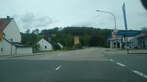

Flammstube
Restaurant · Crepe · 9.0 km
20 Frickenhofener Straße, Neumarkt in der Oberpfalz
We,Th,Fr,Su 16:30-23:59
Gaststättte Habsberg
Restaurant · Regional · 9.4 km
3 Habsberg, Velburg
Apr-Oct: Mo-Sa 10:00-20:00, Su 08:00-20:00, Tu off; Nov-Mar: Th-Sa...
Restaurant Akropolis
Restaurant · Greek
11 Neumarkter Straße, Velburg
Tu-Sa 17:00-22:00; Su 11:00-14:00,17:00-22:00; Mo off

Wir z`Haus Parsberg
Restaurant · Regional, German, Bavarian, Dessert · 8.6 km
Das Wir z’Haus im historischen Spitznerhaus in Parsberg steht für ehrliche Küche mit regionalen Zutaten, gute Getränke und gelebte...
2 Berstraße, Parsberg
Th-Sa 18:00-23:00
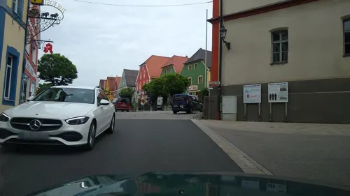


Pizzeria & Restaurante Stella
Restaurant · Italian · 7.1 km
Mo,We-Fr 11:30-14:00,17:00-23:00; Tu,Sa 17:00-23:00; Su,PH 11:30-22:00
46 more on the map.
Where to stay9
Churches and places of worship73
St. Michael
Church · Catholic · 10.6 km
11 Zur Kapelle, Neumarkt in der Oberpfalz
Mariä Aufnahme in den Himmel
Church · Roman Catholic · 9.7 km
14 Bundesstraße, Seubersdorf in der Oberpfalz
Maria Heil der Kranken
Church · Roman Catholic · 9.5 km
2 Habsberg, Velburg
Shopping18
Gas and EV charging17
Rastplatz Jura Ost
Gas station · 6.6 km
An der A3 Regensburg Ri Nürnberg,, Velburg OT Krondorf
Schools, colleges and libraries11
Healthcare9
Map of Velburg
250 places. The map loads OpenStreetMap tiles when you open it.
Getting there and nearby towns
Albrecht Dürer Airport Nuremberg (NUE) is the nearest airport with scheduled flights listed in OpenStreetMap, 52 km away.
- Neumarkt in der Oberpfalz 16 km west, about 16 min by car
- Kümmersbruck 26 km northeast, about 26 min by car
- Amberg 27 km northeast, about 27 min by car
- Burglengenfeld 27 km east, about 27 min by car
- Altdorf bei Nürnberg 28 km northwest, about 28 min by car
- Burgthann 29 km northwest, about 29 min by car
- Sulzbach-Rosenberg 30 km north, about 30 min by car
- Maxhütte-Haidhof 31 km east, about 31 min by car
- Hilpoltstein 35 km west, about 35 min by car
- Regensburg 40 km southeast, about 40 min by car
Drive times are estimates from straight-line distance, not routes.
Local news
Headlines from INDB.
Reviews, tips and questions
Loading what members have shared...
Sources and licences
- GeoNames (CC BY 4.0): population, coordinates, regions and time zone
- Mapillary (see each image): photos
- OpenStreetMap contributors (ODbL 1.0): places, airports, map data
- Wikidata (CC0 1.0): elevation, founding date, time zone, website, landmarks and historic places
- Wikimedia Commons (see each image): photos
- Wikipedia (CC BY-SA 4.0): overview and history text
Photo credits
- VelburgRathaus-01, Traveler100, CC BY-SA 3.0
- Velburg 015, DALIBRI, CC BY-SA 4.0
- Burgstraße 2 (Velburg), Kd6=dra, CC0
- Velburg 014, DALIBRI, CC BY-SA 4.0
- Velburg 017, DALIBRI, CC BY-SA 4.0
- Velburg 016, DALIBRI, CC BY-SA 4.0
- Velburg 041, DALIBRI, CC BY-SA 4.0
- Velburg 042, DALIBRI, CC BY-SA 4.0
- Velburg 040, DALIBRI, CC BY-SA 4.0
- Velburg 018, DALIBRI, CC BY-SA 4.0
- Velburg 013, DALIBRI, CC BY-SA 4.0
- Velburg 019, DALIBRI, CC BY-SA 4.0
- Velburg 049, DALIBRI, CC BY-SA 4.0
- Velburg 020, DALIBRI, CC BY-SA 4.0
- Velburg 039, DALIBRI, CC BY-SA 4.0
- Velburg 043, DALIBRI, CC BY-SA 4.0
- Velburg 050, DALIBRI, CC BY-SA 4.0
- Velburg 047, DALIBRI, CC BY-SA 4.0
- Velburg 048, DALIBRI, CC BY-SA 4.0
- Untere Gasse 7 (Velburg), Kd6=dra, CC0
- Velburg 009, DALIBRI, CC BY-SA 4.0
- Velburg 038, DALIBRI, CC BY-SA 4.0
- Velburg 037, DALIBRI, CC BY-SA 4.0
- Velburg 021, DALIBRI, CC BY-SA 4.0
- Velburg 022, DALIBRI, CC BY-SA 4.0
- Velburg 036, DALIBRI, CC BY-SA 4.0
- Velburg 035, DALIBRI, CC BY-SA 4.0
- Velburg 011, DALIBRI, CC BY-SA 4.0
- Hinterer Markt 2 (Velburg), Kd6=dra, CC0
- Velburg 053, DALIBRI, CC BY-SA 4.0
- Velburg 051, DALIBRI, CC BY-SA 4.0
- Velburg 052, DALIBRI, CC BY-SA 4.0
- Velburg 012, DALIBRI, CC BY-SA 4.0
- Velburg 034, DALIBRI, CC BY-SA 4.0
- Velburg 046, DALIBRI, CC BY-SA 4.0
- Velburg 044, DALIBRI, CC BY-SA 4.0
- Velburg 045, DALIBRI, CC BY-SA 4.0
- Velburg 010, DALIBRI, CC BY-SA 4.0
- Velburg 033, DALIBRI, CC BY-SA 4.0
- Velburg 023, DALIBRI, CC BY-SA 4.0
- König-Otto-Tropfsteinhöhle, 2, Rainer Lippert, CC BY-SA 4.0
- Deusmauer Moor bei Dietkirchen -003, DALIBRI, CC BY-SA 4.0
- Hohe Schule Ingolstadt, Brian Clontarf, Public domain
- Aerial image of the Burg Parsberg (view from the west), Carsten Steger, CC BY-SA 4.0
- Lupburg 01, MacElch (Rainer Kunze), CC BY-SA 3.0
- Burgruine Adelburg 01, Sven-121, Public domain
- Burgruine Helfenberg1 14062009, pegasus2, Public domain
- Burgstall Frickenhofen02, Sven-121, CC0
- Burgstall-Lützelburg1, Sven-121 at de.wikipedia, Public domain
- Burgstall-Plankenstein,Kernburg2, Sven-121, Public domain
- Am Habsberg NM 008, DALIBRI, CC BY-SA 4.0
- Johann-Nepomuk-Kapelle (Lupburg) 270, Kd6=dra, CC0
- St. Michael (Rackendorf) 02, Kd6=dra, CC0
- St Michael - Lippertshofen 001, DALIBRI, CC BY-SA 3.0
- St Vitus - Großalfalterbach NM 098, DALIBRI, CC BY-SA 3.0
- Kapelle Hl. Familie (Körndlhof) 260, Kd6=dra, CC0
- St. Pankratius Siegenhofen NM 0040, DALIBRI, CC BY-SA 3.0
- St Leonhard - Velburg 001, DALIBRI, CC BY-SA 3.0
- St. Johann Baptist (Albertshofen), Orzowei, CC BY-SA 3.0
- Habsberg Oberpfalz 0001 04, DALIBRI, CC BY-SA 3.0
- Ringwall Buchenberg01, Sven-121, CC0
- Mariä Aufnahme - Daßwang 001, DALIBRI, CC BY-SA 3.0
- St Michael - Parsberg 003, DALIBRI, CC BY-SA 4.0
- Burgruine Velburg02, Sven-121, CC0
- Kriegerdenkmal (Velburg), Kd6=dra, CC0
- Weiße Laaber bei Waltersberg 3, HerkanD, CC BY-SA 4.0
- Tal der Weißen Laaber bei Deining 2, HerkanD, CC BY-SA 4.0
- Höhle am Buchenberg (H 44) 03, Sven-121, CC0
- Street-level photo, wegavision, CC BY-SA 4.0
- Street-level photo, wegavision, CC BY-SA 4.0
- Street-level photo, editid, CC BY-SA 4.0
- Street-level photo, mike409, CC BY-SA 4.0
- Street-level photo, mike409, CC BY-SA 4.0
- Street-level photo, mike409, CC BY-SA 4.0


Page built November 9, 2026. Spotted a mistake? Tell us or suggest a place.