


Why visit Kelheim
Townapedia lists 60 museums and landmarks, 16 parks and trails, 74 places to eat, 12 places to stay and 49 attractions in and around town.
Highlights include Kinocenter Kelheim, Schulerloch, Ludwig-Donau-Main-Kanal and Ludwig-Donau-Main-Kanal.
Weather in Kelheim
Forecast from MET Norway (CC BY 4.0). Full forecast
About Kelheim
Kelheim (German: [ˈkeːlhaɪ̯m] ) is a town and municipality in Bavaria, Germany. It is the capital of the district Kelheim and is situated at the confluence of the rivers Altmühl and Danube. Kelheim has a population of around 16,750 (2020).
From the Wikipedia article Kelheim (this version), under CC BY-SA 4.0.
Travel tips from other travellers: Kelheim on Wikivoyage (CC BY-SA 4.0).
Things to do49




37 more on the map.
Museums and landmarks60


Ludwig-Donau-Main-Kanal
Monument and historic site · 5.3 km
Schleuse mit Wärterhaus, aufgesetzter Nachbau

Hall of Liberation
Monument and historic site · 1.9 km
11 Befreiungshallestraße, Kelheim
Apr-Oct: Mo-Su 09:00-18:00; Nov-Mar: Mo-Su 09:00-16:00; Jan 01...


Schleusenwärterhaus 1 und Kanalmeisterhaus
Monument and historic site · 1.3 km
Schleusenwärter- und Kanalmeisterhaus, Ludwig-Donau-Main-Kanal
5 Hienheimer Straße, Kelheim


Bezirkskriegerdenkmal
Monument and historic site · 1.8 km
Namentliches Denkmal für 80 Gefallene aus den Kriegen von 1866 und 1870/71 aus dem Landkreis Kelheim.


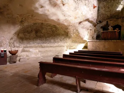
Kloster Trauntal bei Kelheim
Monument and historic site · Roman Catholic · 2.7 km

48 more on the map.
Parks, trails and playgrounds16

Keldorado
Sports field and stadium
60 Rennweg, Kelheim
May-Sep 09:00-21:00; Oct-Apr Mo-Fr 09:00-20:30, Sa-Su 09:00-20:00;...




4 more on the map.
Restaurants and cafes74
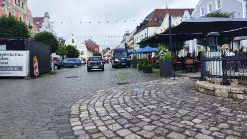
VOX
Restaurant · Burger, Regional, German, Pasta · 1.0 km
4 Ludwigsplatz, Kelheim
09:00-23:00; Tu off; Fr,Sa 09:00-01:00
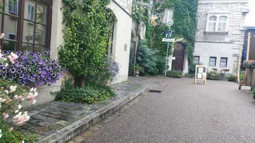

Duc Viet
Restaurant · Asian, Vietnamese, Bubble Tea, Sushi
Restaurant nach Schließung des Einkaufszentrums über die Außentreppe zu erreichen
1 Schäfflerstraße, Kelheim
Mo-Th 11:00-15:00,17:00-21:00; Fr,Sa 11:00-21:00; PH,Su...
Vivido Ristorante Pizzeria
Restaurant · Pizza, Pasta · 0.7 km
Alte Beschilderung für Pizzeria Riviera teilweise noch vorhanden
1 Am Pflegerspitz, Kelheim
Tu,Th 11:30-14:00,17:30-21:30; We 17:30-21:30; Fr 17:30-22:30; Sa...
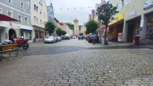
Café BUK.
Cafe · Cake, Ice Cream, Coffee Shop · 1.0 km
5 Donaustraße, Kelheim
Mo off; Tu-Sa 08:30-17:00; Su 09:00-17:00
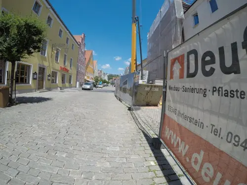
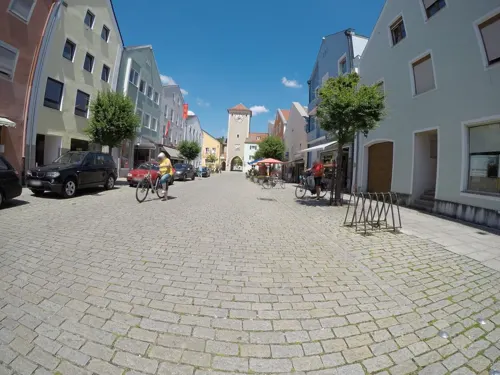
Eis Primavera
Ice cream · 1.0 km
22 Altmühlstraße, Kelheim
Mo-Th 11:00-21:00; PH,Fr-Su 11:00-22:00


Gasthaus Meinzer
Restaurant · Local · 5.4 km
15 Rohrer Straße, Reißing
Mo 10:00-14:00; We-Sa 10:00-14:00,17:00-00:00; Su 10:00-21:00
Gasthaus in der Heide
Restaurant · Regional · 3.2 km
30 Lindenstraße, Saal a.d.Donau
Tu 11:00-14:00; We,Th 11:00-14:00,16:00-21:00; Fr,Sa 16:00-22:00;...
Gasthaus zum Schützen
Restaurant · 0.9 km
Inhaber: Edin Radoncic [email protected]
1 Zeisigstraße, Kelheim
Mo, We-Su 11:30-14:00, 16:30-21:00
62 more on the map.
History
Kelheim is the site of a large Iron Age oppidum from the La Tène period, which has been tentatively identified with the Celtic city of Alcimoennis mentioned by Ptolemy in his Geography. The ramparts of the fort cross the promontory between the rivers Altmühl and Danube. There is an inner defensive line enclosing 60 ha near the confluence, then a long outer rampart enclosing an enormous area of 630 ha. A small promontory fort on the other bank of the Danube has a series of short linear ramparts protecting a settlement in the bend of a meander. This is aligned with the end of the outer rampart on the far bank, dominating traffic on the river. Kelheim has given its name to the pfostenschlitzmauer style of rampart construction characterized by vertical wooden posts set into the stone facing.
Kelheim was first mentioned in the 9th century. At this time it was the seat of a count (Graf). According to tradition of Braunau in Rohr Abbey, Kelheim received borough rights in 1151.
G. Schneider & Sohn has a large weissbier brewery in the city.
From the History section of Kelheim on Wikipedia, under CC BY-SA 4.0.
Where to stay12
Anita's Altstadt Pension Kehlheim
Motel and hotel · 0.9 km
2 Benifiziatengasse, Kelheim
Churches and places of worship43
Mariä Himmelfahrt
Church · Roman Catholic · 0.9 km
1 Kirchplatz, Kelheim
Maria Immaculata
Church · Roman Catholic · 7.3 km
5 Marienplatz, Kelheim
Ottokapelle
Church · Roman Catholic · 1.1 km
8 Wittelsbachergasse, Kelheim
Shopping20
Gas and EV charging12
Schools, colleges and libraries14
Healthcare7
Map of Kelheim
250 places. The map loads OpenStreetMap tiles when you open it.
Getting there and nearby towns
Ingolstadt Manching Airport (IGS) is the nearest airport with scheduled flights listed in OpenStreetMap, 34 km away.
- Neustadt an der Donau 15 km southwest, about 15 min by car
- Regensburg 19 km northeast, about 19 min by car
- Lappersdorf 21 km northeast, about 21 min by car
- Neutraubling 24 km east, about 24 min by car
- Regenstauf 29 km northeast, about 29 min by car
- Mainburg 32 km south, about 32 min by car
- Maxhütte-Haidhof 35 km northeast, about 35 min by car
- Manching 36 km southwest, about 36 min by car
- Ingolstadt 38 km southwest, about 38 min by car
- Wolnzach 40 km southwest, about 40 min by car
Drive times are estimates from straight-line distance, not routes.
Local news
Headlines from INDB.
Reviews, tips and questions
Loading what members have shared...
Sources and licences
- GeoNames (CC BY 4.0): population, coordinates, regions and time zone
- Mapillary (see each image): photos
- OpenStreetMap contributors (ODbL 1.0): places, airports, map data
- Wikidata (CC0 1.0): elevation, founding date, time zone, website, landmarks and historic places
- Wikimedia Commons (see each image): photos
- Wikipedia (CC BY-SA 4.0): overview and history text
Photo credits
- Befreiungshalle-kelheim-aussen2, Michael.chlistalla, CC BY-SA 3.0
- St. Pius Kelheim 01, H.Helmlechner, CC BY-SA 4.0
- Kelheim - panoramio, Richard Mayer, CC BY 3.0
- St. Sebastian Kelheim 01, Helmlechner, CC0
- St. Sebastian Kelheim 02, Helmlechner, CC0
- 93309 Kelheim, Germany - panoramio, Richard Mayer, CC BY 3.0
- St. Pius Kelheim 02, H.Helmlechner, CC BY-SA 4.0
- St. Pius Kelheim 03, H.Helmlechner, CC BY-SA 4.0
- St. Lukas Kelheim 02, Helmlechner, CC0
- Befreiungshallestraße 3, Kelheim 02, H.Helmlechner, CC BY-SA 4.0
- Befreiungshalle Kelheim 2022 02, H.Helmlechner, CC BY-SA 4.0
- Befreiungshalle Kelheim 2022 03, H.Helmlechner, CC BY-SA 4.0
- Befreiungshalle Kelheim 2022 01, H.Helmlechner, CC BY-SA 4.0
- Kelheim, Orgelmuseum (25), Subbass1, CC BY-SA 4.0
- Kelheim, Orgelmuseum (19), Subbass1, CC BY-SA 4.0
- Mariä Himmelfahrt Kelheim, H.Helmlechner, CC BY-SA 4.0
- DSC02132 - Kelheim (30915798812), Heribert Bechen ... max. 22.500 visits / day ... from Bergisch Gladbach, Germany, CC BY 2.0
- Schulerloch 01, Derzno, CC BY-SA 3.0
- Befreiungshalle Hall of Liberation Kelheim, Richard Bartz, CC BY-SA 2.5
- Herzogkasten Kelheim, Stefan Karl, CC BY-SA 4.0
- Donau Gymnasium Kelheim Niederbayern, Dede2, CC0
- Kelheim Michelsberg Befreiungshalle6, Dede2, Public domain
- Weltenburg - Klosterkirche von aussen 006, DALIBRI, CC BY-SA 4.0
- Stadtpfarrkirche von Kelheim-1, luckyprof, CC BY-SA 3.0
- 120602 Essing Heiligen Geist CS (101), Mattana, CC BY-SA 3.0
- 2016 LDMK Schleuse 04 01, Derzno, CC BY-SA 3.0
- Kelheim 2014 Mattes (22), User:Mattes, CC BY 2.0 de
- 2018 LDMK Hafen Kelheim 07, Derzno, CC BY-SA 4.0
- 2021 LDMK Schleuse 01 01, Derzno, CC BY-SA 4.0
- Ottokapelle StadtKelheim Niederbayern, Dede2, CC0
- Hl. Kreuz Kelheim 03, H.Helmlechner, CC BY-SA 4.0
- 13.08.01 Kapfelberg Maria Immaculata, Gehsport-sepp ( Diskussion ), CC BY-SA 4.0
- 2019 LDMK Abschnitt D-2-73-121-24 01, Derzno, CC BY-SA 4.0
- Schleuse 01 06, Derzno, CC BY 3.0
- Kelheim Kriegerdenkmal-Deutsch-Französischer-Krieg 20240724 143713, Rigorius, CC BY-SA 4.0
- Saal (Donau), Lutherkirche (20), Subbass1, CC BY-SA 4.0
- Schulerloch NSG 02, Derzno, CC BY-SA 3.0
- Donautor Kelheim Niederbayern, Dede2, CC0
- Weltenburg, Klosterkirche St Georg und Martin (102), Mattana, CC BY-SA 3.0
- Ludwigskanal-Karte, jailbird, CC BY-SA 2.0 de
- KELDORADO Abendstimmung in der Schwimmhalle, Keldorado, CC BY-SA 4.0
- Kelheim, Orgelmuseum (14), Subbass1, CC BY-SA 4.0
- Street-level photo, changchun1, CC BY-SA 4.0
- Street-level photo, changchun1, CC BY-SA 4.0
- Street-level photo, AR88, CC BY-SA 4.0
- Street-level photo, wegatest, CC BY-SA 4.0
- Street-level photo, changchun1, CC BY-SA 4.0
- Street-level photo, cghmapper, CC BY-SA 4.0
- Street-level photo, changchun1, CC BY-SA 4.0
- Street-level photo, changchun1, CC BY-SA 4.0
- Street-level photo, cghmapper, CC BY-SA 4.0
- Street-level photo, geoeki, CC BY-SA 4.0
- Street-level photo, zugnomade, CC BY-SA 4.0
- Street-level photo, rnissl, CC BY-SA 4.0
- Street-level photo, changchun1, CC BY-SA 4.0
- Street-level photo, changchun1, CC BY-SA 4.0
- Street-level photo, changchun1, CC BY-SA 4.0
- Street-level photo, cghmapper, CC BY-SA 4.0
- Street-level photo, cghmapper, CC BY-SA 4.0
- Street-level photo, svencb, CC BY-SA 4.0
- Street-level photo, geoeki, CC BY-SA 4.0
- Street-level photo, geoeki, CC BY-SA 4.0
- Street-level photo, changchun1, CC BY-SA 4.0
- Street-level photo, changchun1, CC BY-SA 4.0


Page built November 8, 2026. Spotted a mistake? Tell us or suggest a place.