


Donauwörth, Germany
Donauwörth is a town of 18,364 people in Bavaria, Germany, founded in 1100.
Why visit Donauwörth
Townapedia lists 25 museums and landmarks, 21 parks and trails, 100 places to eat, 22 places to stay and 9 attractions in and around town.
Highlights include Der Posthof - Familie Keßler, Hofladen Landes, Hinter Gittern and Färbertor.
Weather in Donauwörth
Forecast from MET Norway (CC BY 4.0). Full forecast
About Donauwörth
Donauwörth (German: [ˌdoːnaʊˈvøːɐ̯t] ; Swabian: Donawerd) is a town and the capital of the Donau-Ries district in Swabia, Bavaria, Germany. It is said to have been founded by two fishermen where the rivers Danube (Donau) and Wörnitz meet. The city is part of the scenic route called "Romantische Straße" (Romantic Road).
From the Wikipedia article Donauwörth (this version), under CC BY-SA 4.0.
Travel tips from other travellers: Donauwörth on Wikivoyage (CC BY-SA 4.0).
Things to do9




Museums and landmarks25

Hinter Gittern
Museum · 5.7 km
Im Kaisersaalflügel
4 Abteistraße, Kaisheim
closed "bis auf weiteres geschlossen"


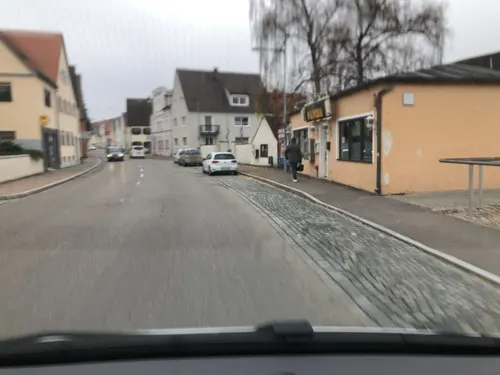



Ehemaliger Bahnhof Donauwörth/Progymnasium
Monument and historic site
Ehemaliger Bahnhof Donauwörth (1847-1877). Ab 1894 Progymnasium, in 1945 Zerstört.
Fallen monument
Monument and historic site
Bürgermeister-Gebhardt-Platz, Donauwörth

13 more on the map.
Parks, trails and playgrounds21

Golfclub Donauwörth Gut Lederstatt
Golf course · 2.9 km
18 hole Par 72 + 3 hole Par 10
1 Lederstatt, Donauwörth





9 more on the map.
Restaurants and cafes100
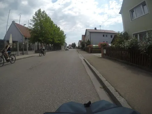
Alte Brauerei Mertingen
Restaurant · Regional · 7.3 km
21 Hilaria-Lechner-Straße, Mertingen
Mo,Tu 17:00-22:00; We-Sa 12:00-22:00; Su 10:00-15:00; PH 10:00-21:00

Thaddäus
Restaurant · Regional, German · 5.5 km
23 Abteistraße, Kaisheim
Fr,Sa 18:00-24:00; Su 11:30-15:00
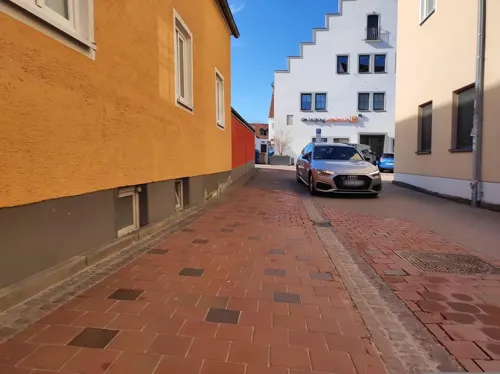
Cilento
Restaurant · Italian
32 Hindenburgstraße, Donauwörth
Mo,Tu,Th,Sa 11:00-14:00,17:30-23:00; Fr 17:30-23:00; Su...
Gasthof Zum Hofwirt
Restaurant · Greek, German · 5.7 km
44 Hauptstraße, Kaisheim
Tu-Sa 11:30-14:00,17:00-22:00; Su,PH 11:00-14:00,17:00-21:30
Metzgerwirt im Vereinsheim
Restaurant · German · 6.7 km
7 Auenweg, Oberndorf a. Lech
Tu-Su 17:30-21:30
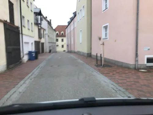
PhoShi Fusion Kitchen
Restaurant · Asian, Sushi
29 Hindenburgstraße, Donauwörth
Mo off; Tu-Th 11:30-14:30,17:00-21:30; Fr 11:30-14:30,17:00-22:30;...
Pizzeria Santa Chiara
Restaurant · Pizza, Burger, Italian, Kebab · 7.3 km
14 Bahnhofstraße, Mertingen
Tu-Su,PH 16:30-22:15; Mo off



88 more on the map.
History
Donauwörth grew up in the course of the 11th and 12th centuries under the protection of the castle of Mangoldstein, became in the 13th century a seat of Duke Ludwig II of Bavaria, who, however, soon withdrew to Munich to escape from his wife, Duchess Maria of Brabant, whom he had there beheaded on an unfounded suspicion of infidelity. The town received the freedom of the Holy Roman Empire in 1308, and maintained its position in spite of the encroachments of Bavaria till 1607, when the interference of the Protestant inhabitants with the abbot of the Heilig-Kreuz called forth an imperial law authorizing the duke of Bavaria to punish them for the offence.
It is historically important to Germany as the site of one of the incidents which led to the Thirty Years' War (1618–1648). In 1606, the Lutheran majority barred the Catholic Church residents of the town from holding an annual Markus procession, causing a riot to break out. During the war, it was stormed by Gustavus Adolphus (1632) and captured by Ferdinand III (1634).
From the History section of Donauwörth on Wikipedia, under CC BY-SA 4.0.
Where to stay22
Churches and places of worship38
Kalvarienberg-Kapelle St. Petrus
Church · Catholic · 4.3 km
13 Abt-Cölestin-Straße, Donauwörth
St. Antonius von Padua
Church · Roman Catholic · 4.7 km
12 Im Weiler, Asbach-Bäumenheim
Pfarrkirche Mariä Himmelfahrt
Church · Roman Catholic · 5.7 km
6 Abteistraße, Kaisheim
Maria Immaculata
Church · Roman Catholic · 2.2 km
5 Kirchberg, Donauwörth
Shopping26
Gas and EV charging15
Seel Mineralöl-Handel GmbH & Co. KG
Gas station · 4.2 km
29 Donauwörther Straße, Asbach-Bäumenheim
Schools, colleges and libraries19
Hans-Leipelt-Schule Staatliche Fachoberschule und Berufsoberschule
School · 1.7 km
9 Neudegger Allee, Donauwörth
Healthcare10
Onkologiezentrum Donauwörth
Clinic and pharmacy · 2.1 km
10 Neudegger Allee, Donauwörth
Map of Donauwörth
250 places. The map loads OpenStreetMap tiles when you open it.
Getting there and nearby towns
Flughafen Augsburg (AGB) is the nearest airport with scheduled flights listed in OpenStreetMap, 35 km away.
- Meitingen 20 km south, about 20 min by car
- Nördlingen 26 km northwest, about 26 min by car
- Treuchtlingen 28 km north, about 28 min by car
- Neuburg an der Donau 30 km east, about 30 min by car
- Lauingen 31 km southwest, about 31 min by car
- Gersthofen 33 km south, about 33 min by car
- Bopfingen 35 km northwest, about 35 min by car
- Eichstätt 36 km northeast, about 36 min by car
- Neusäß 36 km south, about 36 min by car
- Augsburg 40 km south, about 40 min by car
Drive times are estimates from straight-line distance, not routes.
Local news
Headlines from INDB.
Reviews, tips and questions
Loading what members have shared...
Sources and licences
- GeoNames (CC BY 4.0): population, coordinates, regions and time zone
- Mapillary (see each image): photos
- OpenStreetMap contributors (ODbL 1.0): places, airports, map data
- Wikidata (CC0 1.0): elevation, founding date, time zone, website, landmarks and historic places
- Wikimedia Commons (see each image): photos
- Wikipedia (CC BY-SA 4.0): overview and history text
Photo credits
- Donauwörth - Kalvarienberg - Donauwörth v NO 01, Flodur63, CC BY-SA 4.0
- D-7-79-131-42 Färbertor Donauwörth 5 Südansicht, Ivo.schwalbe, CC BY-SA 3.0
- Donauwörth - Kronengasse 1 - 01, Jkü, CC BY-SA 4.0
- D-7-79-131-42 Färbertor Donauwörth 3 Seitenansicht, Ivo.schwalbe, CC BY-SA 3.0
- D-7-79-131-42 Färbertor Donauwörth 2 Giebel, Ivo.schwalbe, CC BY-SA 3.0
- D-7-79-131-42 Färbertor Donauwörth 4 Durchgang, Ivo.schwalbe, CC BY-SA 3.0
- D-7-79-131-42 Färbertor Donauwörth 1 Gesamtansicht frontal, Ivo.schwalbe, CC BY-SA 3.0
- Museumsplatz 2, Donauwörth, H.Helmlechner, CC BY-SA 4.0
- Reichsstr 15 Donauwörth, Ricardalovesmonuments, CC BY-SA 4.0
- Färbertor Donauwörth 02, H.Helmlechner, CC BY-SA 4.0
- Heimatmuseum Ried (Donauwörth), Ricardalovesmonuments, CC BY-SA 4.0
- Donauwörth - Kronengasse 1 - 02, Jkü, CC BY-SA 4.0
- Tanzhaus Donauwörth, Ricardalovesmonuments, CC BY-SA 4.0
- D-7-79-131-25 Hindenburgstraße 11 Donauwörth (1 von 2), Ivo.schwalbe, CC BY-SA 3.0
- D-7-79-131-25 Hindenburgstraße 11 Donauwörth (2 von 2), Ivo.schwalbe, CC BY-SA 3.0
- Reichsstr 20 Donauwörth, Ricardalovesmonuments, CC BY-SA 4.0
- D-7-79-131-27 Heimatmuseum Hindenburgstraße 15 Donauwörth (3 von 4), Ivo.schwalbe, CC BY-SA 3.0
- D-7-79-131-27 Heimatmuseum Hindenburgstraße 15 Donauwörth (1 von 4), Ivo.schwalbe, CC BY-SA 3.0
- D-7-79-131-27 Heimatmuseum Hindenburgstraße 15 Donauwörth (2 von 4), Ivo.schwalbe, CC BY-SA 3.0
- D-7-79-131-27 Heimatmuseum Hindenburgstraße 15 Donauwörth (4 von 4), Ivo.schwalbe, CC BY-SA 3.0
- Donauwörth Heilig-Kreuz-Kirche Gnadenkapelle 02, H.Helmlechner, CC BY-SA 4.0
- Donauwörth Heilig-Kreuz-Kirche Gnadenkapelle 01, H.Helmlechner, CC BY-SA 4.0
- Spitalgasse 9 Donauwörth, Jkü, CC BY 4.0
- Färbertor Donauwörth 01, H.Helmlechner, CC BY-SA 4.0
- Donauwörth - Kugelplatz 7 - 01, Jkü, CC BY-SA 4.0
- D-7-79-131-84 Donauwörth Rieder-Tor von-Sueden, Rikiwiki2, CC BY-SA 4.0
- D-7-79-131-84 Donauwörth Rieder-Tor von-Suedost, Rikiwiki2, CC BY-SA 4.0
- Harburg in Schwaben, Burg 20170826 001, Tilman2007, CC BY-SA 4.0
- Gymnasium Donauwörth 01, Jkü, CC BY 4.0
- Donauwoerth Liebfrauenmuenster Chorraum-1, Rufus46, CC BY-SA 3.0
- Wörnitzstein Kalvarienbergkapelle 80073, Reinhardhauke, CC BY-SA 3.0
- Kaisheim Kirche 1, No machine-readable author provided. Dark Avenger~commonswiki assumed (based on copyright claims)., CC BY-SA 3.0
- Riedertor, Patrick Huebgen, Public domain
- GER Donauwörth, Färbertörl 001, -wuppertaler, CC BY 4.0
- Donauwörth, Museumsplatz 2, 001, Tilman2007, CC BY-SA 3.0
- St. Georg, Auchsesheim 03, Jkü, CC BY-SA 3.0
- Maria Immaculata Donauwörth-Nordheim 01, Jkü, CC BY-SA 3.0
- Maria Immaculata (Zirgesheim) 01, Jkü, CC BY 4.0
- Kapelle St. Sebastian (Zusum) 01, Kd6=dra, CC0
- Maria Immaculata (Asbach) 02, Jkü, CC BY 4.0
- St.-Albanus-Kapelle 01, Jkü, CC BY 4.0
- St. Georg (Hafenreut) 02, Jkü, CC BY 4.0
- Christuskirche (Donauwörth) 4, Ricardalovesmonuments, CC BY-SA 4.0
- NSG Mertinger Höll - von Süden 1, Rikiwiki2, CC BY-SA 4.0
- NSG "Priel" Harburg-Bruennsee Gesamtübersicht von Süden, Rikiwiki2, CC BY-SA 4.0
- Antoniuskapelle bäumenheim, Midon~dewiki, CC BY-SA 4.0
- Schloss-Donaumuenster-Herbst-2019, David Sohl, CC BY-SA 4.0
- D-7-79-131-84 Donauwörth Rieder-Tor Stadtwappen, Rikiwiki2, CC BY-SA 4.0
- Stadtbefestigung im Bereich Spindeltal und Mangoldfelsen (Donauwörth) 005, Rikiwiki2, CC BY-SA 4.0
- Street-level photo, mfa, CC BY-SA 4.0
- Street-level photo, institutverkehr, CC BY-SA 4.0
- Street-level photo, mfa, CC BY-SA 4.0
- Street-level photo, institutverkehr, CC BY-SA 4.0
- Street-level photo, msdess, CC BY-SA 4.0
- Street-level photo, mfa, CC BY-SA 4.0
- Street-level photo, msdess, CC BY-SA 4.0
- Street-level photo, soulcover, CC BY-SA 4.0
- Street-level photo, tasmaniadevil, CC BY-SA 4.0
- Street-level photo, derzornigemarkus, CC BY-SA 4.0
- Street-level photo, skyrising, CC BY-SA 4.0
- Street-level photo, msdess, CC BY-SA 4.0
- Street-level photo, institutverkehr, CC BY-SA 4.0
- Street-level photo, institutverkehr, CC BY-SA 4.0
- Street-level photo, mfa, CC BY-SA 4.0
- Street-level photo, skyrising, CC BY-SA 4.0
- Street-level photo, msdess, CC BY-SA 4.0
- Street-level photo, skyrising, CC BY-SA 4.0
- Street-level photo, wegatest, CC BY-SA 4.0


Page built November 8, 2026. Spotted a mistake? Tell us or suggest a place.