


Neuburg an der Donau, Germany
Neuburg an der Donau is a town of 28,370 people in Bavaria, Germany.
Why visit Neuburg an der Donau
Townapedia lists 40 museums and landmarks, 16 parks and trails, 112 places to eat, 12 places to stay and 6 attractions in and around town.
Highlights include Gemüse & mehr, Boarisch Bauer, Schloss Sinning and Aueninformationszentrum Neuburg.
Weather in Neuburg an der Donau
Forecast from MET Norway (CC BY 4.0). Full forecast
About Neuburg an der Donau
Neuburg an der Donau (German pronunciation: [ˈnɔʏbʊʁk ʔan deːɐ̯ ˈdoːnaʊ] , lit. 'Neuburg on the Danube'; Central Bavarian: Neiburg an da Donau) is a town which is the capital of the Neuburg-Schrobenhausen district in the state of Bavaria in Germany that is over 1,200 years old.
From the Wikipedia article Neuburg an der Donau (this version), under CC BY-SA 4.0.
Things to do6

Boarisch Bauer
Farm and orchard · 1.0 km
Ganzjährig Kartoffeln aller Kochtypen - Kartoffelsorten Princess, Quarta und Agria


Neuburger Volktheater e. V. Box 15
Cinema and theater · 1.0 km
78 1/2 Donauwörther Straße, Neuburg a. d. Donau
Museums and landmarks40


Aueninformationszentrum Neuburg
Museum · 5.6 km
Apr-Oct: We-Fr 09:00-12:00,13:00-18:00; Sa,Su,PH 10:00-18:00


Oberes Tor
Monument and historic site · 1.0 km
A 32 Oberes Tor, Neuburg a. d. Donau

Schloss Neuburg
Monument and historic site · 0.7 km
2 Residenzstraße, Neuburg an der Donau


Biohistoricum
Museum · 1.0 km
Museum und Forschungsarchiv für die Geschichte der Biologie.
Tu-Fr 14:00-17:00; Su 10:00-17:00


28 more on the map.
Parks, trails and playgrounds16

Brandl Freibad
Sports field and stadium · 1.7 km
B 30 1/2 Unterer Brandl, Neuburg an der Donau
Mo-Su 10:00-19:00





4 more on the map.
Restaurants and cafes112

Zur blauen Traube
Restaurant · Regional · 0.9 km
A 49 Amalienstraße, Neuburg an der Donau
Tu-Fr 16:00-22:00; Sa,Su 11:00-22:00

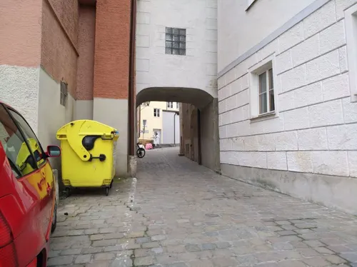
View
Restaurant · Barbecue · 0.8 km
"Dry Aging Next Level"
C 15 Elisenplatz, Neuburg an der Donau
We-Mo 12:00-14:30,17:45+; Tu off
Ganesha
Restaurant · Indian · 0.6 km
C 122 Weinstraße, Neuburg an der Donau
Mo-Sa 11:30-14:30,17:00-23:00; Tu off; Su 11:30-14:30,17:00-22:00
Gasthof Neuwirt
Restaurant · Regional
C 88 Färberstraße
Mo,We-Sa 17:00-23:00; Tu off; Su,PH 11:00-15:00
Goldener Schwan
Restaurant · Italian · 0.9 km
1 Ingolstädter Straße, Neuburg a. d. Donau
Tu-Su 11:00-14:00, 18:00-22:00; Mo off

Ihle
Cafe · Cake, Coffee Shop, German · 1.3 km
70 Donauwörther Straße, Neuburg an der Donau
Mo-Sa 06:00-20:00; Su 07:30-12:00
Jagdschlössl
Restaurant · Regional · 2.4 km
43 Gietlhausener Straße, Neuburg an der Donau
Fr,Sa 17:00-22:00; Su 09:00-14:00,17:00-22:00
Lorenz Tagesbar
Cafe · Bistro · 0.7 km
5a Franz-Boecker-Straße, Neuburg a. d. Donau
Mo-Sa 08:00-14:00; Su off
SAPA Restaurant
Restaurant · Vietnamese · 5.5 km
22 Hauptstraße, Rohrenfels
Mo-Su 11:30-14:30,17:30-22:00; Sa 17:30-22:00; Tu off
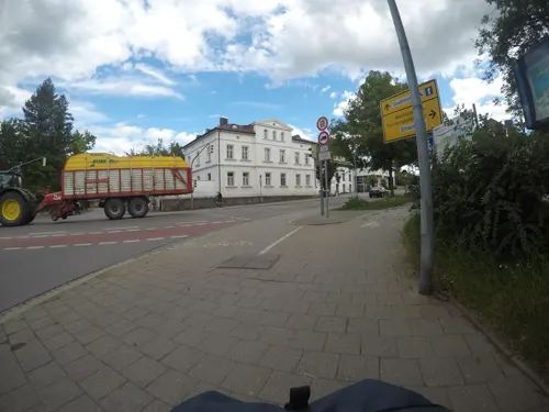


Sao Mai
Restaurant · Vietnamese · 1.0 km
1b Monheimer Straße, Neuburg a. d. Donau
Mo-Su 11:30-14:30,17:30-22:00; Tu off
100 more on the map.
History
Neuburg has been inhabited since the Bronze Age with artifacts discovered on the hill where the modern palace is located.
A Roman settlement was also located on the high hill overlooking the Danube, providing a part of the Limes, the border between the Empire and its Germanic enemies.
The massive Neuburg Castle was built during the early Middle Ages by the Aiglolfings, at the site of the old Roman fortress. In 1527 the Wittelsbach Family re-designed the castle into a Renaissance palace, which is what we see today.
Neuburg was part of an episcopal see. In the 10th century it passed to the counts of Scheyern and through them to Bavaria, being ceded to the Rhenish Palatinate at the close of a war in 1507. From 1557 to 1742 it was the capital of a small principality ruled by a cadet branch of the family of the elector palatine of the Rhine. This principality of Palatinate-Neuburg had an area of about 2,600 square kilometres (1,000 sq mi) and about 100,000 inhabitants.
During the Thirty Years' War, the city was conquered and occupied several times between 1632 and 1634 during the battles for Regensburg by Swedish troops passing through here, while crossing the Danube.
In 1742 it was united again with the Rhenish Palatinate, with which it passed in 1777 to Bavaria.
From the History section of Neuburg an der Donau on Wikipedia, under CC BY-SA 4.0.
Where to stay12
Hotel Garni Die Spindel
Motel and hotel · 1.0 km
2a Mühlenweg, Neuburg an der Donau
Churches and places of worship51
Mariä Heimsuchung
Church · Roman Catholic · 5.5 km
4 Kirchgasse, Rohrenfels
Mariä Himmelfahrt
Church · Roman Catholic · 2.4 km
113 Monheimer Straße, Neuburg an der Donau
Shopping30
Gas and EV charging11
Pinoil Service Station
Gas station · 1.5 km
B 62 Donauwörther Straße, Neuburg a. d. Donau
Schools, colleges and libraries23
Sonderpädagogisches Förderzentrum Neuburg an der Donau
School · 1.7 km
60 Monheimer Straße, Neuburg an der Donau
Healthcare13
Apotheke der Barmherzigen Brüder
Clinic and pharmacy · 0.8 km
107 Bahnhofstraße, Neuburg an der Donau
Kliniken St. Elisabeth
Hospital · 0.9 km
4 Müller-Gnadenegg-Weg, Neuburg a. d. Donau
St. Josef-Apotheke
Clinic and pharmacy · 1.0 km
41 Franz-Hoffmann-Straße, Neuburg an der Donau
Apotheke am Schrannenplatz
Clinic and pharmacy
C208 Schrannenplatz, Neuburg an der Donau
Geriatrisches Rehazentrum Neuburg
Hospital · 0.8 km
B 107 Bahnhofstraße, Neuburg an der Donau
Map of Neuburg an der Donau
250 places. The map loads OpenStreetMap tiles when you open it.
Getting there and nearby towns
Ingolstadt Manching Airport (IGS) is the nearest airport with scheduled flights listed in OpenStreetMap, 25 km away.
- Ingolstadt 18 km east, about 18 min by car
- Schrobenhausen 20 km south, about 20 min by car
- Pfaffenhofen an der Ilm 32 km southeast, about 32 min by car
- Treuchtlingen 32 km northwest, about 32 min by car
- Wolnzach 35 km southeast, about 35 min by car
- Weißenburg in Bayern 37 km northwest, about 37 min by car
- Neustadt an der Donau 43 km east, about 43 min by car
- Augsburg 45 km southwest, about 45 min by car
- Neusäß 46 km southwest, about 46 min by car
- Stadtbergen 48 km southwest, about 48 min by car
Drive times are estimates from straight-line distance, not routes.
Local news
Headlines from INDB.
Reviews, tips and questions
Loading what members have shared...
Sources and licences
- GeoNames (CC BY 4.0): population, coordinates, regions and time zone
- Mapillary (see each image): photos
- OpenStreetMap contributors (ODbL 1.0): places, airports, map data
- Wikidata (CC0 1.0): elevation, founding date, time zone, website, landmarks and historic places
- Wikimedia Commons (see each image): photos
- Wikipedia (CC BY-SA 4.0): overview and history text
Photo credits
- Schloss Neuburg a.d. Donau 01, H.Helmlechner, CC BY-SA 4.0
- Neuburg an der Donau, Pfadfinderturm, 1, Renardo la vulpo, CC BY-SA 4.0
- GER — BY — Oberbayern — Landkreis Neuburg-Schrobenhausen — Neuburg an der Donau („Stadt, Land, Vollpfosten“ · Spielverpackung ) 2025-06-06 Mattes, User:Mattes, CC BY-SA 4.0
- GER — BY — Oberbayern — Landkreis Neuburg-Schrobenhausen — Neuburg an der Donau — Eybstrasse (leerstehender Wohnblock) — 2025-04-20 Mattes, User:Mattes, CC BY-SA 2.0
- GER — BY — Oberbayern — Landkreis Neuburg-Schrobenhausen — Neuburg an der Donau — Séter Platz 1 (Stadtbibliothek außen) — 2025-04-20 Mattes, User:Mattes, CC BY-SA 2.0
- GER — BY — Oberbayern — Landkreis Neuburg-Schrobenhausen — Neuburg an der Donau — Schrannenplatz 131 (Gaststätte · Informationstafel) — 2025-06-06 Mattes, User:Mattes, CC BY-SA 2.0
- GER — BY — Oberbayern — Landkreis Neuburg-Schrobenhausen — Neuburg an der Donau — Schrannenplatz 131 (Gaststätte ) — 2025-06-06 Mattes, User:Mattes, CC BY-SA 2.0
- GER — BY — Oberbayern — Landkreis Neuburg-Schrobenhausen — Neuburg an der Donau — Schrannenplatz (Flaschenhalterungen) — 2025-06-06 Mattes, User:Mattes, CC BY-SA 2.0
- Luitpoldstraße C 74 (Neuburg an der Donau), Kd6=dra, CC0
- Neuburg an der Donau, Augustinskirche v O, 1, Renardo la vulpo, CC BY-SA 4.0
- Burg Nassenfels 5, Dark Avenger, CC BY-SA 3.0
- Schloss Neuburg, The original uploader was Mendli at German Wikipedia ., CC BY-SA 3.0
- Alte Burg Neuburg 3, Dark Avenger at German Wikipedia, Public domain
- Gruenau Jagdschloss aussen 2005, Dr. Stephan Hoppe, CC BY-SA 3.0
- Christusk6069a, Ludwig-wagner, CC BY-SA 3.0
- MarienheimKirche40614, Ludwig-wagner, CC BY-SA 3.0
- BergenKirche30273, Ludwig-wagner, CC BY-SA 3.0
- Pfarrkirche Zell40320, Ludwig Wagner, CC BY-SA 3.0
- Kaiserburg Oberhausen 1, Bombe 444, CC BY-SA 4.0
- Schloss Sinning bei Neuburg, Manfi.B., CC BY-SA 3.0
- Twelve apostles Church (Neuburg an der Donau), DocReason, CC BY-SA 3.0
- Amalienstr. A49 Neuburg-1, Rufus46, CC BY-SA 3.0
- Oberes Tor Neuburg, Pfahlschuh, CC BY-SA 4.0
- Neuburg Stadttheater 2010 1, Photo: Andreas Praefcke, CC BY 3.0
- D-ND-Bittenbrunn, Szeder László, CC BY-SA 4.0
- JoshofenKirche5754, Ludwig-wagner, CC BY-SA 3.0
- Kirche in Rohrenfels, Christian-wittmann-1964, CC BY-SA 4.0
- Amalienstr. A19 Neuburg-7, Rufus46, CC BY-SA 3.0
- Neuburg an der Donau Schloss 444, GFreihalter, CC BY-SA 4.0
- Neuburg, Residenzstr. A 67 (Stadttheater) v SO, 5, Renardo la vulpo, CC BY-SA 4.0
- Stipa pulcherrima ssp. bavarica auf Felsnase am Finkenstein bei Neuburg a.d. Donau, Stfhfm, CC BY-SA 3.0
- Alter Friedhof Kreut, MichaelJS., CC BY-SA 3.0
- Kirche in Wagenhofen, MNadler, CC BY-SA 4.0
- Schloss Neuburg a.d. Donau 02, H.Helmlechner, CC BY-SA 4.0
- Schloss Sinning Nordansicht, Manfi.B., CC BY-SA 3.0
- GER Neuburg an der Donau, Christuskirche 001, -wuppertaler, CC BY 4.0
- Descartes-gymnasium entrance area, Elderwald, CC0
- Apostelkirche im Februar 2014 mit Pfarrhaus und dem Spendenbanner für das neue Gemeindehaus, Frank Rothe, CC BY-SA 3.0
- Bergen bei Neuburg Heilig Kreuz 185, GFreihalter, CC BY-SA 3.0
- F-104G JG 74 taking off at Neuburg 1965, Berretty, CC BY-SA 3.0 de
- Street-level photo, stephi2205, CC BY-SA 4.0
- Street-level photo, mfa, CC BY-SA 4.0
- Street-level photo, derzornigemarkus, CC BY-SA 4.0
- Street-level photo, stephi2205, CC BY-SA 4.0
- Street-level photo, soulcover, CC BY-SA 4.0
- Street-level photo, changchun1, CC BY-SA 4.0
- Street-level photo, changchun1, CC BY-SA 4.0
- Street-level photo, derzornigemarkus, CC BY-SA 4.0


Page built November 8, 2026. Spotted a mistake? Tell us or suggest a place.