


Eisleben Lutherstadt, Germany
Eisleben
Eisleben Lutherstadt is a town of 22,505 people in Saxony-Anhalt, Germany.
Why visit Eisleben Lutherstadt
Townapedia lists 114 museums and landmarks, 30 parks and trails, 85 places to eat, 17 places to stay and 18 attractions in and around town.
Highlights include Hofladen Probst, Theater Eisleben, Luthers Sterbehaus and Luthers Geburtshaus.
Weather in Eisleben Lutherstadt
Forecast from MET Norway (CC BY 4.0). Full forecast
About Eisleben Lutherstadt
Eisleben (German pronunciation: [ˈaɪsleːbn̩] ) is a town in Saxony-Anhalt, Germany. It is famous as both the hometown of the influential theologian Martin Luther and the place where he died; hence, its official name is Lutherstadt Eisleben.
From the Wikipedia article Eisleben (this version), under CC BY-SA 4.0.
Travel tips from other travellers: Eisleben Lutherstadt on Wikivoyage (CC BY-SA 4.0).
Things to do18

Hofladen Probst
Farm and orchard · 6.4 km
2 Siebigeröder Straße, Benndorf
Mo-Fr 08:00-17:30; Sa 09:00-12:00; Su,PH off



6 more on the map.
Museums and landmarks114

Luthers Sterbehaus
Museum
7 Andreaskirchplatz, Lutherstadt Eisleben
Apr-Oct: Mo-Su 10:00-18:00; Nov-Mar: Tu-Su 10:00-17:00


Kloster St. Marien zu Helfta
Monument and historic site · Roman Catholic · 2.9 km
36 Lindenstraße, Eisleben

Wasserturm
Monument and historic site · 1.3 km
Wasserturm südöstlich des Bahnhof in Lutherstadt Eisleben
Querfurter Straße, Lutherstadt Eisleben

Wasserturm Klostermansfeld
Monument and historic site · 7.2 km
Wasserturm Klostermansfeld, MIDEWA, Neue Straße, 06308 Klostermansfeld
36-38 Neue Straße, Klostermansfeld
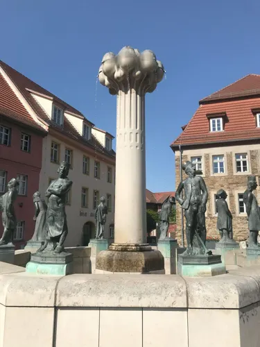
Eisleber Bergschule
Monument and historic site
Hauptgebäude des ehemaligen Katharinen-Hospitals, von 1817-1844 Sitz der Eisleber Bergschule
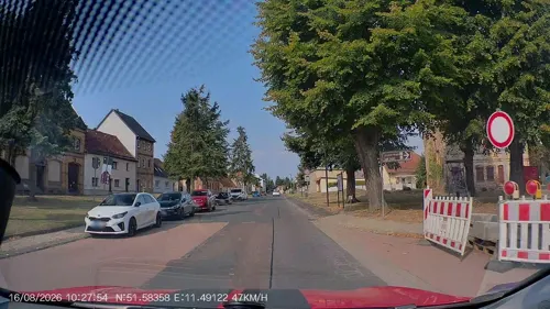
Heimatstube
Museum · 7.4 km
Ehemaliges Landarbeiterhaus
7 Schulplatz, Klostermansfeld
"nach Vereinbarung"

Preußischer Meilenstein
Monument and historic site · 5.2 km
Preußischer Ganzmeilenobelisk mit Sitzbank an der L 151 zwischen Blankenheim und Wimmelburg



102 more on the map.
Parks, trails and playgrounds30





18 more on the map.
Restaurants and cafes85
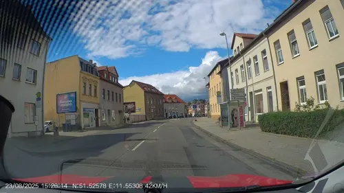

Lutherschenke
Restaurant · Czech
19 Lutherstraße, Lutherstadt Eisleben
Mo-Fr 11:00-15:00,17:00-22:00; Sa 12:00-22:30; Su 11:00-17:00
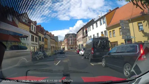
Ratsstube
Restaurant · Regional, German
12 Markt, Lutherstadt Eisleben
Tu-Th 11:30-14:30,18:00-22:00; Fr,Sa 11:30-14:30,18:00-22:30; Su...
Brauhaus am Landmarkt
Restaurant · 8.3 km
23 Gewerbgebiet Rothenschirmbach, Lutherstadt Eisleben
Mo,Tu,Th 11:00-21:00; Fr,Sa 11:00-22:00; Su 11:00-18:00; We,PH off


Bäckerei Roy
Bakery · 0.8 km
35 Fritz-Wenk-Straße, Lutherstadt Eisleben
Tu-Fr 06:00-13:00; Sa 06:00-10:00; Mo,Su off
Diana's Strandrestaurant
Restaurant · 9.5 km
8a Zum Süßen See, Seegebiet Mansfelder Land
Mo-Fr 14:00-21:00; Sa 11:00-22:00; Su,PH 11:00-17:00
Gasthaus Zur Scheune
Restaurant · 8.7 km
4 Allstedter Straße, Lutherstadt Eisleben
Mo off; Tu-Fr 16:00-24:00; Sa 16:00-01:00, Su 10:00-14:00,16:30-22:00

Getränke & Backwaren Reiter
Bakery · 8.7 km
4 Allstedter Straße, Lutherstadt Eisleben
Mo-Th 07:00-13:00,15:00-18:00; Fr 07:00-18:00; Sa 07:00-12:00; Su,PH off
Villa Oberhof
Restaurant · German · 5.0 km
We,Th 17:00-22:00; Fr 17:00-23:00; Sa 11:00-14:00,17:00-23:00; Su...
73 more on the map.
History
Eisleben was first mentioned in 997 as a market called Islebia, and in 1180 as a town. The counts of Mansfeld governed the area until the 18th century. During the Protestant Reformation, Count Hoyer VI of Mansfeld-Vorderort (1477–1540) remained loyal to his Catholic faith, but the family's Mittelort and Hinterort branches sided with Martin Luther.
The German Peasants' War devastated the area, about a century before the Thirty Years War. Count Albert VII of Mansfeld-Hinterort (1480–1560) signed the Protestant Augsburg Confession in 1530 and joined the Schmalkaldic League, a defensive confederation of Protestant princes which ultimately lost the Schmalkaldic War over Saxony to the forces of Emperor Charles V but gained Lutheranism's recognition as an official religion within the Holy Roman Empire, letting princes determine the official religion within their lands.
From the History section of Eisleben on Wikipedia, under CC BY-SA 4.0.
Where to stay17
Churches and places of worship49
St. Andreas
Church · Protestant · 8.3 km
Augsdorfer Straße, Gerbstedt
Shopping25
Gas and EV charging19
Schools, colleges and libraries20
Martin-Luther-Gymnasium
School · 0.6 km
16 Siegfried-Berger-Weg, Lutherstadt Eisleben
BbS Mansfeld - Südharz Haus 4
School · 0.8 km
12 Querfurter Straße, Lutherstadt Eisleben
Grundschule "Geschwister Scholl"
School
15 Friedrich-König-Straße, Lutherstadt Eisleben
Healthcare9
MedFit Eisleben
Clinic and pharmacy · 0.8 km
12 Friedensstraße, Lutherstadt Eisleben
Map of Eisleben Lutherstadt
250 places. The map loads OpenStreetMap tiles when you open it.
Getting there and nearby towns
Flugplatz Köthen (KOQ) is the nearest airport with scheduled flights listed in OpenStreetMap, 35 km away.
- Hettstedt 14 km north, about 14 min by car
- Sangerhausen 19 km west, about 19 min by car
- Aschersleben 26 km north, about 26 min by car
- Halle (Saale) 30 km east, about 30 min by car
- Bernburg 33 km northeast, about 33 min by car
- Merseburg 36 km southeast, about 36 min by car
- Staßfurt 36 km north, about 36 min by car
- Köthen 38 km northeast, about 38 min by car
- Quedlinburg 40 km northwest, about 40 min by car
- Thale 43 km northwest, about 43 min by car
Drive times are estimates from straight-line distance, not routes.
Local news
Headlines from INDB.
Reviews, tips and questions
Loading what members have shared...
Sources and licences
- GeoNames (CC BY 4.0): population, coordinates, regions and time zone
- Mapillary (see each image): photos
- OpenStreetMap contributors (ODbL 1.0): places, airports, map data
- Wikidata (CC0 1.0): elevation, founding date, time zone, website, landmarks and historic places
- Wikimedia Commons (see each image): photos
- Wikipedia (CC BY-SA 4.0): overview and history text
Photo credits
- Lutherstadt Eisleben, town square with the town hall, Luther memorial and St. Andreas church, Dguendel, CC BY 3.0
- StAndreasSl, Pomfuttge, CC BY-SA 3.0
- Helfta Convent (Lutherstadt Eisleben), the church, Dguendel, CC BY 3.0
- Luthers Sterbehaus Eisleben, Andreas Thum, CC BY-SA 3.0
- EislebenPetri5, Jwaller, CC BY-SA 4.0
- Lutherstadt Eisleben, the theatre, Dguendel, CC BY 3.0
- St. Andreaskirche in Lutherstadt Eisleben (121), Michael aus Halle, CC BY-SA 3.0
- Benndorf Gesamtschule, Reise Reise, CC BY-SA 3.0
- Klostermansfeld Wasserturm 1, Reise Reise, CC BY-SA 3.0
- Klostermansfeld Grundschule, Reise Reise, CC BY-SA 3.0
- Eisleben Alter Friedhof Ostflügel 2006-08-09 (1), Hallogen, CC BY 3.0
- Wimmelburg Preussischer Ganzmeilenobelisk-03, Radler59, CC BY-SA 4.0
- Kat Kirche Helbra, Pomfuttge, CC BY-SA 3.0
- Kriegerdenkmal Ahlsdorf, Olaf Meister, CC BY-SA 4.0
- Schmid-Schacht Helbra 01, Olaf Meister, CC BY-SA 4.0
- TurmPolleben2, Pomfuttge, CC BY-SA 3.0
- UnterrißdorfKirche02, Jwaller, CC BY-SA 4.0
- Hornburg (Seegebiet Mansfelder Land), die Dorfkirche, Dguendel, CC BY-SA 4.0
- Burgsdorf (Lutherstadt Eisleben), the village church, Dguendel, CC BY 3.0
- Thondorf (Gerbstedt), the village church, Dguendel, CC BY 3.0
- Hergisdorf, die Kirche St. Ägidius, Dguendel, CC BY 3.0
- Dorfkirche Hedersleben, Pomfuttge, CC BY-SA 3.0
- Dorfkirche Augsdorf Juli 2020, Pomfuttge, CC BY 4.0
- Lutherstadt Eisleben Wasserturm Bf-01, Radler59, CC BY-SA 4.0
- Sterbehaus Luther Eisleben, Olaf Meister, CC BY-SA 3.0
- Luther birthplace, Tilo Hauke, CC BY-SA 2.0 de
- Kloster Helfta - Liboriushaus, Kirche, Konventsgebäude, Helfta_-_Liboriushaus_Kirche_und_Konvent.jpg : Thomas Guffler derivative work: Rabanus Flavus, CC BY-SA 3.0
- Helfta, Klosterkirche St. Maria, Rabanus Flavus, CC0
- Lutherstadt Eisleben, Lutherstraße 16-20150730-009, Tilman2007, CC BY-SA 3.0
- Lutherstadt Eisleben, Andreaskirchplatz 7-20150730-001, Tilman2007, CC BY-SA 3.0
- St Andreas Siersleben 2024, Pomfuttge, CC BY-SA 4.0
- St.Petri- Pauli Kirche, MCPs at German Wikipedia, CC BY-SA 3.0 de
- Eisleben Alter Friedhof Ostflügel 2006-08-09 (2), Hallogen, CC BY 3.0
- Schmid-Schacht Helbra 02, Olaf Meister, CC BY-SA 4.0
- Lutherstadt Eisleben, Haus Lutherstraße 28, Dguendel, CC BY 4.0
- Lutherstraße 27 Lutherstadt Eisleben, Clemensfranz, CC BY-SA 4.0
- Lutherstraße 26 Lutherstadt Eisleben, Clemensfranz, CC BY-SA 4.0
- Lutherstadt Eisleben, Haus Lutherstraße 26, Dguendel, CC BY 4.0
- Lutherstadt Eisleben, die Häuser Badergasse 13 und 14, Dguendel, CC BY 4.0
- Lutherstraße 24 Lutherstadt Eisleben, Clemensfranz, CC BY-SA 4.0
- Street-level photo, AR88, CC BY-SA 4.0
- Street-level photo, AR88, CC BY-SA 4.0
- Street-level photo, saschahaberkorn, CC BY-SA 4.0
- Street-level photo, poxonline, CC BY-SA 4.0
- Street-level photo, surveyor99, CC BY-SA 4.0
- Street-level photo, AR88, CC BY-SA 4.0
- Street-level photo, natura, CC BY-SA 4.0
- Street-level photo, AR88, CC BY-SA 4.0
- Street-level photo, AR88, CC BY-SA 4.0
- Street-level photo, thetornado76, CC BY-SA 4.0
- Street-level photo, AR88, CC BY-SA 4.0
- Street-level photo, cuparius7, CC BY-SA 4.0
- Street-level photo, AR88, CC BY-SA 4.0


Page built November 8, 2026. Spotted a mistake? Tell us or suggest a place.