


Why visit Thale
Townapedia lists 182 museums and landmarks, 37 parks and trails, 105 places to eat, 52 places to stay and 129 attractions in and around town.
Highlights include Tierpark Hexentanzplatz, Central-Theater Thale, Harzer Uhrenmuseum and DDR-Museum Thale.
Weather in Thale
Forecast from MET Norway (CC BY 4.0). Full forecast
About Thale
Thale (pronounced [ˈtaːlə]) is a town in the Harz district in Saxony-Anhalt in central Germany. Located at the steep northeastern rim of the Harz mountain range, it is known for the scenic Bode Gorge stretching above the town centre.
From the Wikipedia article Thale (this version), under CC BY-SA 4.0.
Travel tips from other travellers: Thale on Wikivoyage (CC BY-SA 4.0).
Things to do129


Central-Theater Thale
Cinema and theater · 0.7 km
5 Bahnhofstraße, Thale


Homburg Watchtower
Monument and historic site · 1.3 km
Observation tower near Thale in Harz


Wilhelm Raabe Tower
Monument and historic site · 9.1 km
Observation tower near Blankenburg in Harz



Marienhof Hofladen
Farm and orchard · 3.4 km
1a Am Marienhof, Thale
Mo-Fr 07:00-18:00; Sa 07:00-12:00


117 more on the map.
Museums and landmarks182


Hungerstein
Monument and historic site · 7.2 km
Kleindenkmal Hungerstein , welches an die schwierigen Zeiten der Weltwirtschaftskrise seit 1929 erinnert.




Hexenhaus-Thale
Monument and historic site · 2.0 km
7 Hexentanzplatz, Thale
Apr-Oct Mo-Su,PH 10:00-17:30

Hüttenmuseum
Museum · 1.0 km
Apr-Oct: Tu-Su 10:00-17:00; Nov-Mar: We-Su 11:00-16:00

museum Lyonel Feininger
Museum · 7.8 km
Museum in Quedlinburg, Germany

170 more on the map.
Parks, trails and playgrounds37





25 more on the map.
Restaurants and cafes105
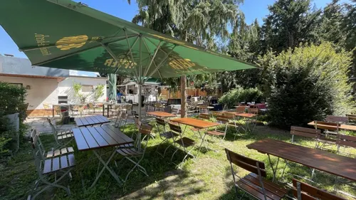
Helsunger Krug
Bar and pub · Coffee Shop, Regional, Cake · 4.5 km
Zur Zeit aufgrund Umbauarbeiten nur Imbissbetrieb,jedoch mit selbstgebackenem Kuchen in herrlichem Biergarten
2 Helsunger Weg, Blankenburg
Fr-Su 11:00-18:00; Mo-Th off

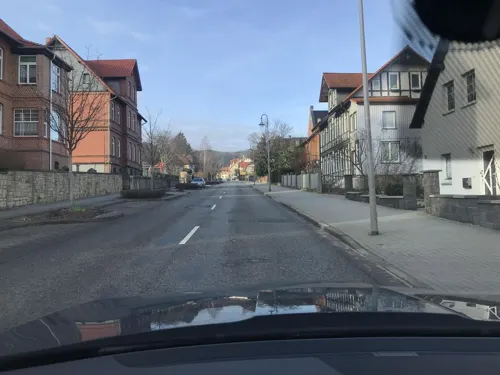
Schnitzelhaus FOR YOU
Restaurant · German · 7.1 km
Schnitzelhaus, Schnitzel-Manufaktur, deutsches Restaurant
1 Friedrich-August-Straße, Blankenburg (Harz)
Mo,Tu 17:00-21:00; Th-Su 17:00-21:00

Athos
Restaurant · Greek · 0.7 km
22 Rudolf-Breitscheid-Straße, Thale
Tu-Th 17:30-23:00, PH,Fr-Su 11:30-14:00, Su 17:30-23:00, PH,Fr,Sa...
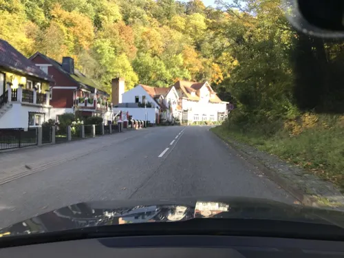

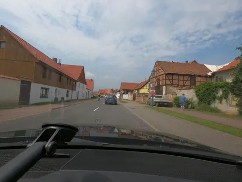
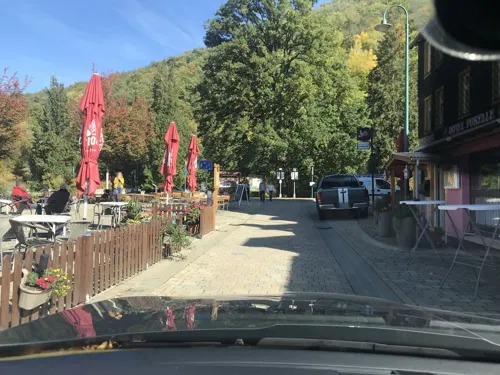
Cafe im Hotel Bodethal
Cafe · Coffee Shop, Regional · 5.9 km
30 Ortsstraße, Thale
We-Sa 11:00-20:00; Su 11:00-18:00; Mo,Tu off
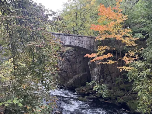
Gaststätte Großvater
Restaurant · Italian · 6.6 km
15 Großvaterweg, Blankenburg (Harz)
We-Mo 11:30-22:00


Hanolds Bräustübl
Restaurant · Regional · 6.7 km
35 Hauptstraße, Thale
Tu-Fr 17:30-21:30; Sa 12:00-14:30,17:30-21:30; Mo,Su off
Harzer Burger König
Restaurant · Regional · 6.8 km
10 Vogelherd, Blankenburg (Harz)
Mo-Th 17:00-21:00; Fr-Sa 12:00-22:00; Su,PH 12:00-21:00
93 more on the map.
History
The settlement of Thale probably emerged at the beginning of the 10th century. It was documented in 936 in connexion with the neighbouring Wendhusen Abbey, which had been founded around 825 AD as a chapter of canonesses (Kanonissenstift). Established by an Eastphalian comital family and based on the model of Herford Abbey, it was one of the first monasteries in the medieval Duchy of Saxony. After Queen Dowager Matilda, wife of the late King Henry the Fowler, tried in vain to relocate the convent in 936, it came under the guardianship of the newly established Quedlinburg chapter.
The adjacent village was first mentioned in a 1231 deed as Dat Dorp to dem Dale (from 1288 it was given the Latinised description de valle, and from 1303 as von Thale). In the late Middle Ages, the estates were held by the Saxon Counts of Regenstein, vassals of the Halberstadt prince-bishops. The monastery premises were stormed and devastated in 1525 during the German Peasants' War.
From the History section of Thale on Wikipedia, under CC BY-SA 4.0.
Where to stay52
Churches and places of worship20
Herz-Jesu-Kirche
Church · Catholic · 1.0 km
2 Walther-Rathenau-Straße, Thale
Shopping20
Gas and EV charging8
Schools, colleges and libraries15
Europagymnasium Richard v. Weizsäcker
School · 0.8 km
34 Erich-Weinert-Straße, Thale
Aus- und Fortbildungsinstitut des Landes Sachsen-Anhalt
School · 0.8 km
3-4 Schmiedestraße, Thale
Healthcare7
Ev. Fachkrankenhaus für Psychiatrie "Hildegard von Bingen"
Hospital · 3.7 km
11 Suderöder Straße, Thale
Map of Thale
250 places. The map loads OpenStreetMap tiles when you open it.
Getting there and nearby towns
Magdeburg-Cochstedt Airport (CSO) is the nearest airport with scheduled flights listed in OpenStreetMap, 28 km away.
- Wernigerode 20 km northwest, about 20 min by car
- Bad Harzburg 36 km northwest, about 36 min by car
- Staßfurt 39 km east, about 39 min by car
- Vienenburg 40 km northwest, about 40 min by car
- Bad Lauterberg im Harz 41 km west, about 41 min by car
- Schöningen 44 km north, about 44 min by car
- Goslar 46 km northwest, about 46 min by car
- Clausthal-Zellerfeld 49 km west, about 49 min by car
- Herzberg am Harz 49 km west, about 49 min by car
- Magdeburg 59 km northeast, about 59 min by car
Drive times are estimates from straight-line distance, not routes.
Local news
Headlines from INDB.
Reviews, tips and questions
Loading what members have shared...
Sources and licences
- GeoNames (CC BY 4.0): population, coordinates, regions and time zone
- Mapillary (see each image): photos
- OpenStreetMap contributors (ODbL 1.0): places, airports, map data
- Wikidata (CC0 1.0): elevation, founding date, time zone, website, landmarks and historic places
- Wikimedia Commons (see each image): photos
- Wikipedia (CC BY-SA 4.0): overview and history text
Photo credits
- 20240510 xl 1858-Bibliothek Thale, Molgreen, CC BY-SA 4.0
- Obersteiger Weg Wotanstraße Wohnquartier (Thale), Migebert, CC BY-SA 3.0
- Obersteiger Weg 1a (Thale), Migebert, CC BY-SA 3.0
- Eisenbahnstraße 26 (Thale) 01, Migebert, CC BY-SA 3.0
- Eisenbahnstraße 24 (Thale), Migebert, CC BY-SA 3.0
- Eisenbahnstraße 23 (Thale) 01, Migebert, CC BY-SA 3.0
- Eisenbahnstraße 26 (Thale) 02, Migebert, CC BY-SA 3.0
- Obersteiger Weg 12-14 Wotanstraße 20-24 Baldurweg 1-2 (Thale), Migebert, CC BY-SA 3.0
- Eisenbahnstraße 22 (Thale) 01, Migebert, CC BY-SA 3.0
- Eisenbahnstraße 22 (Thale) 02, Migebert, CC BY-SA 3.0
- Eisenbahnstraße 21 (Thale), Migebert, CC BY-SA 3.0
- Eisenbahnstraße 23 (Thale) 02, Migebert, CC BY-SA 3.0
- Obersteiger Weg 14-12 (Thale), Migebert, CC BY-SA 3.0
- Obersteiger Weg 30 (Thale), Migebert, CC BY-SA 3.0
- Stecklenberger Allee 58-61 (Thale) 01, Migebert, CC BY-SA 3.0
- Stecklenberger Allee 65-66 (Thale), Migebert, CC BY-SA 3.0
- Stecklenberger Allee 62-64 (Thale), Migebert, CC BY-SA 3.0
- Stecklenberger Allee 51-57 (Thale), Migebert, CC BY-SA 3.0
- Stecklenberger Allee 58-61 (Thale) 02, Migebert, CC BY-SA 3.0
- Obersteiger Weg 29 (Thale), Migebert, CC BY-SA 3.0
- Am Tannenkopf (Thale) Gleditschie 02, Migebert, CC BY-SA 3.0
- Am Tannenkopf (Thale) Gleditschie 01, Migebert, CC BY-SA 3.0
- Obersteiger Weg 28 (Thale), Migebert, CC BY-SA 3.0
- Stecklenberger Allee 45-50 (Thale), Migebert, CC BY-SA 3.0
- 20240507 xl 1720-Stadtarchiv Thale, Molgreen, CC BY-SA 4.0
- 20240511 xl 1851-Stadtwappen Thale im Boden vor dem Rathaus, Molgreen, CC BY-SA 4.0
- 06502 Thale, Germany - panoramio, superdragon67, CC BY-SA 3.0
- Stecklenberger Allee 40-34 (Thale), Migebert, CC BY-SA 3.0
- Obersteiger Weg 27-32 (Thale), Migebert, CC BY-SA 3.0
- Brunnen der Weisheit Thale Raben, Derbeth, CC BY 4.0
- Brunnen der Weisheit Thale Wotan, Derbeth, CC BY 4.0
- Thale Brunnen der Weisheit (4), Angela Huster, CC0
- Thale Brunnen der Weisheit (6), Angela Huster, CC0
- Thale Brunnen der Weisheit (8), Angela Huster, CC0
- Thale Brunnen der Weisheit (3), Angela Huster, CC0
- Thale Brunnen der Weisheit (7), Angela Huster, CC0
- Homburgswarte, No machine-readable author provided. SehLax assumed (based on copyright claims)., CC BY-SA 3.0
- Wilhelm-raabe-warte-hinten, www.total-reality.de, CC BY 3.0
- Bärendenkmal b. Bremer Teich, Benutzer:Hejkal, CC BY-SA 2.0 de
- Erichsberg, Hejkal, CC BY-SA 3.0
- Quedlinburg Schlossberg Feininger, Fingalo Christian Bickel, CC BY-SA 2.0 de
- 20190419 Gernrode StCyriakus DSC07781 HDRfusion PtrQs, PtrQs, CC BY-SA 4.0
- Bodetal Bergtheater innen, Axel Hindemith, Public domain
- Thale Hotel Waldkater, Olaf Meister, CC BY-SA 3.0
- Thale Huettenmuseum, Angela Huster, CC0
- Kloster Wendhusen, Unknown author, Public domain
- Blankenburg Kirche Josef, Kirchenfan, CC0
- Lindenstraße 5 (Gernrode), Olaf Meister, CC BY-SA 3.0
- Neue Kirche Bad Suderode, Olaf Meister, CC BY-SA 4.0
- Preußenturm Bad Suderode, Olaf Meister, CC BY-SA 4.0
- DDR Museum Thale, Olaf Meister, CC BY-SA 3.0
- Berghotel Roßtrappe, Olaf Meister, CC BY-SA 3.0
- Bahnhofstraße 5 (Thale), Olaf Meister, CC BY-SA 3.0
- Blankenburg Harz 001, Krajo, CC BY-SA 3.0
- Schnapelberg 5 (Blankenburg), Olaf Meister, CC BY-SA 4.0
- Kirche Westerhausen, Benutzer:Hejkal, CC BY-SA 2.0 de
- 20240504 xl 1456-Freie Waldorfschule Harzvorland, Molgreen, CC BY-SA 4.0
- Kirche in Friedrichsbrunn, Olaf Meister, CC BY-SA 4.0
- Auf dem Kirchberg 3 (Neinstedt) Kirche 02, Migebert, CC BY-SA 4.0
- St. Michael (Weddersleben) 01, Migebert, CC BY-SA 3.0
- St. Martin Cattenstedt, HarzerJunge, CC BY-SA 4.0
- Lindenhofkirche Neinstedt 08, Migebert, CC BY-SA 4.0
- 20240506 xl 1224-Tierpark Hexentanzplatz 2, Molgreen, CC BY-SA 4.0
- 20240505 xl 1838-Hotel Villa Alice 2, Molgreen, CC BY-SA 4.0
- Thale Dambachhaus 07, Jan-Herm Janßen, CC BY-SA 4.0
- 20240510 xl 1848-Europagymnasium Richard von Weizsäcker 2, Molgreen, CC BY-SA 4.0
- Brunnennachahmung und Voliere im Fasanengarten Blankenburg, Adkott2, CC BY-SA 4.0
- Blankenburg (Harz) Barockgarten by Stepro DSC 5440, Steffen Prößdorf, CC BY-SA 3.0 de
- Blick zum Hexentanzplatz, Hejkal, CC BY 3.0
- La Viers-Höhe, Olaf Meister, CC BY-SA 3.0
- Hungerstein Westerhausen, Benutzer:Hejkal, CC BY-SA 3.0 de
- Himmelschlüssel NSG Münchenberg 01, Feuerbaum, CC BY-SA 3.0
- Anhaltinischer Saalstein, Olaf Meister, CC BY-SA 4.0
- Bodetal bodekessel, Tremlin, CC BY-SA 3.0
- 20240513 xl 0959-Rudolf-Breitscheid-Straße 22, Thale (Harz), Restaurant Athos, Molgreen, CC BY-SA 4.0
- Ölbergshöhe 2018, Olaf Meister, CC BY-SA 4.0
- Helsunger Bruch P1060865, Goldmull, CC BY-SA 4.0
- Treseburg Wilhelmsblick 01, ErwinMeier, CC BY-SA 4.0
- Schützenhaus (Westerhausen) DSC 6154, Goldmull, CC BY-SA 4.0
- Wasserwelt (Thale) 01, Migebert, CC BY-SA 3.0
- Street-level photo, surveyor99, CC BY-SA 4.0
- Street-level photo, surveyor99, CC BY-SA 4.0
- Street-level photo, surveyor99, CC BY-SA 4.0
- Street-level photo, surveyor99, CC BY-SA 4.0
- Street-level photo, surveyor99, CC BY-SA 4.0
- Street-level photo, surveyor99, CC BY-SA 4.0
- Street-level photo, surveyor99, CC BY-SA 4.0
- Street-level photo, surveyor99, CC BY-SA 4.0
- Street-level photo, surveyor99, CC BY-SA 4.0
- Street-level photo, surveyor99, CC BY-SA 4.0
- Street-level photo, ReisenderKaufmann, CC BY-SA 4.0
- Street-level photo, ReisenderKaufmann, CC BY-SA 4.0
- Street-level photo, ReisenderKaufmann, CC BY-SA 4.0
- Street-level photo, surveyor99, CC BY-SA 4.0
- Street-level photo, saschahaberkorn, CC BY-SA 4.0
- Street-level photo, surveyor99, CC BY-SA 4.0
- Street-level photo, surveyor99, CC BY-SA 4.0
- Street-level photo, surveyor99, CC BY-SA 4.0
- Street-level photo, mezazis, CC BY-SA 4.0
- Street-level photo, ramap, CC BY-SA 4.0
- Street-level photo, ReisenderKaufmann, CC BY-SA 4.0
- Street-level photo, AR88, CC BY-SA 4.0
- Street-level photo, AR88, CC BY-SA 4.0
- Street-level photo, surveyor99, CC BY-SA 4.0
- Street-level photo, TechniPorter, CC BY-SA 4.0
- Street-level photo, surveyor99, CC BY-SA 4.0
- Street-level photo, dsmm, CC BY-SA 4.0


Page built November 8, 2026. Spotted a mistake? Tell us or suggest a place.