


Why visit Ergolding
Townapedia lists 60 museums and landmarks, 35 parks and trails, 249 places to eat, 22 places to stay and 14 attractions in and around town.
Highlights include Das Kleine Theater, Kinopolis Landshut, LANDSHUTmuseum and Burgfriedensäule.
Weather in Ergolding
Forecast from MET Norway (CC BY 4.0). Full forecast
About Ergolding
Ergolding (Central Bavarian: Erwading) is a municipality in the district of Landshut, in Bavaria, Germany. It is situated on the left bank of the Isar, 5 km northeast of Landshut.
From the Wikipedia article Ergolding (this version), under CC BY-SA 4.0.
Things to do14


Kleines theater – Kammerspiele Landshut
Cinema and theater · 4.3 km
Theatre in Landshut, Bavaria, Germany

Biohof Pollner
Farm and orchard · 2.9 km
Eier, Nudeln, Milchtankstelle
18 Dekan-Simbürger-Straße, Ergolding

Theaterzelt des Stadttheaters Landshut
Cinema and theater · 3.1 km
101 Niedermayerstraße, Landshut
2 more on the map.
Museums and landmarks60



Galerie Kunstwerk La
Museum · 4.8 km
3 Papiererstraße, Landshut
We,Fr,Sa 15:00-18:00 || "gerne nach Vereinbarung"; PH off


Kunstgalerie Hackl
Museum · 4.6 km
447 Neustadt, Landshut
Tu-Fr 10:00-18:00; Apr-Sep Sa 10:00-14:00; Oct-Mar Sa 10:00-16:00




Realschulgebäude (HCG)
Monument and historic site · 4.5 km
7 Marienplatz, Landshut
48 more on the map.
Parks, trails and playgrounds35

Ehemaliger Standortübungsplatz Landshut mit Isarleite
Hiking and trails · 3.8 km




Spielplatz Bayerwald
Playground · 2.9 km
May-Sep 09:00-21:00; Oct-Apr 09:00-19:00
23 more on the map.
Restaurants and cafes249
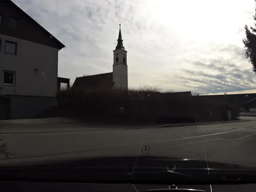
Drei Tannen
Restaurant · Balkan · 4.4 km
75 Hauptstraße, Altdorf
Tu-Sa 11:00-14:00,17:00-22:00; Su,PH 11:00-14:30,17:00-22:00

Pizzeria Da Vittorio
Restaurant · Italian, Pasta, Pizza · 3.0 km
14 Donaustraße, Landshut
Tu-Su 17:00-23:30; Fr-Su 11:30-14:30; PH 11:30-14:30, 17:00-23:30
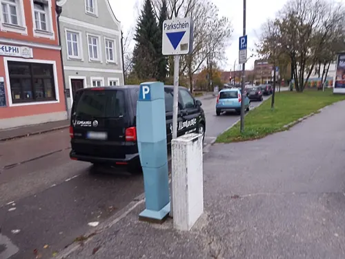
An Lac Chay
Restaurant · Asian, Sushi, Vietnamese · 4.8 km
141 Ländgasse, Landshut
Mo-Sa 11:00-14:30,17:00-22:00
Burgerlon
Restaurant · Burger · 4.4 km
401 Heilig-Geist-Gasse, Landshut
Tu-Sa 11:30-14:00; Tu-Th 17:00-21:00; Fr-Sa 17:00-22:00
Cafe Himmel
Restaurant · Regional · 4.3 km
734 Isargestade, Landshut
Mo 08:00-18:00; Tu-Fr 08:00-23:00; Sa 09:00-23:00; Su 09:00-18:00
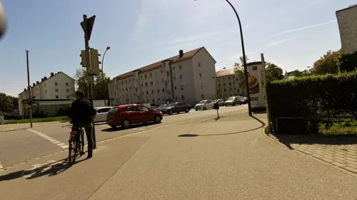
Café 73 - Die Balkanlounge Landshut
Restaurant · Balkan, Pizza, Pasta · 4.3 km
73 Luitpoldstraße, Landshut
Mo-Fr 11:30-14:00,17:00-22:00; Sa,Su 11:30-22:00
Dhaba
Restaurant · Indian · 4.8 km
264 Schirmgasse, Landshut
Tu-Fr 11:30-14:30,17:30-23:30; Sa 12:00-23:00; Su,PH 12:00-23:00
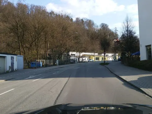



237 more on the map.
Where to stay22
Churches and places of worship38
St. Peter und Paul
Church · Catholic · 0.9 km
94 Lindenstraße, Ergolding
Abteikirche Seligenthal
Church · Roman Catholic · 4.1 km
14 Bismarckplatz, Landshut
Dominikanerkirche St. Blasius
Church · Roman Catholic · 4.5 km
541 Regierungsplatz, Landshut
Shopping72
City Center Landshut
Shopping center · 4.3 km
5 Am Alten Viehmarkt, Landshut
Gas and EV charging19
Schools, colleges and libraries56
Staatl. Fachschule für Agrarwirtschaft Landshut, Fachricht. Gartenbau, Garten- u. Landschaftsbau
School · 2.8 km
3l Am Lurzenhof, Landshut
Healthcare14
Map of Ergolding
250 places. The map loads OpenStreetMap tiles when you open it.
Getting there and nearby towns
Munich International Airport (MUC) is the nearest airport with scheduled flights listed in OpenStreetMap, 38 km away.
- Landshut 5 km south, about 5 min by car
- Vilsbiburg 19 km southeast, about 19 min by car
- Mainburg 30 km west, about 30 min by car
- Freising 37 km southwest, about 37 min by car
- Neustadt an der Donau 39 km northwest, about 39 min by car
- Landau an der Isar 40 km east, about 40 min by car
- Wolnzach 40 km west, about 40 min by car
- Waldkraiburg 44 km south, about 44 min by car
- Straubing 45 km northeast, about 45 min by car
- Regensburg 49 km north, about 49 min by car
Drive times are estimates from straight-line distance, not routes.
Local news
Headlines from INDB.
Reviews, tips and questions
Loading what members have shared...
Sources and licences
- GeoNames (CC BY 4.0): population, coordinates, regions and time zone
- Mapillary (see each image): photos
- OpenStreetMap contributors (ODbL 1.0): places, airports, map data
- Wikidata (CC0 1.0): elevation, founding date, time zone, website, landmarks and historic places
- Wikimedia Commons (see each image): photos
- Wikipedia (CC BY-SA 4.0): overview and history text
Photo credits
- Mariä Heimsuchung Ergolding 03, H.Helmlechner, CC BY-SA 4.0
- Mariä Heimsuchung Ergolding 01, H.Helmlechner, CC BY-SA 4.0
- Mariä Heimsuchung Ergolding 05, H.Helmlechner, CC BY-SA 4.0
- Mariä Heimsuchung Ergolding 07, H.Helmlechner, CC BY-SA 4.0
- Mariä Heimsuchung Ergolding 02, H.Helmlechner, CC BY-SA 4.0
- Ergolding Kirche Sankt Peter Epitahp, Elcom.stadler, CC BY-SA 4.0
- Ergolding Kirche Sankt Peter Kanzel, Elcom.stadler, CC BY-SA 4.0
- Ergolding Kirche Sankt Peter Innenraum, Elcom.stadler, CC BY-SA 4.0
- Ergolding Kirche Sankt Peter Volksaltar, Elcom.stadler, CC BY-SA 4.0
- Ergolding Kirche Sankt Peter Altarraum, Elcom.stadler, CC BY-SA 4.0
- Ergolding Kirche Sankt Peter Emporenbrüstung, Elcom.stadler, CC BY-SA 4.0
- Ergolding Kirche Sankt Peter Fenstermaßwerk, Elcom.stadler, CC BY-SA 4.0
- Ergolding Kirche Sankt Peter Westempore, Elcom.stadler, CC BY-SA 4.0
- Ergolding Kirche Sankt Peter Madonna, Elcom.stadler, CC BY-SA 4.0
- Ergolding Kirche Sankt Peter Stuhlwangen, Elcom.stadler, CC BY-SA 4.0
- Ergolding Kirche Sankt Peter Sakramentennische, Elcom.stadler, CC BY-SA 4.0
- Landshut - kleines theater, Marek Śliwecki, CC BY-SA 4.0
- CityCenterLandshut, Andiamfeelinggood, CC BY-SA 4.0
- Dominikanerkirche St. Blasius Landshut, ChGlas, CC BY-SA 3.0
- Iglesia del Espíritu Santo, Landshut, Alemania, 2012-05-27, DD 03, Diego Delso, CC BY-SA 3.0
- Technologiezentrum PULS Dingolfing Südseite, Ratzer, CC BY-SA 4.0
- Freyung 592 St. Jodok Landshut-1, Rufus46, CC BY-SA 3.0
- Landshut - Stadtresidenz Landshut, Marek Śliwecki, CC BY-SA 4.0
- Nikolastr. 43 Alt-St.-Nikola Landshut-3, Rufus46, CC BY-SA 3.0
- Ergolding-Kirche-Sankt-Peter, Elcom.stadler, CC0
- Freyung 630-Westansicht, Gliwi, CC BY-SA 3.0
- Litschengasse 716 St. Sebastian Landshut-3, Rufus46, CC BY-SA 3.0
- Schützenstraße 55; Schützenstraße 57 Landshut, Gliwi, CC BY-SA 3.0
- StB LA Weilerstrasse Aussen Baum M, Stadtbücherei Weilerstraße, CC BY-SA 3.0
- Landshut-Schönbrunn-St.-Michael, Gliwi, CC BY-SA 3.0
- Altstadt 68 Landshut-1, Rufus46, CC BY-SA 3.0
- Altstadt 339 Landshut-1, Rufus46, CC BY-SA 3.0
- Ländtor in Landshut, 2026, Burkhard Mücke, CC BY-SA 4.0
- Theaterstr. 66 Landshut-1, Rufus46, CC BY-SA 3.0
- Landshut, Klosterkirche Mariä Himmelfahrt, 9, Renardo la vulpo, CC BY-SA 4.0
- Landshut Freyung 104, GFreihalter, CC BY-SA 3.0
- Pauluskirche Ergolding (1990), Berlinger11, CC BY-SA 3.0
- Ehemaliges Franziskanerkloster Landshut, Gliwi, CC BY-SA 3.0
- XVI. Burgfriedenssäule Landshut, Gliwi, CC BY-SA 3.0
- Altstadt 79 Stadtresidenz Landshut-1, Rufus46, CC BY-SA 3.0
- Regierungsplatz 542 Landshut-1, Rufus46, CC BY-SA 3.0
- Ergolding Lindenstr-021 Pfarrhof, Mathias Plonka, CC BY-SA 3.0
- Marienplatz 7 - Fassade, Gliwi, CC BY-SA 3.0
- 20140615 Ochsenau mit Trockenhuegel, Wolfgang Pest, CC BY-SA 3.0
- Ergolding-Kirche-Mariä-Heimsuchung, Elcom.stadler, CC0
- St. Peter Ergolding, Konrad Lackerbeck, Public domain
- Unterglaim-Kirche-Sankt-Pankratius, Elcom.stadler, CC0
- Kloster Seligenthal (Landshut), Bodo Kubrak, CC BY-SA 4.0
- 2013-09 Gymnasium Ergolding, Wana-Gond, CC BY-SA 3.0
- Street-level photo, czmrtn, CC BY-SA 4.0
- Street-level photo, changchun1, CC BY-SA 4.0
- Street-level photo, czmrtn, CC BY-SA 4.0
- Street-level photo, erias, CC BY-SA 4.0
- Street-level photo, soulcover, CC BY-SA 4.0
- Street-level photo, plonma1, CC BY-SA 4.0
- Street-level photo, czmrtn, CC BY-SA 4.0
- Street-level photo, heetENkoel, CC BY-SA 4.0
- Street-level photo, czmrtn, CC BY-SA 4.0
- Street-level photo, changchun1, CC BY-SA 4.0
- Street-level photo, czmrtn, CC BY-SA 4.0
- Street-level photo, czmrtn, CC BY-SA 4.0
- Street-level photo, czmrtn, CC BY-SA 4.0
- Street-level photo, czmrtn, CC BY-SA 4.0
- Street-level photo, czmrtn, CC BY-SA 4.0
- Street-level photo, czmrtn, CC BY-SA 4.0
- Street-level photo, czmrtn, CC BY-SA 4.0
- Street-level photo, plonma1, CC BY-SA 4.0
- Street-level photo, plonma1, CC BY-SA 4.0
- Street-level photo, changchun1, CC BY-SA 4.0
- Street-level photo, czmrtn, CC BY-SA 4.0
- Street-level photo, czmrtn, CC BY-SA 4.0


Page built November 8, 2026. Spotted a mistake? Tell us or suggest a place.