


Why visit Essenbach
Townapedia lists 26 museums and landmarks, 23 parks and trails, 86 places to eat, 9 places to stay and 11 attractions in and around town.
Highlights include Kleines theater – Kammerspiele Landshut, Beim HOGA, Pfarrhof and Schulmuseum Ahrain.
Weather in Essenbach
Forecast from MET Norway (CC BY 4.0). Full forecast
About Essenbach
Essenbach (German pronunciation: [ˈɛsn̩bax]) is a municipality in the district of Landshut, in Bavaria, Germany. It is situated 9 km northeast of Landshut.
From the Wikipedia article Essenbach (this version), under CC BY-SA 4.0.
Things to do11

Kleines theater – Kammerspiele Landshut
Cinema and theater · 9.5 km
Theatre in Landshut, Bavaria, Germany

Biohof Hanglberger
Farm and orchard · 3.1 km
Fleisch, Kartoffeln, Obst, Apfelsaft
6 Am Berg, Oberwattenbach

Theaterzelt des Stadttheaters Landshut
Cinema and theater · 7.2 km
101 Niedermayerstraße, Landshut

Museums and landmarks26




Wachsender Stein E von Schönbrunn
Monument and historic site · 7.0 km

Schloss Mirskofen
Monument and historic site · 1.6 km
20 Schlossstraße, Essenbach




14 more on the map.
Parks, trails and playgrounds23

Ehemaliger Standortübungsplatz Landshut mit Isarleite
Hiking and trails · 6.2 km

Freibad Mirskofen
Sports field and stadium · 2.7 km
4 Steinmühle, Essenbach
May-Sep: Mo-Fr 10:00-20:00; Sa,Su 09:00-20:00



11 more on the map.
Restaurants and cafes86
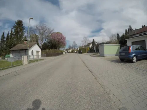
Pizzeria Da Vittorio
Restaurant · Italian, Pasta, Pizza · 5.0 km
14 Donaustraße, Landshut
Tu-Su 17:00-23:30; Fr-Su 11:30-14:30; PH 11:30-14:30, 17:00-23:30

AMOdoMIO
Restaurant · Italian, Pizza · 0.6 km
58 Ahrainer Straße, Essenbach
Mo 11:30-14:00,17:00-21:30; We-Su 11:30-14:00,17:00-21:30

Ergoldinger Stuben
Restaurant · Regional · 6.2 km
1 Am Sportpark, Ergolding
We-Sa 11:00-24:00; Su 11:00-22:00
Gasthaus Grosswirt
Restaurant · Regional · 2.1 km
Zweimal im Monat - Sonntags Mittagstisch mit Speziellem Essen. Bitte die Webseite beachten!
Th-Sa 18:00-23:30
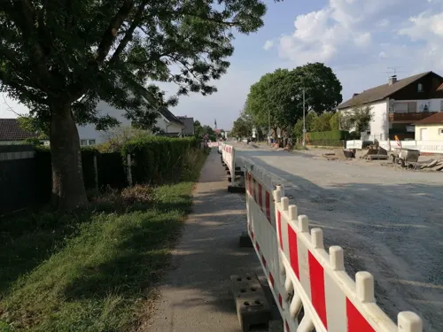


Gasthof Luginger
Restaurant · Bavarian · 2.2 km
11 Obere Sendlbachstraße, Essenbach
Mo-Tu,Th-Fr 17:00-24:00; We off; Sa 11:00-14:00,17:00-24:00; Su 11:00-15:00
Lindenwirt
Restaurant · Italian · 5.2 km
9 Rottenburger Straße, Ergolding
Mo-Su 11:30-14:00, 17:30-22:00
Mythos Landshut
Restaurant · Greek · 7.3 km
123 Breslauer Straße, Landshut
We-Sa 17:00-22:00; Su 11:00-22:00
Neumeier
Restaurant · Regional · 2.6 km
49 Dorfstraße, Essenbach
Th 18:00-23:00; Fr 18:00-23:00; Sa 10:30-23:00
74 more on the map.
Where to stay9
Churches and places of worship47
Mariä Heimsuchung
Church · Catholic · 5.2 km
19 Lindenstraße, Ergolding
Maria Heimsuchung
Church · Roman Catholic · 5.5 km
14 Frauenberg, Landshut
Mariä Himmelfahrt
Church · Roman Catholic · 7.5 km
46 Oberglaim, Ergolding
St. Peter und Paul
Church · Catholic · 6.1 km
94 Lindenstraße, Ergolding
Mater Dolorosa
Church · Roman Catholic · 1.9 km
18 Untere Sendlbachstraße, Essenbach
St. Jakob
Church · Roman Catholic · 7.5 km
6 Am alten Dorfplatz, Postau
St. Johannes
Church · Roman Catholic · 7.6 km
43 Alte Regensburger Straße, Ergolding
Shopping22
Gas and EV charging9
Schools, colleges and libraries32
Staatl. Fachschule für Agrarwirtschaft Landshut, Fachricht. Gartenbau, Garten- u. Landschaftsbau
School · 6.2 km
3l Am Lurzenhof, Landshut
Healthcare4
Map of Essenbach
250 places. The map loads OpenStreetMap tiles when you open it.
Getting there and nearby towns
Flugplatz Straubing-Wallmühle (RBM) is the nearest airport with scheduled flights listed in OpenStreetMap, 39 km away.
- Ergolding 5 km southwest, about 5 min by car
- Landshut 10 km southwest, about 10 min by car
- Vilsbiburg 21 km southeast, about 21 min by car
- Mainburg 32 km west, about 32 min by car
- Landau an der Isar 36 km east, about 36 min by car
- Neustadt an der Donau 39 km northwest, about 39 min by car
- Straubing 40 km northeast, about 40 min by car
- Freising 42 km southwest, about 42 min by car
- Kelheim 42 km northwest, about 42 min by car
- Regensburg 45 km north, about 45 min by car
Drive times are estimates from straight-line distance, not routes.
Local news
Headlines from INDB.
Reviews, tips and questions
Loading what members have shared...
Sources and licences
- GeoNames (CC BY 4.0): population, coordinates, regions and time zone
- Mapillary (see each image): photos
- OpenStreetMap contributors (ODbL 1.0): places, airports, map data
- Wikidata (CC0 1.0): elevation, founding date, time zone, website, landmarks and historic places
- Wikimedia Commons (see each image): photos
- Wikipedia (CC BY-SA 4.0): overview and history text
Photo credits
- Essenbach-Kirche-Mariä-Himmelfahrt, Elcom.stadler, CC BY-SA 3.0
- Essenbach Kirche-Maria-Himmelfahrt, Mathias Plonka, CC BY-SA 3.0
- Rathaus Essenbach, H.Helmlechner, CC BY-SA 4.0
- Gemeindebrunnen Essenbach, H.Helmlechner, CC BY-SA 4.0
- Essenbach-Kirche-Mariä-Himmelfahrt-Innenraum, Elcom.stadler, CC BY-SA 4.0
- Essenbach-Kirche-Mariä-Himmelfahrt-Stuckdecke, Elcom.stadler, CC BY-SA 4.0
- Essenbach-Kirche-Mariä-Himmelfahrt-Säulen, Elcom.stadler, CC BY-SA 4.0
- Essenbach-Kirche-Mariä-Himmelfahrt-Chorraum, Elcom.stadler, CC BY-SA 4.0
- Essenbach-Kirche-Mariä-Himmelfahrt-linker-Seitenaltar, Elcom.stadler, CC BY-SA 4.0
- Essenbach-Kirche-Mariä-Himmelfahrt-Turm, Elcom.stadler, CC BY-SA 4.0
- Essenbach-Kirche-Mariä-Himmelfahrt-Kanzel, Elcom.stadler, CC BY-SA 4.0
- Essenbach-Kirche-Mariä-Himmelfahrt-Orgelempore, Elcom.stadler, CC BY-SA 4.0
- Essenbach Kirche Mariä Himmelfahrt Rosenkranzmadonna, Elcom.stadler, CC BY-SA 4.0
- Essenbach-Kirche-Mariä-Himmelfahrt-Taufstein, Elcom.stadler, CC BY-SA 4.0
- Essenbach-Kirche-Mariä-Himmelfahrt-Stuhlwangen, Elcom.stadler, CC BY-SA 4.0
- Essenbach Kirche Mariä Himmelfahrt Orgel, Elcom.stadler, CC BY-SA 4.0
- St. Wolfgang Essenbach 02, H.Helmlechner, CC BY-SA 4.0
- Essenbach-Kirche-Sankt-Wolfgang-Ensemble, Elcom.stadler, CC BY-SA 4.0
- St. Wolfgang Essenbach 01, H.Helmlechner, CC BY-SA 4.0
- Essenbach-Kirche-Sankt-Wolfgang-Altar, Elcom.stadler, CC BY-SA 4.0
- Essenbach-Kirche-Sankt-Wolfgang-innen, Elcom.stadler, CC BY-SA 4.0
- Landshut - kleines theater, Marek Śliwecki, CC BY-SA 4.0
- Technologiezentrum PULS Dingolfing Südseite, Ratzer, CC BY-SA 4.0
- Rathausplatz 14 Essenbach, Gliwi, CC BY-SA 3.0
- Bauernhaus, Wolfstein 1, Landshut-Frauenberg, Didi43, CC BY-SA 3.0
- Ergolding-Kirche-Sankt-Peter, Elcom.stadler, CC0
- Piflas St. Johannes Außenansicht, Cm95, CC0
- Landshut-Frauenberg-14-Kirche, Elcom.stadler, CC BY-SA 3.0
- Oberlaim-Kirche-Mariä-Himmelfahrt, Elcom.stadler, CC0
- Schloßstraße 2 (Deutenkofen), Gliwi, CC BY-SA 3.0
- Schloss Niederaichbach, Konrad Lackerbeck, Public domain
- Moosthann-kirche-sankt-jakob, Elcom.stadler at German Wikipedia, Public domain
- Essenbach-Mirskofen-Kirche-Maria-Dolorosa, Elcom.stadler, CC BY-SA 3.0
- Pauluskirche Ergolding (1990), Berlinger11, CC BY-SA 3.0
- Ergolding Lindenstr-021 Pfarrhof, Mathias Plonka, CC BY-SA 3.0
- Wachsender Stein 2 (Landshut), Gliwi, CC BY-SA 4.0
- ErgoldingPiflas GustlWaldauStr-046 Schloss, Mathias Plonka, CC BY-SA 3.0
- 20140615 Ochsenau mit Trockenhuegel, Wolfgang Pest, CC BY-SA 3.0
- Ergolding-Kirche-Mariä-Heimsuchung, Elcom.stadler, CC0
- St. Peter Ergolding, Konrad Lackerbeck, Public domain
- Unterglaim-Kirche-Sankt-Pankratius, Elcom.stadler, CC0
- Hader-Hofkapelle-Sankt-Maria, Elcom.stadler, CC0
- 2013-09 Gymnasium Ergolding, Wana-Gond, CC BY-SA 3.0
- Schlossstraße 20, 22, Gliwi, CC BY-SA 3.0
- Street-level photo, cghmapper, CC BY-SA 4.0
- Street-level photo, soulcover, CC BY-SA 4.0
- Street-level photo, plonma1, CC BY-SA 4.0
- Street-level photo, erias, CC BY-SA 4.0
- Street-level photo, czmrtn, CC BY-SA 4.0
- Street-level photo, plonma1, CC BY-SA 4.0
- Street-level photo, changchun1, CC BY-SA 4.0
- Street-level photo, plonma1, CC BY-SA 4.0
- Street-level photo, plonma1, CC BY-SA 4.0
- Street-level photo, plonma1, CC BY-SA 4.0
- Street-level photo, sennewald63, CC BY-SA 4.0
- Street-level photo, plonma1, CC BY-SA 4.0


Page built November 8, 2026. Spotted a mistake? Tell us or suggest a place.