


Why visit Haßloch
Townapedia lists 57 museums and landmarks, 21 parks and trails, 111 places to eat, 9 places to stay and 9 attractions in and around town.
Highlights include Klings Lehmgrubenhof, Plopsaland Deutschland, Heimatmuseum Altes Schulhaus and Sky Scream.
Weather in Haßloch
Forecast from MET Norway (CC BY 4.0). Full forecast
About Haßloch
Haßloch (German pronunciation: [ˈhaslɔx]) is a large village in the Bad Dürkheim district in Rhineland-Palatinate, Germany. Unlike most municipalities in the district, it does not belong to any Verbandsgemeinde – a type of collective municipality. It lies near the Mannheim/Ludwigshafen built-up area. The municipality has grown out of a single centre and is thus sometimes styled “Germany’s biggest village”.
From the Wikipedia article Haßloch (this version), under CC BY-SA 4.0.
Things to do9


Plopsaland Deutschland
Monument and historic site · 5.5 km
Amusement park in Haßloch, Rhineland-Pflaz, Germany
Obsthof Hass
Farm and orchard · 3.8 km
Obstverkauf
13 Hauptstraße, Böhl-Iggelheim
Mo-Sa 08:30-12:30; Fr 14:30-18:00
Obst & Gemüse Groß
Farm and orchard · 4.8 km
3 Ruppertsberger Straße, Meckenheim
Mo-Sa 08:30-18:00

Museums and landmarks57


ehemaliges Gemeindehaus
Monument and historic site · 3.7 km
Gemeindehaus, neuklassizistischer Walmdachbau, 1883; platzbildprägend
23 Kirchenstraße, Böhl-Iggelheim


Wohnhaus 17. Jhd
Monument and historic site · 3.7 km
Fachwerkwohnhaus mit Krüppelwalmdach, wohl 17. Jahrhundert
3 Kirchenstraße, Böhl-Iggelheim

Wohnhaus 1784
Monument and historic site · 3.8 km
Wohnhaus mit Sandstein- und Holzarchitekturteilen, drittes Viertel des 19. Jahrhunderts; rückwärtige Fachwerkgebäude älter, Scheune...
77 Hauptstraße, Böhl-Iggelheim

anspruchsvolle klassizistische Toranlage
Monument and historic site · 3.8 km
Anspruchsvolle klassizistische Toranlage, zweite Hälfte des 18. Jahrhunderts

Ehemaliges protestantisches Pfarrhaus
Monument and historic site · 3.8 km
1 Kirchenstraße, Böhl-Iggelheim

Steinkreuz
Monument and historic site · 3.7 km
Ehemaliges Friedhofskreuz (?) barock, Sandstein

45 more on the map.
Parks, trails and playgrounds21






9 more on the map.
Restaurants and cafes111
Amalfi
Restaurant · Italian, Pasta, Pizza · 0.6 km
23 Lachener Weg, Haßloch
Th-Tu 17:00+, Su,PH 11:30-14:00
Bäcker Görtz
Bakery · 3.7 km
12 Eisenbahnstraße, Böhl-Iggelheim
Mo-Fr 05:30-18:00; Sa 06:00-13:00; Su 07:30-12:00
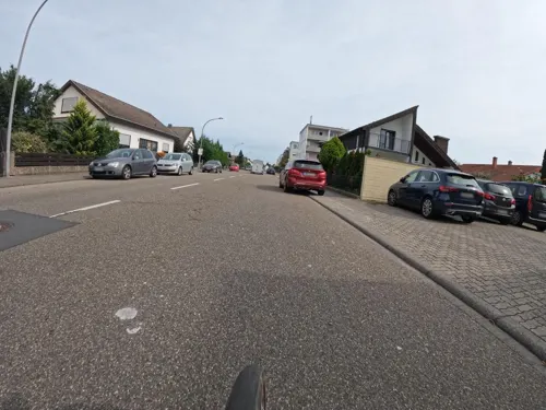
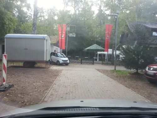
Naturfreundehaus Haßloch
Restaurant · 1.9 km
55 An der Fohlenweide, Haßloch
Mo-We 09:00-20:00; Fr-Su 09:00-20:00
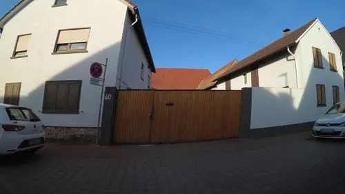
Pavia Restaurant
Restaurant · Italian · 3.8 km
31 Hauptstraße, Böhl-Iggelheim
Mo-We,Fr 16:00-22:00; PH,Sa,Su 12:00-22:00
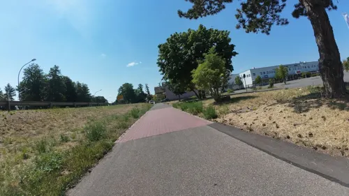
TSG-Gaststätte
Restaurant · Greek · 1.9 km
1 Ludwig-Gramlich-Straße, Haßloch
Mo-Su 11:30-14:30, 17:30-23:30
Zum Storchen
Restaurant · Regional
71 Kirchgasse, Haßloch
Tu-Fr 11:00-14:00,17:00-22:00; Sa,Su,PH 11:00-22:00


Richards Backhaus
Bakery · 3.9 km
31 Luitpoldstraße, Böhl-Iggelheim
Mo-Fr 06:00-12:00,14:00-18:00; Sa 06:00-12:00; Su 08:00-11:00
99 more on the map.
History
Haßloch's beginnings stretch at least as far back as Roman times with settlement activity by the Romans known to have been taking place about AD 400. About 500, the Alamanni were driven out of the area by the Franks. The village itself came into being sometime about 600, with its first documentary mention – as Hasalaha – coming in 773 or 774.
In 985, Haßloch was one of the many villages in the region subject to the Salischer Kirchenraub, or “Salian Church Robbery”, a land grab in which Otto I, Duke of Carinthia took over ownership of various landholdings formerly belonging to the Weißenburg Monastery (in the town now called Wissembourg in Alsace, France) on the Upper and Middle Rhine.
Some time between 900 and 1000, Haßloch became an Imperial Village. In 1186, Emperor Friedrich I Barbarossa spent the night in Haßloch. In 1330, Emperor Louis the Bavarian pledged Haßloch to the Electorate of the Palatinate, who then in turn pledged three fourths of this pledge to the Counts of Leiningen in the same year.
In 1621, during the Thirty Years' War, Haßloch was laid waste by the Spaniards. In 1689, it met the same fate again, more than once, in the Nine Years' War (known in Germany as the Pfälzischer Erbfolgekrieg, or War of the Palatine Succession), this time at the hands of the Spaniards and the French.
From the History section of Haßloch on Wikipedia, under CC BY-SA 4.0.
Where to stay9
Churches and places of worship18
Evangelische Christusgemeinde Böhl-Iggelheim
Church · Protestant · 3.8 km
9 Mühlwiesenstraße, Böhl-Iggelheim
Evangelische Brüdergemeinde
Church · Protestant · 0.7 km
43 Anilinstraße, Haßloch
Freie Evangelische Gemeinde Haßloch
Church · Evangelical · 0.7 km
56a Forstgasse, Haßloch
Shopping28
Gas and EV charging7
Fahrzeugtechnik Hess (Tankautomat)
Gas station · 1.6 km
107 a Rennbahnstraße, Haßloch
Schools, colleges and libraries14
Healthcare10
Apotheke am MediZentrum
Clinic and pharmacy · 1.9 km
20 Hans-Böckler-Straße, Haßloch
Map of Haßloch
250 places. The map loads OpenStreetMap tiles when you open it.
Getting there and nearby towns
City-Airport Mannheim (MHG) is the nearest airport with scheduled flights listed in OpenStreetMap, 22 km away.
- Neustadt an der Weinstraße 9 km west, about 9 min by car
- Schifferstadt 9 km east, about 9 min by car
- Mutterstadt 11 km northeast, about 11 min by car
- Limburgerhof 12 km northeast, about 12 min by car
- Speyer 13 km east, about 13 min by car
- Herxheim am Berg 17 km north, about 17 min by car
- Ludwigshafen am Rhein 19 km northeast, about 19 min by car
- Ketsch 20 km east, about 20 min by car
- Mannheim 21 km northeast, about 21 min by car
- Landau in der Pfalz 21 km southwest, about 21 min by car
Drive times are estimates from straight-line distance, not routes.
Local news
Headlines from INDB.
Reviews, tips and questions
Loading what members have shared...
Sources and licences
- GeoNames (CC BY 4.0): population, coordinates, regions and time zone
- Mapillary (see each image): photos
- OpenStreetMap contributors (ODbL 1.0): places, airports, map data
- Wikidata (CC0 1.0): elevation, founding date, time zone, website, landmarks and historic places
- Wikimedia Commons (see each image): photos
- Wikipedia (CC BY-SA 4.0): overview and history text
Photo credits
- Hassloch 01, Immanuel Giel, CC0
- Haßloch Rathaus 20130604, Rudolf Stricker, CC BY-SA 2.0 de
- Haßloch evangelische Christuskirche 20130604, Rudolf Stricker, CC BY-SA 2.0 de
- Haßloch, Langgasse 20150908, P170, CC BY-SA 4.0
- Haßloch Christuskirche Orgelprospekt, Musiker TK, CC BY-SA 4.0
- Haßloch Christuskirche Orgelspieltisch, Musiker TK, CC BY-SA 4.0
- Haßloch Christuskirche Innenansicht, Musiker TK, CC BY-SA 4.0
- Haßloch Langgasse 66 (zu) 011 2018 09 09, Friedrich Haag, CC BY-SA 4.0
- Haßloch Langgasse 66 (zu) 012 2018 09 09, Friedrich Haag, CC BY-SA 4.0
- Haßloch Langgasse 66 (zu) 002 2018 09 09, Friedrich Haag, CC BY-SA 4.0
- Haßloch Langgasse 66 (zu) 014 2018 09 09, Friedrich Haag, CC BY-SA 4.0
- Haßloch Langgasse 66 (zu) 006 2018 09 09, Friedrich Haag, CC BY-SA 4.0
- Haßloch Langgasse 66 (zu) 003 2018 09 09, Friedrich Haag, CC BY-SA 4.0
- Haßloch Langgasse 66 (zu) 005 2018 09 09, Friedrich Haag, CC BY-SA 4.0
- Haßloch Langgasse 66 (zu) 013 2018 09 09, Friedrich Haag, CC BY-SA 4.0
- Haßloch Langgasse 66 (zu) 008 2018 09 09, Friedrich Haag, CC BY-SA 4.0
- Haßloch, Langgasse 20150908 (4), P170, CC BY-SA 4.0
- Haßloch Langgasse 66 (zu) 001 2018 09 09, Friedrich Haag, CC BY-SA 4.0
- Haßloch Langgasse 66 (zu) 007 2018 09 09, Friedrich Haag, CC BY-SA 4.0
- Haßloch Langgasse 66 (zu) 010 2018 09 09, Friedrich Haag, CC BY-SA 4.0
- Haßloch Langgasse 66 (zu) 004 2018 09 09, Friedrich Haag, CC BY-SA 4.0
- Haßloch Langgasse 66 (zu) 009 2018 09 09, Friedrich Haag, CC BY-SA 4.0
- Sky Scream Holiday Park, Coaster J, CC BY-SA 3.0
- Mußbacher Baggerweiher - panoramio, Stefan Hoffmann, CC BY 3.0
- Kirche Hassloch 03, Immanuel Giel, CC0
- Ehemalige katholische Kirche Iggelheim 01, Immanuel Giel, Public domain
- Böhl-Iggelheim Kirchenstraße23-01, Wegavision, CC0
- Böhl-Iggelheim Kirchenstr3-01, Wegavision, CC0
- Hauptstraße 77, Wegavision, CC0
- Böhl-Iggelheim Hauptstraße73, Wegavision, CC0
- Böhl-Iggelheim Kirchenstraße 1, Wegavision, CC0
- Barockes Steinkreuz Böhl-Iggelheim Kirchenstraße, Wegavision, CC0
- Lochbusch-Königswiesen, Von Hassloch Richtung Golfplatz Geinsheim, Majormum, CC BY-SA 4.0
- Katholische Kirche Boehl 02, Immanuel Giel, Public domain
- 015 2015 08 27 Kulturdenkmaeler Hassloch, Friedrich Haag, CC BY-SA 4.0
- 013 2015 07 09 Kulturdenkmaeler Hassloch, Friedrich Haag, CC BY-SA 4.0
- 016 2015 07 09 Kulturdenkmaeler Hassloch, Friedrich Haag, CC BY-SA 4.0
- 012 2015 07 09 Kulturdenkmaeler Hassloch, Friedrich Haag, CC BY-SA 4.0
- Hassloch langgasse-87 20120914 621e, Georg Slickers, CC BY-SA 3.0
- 011 2015 07 09 Kulturdenkmaeler Hassloch, Friedrich Haag, CC BY-SA 4.0
- Iggelheim Altes Rathaus 20130605, Rudolf Stricker, CC BY-SA 2.0 de
- Plopsaland Deutschland Splash Battle, Freak-Line-Community, CC BY-SA 4.0
- Street-level photo, changchun1, CC BY-SA 4.0
- Street-level photo, VIA_DT, CC BY-SA 4.0
- Street-level photo, wegavision, CC BY-SA 4.0
- Street-level photo, wegavision, CC BY-SA 4.0
- Street-level photo, wegavision, CC BY-SA 4.0
- Street-level photo, ec411, CC BY-SA 4.0
- Street-level photo, ec411, CC BY-SA 4.0
- Street-level photo, teddy73, CC BY-SA 4.0
- Street-level photo, teddy73, CC BY-SA 4.0
- Street-level photo, changchun1, CC BY-SA 4.0
- Street-level photo, wegavision, CC BY-SA 4.0
- Street-level photo, changchun1, CC BY-SA 4.0
- Street-level photo, wegavision, CC BY-SA 4.0
- Street-level photo, wegavision, CC BY-SA 4.0
- Street-level photo, wegavision, CC BY-SA 4.0
- Street-level photo, wegavision, CC BY-SA 4.0
- Street-level photo, wegavision, CC BY-SA 4.0
- Street-level photo, wegavision, CC BY-SA 4.0
- Street-level photo, teddy73, CC BY-SA 4.0
- Street-level photo, teddy73, CC BY-SA 4.0
- Street-level photo, wegavision, CC BY-SA 4.0
- Street-level photo, wegavision, CC BY-SA 4.0
- Street-level photo, changchun1, CC BY-SA 4.0
- Street-level photo, cohead, CC BY-SA 4.0
- Street-level photo, cohead, CC BY-SA 4.0
- Street-level photo, wegavision, CC BY-SA 4.0
- Street-level photo, teddy73, CC BY-SA 4.0
- Street-level photo, changchun1, CC BY-SA 4.0
- Street-level photo, lvl5, CC BY-SA 4.0
- Street-level photo, teddy73, CC BY-SA 4.0


Page built November 8, 2026. Spotted a mistake? Tell us or suggest a place.