


Why visit Heilsbronn
Townapedia lists 89 museums and landmarks, 8 parks and trails, 59 places to eat, 4 places to stay and 24 attractions in and around town.
Highlights include Aschberg, Boxberg, Pfarramt and Kettelbach.
Weather in Heilsbronn
Forecast from MET Norway (CC BY 4.0). Full forecast
About Heilsbronn
Heilsbronn (German pronunciation: [haɪlsˈbʁɔn] ) is a town in the Ansbach district of the Mittelfranken administrative region of Franconia, in the German state of Bavaria between Nuremberg and Ansbach, in the wooded valley of the Rangau. Its hallmark is the Katharinenturm, a medieval tower.
From the Wikipedia article Heilsbronn (this version), under CC BY-SA 4.0.
Things to do24

12 more on the map.
Museums and landmarks89

Pfarramt
Monument and historic site
8 Pfarrgasse, Heilsbronn
Mo 09:00-12:00; We 09:00-12:00; Fr 09:00-12:00; Th 15:30-17:30



Alte Post
Monument and historic site · 4.4 km
22 Großhabersdorfer Straße, Heilsbronn


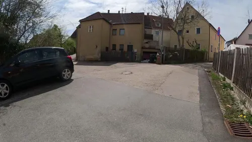


Ehemaliges Forsthaus
Monument and historic site · 2.3 km
15 Sonnenstraße, Heilsbronn
77 more on the map.
Parks, trails and playgrounds8



Restaurants and cafes59

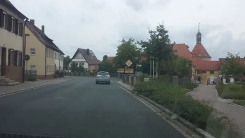
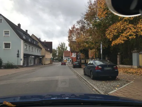
Gasthof Schönau
Restaurant · Italian
38 Neuendettelsauer Straße, Heilsbronn
Mo-Tu,Th-Sa 12:00-22:30; Su 11:30-22:00
Aurach-Stüberl
Restaurant · Fish, Regional · 2.7 km
4 Klosterstraße, Neuendettelsau
We-Fr 17:00-21:00; Sa,Su 10:00-21:00
Gasthaus Lutz
Restaurant · German, Regional · 2.7 km
23 Bürgleiner Straße, Heilsbronn
Tu-Sa 16:00-22:00; Su 11:00-14:00,16:00-21:00
Kupfers Landbistro
Cafe · Regional · 0.6 km
2 Am Klosterwald, Heilsbronn
Mo-Fr 07:00-18:00; Sa 08:00-14:00
Restaurant zur Friedenseiche
Restaurant · Greek · 4.3 km
5 Großhabersdorfer Straße, Heilsbronn
Tu-Sa 17:00-00:00; Su 11:00-14:00, 17:00-00:00

Stoff am Turm
Cafe · Coffee Shop
23 Hauptstraße, Heilsbronn
Mo-Tu 09:00-13:00, 15:00-18:00; Th-Fr 09:00-13:00, 15:00-18:00
Zur Linde
Restaurant · German, Regional · 5.2 km
2, Heilsbronn
week 02-52/2 Tu 11:00-21:30 open "Schaschlik", Th-Su 11:00-21:30; PH off

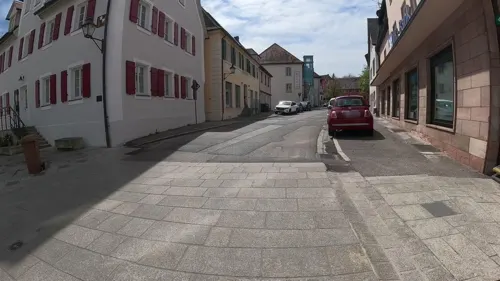


Pizzeria Catania
Restaurant · Italian
15 Marktplatz, Heilsbronn
Tu,We 17:00-22:00; Th-Su 11:00-22:00; Mo off
Adler
Restaurant · Regional
3 Kammereckerplatz, Heilsbronn
Mo-Tu,Th-Su 15:00-19:00+
47 more on the map.
Where to stay4
Churches and places of worship21
St. Laurentius
Church · Lutheran · 5.2 km
Wilhelm-Löhe-Straße, Neuendettelsau
St. Nikolai
Church · Lutheran · 5.6 km
2 1/2 Hauptstraße, Neuendettelsau
Shopping17
Gas and EV charging4
Schools, colleges and libraries18
Healthcare6
Diakoneo Gesundheitszentrum Mittelfranken
Clinic and pharmacy · 4.7 km
44 Heilsbronner Straße, Neuendettelsau
Praeventicus-Apotheke
Clinic and pharmacy · 4.1 km
3a Altendettelsauer Straße, Petersaurach
Map of Heilsbronn
250 places. The map loads OpenStreetMap tiles when you open it.
Getting there and nearby towns
Albrecht Dürer Airport Nuremberg (NUE) is the nearest airport with scheduled flights listed in OpenStreetMap, 28 km away.
- Petersaurach 5 km southwest, about 5 min by car
- Neuendettelsau 6 km south, about 6 min by car
- Roßtal 10 km northeast, about 10 min by car
- Dietenhofen 10 km northwest, about 10 min by car
- Windsbach 10 km south, about 10 min by car
- Ansbach 14 km west, about 14 min by car
- Cadolzburg 14 km north, about 14 min by car
- Oberasbach 16 km northeast, about 16 min by car
- Schwabach 17 km east, about 17 min by car
- Zirndorf 17 km northeast, about 17 min by car
Drive times are estimates from straight-line distance, not routes.
Local news
Headlines from INDB.
Reviews, tips and questions
Loading what members have shared...
Sources and licences
- GeoNames (CC BY 4.0): population, coordinates, regions and time zone
- Mapillary (see each image): photos
- OpenStreetMap contributors (ODbL 1.0): places, airports, map data
- Wikidata (CC0 1.0): elevation, founding date, time zone, website
- Wikimedia Commons (see each image): photos
- Wikipedia (CC BY-SA 4.0): overview and history text
Photo credits
- Konventhaus, Münster, Refektorium in Heilsbronn, Burkhard Mücke, CC BY-SA 4.0
- Katharinenturm Heilsbronn 2, Burkhard Mücke, CC BY-SA 4.0
- Heilsbronn, Ansbacher Straße 2, Living-wreck, CC BY-SA 4.0
- 2023-07-02 Führung zu Tombs and Epitaphs im Münster Heilsbronn 34, Burkhard Mücke, CC BY-SA 4.0
- Katharinenturm Heilsbronn 1, Burkhard Mücke, CC BY-SA 4.0
- 2023 Heilsbronn-Perspektiven 30, Burkhard Mücke, CC BY-SA 4.0
- 2023 Heilsbronn-Perspektiven 29, Burkhard Mücke, CC BY-SA 4.0
- 2023 Heilsbronn-Perspektiven 26, Burkhard Mücke, CC BY-SA 4.0
- 20260731 Kloster Heilsbronn-A6406877, Zinnmann, CC BY-SA 4.0
- 2023 Heilsbronn-Perspektiven 20, Burkhard Mücke, CC BY-SA 4.0
- 2023 Heilsbronn-Perspektiven 25, Burkhard Mücke, CC BY-SA 4.0
- Gebäude Spitalkapelle 6 in Heilsbronn, Burkhard Mücke, CC BY-SA 4.0
- 2023 Heilsbronn-Perspektiven 24, Burkhard Mücke, CC BY-SA 4.0
- Gründungsstein Spitalkapelle Heilsbronn, Burkhard Mücke, CC BY-SA 4.0
- Heilsbronn Spitalgasse 6 Nummernschild, Burkhard Mücke, CC BY-SA 4.0
- Epitaph des Schwanenordensritters Georg Sack im Kloster Heilsbronn, Brontesaurussss, CC0
- 20260731 Kloster Heilsbronn-A6406863, Zinnmann, CC BY-SA 4.0
- 20260731 Kloster Heilsbronn-A6406862, Zinnmann, CC BY-SA 4.0
- 2023-06-30 Altäre im Heilsbronner Münster 10, Burkhard Mücke, CC BY-SA 4.0
- 2023-06-30 Altäre im Heilsbronner Münster 12, Burkhard Mücke, CC BY-SA 4.0
- 2023-06-30 Altäre im Heilsbronner Münster 13, Burkhard Mücke, CC BY-SA 4.0
- Heilsbronn Kloster Lageplan P1051127 20200917, Karlunun, CC BY-SA 4.0
- Heilsbronn Klosterkirche Michael Drache P1051140 20200917, Karlunun, CC BY-SA 4.0
- 2023-06-30 Führung zu Tombs and epitaphs im Münster Heilsbronn 30, Burkhard Mücke, CC BY-SA 4.0
- 2023-06-30 Führung zu Tombs and epitaphs im Münster Heilsbronn 28, Burkhard Mücke, CC BY-SA 4.0
- 2023-06-30 Führung zu Tombs and epitaphs im Münster Heilsbronn 29, Burkhard Mücke, CC BY-SA 4.0
- 2023-06-30 Münster Heilsbronn am Bachkantatenwochende 04, Burkhard Mücke, CC BY-SA 4.0
- 2023-06-30 Führung zu Tombs and epitaphs im Münster Heilsbronn 03, Burkhard Mücke, CC BY-SA 4.0
- 2023-06-30 Führung zu Tombs and epitaphs im Münster Heilsbronn 25, Burkhard Mücke, CC BY-SA 4.0
- 2023-06-30 Führung zu Tombs and epitaphs im Münster Heilsbronn 24, Burkhard Mücke, CC BY-SA 4.0
- 2023-06-30 Führung zu Tombs and epitaphs im Münster Heilsbronn 27, Burkhard Mücke, CC BY-SA 4.0
- 2023-06-30 Führung zu Tombs and epitaphs im Münster Heilsbronn 26, Burkhard Mücke, CC BY-SA 4.0
- 2023-06-30 Führung zu Tombs and epitaphs im Münster Heilsbronn 21, Burkhard Mücke, CC BY-SA 4.0
- 2023-06-30 Führung zu Tombs and epitaphs im Münster Heilsbronn 23, Burkhard Mücke, CC BY-SA 4.0
- 2023-07-02 Führung zu Tombs and epitaphs im Münster Heilsbronn 19, Burkhard Mücke, CC BY-SA 4.0
- 2023-06-30 Führung zu Tombs and epitaphs im Münster Heilsbronn 31, Burkhard Mücke, CC BY-SA 4.0
- 2023-06-30 Führung zu Tombs and epitaphs im Münster Heilsbronn 32, Burkhard Mücke, CC BY-SA 4.0
- 2023-07-02 Führung zu Tombs and epitaphs im Münster Heilsbronn 20, Burkhard Mücke, CC BY-SA 4.0
- 2023-06-30 Führung zu Tombs and epitaphs im Münster Heilsbronn 22, Burkhard Mücke, CC BY-SA 4.0
- 2023-06-30 Führung zu Tombs and epitaphs im Münster Heilsbronn 02, Burkhard Mücke, CC BY-SA 4.0
- St. Mauritius (Gleizendorf) 1179, AlexanderRahm, CC BY 3.0
- Kirche Wicklesgreuth0289, AlexanderRahm, CC BY 3.0
- Kirche Bruckberg 1348, AlexanderRahm, CC BY 3.0
- St. Maria (Großhaslach) 2, Mkummerer, CC BY-SA 3.0
- St. Peter (Petersaurach) 0395, AlexanderRahm, CC BY 3.0
- Hauptstraße 20 Petersaurach 01, Aarp65, CC BY-SA 4.0
- Heilsbronn, Pfarrgasse 1-001, Tilman2007, CC BY-SA 3.0
- Heilsbronn, Kammereckerplatz 3-001, Tilman2007, CC BY-SA 3.0
- Gasthaus Zur Post Bürglein, WMguegafue, CC BY-SA 4.0
- Heilsbronn, Hauptstraße 24-001, Tilman2007, CC BY-SA 3.0
- Heilsbronn Alte Abtei, Photo: Andreas Praefcke, CC BY 3.0
- Heilsbronn, Hauptstraße 1-001, Tilman2007, CC BY-SA 3.0
- Religionspädagogisches Zentrum Heilsbronn 19, Burkhard Mücke, CC BY-SA 4.0
- Brauereiwohnhaus in Bonnhof, Seitenansicht, Peidakiwi17, CC BY-SA 4.0
- St. Johannes (Bürglein) 2, Matze.fu, CC BY 3.0
- Evangelische Kirche (Ketteldorf) 1086, AlexanderRahm, CC BY 3.0
- 2023-06-30 Münster Heilsbronn am Bachkantatenwochende 09, Burkhard Mücke, CC BY-SA 4.0
- St. Michael (Weißenbronn), Matze.fu, CC BY 3.0
- St. Matthäus (Markttriebendorf) 0948, AlexanderRahm, CC BY 3.0
- St. Laurentius Neuendettelsau3, Aarp65, CC BY-SA 3.0
- St. Nikolai (Neuendettelsau), Strahtw, CC BY-SA 3.0
- Street-level photo, renade, CC BY-SA 4.0
- Street-level photo, joniarida, CC BY-SA 4.0
- Street-level photo, soulcover, CC BY-SA 4.0
- Street-level photo, HeiKue, CC BY-SA 4.0
- Street-level photo, HeiKue, CC BY-SA 4.0
- Street-level photo, HeiKue, CC BY-SA 4.0
- Street-level photo, HeiKue, CC BY-SA 4.0
- Street-level photo, HeiKue, CC BY-SA 4.0
- Street-level photo, HeiKue, CC BY-SA 4.0
- Street-level photo, HeiKue, CC BY-SA 4.0
- Street-level photo, HeiKue, CC BY-SA 4.0
- Street-level photo, HeiKue, CC BY-SA 4.0
- Street-level photo, joniarida, CC BY-SA 4.0
- Street-level photo, joniarida, CC BY-SA 4.0
- Street-level photo, joniarida, CC BY-SA 4.0


Page built November 9, 2026. Spotted a mistake? Tell us or suggest a place.