


Why visit Windsbach
Townapedia lists 7 museums and landmarks, 4 parks and trails, 11 places to eat, 2 places to stay and 6 attractions in and around town.
Highlights include Stadtturm, Adenberg, Beß'n Haus and Oberes Tor.
Weather in Windsbach
Forecast from MET Norway (CC BY 4.0). Full forecast
About Windsbach
Windsbach station is a railway station in the municipality of Windsbach, located in the Ansbach district in Middle Franconia, Germany.
From the Wikipedia article Windsbach station (this version), under CC BY-SA 4.0.
Things to do6


Museums and landmarks7


Parks, trails and playgrounds4


Restaurants and cafes11


Konditorei-Café Helmreich
Cafe
23 Hauptstraße, Windsbach
Tu-Fr 07:30-12:00, 14:00-17:00; Sa 07:30-12:00; Su, PH 08:00-17:00
Il Corso
Restaurant · Italian
4 Heinrich-Brandt-Straße, Windsbach
Tu-Su 11:00-24:00
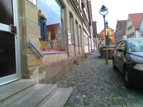
Pizza & Eis Venezia
Restaurant · Italian
18 Hauptstraße, Windsbach
Apr-Aug Tu-Sa 14:00-21:30; Su, PH 11:00-21:30; Jan-Mar, Sep-Dec...

Klause Windsbach
Bar and pub
"Meist Donnerstag Abend zu besonderen Anlässen Samstag Abend"

Felsenbrand GbR Abfindungsbrennerei
Brewery and winery · 0.6 km
5 Fichtenstraße, Windsbach
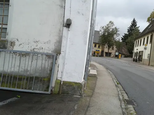


Where to stay2
Churches and places of worship5
Christenruhkapelle
Church · Lutheran
12 Retzendorfer Straße, Windsbach
St. Bonifatius
Church · Roman Catholic
44 Ansbacher Straße, Windsbach
Shopping4
Gas and EV charging3
Schools, colleges and libraries3
Healthcare2
Map of Windsbach
47 places. The map loads OpenStreetMap tiles when you open it.
Getting there and nearby towns
Albrecht Dürer Airport Nuremberg (NUE) is the nearest airport with scheduled flights listed in OpenStreetMap, 33 km away.
- Gunzenhausen 15 km south, about 15 min by car
- Schwabach 17 km northeast, about 17 min by car
- Ansbach 18 km west, about 18 min by car
- Roßtal 17 km north, about 17 min by car
- Roth 19 km east, about 19 min by car
- Oberasbach 22 km northeast, about 22 min by car
- Zirndorf 24 km northeast, about 24 min by car
- Cadolzburg 23 km north, about 23 min by car
- Fürth 28 km northeast, about 28 min by car
- Nuremberg 29 km northeast, about 29 min by car
Drive times are estimates from straight-line distance, not routes.
Local news
Headlines from INDB.
Reviews, tips and questions
Loading what members have shared...
Sources and licences
- GeoNames (CC BY 4.0): population, coordinates, regions and time zone
- Mapillary (see each image): photos
- OpenStreetMap contributors (ODbL 1.0): places, airports, map data
- Wikidata (CC0 1.0): elevation, founding date, time zone, website
- Wikimedia Commons (see each image): photos
- Wikipedia (CC BY-SA 4.0): overview and history text
Photo credits
- Hauptstraße 25 (Windsbach), Strahtw, CC BY-SA 3.0
- Windsbach Hauptstraße 27, Strahtw, CC BY-SA 3.0
- Hauptstraße 16 (Windsbach), Strahtw, CC BY-SA 3.0
- Hauptstraße 10-Windsbach, Strahtw, CC BY-SA 3.0
- Rathaus Windsbach 01, Aarp65, CC BY-SA 3.0
- Rathaus Windsbach 02, Aarp65, CC BY-SA 3.0
- Hauptstraße 14 (Windsbach), Strahtw, CC BY-SA 3.0
- Windsbach Hauptstraße 6, Strahtw, CC BY-SA 3.0
- Hauptstraße 24 (Windsbach), Strahtw, CC BY-SA 3.0
- Windsbach Hauptstraße 4, Strahtw, CC BY-SA 3.0
- Windsbach Hauptstraße 13-Amtshaus, Strahtw, CC BY-SA 3.0
- Windsbach Hauptstraße 4-6, Strahtw, CC BY-SA 3.0
- Hintere Gasse 21 (Windsbach), Strahtw, CC BY-SA 3.0
- Hauptstraße 28 (Windsbach), Strahtw, CC BY-SA 3.0
- Schwabacher Tor Windsbach, Aarp65, CC BY-SA 3.0
- Kolbenstraße 52 (Windsbach) 2, Strahtw, CC BY-SA 3.0
- Franken, Windsbach - geo.hlipp.de - 5028, Udo und Joan Fugel on geo.hlipp.de, CC BY-SA 2.0
- Scheune hinter Hauptstraße 10 (Windsbach), Strahtw, CC BY-SA 3.0
- Ehemalige Schule Windsbach, Aarp65, CC BY-SA 3.0
- Windsbacher Stadtmauer am Oberen Tor, Strahtw, CC BY-SA 3.0
- Oberes Tor Windsbach, Strahtw, CC BY-SA 3.0
- Windsbach - Oberes Tor - 01, Howwi, CC BY-SA 3.0
- St. Margareta Windsbach 05, Aarp65, CC BY-SA 3.0
- St. Margareta Windsbach 03 (cropped), Aarp65, CC BY-SA 3.0
- St. Margareta Windsbach 04, Aarp65, CC BY-SA 3.0
- St. Margareta Windsbach 03, Aarp65, CC BY-SA 3.0
- St. Margareta Windsbach 02, Aarp65, CC BY-SA 3.0
- St. Margareta Windsbach 01, Aarp65, CC BY-SA 3.0
- Windsbach - Evangelisch-Lutherisches Dekanatamt - 03, Howwi, CC BY-SA 3.0
- Kolbenstraße 50 (Windsbach), Scheune, Strahtw, CC BY-SA 3.0
- Kolbenstraße 52 (Windsbach) 1, Strahtw, CC BY-SA 3.0
- Windsbach Hauptstraße 5-Gasthaus Stern, Strahtw, CC BY-SA 3.0
- Windsbach Hauptstraße 3, Strahtw, CC BY-SA 3.0
- Kolbenstraße 8 (Windsbach), Pfarrhaus, Strahtw, CC BY-SA 3.0
- Windsbach - Evangelisch-Lutherisches Dekanatamt - 02, Howwi, CC BY-SA 3.0
- Evangelisch-lutherisches Studienheim Windsbach 01, Aarp65, CC BY-SA 3.0
- Johann-Sebastian-Bach-Gymnasium in Windsbach 04, Aarp65, CC BY-SA 3.0
- Windsbach Kirchplatz 3-4, Strahtw, CC BY-SA 3.0
- Kriegerdenkmal in Windsbach2, Aarp65, CC BY-SA 3.0
- Friedhofskapelle Windsbach, Strahtw, CC BY-SA 3.0
- Windsbach, Oberes Tor, 001, Tilman2007, CC BY-SA 4.0
- Windsbach, Markgrafenbrücke, 001, Tilman2007, CC BY-SA 4.0
- Windsbach, Hauptstraße 13, 003, Tilman2007, CC BY-SA 4.0
- St. Bonifatius, Windsbach (1), Fl.schmitt, CC0
- Windsbach, Hauptstraße 19, 001, Tilman2007, CC BY-SA 4.0
- Gottesruhkapelle-14, Strahtw, CC BY-SA 3.0
- St Margarete - Windsbach-000, DALIBRI, CC BY-SA 4.0
- St. Laurentius Wernsbach 2337, AlexanderRahm, CC BY 3.0
- Stadtturm Windsbach, Aarp65, CC BY-SA 3.0
- Windsbacher Stadtmauer bei Kolbenstraße, Strahtw, CC BY-SA 3.0
- Street-level photo, bernd_niemann, CC BY-SA 4.0
- Street-level photo, wegavision, CC BY-SA 4.0
- Street-level photo, bernd_niemann, CC BY-SA 4.0
- Street-level photo, bernd_niemann, CC BY-SA 4.0
- Street-level photo, bernd_niemann, CC BY-SA 4.0
- Street-level photo, bernd_niemann, CC BY-SA 4.0
- Street-level photo, wegavision, CC BY-SA 4.0
- Street-level photo, wegavision, CC BY-SA 4.0
- Street-level photo, bernd_niemann, CC BY-SA 4.0
- Street-level photo, bernd_niemann, CC BY-SA 4.0


Page built November 9, 2026. Spotted a mistake? Tell us or suggest a place.