


Why visit Roßtal
Townapedia lists 14 museums and landmarks, 26 parks and trails, 51 places to eat, 7 places to stay and 20 attractions in and around town.
Highlights include Bauernladen Hofmann, Bauernladen Insenhöfer, Museumshof Roßtal and Playmobil Funpark.
Weather in Roßtal
Forecast from MET Norway (CC BY 4.0). Full forecast
About Roßtal
Roßtal is a market town in the district of Fürth, Bavaria, Germany. It has a population of 9,739 as of 2023. It has a primary school and a secondary school. The church is named St.
From the Wikipedia article Roßtal (this version), under CC BY-SA 4.0.
Things to do20

Bauernladen Hofmann
Farm and orchard · 4.6 km
5 Fernabrünster Hauptstraße, Großhabersdorf
Fr 12:00-18:00; Sa 09:00-14:00
Bauernladen Insenhöfer
Farm and orchard · 1.4 km
12 Erlachstraße, Roßtal
Sa 07:00-13:00

8 more on the map.
Museums and landmarks14


2 more on the map.
Parks, trails and playgrounds26

Playmobil Funpark
Sports field and stadium · 5.6 km
2-10 Brandstätterstraße, Zirndorf
Mo-Su,PH 09:00-19:00

14 more on the map.
Restaurants and cafes51
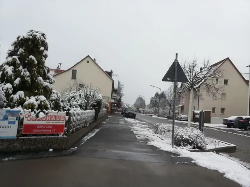
Hotel Ristorante Regina
Restaurant · Italian · 3.8 km
28 Ansbacher Straße, Zirndorf
Mo-Sa 11:30-14:30,17:00-22:00; Su,PH 11:30-14:30,17:00-21:00

Zum DEDDÈ
Bar and pub · Pizza, Burger
1 Pelzleinstraße, Roßtal
Mo-Sa 16:00-22:00; We off; Su 12:00-21:00
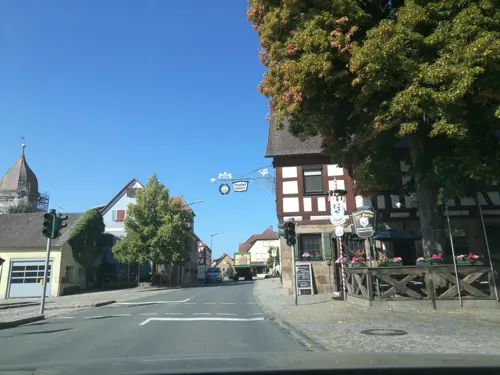
Ammerndorfer Brauerei
Restaurant · Regional · 3.8 km
1-2 Marktplatz, Ammerndorf
Mo-Fr 08:00-12:00, 13:00-18:00; Sa 08:00-12:00

Gasthof Schwarzer Adler
Restaurant · German · 5.8 km
20 Gutzberger Dorfstraße, Stein
09:30-19:30; Mo off
Pizzeria Zum Hopfenweg
Restaurant · Italian · 5.9 km
35 Leitelshofer Straße, Rohr OT Regelsbach
We-Su 17:30-22:00; PH 17:30-22:00; Mo,Tu off
Zur frischen Quelle
Restaurant · German · 5.1 km
8 Rehdorfer Straße, Oberasbach
We-Mo 11:30-22:00; Tu off



39 more on the map.
Where to stay7
Churches and places of worship15
Maria Königin
Church · Roman Catholic · 2.8 km
14 Zuckermandelweg, Roßtal
St. Peter und Paul
Church · Protestant · 3.9 km
4 Steingruberstraße, Ammerndorf
Neuapostolische Kirche
Church · New Apostolic · 5.2 km
2 Rudolf-Diesel-Straße, Zirndorf
Shopping10
Gas and EV charging3
Schools, colleges and libraries5
Healthcare3
Map of Roßtal
154 places. The map loads OpenStreetMap tiles when you open it.
Getting there and nearby towns
Albrecht Dürer Airport Nuremberg (NUE) is the nearest airport with scheduled flights listed in OpenStreetMap, 18 km away.
- Zirndorf 7 km northeast, about 7 min by car
- Fürth 11 km northeast, about 11 min by car
- Schwabach 12 km southeast, about 12 min by car
- Nuremberg 15 km northeast, about 15 min by car
- Wendelstein 20 km east, about 20 min by car
- Roth 22 km southeast, about 22 min by car
- Erlangen 23 km north, about 23 min by car
- Röthenbach an der Pegnitz 27 km east, about 27 min by car
- Weißenburg in Bayern 41 km south, about 41 min by car
- Treuchtlingen 49 km south, about 49 min by car
Drive times are estimates from straight-line distance, not routes.
Local news
Headlines from INDB.
Reviews, tips and questions
Loading what members have shared...
Sources and licences
- GeoNames (CC BY 4.0): population, coordinates, regions and time zone
- Mapillary (see each image): photos
- OpenStreetMap contributors (ODbL 1.0): places, airports, map data
- Wikidata (CC0 1.0): elevation, founding date, time zone, website
- Wikimedia Commons (see each image): photos
- Wikipedia (CC BY-SA 4.0): overview and history text
Photo credits
- Rosstal2017-06-11 28 Ortskern, Franck-N, CC BY-SA 4.0
- Roßtal - Kirche Gesamt, Wolfgang Sauber, CC BY-SA 3.0
- Spitzweed-Teich Roßtal 02, Aarp65, CC BY-SA 3.0
- Spitzweed-Teich Roßtal 01, Aarp65, CC BY-SA 3.0
- Kindergarten in Roßtal (Richtersgasse 33), Aarp65, CC BY-SA 3.0
- Spitzweed-Scheune Roßtal (Schulstraße 25) 02, Aarp65, CC BY-SA 3.0
- Blumengeschäft (Rathausgasse 22) in Roßtal, Aarp65, CC BY-SA 3.0
- Spitzweed-Scheune Roßtal (Schulstraße 25) 01, Aarp65, CC BY-SA 3.0
- Roßtal St Laurentius 001, Janericloebe, CC BY 3.0
- Roßtal St.Lorenz - Ölberg, Wolfgang Sauber, CC BY-SA 3.0
- Pfarrkirche St. Peter und Paul, Ammerndorf, Hans-Jürgen Neubert, CC BY 4.0
- Vincenzenbronn-Ansicht von Südosten mit Kirche über Kirchhofmauer in erhöhter Lage am Ortsrand-23022012, Robert Pietschmann, CC BY-SA 4.0
- BuchschwabachMariaMagdalena, Kassandro, CC BY-SA 3.0
- D-5-73-125-32 Sankt Jakob Sankt Aegidius Buttendorf Roßtal, Optophonic, CC BY-SA 3.0
- Rosstal-Ansicht von Westsüdwest aus dem Ort mit Kirche sowie möglicherweise ehemaligen (jetzt veränderten) Gaden-28052012, Robert Pietschmann, CC BY-SA 4.0
- FÜRoßtalWeitersdorf01, Ammerseer, CC BY-SA 3.0
- Playmobil-funpark-zirndorf-eingang, Manuela2, CC BY-SA 3.0
- Vincenzenbronn-Ansicht von Nordwesten mit Kirche über Kirchhofmauer-23022012, Robert Pietschmann, CC BY-SA 4.0
- Rosstal2017-06-11 25 Ortskern, Franck-N, CC BY-SA 4.0
- Rosstal2017-06-11 01 Kirche, Franck-N, CC BY-SA 4.0
- Rosstal2017-06-11 04 Kirche, Franck-N, CC BY-SA 4.0
- Rosstal2017-06-11 07 Kirche, Franck-N, CC BY-SA 4.0
- Rosstal2017-06-11 05 Kirche, Franck-N, CC BY-SA 4.0
- Rosstal2017-06-11 03 Kirche, Franck-N, CC BY-SA 4.0
- Rosstal2017-06-11 02 Kirche, Franck-N, CC BY-SA 4.0
- D-5-73-125-14 Spitzweed-Scheune Rosstal SW, Optophonic, CC BY-SA 3.0
- D-5-73-125-14 Spitzweed-Scheune Rosstal NO, Optophonic, CC BY-SA 3.0
- D-5-73-125-14 Spitzweed-Scheune Rosstal SO, Optophonic, CC BY-SA 3.0
- Rosstal2017-06-11 06 Kirche, Franck-N, CC BY-SA 4.0
- Rosstal2017-06-11 24 Kirche, Franck-N, CC BY-SA 4.0
- Rosstal2017-06-11 11 Kirche, Franck-N, CC BY-SA 4.0
- Rosstal2017-06-11 08 Kirche, Franck-N, CC BY-SA 4.0
- Rosstal2017-06-11 23 Kirche, Franck-N, CC BY-SA 4.0
- Rosstal2017-06-11 09 Kirche, Franck-N, CC BY-SA 4.0
- Spitzweed-Scheune von 1829 - panoramio, Siegmar S., CC BY-SA 3.0
- Rosstal - Ansicht von Osten mit Kirche über Chor sowie Rest der alten Kirchhofmauer von Ortsseite - 28052012, Robert Pietschmann, CC BY-SA 4.0
- D-5-73-125-16 Mesnerhaus Rosstal, Optophonic, CC BY-SA 3.0
- Blumengeschäft an der Ecke Rathausgasse Schulstraße, Aarp65, CC BY-SA 3.0
- Rosstal2017-06-11 12 Kirche, Franck-N, CC BY-SA 4.0
- D-5-73-125-15 Zweites Pfarrhaus Rosstal, Optophonic, CC BY-SA 3.0
- Street-level photo, schnatterfleck, CC BY-SA 4.0
- Street-level photo, mike409, CC BY-SA 4.0
- Street-level photo, geo, CC BY-SA 4.0
- Street-level photo, chri_som, CC BY-SA 4.0
- Street-level photo, geo, CC BY-SA 4.0
- Street-level photo, soulcover, CC BY-SA 4.0
- Street-level photo, chri_som, CC BY-SA 4.0
- Street-level photo, changchun1, CC BY-SA 4.0
- Street-level photo, mike409, CC BY-SA 4.0
- Street-level photo, thetornado76, CC BY-SA 4.0


Page built November 8, 2026. Spotted a mistake? Tell us or suggest a place.