


Why visit Ansbach
Townapedia lists 253 museums and landmarks, 20 parks and trails, 148 places to eat, 13 places to stay and 16 attractions in and around town.
Highlights include Verein Ansbacher Kammerspiele e. V., Borkholder-Haus, Stadthaus and Regierung von Mittelfranken, Dienstgebäude Bischof-Meiser-Straße.
Weather in Ansbach
Forecast from MET Norway (CC BY 4.0). Full forecast
About Ansbach
Ansbach ( ANZ-bak, German: [ˈansbax] ; East Franconian: Anschba) is a city in the German state of Bavaria. It is the capital of the administrative region of Middle Franconia. Ansbach is 40 kilometers (25 miles) southwest of Nuremberg and 140 kilometers (90 miles) north of Munich, on the river Fränkische Rezat, a tributary of the river Main. In 2020, its population was 41,681.
From the Wikipedia article Ansbach (this version), under CC BY-SA 4.0.
Travel tips from other travellers: Ansbach on Wikivoyage (CC BY-SA 4.0).
Photos of Ansbach


Things to do16
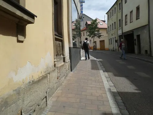





4 more on the map.
Museums and landmarks253

Stadthaus
Monument and historic site · 1.5 km
1 Johann-Sebastian-Bach-Platz, Ansbach
Mo-Fr 10:00-17:00; Sa 10:00-14:00

Regierung von Mittelfranken, Dienstgebäude Bischof-Meiser-Straße
Monument and historic site · 1.2 km
2 - 4 Bischof-Meiser-Straße, Ansbach


Karolinenschule
Monument and historic site · 1.3 km
27 Karolinenstraße, Ansbach
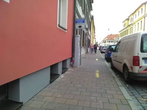



Brodswinder Mühle
Monument and historic site · 4.5 km
15 Wallersdorfer Straße, Ansbach
241 more on the map.
Parks, trails and playgrounds20

Hofgarten
Park · 0.9 km
Mar: Mo-Su 07:15-20:00; Apr-Aug: Mo-Su 07:15-22:00; Sep-Oct:...



Aquella
Sports field and stadium · 2.5 km
In and outdoors
Mo 09:30-21:00; Tu-Sa 07:00-21:00; Su,PH 07:00-20:00

Leonhart-Fuchs-Garten
Park · 1.2 km
Mar: Mo-Su 07:15-20:00; Apr-Aug: Mo-Su 07:15-22:00; Sep-Oct:...

Kinderspielplatz Buchenweg 5a
Playground · 5.2 km
5a Buchenweg, Sachsen bei Ansbach
8 more on the map.
Restaurants and cafes148
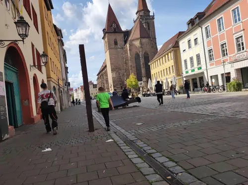
Gaststätte Kaspar Hauser
Restaurant · Italian · 1.5 km
Viel vegetarische und vegane Gerichte
10 Pfarrstraße, Ansbach
Tu-Sa 17:00-21:00; Su,Mo off
Mamma Mia Eiscafè - Cocktail Bar - Restaurant
Restaurant · Italian, Noodle, Coffee Shop, Ice Cream, Pizza · 1.6 km
2-6 Residenzstraße, Ansbach
Mo-Sa 12:30-19:00; PH closed
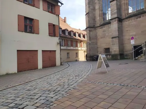
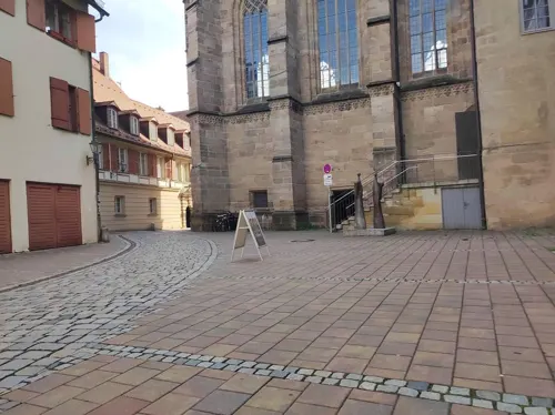
Green & Bean
Cafe · Coffee Shop, Sandwich, Cake · 1.4 km
1 Reitbahn, Ansbach
Mo-Fr 09:30-17:00; Sa 09:30-14:00
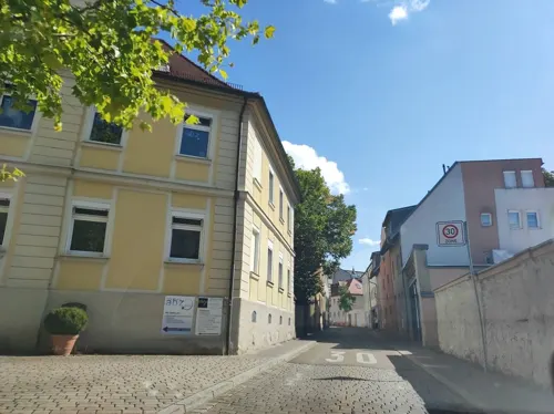
Kammerkneipe
Restaurant · Pizza, Burger · 1.7 km
29 Maximilianstraße, Ansbach
Su-Th 18:00-01:00; Fr, Sa 18:00-02:00
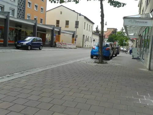
La Taverna
Restaurant · Italian, Italian Pizza · 1.3 km
7 Bahnhofsplatz, Ansbach
We-Mo 11:00-14:00, 17:00-22:00; Tu off

An der Schwedenschanze
Restaurant · Regional · 2.0 km
1 Zur Schwedenschanz, Ansbach
Mo off; Tu "nur Mittagstisch"; We off; Fr-Sa 11:30-14:30,...
Bratwurst-Glöckle
Restaurant · Regional · 1.5 km
4 Uzstraße, Ansbach
Mo off; Tu-Sa 11:30-14:30, 17:30-22:30 open "warme Küche bis 21...
Gasthaus Landisch
Restaurant · Regional, German · 5.2 km
29 Hauptstraße, Sachsen bei Ansbach
Mo,Th 17:00+; Fr,Sa 11:00-13:00,17:00+; Su 11:00-14:00,17:00+
Gasthaus zum Mohren
Restaurant · German · 1.5 km
9 Pfarrstraße, Ansbach
Mo-Su 11:00-15:00, 17:00-23:00
Gasthof Schwarzes Roß
Restaurant · Regional · 4.1 km
21, Ansbach
Mo off;Tu 17:00-21:00;We 11:00-14:00, 17:00-21:00
Korfu
Restaurant · Greek · 1.6 km
21-23 Uzstraße, Ansbach
Mo-Su 11:30-14:30 "Küche bis 14:00", 17:00-22:30 "Küche bis 21:30"; Tu off
136 more on the map.
History
According to folklore, towards the end of the 7th century a group of Franconian peasants and their families went up into the wilderness to found a new settlement. Their leader Onold led them to an area called the "Rezattal" (Rezat valley). This is where they founded the "Urhöfe" (meaning the first farms: Knollenhof, Voggenhof and Rabenhof). Gradually more settlers, such as the "Winden-Tribe" came, and the farms grew into a small village. Many villages around Ansbach were founded by the "Winden" during that period (even today, their settlements can easily identified by their names, like Meinhardswinden, Dautenwinden or Brodswinden). A Benedictine monastery was established there around 748 by the Frankish noble St Gumbertus. The adjoining village of Onoltesbach was first noticed as a proper town in 1221.
The counts of Öttingen ruled over Ansbach until the Hohenzollern burgrave of Nürnberg took over in 1331. The Hohenzollerns made Ansbach the seat of their dynasty until their acquisition of the Margraviate of Brandenburg in 1415. After the 1440 death of Frederick I, a cadet branch of the family established itself as the margraves of Ansbach. George the Pious introduced the Protestant Reformation to Ansbach in 1528, leading to Gumbertus Abbey's secularization in 1563.
Read more of the history
The Markgrafenschloß was built between 1704 and 1738. Its gardens continued to be a notable attraction into the 1800s. In 1791, the last margrave sold his realm to the Kingdom of Prussia. In 1796, the Duke of Zweibrücken, Maximilian Joseph — the future Bavarian king— was exiled to Ansbach the French took Zweibrücken. In Ansbach, Maximilian von Montgelas wrote an elaborate concept for the future political organization of Bavaria, which is known as the Ansbacher Mémoire. Napoleon forced Prussia to cede Ansbach and its principality to Bavaria in the Franco-Prussian treaty of alliance signed at Schönbrunn Palace on 15 December 1805 at the end of the Third Coalition. Ansbach became the capital of the Rezatkreis ('Circle of the Rezat'). Bavarian ownership was confirmed by the 1815 Congress of Vienna; Prussia was compensated with the Bavarian Duchy of Berg. In 1837 the Rezatkreis became the circle of Middle Franconia. Following the unification of Germany Ansbach had a population of 12,635, which by 1925 had risen to 21,923.
Jewish families were resident in Ansbach from at least the end of the 18th century. They set up a Jewish Cemetery in the Ruglaender Strasse, which was vandalised and razed under the Nazi regime in the Kristallnacht. It was repaired in 1946, but it was damaged several times more. A plaque on the wall of the cemetery commemorates these events. The Jewish Congregation built its synagogue at No 3 Rosenbadstrasse, but it too was damaged by the SA, though it was not burnt down for fear of damaging the neighbouring buildings. It serves today as a "Symbolic House of God". A plaque in the entrance serves as a memorial to the synagogue and to Jewish residents who were murdered during the Holocaust. In 1940, at least 500 patients were deported from the Heil- und Pflegeanstalt Ansbach [Ansbach Medical and Nursing Clinic] to the extermination facilities Sonnenstein and Hartheim which were disguised as psychiatric institutions, as part of the Action T4 euthanasia action. They were gassed there. At the clinic in Ansbach itself, around 50 intellectually disabled children were injected with the drug Luminal and killed that way. A plaque was erected in their memory in 1988 in the local hospital at No. 38 Feuchtwangerstrasse.
During World War II, a subcamp of Flossenbürg concentration camp was located here. Also during the Second World War the Luftwaffe and Wehrmacht had bases here. The nearby airbase was the home station for the Stab & I/KG53 (Staff & 1st Group of Kampfgeschwader 53) operating 38 Heinkel He 111 bombers. On 1 September 1939 this unit was one of the many that participated in the attack on Poland that started the war. All of its bridges were destroyed during the course of the war. During the Western Allied invasion of Germany in April 1945, the airfield was seized by the United States Third Army, and used by the USAAF 354th Fighter Group which flew P-47 Thunderbolts from the aerodrome (designated ALG R-82) from late April until the German capitulation on 7 May 1945. At the end of the war, 19-year-old student Robert Limpert tried to get the town to surrender to the US Forces without a fight. He was betrayed by Hitler Youth and was hanged from the portal of the City Hall by the city's military commander, Col. (Oberst) Ernst Meyer. Several memorials to his heroic deed have been erected over the years, despite opposition from some residents — in the Ludwigskirche, in the Gymnasium Carolinum and at No 6 Kronenstrasse. After the Second World War, Ansbach belonged to the American Zone. The American Military authorities established a displaced persons (DP) camp in what used to be a sanatorium in what is today the Strüth quarter.
From the History section of Ansbach on Wikipedia, under CC BY-SA 4.0.
More about Ansbach
Economy
Around the time of the unification of Germany in 1871, the chief manufactures of Ansbach were woollen, cotton, and half-silk goods; earthenware; tobacco; cutlery; and playing cards. A considerable trade in grain, wool, and flax was also supported. By the onset of the First World War, it also produced machinery, toys, and embroidery.
Today there is a large density of plastics industry in the city and rural districts around Ansbach.
The city is known for making Peperami pork sausages and jerky.
From the Wikipedia article Ansbach, under CC BY-SA 4.0.
Notable people from Ansbach
 Albert, Duke in PrussiaDuke of Prussia from 1525 to 1568Photo: Lucas Cranach the Elder, Public domain
 Georg Ernst StahlGerman physician and chemist (1659-1734)Photo: Johann Georg Mentzel, Public domain
 John Cicero, Elector of BrandenburgElector of Brandenburg (1455–1499)Photo: Unknown author Unknown author, Public domain
 George of Brandenburg-AnsbachMargrave of Brandenburg-Ansbach (1484-1543)Photo: Hans Krell, Public domain
 George Frederick, Margrave of Brandenburg-AnsbachMargrave of Brandenburg-Ansbach, Regent of Prussia (1539-1603)Photo: Andreas Riehl the Younger, Public domain
 Albert Alcibiades, Margrave of Brandenburg-KulmbachMargrave of Brandenburg-Kulmbach (1527-1553)Photo: After Andreas Riehl (or Richl) the..., Public domain
- August von Platen-HallermündeGerman poet (1796-1835)
- Hermann FegeleinGerman lieutenant general in the Waffen-SS (1906–1945)
- Marcus Elieser BlochGerman physician and zoologist (1723–1799)
- Theodor EscherichAustrian doctor (1857–1911)
- Marie of Brandenburg-KulmbachGerman princess
- Frederick I, Margrave of Brandenburg-AnsbachMargrave of Brandenburg-Ansbach and Brandenburg-Bayreuth (1460-1536)
Born in Ansbach, according to Wikidata (CC0). Each name links to its Wikipedia article.
Where to stay13
Privatvermieter Popp-Hessenauer
Motel and hotel · 3.9 km
36 Meinhardswinden, Ansbach
Churches and places of worship32
St. Johannes der Täufer
Church · Lutheran · 5.5 km
30 Wernsbach, Weihenzell
St. Peter und Paul
Church · Lutheran · 4.5 km
14 Neukirchen, Sachsen bei Ansbach
Shopping43
Gas and EV charging9
Schools, colleges and libraries35
Healthcare15
Hof- und Rats-Apotheke
Clinic and pharmacy · 1.5 km
1 Martin-Luther-Platz, Ansbach
Map of Ansbach
250 places. The map loads OpenStreetMap tiles when you open it.
Getting there and nearby towns
Illesheim Army Heliport (ILH) is the nearest airport with scheduled flights listed in OpenStreetMap, 24 km away.
- Herrieden 10 km southwest, about 10 min by car
- Petersaurach 11 km east, about 11 min by car
- Dietenhofen 13 km northeast, about 13 min by car
- Leutershausen 13 km west, about 13 min by car
- Neuendettelsau 14 km east, about 14 min by car
- Heilsbronn 14 km east, about 14 min by car
- Windsbach 18 km east, about 18 min by car
- Markt Erlbach 21 km north, about 21 min by car
- Wilhermsdorf 22 km northeast, about 22 min by car
- Gunzenhausen 24 km southeast, about 24 min by car
Drive times are estimates from straight-line distance, not routes.
Towns near Ansbach


Keep exploring
Local news
Headlines from INDB.
Reviews, tips and questions
Loading what members have shared...
Sources and licences
- GeoNames (CC BY 4.0): population, coordinates, regions and time zone
- Mapillary (see each image): photos
- OpenStreetMap contributors (ODbL 1.0): places, airports, map data
- Wikidata (CC0 1.0): elevation, founding date, time zone, website, landmarks and historic places
- Wikimedia Commons (see each image): photos
- Wikipedia (CC BY-SA 4.0): overview and history text
Photo credits
- Ansbach, Martin-Luther-Platz-001, Tilman2007, CC BY-SA 3.0
- Diakonie Ansbach Rummelsbergerstrasse 11 HaJN 4880, Hans-Jürgen Neubert, CC BY 4.0
- Schafft Kamin Ansbach 03072015, Zonk43, CC BY-SA 3.0
- Ansbach, die Orangerie, Dguendel, CC BY 3.0
- Ansbach, Orangerie 012, Bybbisch94, Christian Gebhardt, CC BY-SA 4.0
- Ansbach, Orangerie 013, Bybbisch94, Christian Gebhardt, CC BY-SA 4.0
- Orangerie Ansbach - Flickr - Stiller Beobachter, Stiller Beobachter from Ansbach, Germany, CC BY 2.0
- Ansbach - 2013 Mattes (83), User:Mattes, CC BY-SA 2.0
- Ansbach - 2013 Mattes (82), User:Mattes, CC BY-SA 2.0
- Ansbach, the orangery, Dguendel, CC BY 3.0
- Ansbach, Orangerie 014, Bybbisch94, Christian Gebhardt, CC BY-SA 4.0
- Ansbach- Stellwerk - geo.hlipp.de - 25762, Hubert F on geo.hlipp.de, CC BY-SA 2.0
- Theater Promenade Ansbach, Aarp65, CC BY-SA 3.0
- St. Gumbertus, von Westen Ansbach 20220102 0114, Tilman2007, CC BY-SA 4.0
- Ansbach, Reuterstraße 9-006, Tilman2007, CC BY-SA 3.0
- St. Johannis, von Osten Ansbach 20220102 0113, Tilman2007, CC BY-SA 4.0
- Staatsbibliothek Ansbach 08, Burkhard Mücke, CC BY-SA 4.0
- Bibliothek Gebäude, HochschuleAnsbach, CC BY-SA 3.0
- St. Peter und Paul (Neukirchen bei Ansbach) 2564, AlexanderRahm, CC BY 3.0
- St. Bartholomäus (Brodswinden) 1498, AlexanderRahm, CC BY 4.0
- Bismarck Tower label QS:Lde,"Bismarckturm" label QS:Len,"Bismarck Tower", Tilman2007, CC BY-SA 4.0
- Ansbach, Bischof-Meiser-Straße 2, 2a, 4-001, Tilman2007, CC BY-SA 3.0
- Ansbach, Heilig Kreuz Kirche-004, Tilman2007, CC BY-SA 3.0
- Ansbach, Johann-Sebastian-Bach-Platz 1-001, Tilman2007, CC BY-SA 3.0
- Promenade 22 Ansbach 20220106 0086, Tilman2007, CC BY-SA 4.0
- Ansbach, Maximilianstraße 26-002, Tilman2007, CC BY-SA 3.0
- Neustadt 4 Ansbach 20220102 0413, Tilman2007, CC BY-SA 4.0
- Promenade 29 Ansbach 20220106 0378, Tilman2007, CC BY-SA 4.0
- Kaspar-Hauser-Platz 1 Ansbach 20220106 0006, Tilman2007, CC BY-SA 4.0
- Hofgarten, Nutzgarten Promenade 32 Ansbach 20220102 0180, Tilman2007, CC BY-SA 3.0
- Pfarrstraße 29 Ansbach 20220106 0040, Tilman2007, CC BY-SA 4.0
- Hofgarten, Orangerie Ansbach 20220102 0162, Tilman2007, CC BY-SA 4.0
- Aerial image of the Hofgarten Ansbach (view from the south), Carsten Steger, CC BY-SA 4.0
- Scheerweiher, EapClochydd, CC BY-SA 3.0
- Eyb, St. Lambertus (37) (cropped), Subbass1, CC BY-SA 4.0
- St. Alban (Sachsen bei Ansbach) 1623, AlexanderRahm, CC BY-SA 4.0
- St. Johannes Wernsbach bei Ansbach 3, Fl.schmitt, CC0
- Ansbach, St. Ludwig-001, Tilman2007, CC BY-SA 3.0
- Orangerie Ansbach 02, Helmlechner, CC BY-SA 3.0
- Denkmal Graf Platen, Mustermeister, CC BY-SA 3.0
- Street-level photo, msdess, CC BY-SA 4.0
- Street-level photo, taufkirchner, CC BY-SA 4.0
- Street-level photo, heilbron, CC BY-SA 4.0
- Street-level photo, msdess, CC BY-SA 4.0
- Street-level photo, bernd_niemann, CC BY-SA 4.0
- Street-level photo, bernd_niemann, CC BY-SA 4.0
- Street-level photo, msdess, CC BY-SA 4.0
- Street-level photo, msdess, CC BY-SA 4.0
- Street-level photo, msdess, CC BY-SA 4.0
- Street-level photo, msdess, CC BY-SA 4.0
- Street-level photo, bernd_niemann, CC BY-SA 4.0
- Street-level photo, msdess, CC BY-SA 4.0
- Street-level photo, heilbron, CC BY-SA 4.0
- Street-level photo, msdess, CC BY-SA 4.0
- Street-level photo, bernd_niemann, CC BY-SA 4.0
- Street-level photo, taufkirchner, CC BY-SA 4.0
- Street-level photo, msdess, CC BY-SA 4.0


Page built November 9, 2026. Spotted a mistake? Tell us or suggest a place.