


Why visit Helmstedt
Townapedia lists 64 museums and landmarks, 17 parks and trails, 76 places to eat, 12 places to stay and 11 attractions in and around town.
Highlights include Brunnentheater, Weizenbrennerei Diekmann - Hofladen, Begegnungsstätte Kloster St. Ludgerus and 2. Walbecker Warte.
Weather in Helmstedt
Forecast from MET Norway (CC BY 4.0). Full forecast
About Helmstedt
Helmstedt (German pronunciation: [ˈhɛlmˌʃtɛt] ; Eastphalian: Helmstidde) is a town on the eastern edge of the German state of Lower Saxony. It is the capital of the District of Helmstedt. The historic university and Hanseatic city conserves an important monumental heritage of Romanesque and Renaissance buildings, as well as numerous timber framed houses. During the German partition the nearby Bundesautobahn 2 was the site of the Helmstedt–Marienborn border crossing, the most important on the former inner German border as starting point of the shortest land route between West Germany and West Berlin.
From the Wikipedia article Helmstedt (this version), under CC BY-SA 4.0.
Travel tips from other travellers: Helmstedt on Wikivoyage (CC BY-SA 4.0).
Things to do11


Weizenbrennerei Diekmann - Hofladen
Farm and orchard · 0.6 km
Th 10:00-12:00, 14:00-18:00, Fr 10:00-12:00


Museums and landmarks64

Begegnungsstätte Kloster St. Ludgerus
Monument and historic site · Roman Catholic
Am Ludgerihof, Helmstedt

2. Walbecker Warte
Monument and historic site · 4.2 km
2. Walbecker Warte im Lappwald bei Bad Helmstedt

Die Wölbung der Hände
Monument and historic site · 3.0 km
Die ineinandergreifenden Hände symbolisieren die Einheit der vormals getrennten Menschen in zwei unterschiedlichen deutschen Systemen.

Gedenkstätte Deutsche Teilung Marienborn
Museum · 5.3 km
An der Bundesautobahn 2, Marienborn
10:00-17:00


Steinkreuz
Monument and historic site
Östliche Giebelwand der St.-Georgs-Kapelle (heute Geschäftshaus Steinert) ca. 4m Höhe

Wachturm
Monument and historic site · 4.7 km
Aus Betonplatten errichtete Turm diente als Beobachtungsturm (B-Turm)

Zonengrenzmuseum
Museum
1 Südertor, Helmstedt
Tu, We, Fr 15:00-17:00; We 10:00-12:00; Th 15:00-18:30; Sa, Su 10:00-17:00


Gotisches Kreuz
Monument and historic site · 7.0 km
Gotisches Kreuz auf dem Domberg, nördlich der Stiftsruine, am Weg in den Ort auf der Westseite in Oebisfelde-Weferlingen OT Walbeck


52 more on the map.
Parks, trails and playgrounds17



Julius-Bad
Sports field and stadium
Tu-Fr 06:30-20:00; Sa-Su 09:00-17:00


5 more on the map.
Restaurants and cafes76

Café Förster
Cafe · Cake, Pastry
26 Neumärker Straße, Helmstedt
Tu-Fr 09:00-18:00, Sa 09:00-14:00, Su 13:00-18:00, Mo off
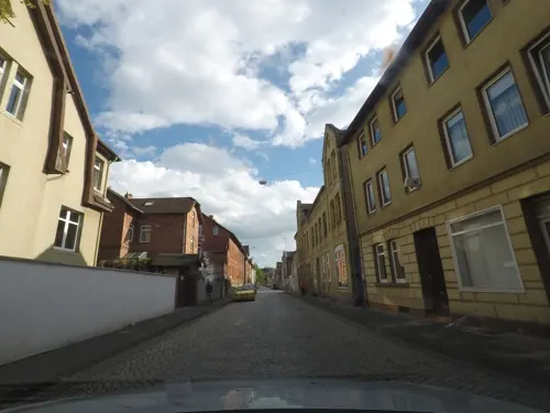
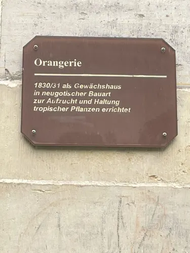

Pizza Garten
Restaurant · Noodle, Pizza · 0.7 km
Mo-Tu,Th-Fr 17:00-22:00; Tu,Th-Fr 11:30-14:00; Sa 16:00-20:45; Sa...
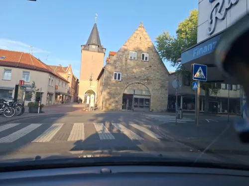
Musuko
Restaurant · Asian · 6.9 km
1 Berliner Platz, Mariental
Mo-Su 11:00-21:30


EQ Helmstedt
Bar and pub · 0.6 km
Walbecker Straße, Helmstedt
We 15:00-22:30; Th 15:00-23:00; Fr 15:00-03:00; Sa 11:00-03:00; Su...
64 more on the map.
History
The settlement in the Duchy of Saxony was first mentioned as Helmonstede in a 952 deed issued by the German king Otto I. In former times also called Helmstädt, the town developed in the vicinity of the Benedictine St. Ludger's Abbey that was founded around 800 by Saint Liudger as a mission station. Helmstedt's town privileges were documented in 1247. It belonged to the Abbacy of Werden until 1490, when it was bought by the Duchy of Brunswick-Lüneburg. From 1576 to 1810, the University of Helmstedt was located here.
From 1807 the town was part of the Napoleonic Kingdom of Westphalia, from 1815 it was part of the Duchy of Brunswick, and from 1871 it was part of the German Empire. During World War I, in 1916–1917, Germany operated a special prisoner-of-war camp for ethnic Polish officers from the Russian Army, with the aim of subjecting them to propaganda and conscripting them into a planned German-controlled Polish army to fight against Russia (Poland was partitioned between Germany, Russia and Austria at the time). In 1918, French officers were also detained in this camp, their return began in January 1919.
From the History section of Helmstedt on Wikipedia, under CC BY-SA 4.0.
Where to stay12
Churches and places of worship22
Doppelkapelle St. Peter u. St. Johannes
Church · Roman Catholic
Am Ludgerihof, Helmstedt
Shopping24
Gas and EV charging14
Schools, colleges and libraries19
Healthcare7
HELIOS St. Marienberg Klinik Helmstedt
Hospital · 0.8 km
26 Conringstraße, Helmstedt
Map of Helmstedt
250 places. The map loads OpenStreetMap tiles when you open it.
Getting there and nearby towns
Forschungsflughafen Braunschweig-Wolfsburg (BWE) is the nearest airport with scheduled flights listed in OpenStreetMap, 32 km away.
- Schöningen 10 km south, about 10 min by car
- Königslutter am Elm 13 km west, about 13 min by car
- Lehre 26 km northwest, about 26 min by car
- Wolfsburg 27 km northwest, about 27 min by car
- Wolfenbüttel 33 km west, about 33 min by car
- Braunschweig 33 km west, about 33 min by car
- Salzgitter 41 km west, about 41 min by car
- Sassenburg 41 km northwest, about 41 min by car
- Magdeburg 44 km east, about 44 min by car
- Vechelde 44 km west, about 44 min by car
Drive times are estimates from straight-line distance, not routes.
Local news
Headlines from INDB.
Reviews, tips and questions
Loading what members have shared...
Sources and licences
- GeoNames (CC BY 4.0): population, coordinates, regions and time zone
- Mapillary (see each image): photos
- OpenStreetMap contributors (ODbL 1.0): places, airports, map data
- Wikidata (CC0 1.0): elevation, founding date, time zone, website, landmarks and historic places
- Wikimedia Commons (see each image): photos
- Wikipedia (CC BY-SA 4.0): overview and history text
Photo credits
- Helmstedt, Wolkenkratzer, CC BY-SA 3.0
- DEU Niedersachsen Helmstedt Markt 14 231028 063, ClausNe, CC BY-SA 4.0
- DEU Niedersachsen Helmstedt Markt 11 231028 064, ClausNe, CC BY-SA 4.0
- Markt 9, 1, Helmstedt, Landkreis Helmstedt, GeorgDerReisende, CC BY-SA 4.0
- Markt 8, 1, Helmstedt, Landkreis Helmstedt, GeorgDerReisende, CC BY-SA 4.0
- Markt 7, 1, Helmstedt, Landkreis Helmstedt, GeorgDerReisende, CC BY-SA 4.0
- Markt 6, 1, Helmstedt, Landkreis Helmstedt, GeorgDerReisende, CC BY-SA 4.0
- Erwin Spindler Ansichtskarte Helmstedt, Erwin Spindler, Public domain
- DEU Niedersachsen Helmstedt Kybitzstraße 01 231028 039, ClausNe, CC BY-SA 4.0
- Markt 3, 1, Helmstedt, Landkreis Helmstedt, GeorgDerReisende, CC BY-SA 4.0
- DEU Niedersachsen Helmstedt Kybitzstraße 02 231028 040, ClausNe, CC BY-SA 4.0
- Schuhstraße 25, 1, Helmstedt, Landkreis Helmstedt, GeorgDerReisende, CC BY-SA 4.0
- DEU Niedersachsen Helmstedt Markt 09 231028 038, ClausNe, CC BY-SA 4.0
- Helmstedt - Rathaus (Town Hall) - geo.hlipp.de - 28025, Colin Smith on geo.hlipp.de, CC BY-SA 2.0
- DEU Niedersachsen Helmstedt Kybitzstraße 03 231028 041, ClausNe, CC BY-SA 4.0
- DEU Niedersachsen Helmstedt Markt 07 231028 037, ClausNe, CC BY-SA 4.0
- Helmstedt - Fachwerkhaus (Timber-framed Building) - geo.hlipp.de - 28026, Colin Smith on geo.hlipp.de, CC BY-SA 2.0
- DEU Niedersachsen Helmstedt Markt 06 231028 036, ClausNe, CC BY-SA 4.0
- DEU Niedersachsen Helmstedt Kybitzstraße 04 231028 042, ClausNe, CC BY-SA 4.0
- Schuhstraße 7, 1, Helmstedt, Landkreis Helmstedt, GeorgDerReisende, CC BY-SA 4.0
- DEU Niedersachsen Helmstedt Markt 03 231028 035, ClausNe, CC BY-SA 4.0
- Papenberg 2, 1, Helmstedt, Landkreis Helmstedt, GeorgDerReisende, CC BY-SA 4.0
- Markt, 1, Helmstedt, Landkreis Helmstedt, GeorgDerReisende, CC BY-SA 4.0
- Schuhstraße 5, 1, Helmstedt, Landkreis Helmstedt, GeorgDerReisende, CC BY-SA 4.0
- DEU Niedersachsen Helmstedt Kybitzstraße 05 231028 043, ClausNe, CC BY-SA 4.0
- DEU Niedersachsen Helmstedt Kybitzstraße 27 231028 062, ClausNe, CC BY-SA 4.0
- Herzog Julius Denkmal Helmstedt 1, Gerd Fahrenhorst, CC BY 4.0
- Herzog Julius Denkmal Helmstedt 2, Gerd Fahrenhorst, CC BY 4.0
- DEU Niedersachsen Helmstedt Holzberg 02 231028 016, ClausNe, CC BY-SA 4.0
- Schuhstraße 7, 4, Helmstedt, Landkreis Helmstedt, GeorgDerReisende, CC BY-SA 4.0
- DEU Niedersachsen Helmstedt Kybitzstraße 26 231028 061, ClausNe, CC BY-SA 4.0
- Schuhstraße 8, 1, Helmstedt, Landkreis Helmstedt, GeorgDerReisende, CC BY-SA 4.0
- Helmstedt - Malerische Stadt (Picturesque Town) - geo.hlipp.de - 28027, Colin Smith on geo.hlipp.de, CC BY-SA 2.0
- Schuhstraße 24, 1, Helmstedt, Landkreis Helmstedt, GeorgDerReisende, CC BY-SA 4.0
- Klostergebaeude und Kirche St. Ludgeri, Times, CC BY-SA 3.0
- Juleum Helmstedt Collegium, Unknown author, Public domain
- Grenzübergang Helmstedt-Marienborn, Heilig, Walter, CC BY-SA 3.0 de
- Helmstedt Brunnentheater, Times, CC BY-SA 3.0
- St. Christophorus Helmstedt Mai 2010, Times, CC BY-SA 3.0
- Stephanikirche Helmstedt, Times, CC BY-SA 3.0
- Helmstedt 1. Walbecker Warte-01, Radler59, CC BY-SA 4.0
- Wachturm Morsleben, Olaf Meister, CC BY-SA 3.0
- Julianum Helmstedt, Times, CC BY-SA 3.0
- St. Thomas-Kirche Helmstedt, Times, CC BY-SA 3.0
- Kloster Marienberg (Helmstedt) (2), Chris06, CC BY-SA 3.0
- Helmstedt-Grenzdenkmal, Times, CC BY-SA 3.0
- St. Walpurgis Helmstedt, de:Benutzer:Hejkal, CC BY-SA 3.0 de
- Helmstedt Zonengrenzmuseum, Times, CC BY-SA 3.0
- Emmerstedt St Petrikirche, Times, CC BY-SA 3.0
- Bad Helmstedt 2. Walbecker Warte-02, Radler59 ( talk ), CC BY-SA 4.0
- 26 Хельмштед, Nikolay Yagunov / Николай Ягунов, CC BY-SA 4.0
- Walbeck Domberg Kreuz-01, Radler59 ( talk ), CC BY-SA 4.0
- Kloster Marienberg (Helmstedt) (5), Chris06, CC BY-SA 3.0
- Neu Büddenstedt Kirche kath, Kirchenfan, CC0
- Walbeck Stiftskirche-01, Radler59 ( talk ), CC BY-SA 4.0
- Doppelkapelle Ludgeri, Times, CC BY-SA 3.0
- Kloster Mariental bei Helmstedt, Bergknappe, CC BY-SA 4.0
- Spiessturm, Timo Pilgram, Public domain
- Helmstedt Klosteranlage St Ludgeri, Times, CC BY-SA 3.0
- Gymnasium am Bötschenberg Helmstedt, Mef.ellingen, CC BY-SA 4.0
- Helmstedt Steinkreuz II, Radler59, CC BY-SA 3.0
- Street-level photo, Langfahrer, CC BY-SA 4.0
- Street-level photo, sunnyteater, CC BY-SA 4.0
- Street-level photo, sunnyteater, CC BY-SA 4.0
- Street-level photo, malenki, CC BY-SA 4.0
- Street-level photo, surveyor99, CC BY-SA 4.0
- Street-level photo, sunnyteater, CC BY-SA 4.0
- Street-level photo, sunnyteater, CC BY-SA 4.0
- Street-level photo, Langfahrer, CC BY-SA 4.0
- Street-level photo, sunnyteater, CC BY-SA 4.0
- Street-level photo, sunnyteater, CC BY-SA 4.0
- Street-level photo, hotteliene, CC BY-SA 4.0
- Street-level photo, Langfahrer, CC BY-SA 4.0
- Street-level photo, zugnomade, CC BY-SA 4.0
- Street-level photo, sunnyteater, CC BY-SA 4.0
- Street-level photo, AR88, CC BY-SA 4.0


Page built November 8, 2026. Spotted a mistake? Tell us or suggest a place.