


Neckargemünd, Germany
Neckargemünd is a town of 14,335 people in Baden-Wurttemberg, Germany.
Why visit Neckargemünd
Townapedia lists 68 museums and landmarks, 48 parks and trails, 110 places to eat, 17 places to stay and 21 attractions in and around town.
Highlights include Old Bridge, Theater & Orchester Heidelberg, Burg Dilsberg and Schloss Langenzell.
Weather in Neckargemünd
Forecast from MET Norway (CC BY 4.0). Full forecast
About Neckargemünd
Neckargemünd (German pronunciation: [ˌnɛkaʁɡəˈmʏnt] ; Palatine German: Neggergmin) is a town in Germany, in the district of Rhein-Neckar-Kreis, state of Baden-Württemberg. It lies on the Neckar, 10 km upriver from Heidelberg at the confluence with the river Elsenz. This confluence of the two rivers is the origin of the name, as Neckargemünd means confluence of the Neckar. As of 2006, there were 14,122 inhabitants.
From the Wikipedia article Neckargemünd (this version), under CC BY-SA 4.0.
Things to do21

Old Bridge
Bridge · 6.9 km
Bridge over the Neckar in Heidelberg, Germany

Theater & Orchester Heidelberg
Cinema and theater · 7.1 km
Theatre and opera house in Heidelberg, Germany




9 more on the map.
Museums and landmarks68



Alte Ziegelei Wiesenbach
Museum · 3.0 km
8 Poststraße, Wiesenbach
"nach telefonischer Vereinbarung +49 6223 95020 (Gemeinde Wiesenbach)"


Posseltslust
Monument and historic site · 4.6 km
Regelmäßig freitags, samstags, sonntags und feiertags jeweils tagsüber bis vor Einbruch der Dämmerung geöffnet. Außerhalb der...

President Friedrich Ebert Memorial
Monument and historic site · 6.9 km
Museum in Baden-Württemberg

Franzosenloch
Monument and historic site · 1.5 km
Frühneuzeitliche Schanze der Eppinger Linien


56 more on the map.
Parks, trails and playgrounds48







36 more on the map.
Restaurants and cafes110
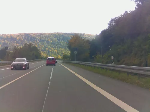

Biergarten Neckargemünd
Bar and pub · Barbecue, Burger, German, Vietnamese · 0.8 km
4 Falltorstraße, Neckargemünd
Mo-Su 11:30-22:00
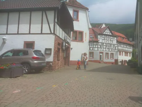
Café und Loungerie am Geopark
Restaurant · Local · 3.6 km
47 Neckarstraße, Neckarsteinach
Mo off; Tu-Su 11:00-18:00

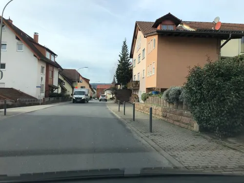
Palermo
Restaurant · Italian · 3.5 km
91 Hauptstraße, Wiesenbach
Mo off; Tu-Fr 11:00-14:00,17:00-23:00; Sa 17:00-22:30; Su,PH 11:00-22:30
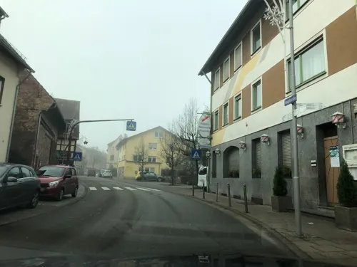
Pizzeria Ristorante Pavarotti
Restaurant · Italian · 3.6 km
8 Hauptstraße, Bammental
11:00-14:30,17:00-23:00;We off

Stella
Restaurant · Italian · 1.2 km
2 Odenwaldstraße, Neckargemünd
Tu-Sa 11:00-23:00; Su,PH 11:00-15:00,17:00-22:00
Wey's Garden
Restaurant · Chinese, Sushi · 1.0 km
6 Schwimmbadstraße, Neckargemünd
Th-Sa 11:30-14:30,17:30-21:00; Su 12:30-20:30; Oct-Mar: Mo off;...
Armonia Italiana
Restaurant · Italian · 4.2 km
Mo-Sa 11:00-14:00,17:30-23:00; Su 11:00-14:00,17:00-23:00
Brand's Weinladen
Brewery and winery · 4.2 km
25 Hauptstraße, Gaiberg
Tu-Th 16:00-22:00; Fr,Sa 11:00-22:00


98 more on the map.
History
The region has been occupied by people for a half a million years as shown by the find of Homo heidelbergensis in nearby Mauer in 1907. Stone shards and stone axes have been found from the Early Stone Age. During Roman times the area was settled by Celts and Suebi. Grave stones from the 2nd and 3rd century in Kleingemünd show Celtic names. From the end of the 5th century the Franks held sway over the region. An iron spear tip and two iron arrow heads were left behind in Neckargemünd.
Neckargemünd was founded in the 10th century, most likely as a fishing village. Neckargemünd was first mentioned by name in documents in 988. Otto III, Holy Roman Emperor enfeoffed Hildebald, Bishop of Worms, with the royal forests around Wimpfen and Neckarbischofsheim. Neckargemünd was named as the northwest corner of this area: a loco Gemundi ubi Elisinzia fluvius influit Neccaro fluvio. The counts of Lauffen also played a role in the region after making Dilsberg the seat of their domain. Neckargemünd became a free town in 1286. In 1395 it passed to the elector palatine and, together with the surrounding district, became part of Baden in 1814.
From the History section of Neckargemünd on Wikipedia, under CC BY-SA 4.0.
Where to stay17
Churches and places of worship26
Herz-Jesu-Kirche
Church · Roman Catholic · 3.7 km
11 Kirchenstraße, Neckarsteinach
Pfarrkirche St. Johannes Nepomuk
Church · Catholic · 0.6 km
6 Marktplatz, Neckargemünd
Shopping44
Gas and EV charging9
Schools, colleges and libraries21
Healthcare12
Kurpfalz-Apotheke
Clinic and pharmacy · 4.1 km
30 Kleingemünder Straße, Heidelberg
Map of Neckargemünd
250 places. The map loads OpenStreetMap tiles when you open it.
Getting there and nearby towns
City-Airport Mannheim (MHG) is the nearest airport with scheduled flights listed in OpenStreetMap, 23 km away.
- Heidelberg 8 km west, about 8 min by car
- Nußloch 10 km southwest, about 10 min by car
- Sandhausen 11 km southwest, about 11 min by car
- Wiesloch 13 km southwest, about 13 min by car
- Schriesheim 13 km northwest, about 13 min by car
- Walldorf 14 km southwest, about 14 min by car
- Schwetzingen 15 km west, about 15 min by car
- Sinsheim 16 km south, about 16 min by car
- Oftersheim 16 km west, about 16 min by car
- Weinheim 20 km northwest, about 20 min by car
Drive times are estimates from straight-line distance, not routes.
Local news
Headlines from INDB.
Reviews, tips and questions
Loading what members have shared...
Sources and licences
- GeoNames (CC BY 4.0): population, coordinates, regions and time zone
- Mapillary (see each image): photos
- OpenStreetMap contributors (ODbL 1.0): places, airports, map data
- Wikidata (CC0 1.0): elevation, founding date, time zone, website, landmarks and historic places
- Wikimedia Commons (see each image): photos
- Wikipedia (CC BY-SA 4.0): overview and history text
Photo credits
- Neckargemünd 2023, Jörg Braukmann, CC BY-SA 4.0
- Friedhof Neckargemünd aus der Bahn, Sarang, Public domain
- Neckargemünd - Burg Reichenstein - 2016-12-04 14-39-22, Photographs by Radosław Drożdżewski (User:Zwiadowca21), CC BY-SA 4.0
- Neckargemünd - Burg Reichenstein - 2016-12-04 14-42-31, Photographs by Radosław Drożdżewski (User:Zwiadowca21), CC BY-SA 4.0
- Neckargemünd - Burg Reichenstein - 2016-12-04 14-41-45, Photographs by Radosław Drożdżewski (User:Zwiadowca21), CC BY-SA 4.0
- Neckargemünd - Burg Reichenstein - 2016-12-04 14-42-11, Photographs by Radosław Drożdżewski (User:Zwiadowca21), CC BY-SA 4.0
- Neckargemünd - Burg Reichenstein - 2016-12-04 14-39-49, Photographs by Radosław Drożdżewski (User:Zwiadowca21), CC BY-SA 4.0
- Neckargemünd - Burg Reichenstein - 2016-12-04 14-43-37, Photographs by Radosław Drożdżewski (User:Zwiadowca21), CC BY-SA 4.0
- Friedhof Neckargemünd Zentralkapelle 3, Sarang, Public domain
- Neckargemünd - Burg Reichenstein - 2016-12-04 14-38-25, Photographs by Radosław Drożdżewski (User:Zwiadowca21), CC BY-SA 4.0
- Neckargemünd - Burg Reichenstein - 2016-12-04 14-42-51, Photographs by Radosław Drożdżewski (User:Zwiadowca21), CC BY-SA 4.0
- Neckargemünd - Burg Reichenstein - 2016-12-04 14-38-28, Photographs by Radosław Drożdżewski (User:Zwiadowca21), CC BY-SA 4.0
- Neckargemünd - Burg Reichenstein - 2016-12-04 14-38-04, Photographs by Radosław Drożdżewski (User:Zwiadowca21), CC BY-SA 4.0
- Friedhof Neckargemünd Nebenkapelle 3, Sarang, Public domain
- Neckargemünd - Burg Reichenstein - 2016-12-04 14-37-33, Photographs by Radosław Drożdżewski (User:Zwiadowca21), CC BY-SA 4.0
- Neckargemünd - Burg Reichenstein - 2016-12-04 14-36-39, Photographs by Radosław Drożdżewski (User:Zwiadowca21), CC BY-SA 4.0
- Neckargemünd - Burg Reichenstein - 2016-12-04 14-36-24, Photographs by Radosław Drożdżewski (User:Zwiadowca21), CC BY-SA 4.0
- Neckargemünd - Burg Reichenstein - 2016-12-04 14-36-11, Photographs by Radosław Drożdżewski (User:Zwiadowca21), CC BY-SA 4.0
- Neckargemünd Altstadt 2025 2, Smiley.toerist, CC BY-SA 4.0
- Neckargemünd - Karlstor und St. Johannes Nepomuk - 2018-08-26 12-15-57, Photographs by Radosław Drożdżewski (User:Zwiadowca21), CC BY-SA 4.0
- Neckargemünd - Karlstor, Radosław Drożdżewski (Zwiadowca21), CC BY-SA 3.0
- Neckargemünd - Karlstor-001, Radosław Drożdżewski (Zwiadowca21), CC BY-SA 3.0
- Neckargemünd - panoramio, maximusgalaktikus, CC BY-SA 3.0
- Neckargemünd - Gebursthaus des dr Peter Schnellbach, Radosław Drożdżewski (Zwiadowca21), CC BY-SA 3.0
- Neckargemünd - Neckargemünd-Altstadt, Radosław Drożdżewski (Zwiadowca21), CC BY-SA 3.0
- Alte Brücke Heidelberg, BishkekRocks, CC BY-SA 3.0
- Heidelberg - Altstadt 001, RAdoslav Droschdschewski (Zwiadowca21), CC BY-SA 3.0
- Heidelberg-Schloß, Pumuckel42 (Reinhard Wolf) at de:Wikipedia, CC BY-SA 3.0
- Kurpfälzisches Museum Haupteingang, 4028mdk09, CC BY-SA 3.0
- President Friedrich Ebert Memorial, Magnus Manske, CC BY-SA 3.0
- Heidelberg 20060420 021, No machine-readable author provided. Hlohning assumed (based on copyright claims)., CC BY 2.5
- Peterskirche, BishkekRocks, CC BY-SA 3.0
- Providenzkirche, Solaris2006, CC BY-SA 3.0
- Heidelberg - Landfriedstraße 12, Radosław Drożdżewski (Zwiadowca21), CC BY-SA 4.0
- Alte Universitaet, Pumuckel42 at German Wikipedia, CC BY-SA 3.0
- Burgturm Dilsberg, Immanuel Giel, Public domain
- Neckargemuend Berufsbildungswerk, E-W, CC BY-SA 3.0
- Gutleuthofkapelle von Osten, 4028mdk09, CC BY-SA 3.0
- Max-Born-Gymnasium Neckargemünd, Ngdm, CC BY-SA 4.0
- Heidelberg Kissel-12 015-f, Hans-Michael Kissel, CC BY-SA 3.0 de
- AltesNeuesSchlossLangenzell2017-03-04-14-37-29, Rolf Kickuth, CC BY-SA 4.0
- Neckarsteinach-mittelburg2, peter schmelzle, CC BY-SA 3.0
- Bammental - Hollmut, Radosław Drożdżewski (Zwiadowca21), CC BY-SA 3.0
- Sandgrube Grafenrain, Gerd A. Piroth, CC BY-SA 3.0
- Heidelberg-Granit-Klippe Russenstein, Jreiners, CC BY-SA 3.0
- 200904141115b RNF Neckarsteinach Schwalbennest, Hartmann Linge, CC BY-SA 4.0
- Buntsandsteinfelsen bei Neckargemünd, Sarang, Public domain
- Wintermorgen im Naturpark Neckartal-Odenwald (2), Evil cactus, CC BY-SA 4.0
- Posseltslust OSO, BonMichel, CC BY-SA 3.0
- Neckarsteinach-kathkirch, peter schmelzle, CC BY-SA 3.0
- Hd-schlierbach-kirche, Peter Schmelzle, CC BY-SA 3.0
- Wiesenbach-Evang-Kirche, Wisseboch, CC BY-SA 3.0
- Gaiberg Evangelische Kirche 20101026, Rudolf Stricker, Attribution
- Waldhilsbach-ev-christuskirche, p.schmelzle, CC BY-SA 2.5
- Bammentaler Duft- und Heilkräutergarten, Michael Linnenbach, CC BY-SA 4.0
- DILSB-141109-007, Bytfisch, CC BY-SA 4.0
- Dilsberg vom Ochsenkopf 2, R. J. Mathar, CC BY-SA 4.0
- Ochsenkopf (Odenwald)-Gipfelstein, Muck, CC BY-SA 4.0
- Street-level photo, teddy73, CC BY-SA 4.0
- Street-level photo, ramap, CC BY-SA 4.0
- Street-level photo, MirDochEga1, CC BY-SA 4.0
- Street-level photo, ramap, CC BY-SA 4.0
- Street-level photo, masterofnoroad, CC BY-SA 4.0
- Street-level photo, knistertoni, CC BY-SA 4.0
- Street-level photo, knistertoni, CC BY-SA 4.0
- Street-level photo, ramap, CC BY-SA 4.0
- Street-level photo, chuck, CC BY-SA 4.0
- Street-level photo, changchun1, CC BY-SA 4.0
- Street-level photo, tmka, CC BY-SA 4.0
- Street-level photo, wegavision, CC BY-SA 4.0
- Street-level photo, plexi32, CC BY-SA 4.0
- Street-level photo, ramap, CC BY-SA 4.0
- Street-level photo, teddy73, CC BY-SA 4.0
- Street-level photo, ramap, CC BY-SA 4.0
- Street-level photo, teddy73, CC BY-SA 4.0
- Street-level photo, wegavision, CC BY-SA 4.0
- Street-level photo, knistertoni, CC BY-SA 4.0
- Street-level photo, Eraoniel, CC BY-SA 4.0
- Street-level photo, changchun1, CC BY-SA 4.0
- Street-level photo, knistertoni, CC BY-SA 4.0
- Street-level photo, ramap, CC BY-SA 4.0
- Street-level photo, 5rmft, CC BY-SA 4.0


Page built November 8, 2026. Spotted a mistake? Tell us or suggest a place.