


Why visit Leimen
Townapedia lists 69 museums and landmarks, 45 parks and trails, 213 places to eat, 19 places to stay and 16 attractions in and around town.
Highlights include Nußlocher Schafhof, Nußlocher Ziegenkäsehof Hofladen, Heimatmuseum im alten Rathaus and Rohrbacher Schlößchen.
Weather in Leimen
Forecast from MET Norway (CC BY 4.0). Full forecast
About Leimen
Leimen (German pronunciation: [ˈlaɪmən] ; Palatine German: Lome) is a town in north-west Baden-Württemberg, Germany. It is about seven kilometres (4+1⁄2 miles) south of Heidelberg and the fourth largest town of the Rhein-Neckar district after Weinheim, Sinsheim and Wiesloch. It directly borders the Heidelberg district of Rohrbach. Leimen is also the area's industrial centre.
From the Wikipedia article Leimen (Baden) (this version), under CC BY-SA 4.0.
Things to do16

Nußlocher Ziegenkäsehof Hofladen
Farm and orchard · 1.3 km
1 Fischweiher, Nußloch
Th-Fr 16:00-18:30; Sa 09:30-16:00; PH off; Dec,Jan off

Theater & Orchester Heidelberg
Cinema and theater · 7.1 km
Theatre and opera house in Heidelberg, Germany
Reit- und Spargelhof Rehm BIOLAND
Farm and orchard · 3.8 km
9 Kirchheimer Hof, Heidelberg
Mo-Su 10:00-12:00,17:00-19:00 open "Spargelsaison Apr-Jun"

Hofverkauf Gieser
Farm and orchard · 3.8 km
8 Kirchheimer Hof, Heidelberg
Mo-Su 08:00-22:00
Apfel Land
Farm and orchard · 3.2 km
Sep-Oct Fr 16:00-18:00; Sep-Apr Sa 11:00-17:00

4 more on the map.
Museums and landmarks69


Heimatmuseum Rohrbach
Museum · 3.4 km
76 Rathausstraße, Heidelberg
"jeden ersten Sonntag im Monat von 14 bis 17 Uhr"


Wiesloch Feldbahn and Industrial Museum
Museum · 5.7 km
Open-air museum

Alte Synagoge
Monument and historic site · 2.2 km
115 Hauptstraße, Sandhausen

Altes Rathaus
Monument and historic site · 3.6 km
43 Rathausstraße, Heidelberg

Wasserturm
Monument and historic site · 3.9 km
Wasserturm der ehem. Waggonfabrik Fuchs in Heidelberg-Rohrbach

57 more on the map.
Parks, trails and playgrounds45




Sandhausener Düne, Pflege Schönau-Galgenbuckel
Hiking and trails · 3.4 km


Brühlwegdüne
Hiking and trails · 3.3 km
Hier werden in den nächsten Jahren große Freiflächen entstehen. Siehe...


33 more on the map.
Restaurants and cafes213

Ristorante Il Duetto
Restaurant · Italian · 3.7 km
Bitte Reservierungen nur telefonisch anfragen!
3 Bruchhausen, Sandhausen
Tu-Sa 11:30-14:30,17:30-23:00; Su 11:30-14:30,17:00-23:00
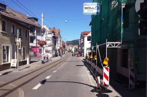
Athidhi Heidelberg
Restaurant · Indian · 3.7 km
29 Schwetzinger Straße, Heidelberg
Mo-Fr 11:30-15:00,17:30-22:30; Sa-Su 12:30-22:30

GiGi
Restaurant · German, Italian, Persian · 0.7 km
1 Jahnstraße, Leimen
Tu-Fr 17:00-22:30; Sa 11:00-22:30; Su 12:00-18:00
Goldene Rose
Restaurant · Italian · 3.6 km
10 Hegenichstraße, Heidelberg
Mo-Sa 11:00-14:30,17:30-23:00; Su 11:30-22:00
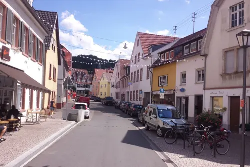
Il Gambero Rosso
Restaurant · Italian · 3.5 km
45 Rathausstraße, Heidelberg
Mo-Fr 17:30-22:45; Su 12:00-22:45
Indian Palace
Restaurant · Indian · 3.8 km
74 Karlsruher Straße, Heidelberg
PH,Tu-Su 11:30-14:30,18:00-22:30
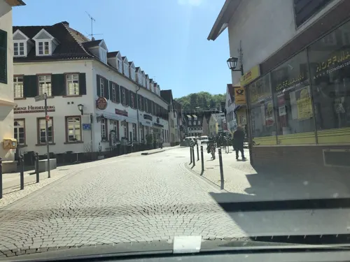
La Vesbar/Illegally Tasty
Restaurant · Cafe, Ice Cream, Italian · 3.5 km
58 Rathausstraße, Heidelberg
We 17:17-21:21; Th-Su 09:59-21:21
La Vite
Restaurant · Italian
14 Danziger Straße, Leimen
Mo-Sa 11:30-14:30,17:00-23:00; Tu off; PH,Su 11:30-23:00


Leimener Brauhaus
Restaurant · German, Regional
6 Rohrbacher Straße, Leimen
Mo-Th 11:00-24:00, Fr-Sa 11:00-02:00, Su 10:00-24:00
201 more on the map.
History
The first documentary record of Leimen is from 791, when both the Lorsch Abbey and the Diocese of Worms owned land there. First records of the districts are from 1270 for Gauangelloch (a document supposedly from 1016 was found out to be a fake), 1312 for Lingental, around 1300 for Ochsenbach and 1100 for Sankt Ilgen, then called bruch, an Old High German word for bog.
In 1262, the lords of Bruchsal gave Leimen to the Electorate of the Palatinate as a fiefdom and from 1464 on Leimen was part of the Palatinate. In 1579, Leimen was granted the right to celebrate an annual fair and became a marketplace in 1595. In 1674, Leimen was partially destroyed.
From the History section of Leimen (Baden) on Wikipedia, under CC BY-SA 4.0.
Where to stay19
Churches and places of worship31
St.-Bartholomäus-Kirche - alte Katholische Kirche
Church · Catholic · 2.3 km
5 Waldstraße, Sandhausen
Sankt Paul
Church · Roman Catholic · 3.1 km
2 Buchwaldweg, Heidelberg
Petruskirche
Church · Protestant · 3.6 km
13 Hegenichstraße, Heidelberg
Sankt Peter
Church · Catholic · 3.9 km
41 Lochheimer Straße, Heidelberg
Shopping52
Gas and EV charging23
Schools, colleges and libraries27
Healthcare23
Map of Leimen
250 places. The map loads OpenStreetMap tiles when you open it.
Getting there and nearby towns
City-Airport Mannheim (MHG) is the nearest airport with scheduled flights listed in OpenStreetMap, 19 km away.
- Sandhausen 2 km west, about 2 min by car
- Nußloch 3 km south, about 3 min by car
- Walldorf 6 km southwest, about 6 min by car
- Wiesloch 6 km south, about 6 min by car
- Heidelberg 7 km north, about 7 min by car
- Oftersheim 8 km west, about 8 min by car
- Schwetzingen 9 km northwest, about 9 min by car
- Neckargemünd 9 km northeast, about 9 min by car
- Schriesheim 14 km north, about 14 min by car
- Östringen 14 km south, about 14 min by car
Drive times are estimates from straight-line distance, not routes.
Local news
Headlines from INDB.
Reviews, tips and questions
Loading what members have shared...
Sources and licences
- GeoNames (CC BY 4.0): population, coordinates, regions and time zone
- Mapillary (see each image): photos
- OpenStreetMap contributors (ODbL 1.0): places, airports, map data
- Wikidata (CC0 1.0): elevation, founding date, time zone, website, landmarks and historic places
- Wikimedia Commons (see each image): photos
- Wikipedia (CC BY-SA 4.0): overview and history text
Photo credits
- Rathaus Leimen, Unknown author, Public domain
- Leimen evangelische Kirche 20100620, Rudolf Stricker, Attribution
- Stuetze13 Materialseilbahn Leimen01042024, Zonk43, CC BY-SA 4.0
- Schild Stuetze13 Materialseilbahn Leimen01042024, Zonk43, CC BY-SA 4.0
- Leimen, Römerstraße 23a, Turm, 3, Renardo la vulpo, CC BY-SA 4.0
- Leimen (Baden) – Altes Haus, Neq00, CC BY-SA 4.0
- Leimen, Turmschule, 3, Renardo la vulpo, CC BY-SA 4.0
- Leimen (Baden) – Georgi-Marktplatz (3), Neq00, CC BY-SA 4.0
- Leimen (Baden) – Georgi-Marktplatz (1), Neq00, CC BY-SA 4.0
- Leimen (Baden) – Georgi-Marktplatz (2), Neq00, CC BY-SA 4.0
- Leimen Rathaus 20100620, Rudolf Stricker, Attribution
- Leimen (Baden) – Franzosenturm (2), Neq00, CC BY-SA 4.0
- Leimen (Baden) Franzosenturm, Raubdinosaurier, CC BY-SA 3.0
- Leimen (Baden) – Franzosenturm (1), Neq00, CC BY-SA 4.0
- Leimen - Im Kreuzgewann 9 2015-03-20 11-18-59, Radosław Drożdżewski (Zwiadowca21), CC BY-SA 4.0
- Leimen - Im Kreuzgewann 9 2015-03-20 11-19-08, Radosław Drożdżewski (Zwiadowca21), CC BY-SA 4.0
- Leimen - Im Kreuzgewann 9 2015-03-20 11-17-58, Radosław Drożdżewski (Zwiadowca21), CC BY-SA 4.0
- Leimen - Im Kreuzgewann 9 2015-03-20 11-18-56, Radosław Drożdżewski (Zwiadowca21), CC BY-SA 4.0
- Leimen - Römerstraße - MAN NL 283 Lion’s City - LU-ET 744 - 2019-02-05 14-23-20, Photographs by Radosław Drożdżewski (User:Zwiadowca21), CC BY-SA 4.0
- Leimen - Römerstraße - MAN NL 283 Lion’s City - LU-ET 744 - 2019-02-05 14-23-18, Photographs by Radosław Drożdżewski (User:Zwiadowca21), CC BY-SA 4.0
- Leimen - Römerstraße - MAN NL 283 Lion’s City - LU-ET 782 - 2019-02-05 14-17-33, Photographs by Radosław Drożdżewski (User:Zwiadowca21), CC BY-SA 4.0
- Leimen - Römerstraße - Solaris Urbino IV - RP-R 633 -001, Photographs by Radosław Drożdżewski (User:Zwiadowca21), CC BY-SA 4.0
- Leimen - Römerstraße - Solaris Urbino IV - RP-R 633 -, Photographs by Radosław Drożdżewski (User:Zwiadowca21), CC BY-SA 4.0
- Leimen - Römerstraße - MAN NL 283 Lion’s City - LU-ET 782 - 2019-02-05 14-17-34, Photographs by Radosław Drożdżewski (User:Zwiadowca21), CC BY-SA 4.0
- Leimen - Römerstraße - 2019-02-05 14-08-58, Photographs by Radosław Drożdżewski (User:Zwiadowca21), CC BY-SA 4.0
- Leimen - Römerstraße - Straßenbahnhaltestelle Moltkestraße - 2019-02-05 14-10-19, Photographs by Radosław Drożdżewski (User:Zwiadowca21), CC BY-SA 4.0
- Leimen - Römerstraße - 2019-02-05 14-08-49, Photographs by Radosław Drożdżewski (User:Zwiadowca21), CC BY-SA 4.0
- Leimen - Römerstraße - 2019-02-05 14-08-46, Photographs by Radosław Drożdżewski (User:Zwiadowca21), CC BY-SA 4.0
- Leimen - Römerstraße - 2019-02-05 14-09-06, Photographs by Radosław Drożdżewski (User:Zwiadowca21), CC BY-SA 4.0
- Leimen katholische Herz-Jesu-Kirche 20100620, Rudolf Stricker, Attribution
- Leimen - EvoBus Mercedes-Benz O 530 Citaro FL LU-ET 636, Radosław Drożdżewski (Zwiadowca21), CC BY-SA 4.0
- Materialseilbahn Leimen29032024, Zonk43, CC BY-SA 3.0
- Heidelberg - Altstadt 001, RAdoslav Droschdschewski (Zwiadowca21), CC BY-SA 3.0
- Kurpfälzisches Museum Haupteingang, 4028mdk09, CC BY-SA 3.0
- Sammlung Prinzhorn Ansicht von Westen, 4028mdk09, CC BY-SA 3.0
- Peterskirche, BishkekRocks, CC BY-SA 3.0
- Providenzkirche, Solaris2006, CC BY-SA 3.0
- Heidelberg - Landfriedstraße 12, Radosław Drożdżewski (Zwiadowca21), CC BY-SA 4.0
- Alte Universitaet, Pumuckel42 at German Wikipedia, CC BY-SA 3.0
- Hardtwaldstadion, KatB, CC BY-SA 3.0
- Nußloch evangelische Kirche 20100620, Rudolf Stricker, Attribution
- Heidelberg Thoraxklinik 20101004, Rudolf Stricker, Attribution
- Rohrbacher Schlösschen 01, Hartmann Linge at German Wikipedia, CC BY-SA 4.0
- St Paul Heidelberg 1, Luftschiffhafen, CC BY-SA 3.0
- Heidelberg Kirchheim Sankt-Peter-Kirche 20110302, Rudolf Stricker, Attribution
- Sandhausen Synagoge, Pitichinaccio, Public domain
- Haupteingang Eichendorff-Grundschule Mendel-Realschule, 4028mdk09, CC BY-SA 3.0
- Rohrbach Rathaus 200607271521a, Hartmann Linge, CC BY-SA 4.0
- NSG Zugmantel, Emmy Sophie, CC BY-SA 3.0
- Haupteingang der Waldparkschule 2, Waldparkschule derivative work: Regi51, CC BY-SA 4.0
- Heidelberg Kirchheim evangelische Kirche 20110302, Rudolf Stricker, Attribution
- NSG 2168 Nußlocher Wiesen-Feld, Deepbluesea70, CC BY-SA 3.0
- Steinbruch Leimen, Blick von Brücke der L 600 nach Süden in Richtung Leimen, JoPaK, CC BY-SA 4.0
- Maikäfer Sandhausenerduenen 23052021, Janek Kasperowski, CC BY 2.0
- Sandhausen Bartholomae, 4028mdk09, CC BY-SA 3.0
- Melanchthonkirche Rohrbach 04, Luftschiffhafen, CC BY-SA 4.0
- St Thomas Heidelberg, Luftschiffhafen, CC BY-SA 3.0
- Brühlwegdüne, Michael Linnenbach, CC BY-SA 4.0
- Sandhausen Evangelische Christuskirche 20130602, Rudolf Stricker, CC BY-SA 2.0 de
- Stolperstein für Albert Bodem (Heidelberg), Christian Michelides, CC BY-SA 4.0
- Hotelfachschule Heidelberg November 2025, Silvie97, CC BY 4.0
- Loco shed Wiesloch Feldbahn and Industrial Museum, William Boughton, CC BY-SA 4.0
- Street-level photo, knistertoni, CC BY-SA 4.0
- Street-level photo, wegavision, CC BY-SA 4.0
- Street-level photo, miguel_andrade, CC BY-SA 4.0
- Street-level photo, changchun1, CC BY-SA 4.0
- Street-level photo, miguel_andrade, CC BY-SA 4.0
- Street-level photo, ramap, CC BY-SA 4.0
- Street-level photo, miguel_andrade, CC BY-SA 4.0
- Street-level photo, knistertoni, CC BY-SA 4.0
- Street-level photo, wegavision, CC BY-SA 4.0
- Street-level photo, wegavision, CC BY-SA 4.0
- Street-level photo, wegavision, CC BY-SA 4.0
- Street-level photo, cato_d_ae, CC BY-SA 4.0
- Street-level photo, c0rnsnake, CC BY-SA 4.0
- Street-level photo, miguel_andrade, CC BY-SA 4.0
- Street-level photo, knistertoni, CC BY-SA 4.0
- Street-level photo, offtoearth, CC BY-SA 4.0
- Street-level photo, ramap, CC BY-SA 4.0
- Street-level photo, knistertoni, CC BY-SA 4.0
- Street-level photo, ramap, CC BY-SA 4.0
- Street-level photo, wegavision, CC BY-SA 4.0
- Street-level photo, c0rnsnake, CC BY-SA 4.0
- Street-level photo, knistertoni, CC BY-SA 4.0
- Street-level photo, knistertoni, CC BY-SA 4.0
- Street-level photo, miguel_andrade, CC BY-SA 4.0
- Street-level photo, miguel_andrade, CC BY-SA 4.0
- Street-level photo, wegavision, CC BY-SA 4.0
- Street-level photo, knistertoni, CC BY-SA 4.0


Page built November 8, 2026. Spotted a mistake? Tell us or suggest a place.