


Why visit Herne
Townapedia lists 38 museums and landmarks, 56 parks and trails, 229 places to eat, 12 places to stay and 21 attractions in and around town.
Highlights include Kulturzentrum, Filmwelt Herne, LWL-Museum für Archäologie und Kultur and Flottmannhallen.
Weather in Herne
Forecast from MET Norway (CC BY 4.0). Full forecast
About Herne
Herne (German pronunciation: [ˈhɛʁnə] ) is a city in North Rhine-Westphalia, Germany. It is located in the Ruhr area directly between the cities of Bochum, and Gelsenkirchen.
From the Wikipedia article Herne, North Rhine-Westphalia (this version), under CC BY-SA 4.0.
Travel tips from other travellers: Herne on Wikivoyage (CC BY-SA 4.0).
Things to do21



Hof Sasse
Farm and orchard · 3.8 km
308 Hiltroper Straße, Bochum
Tu,We,Fr 11:00-18:00; Sa,Su,PH 11:00-17:00
Rottstraße 5 Theater
Cinema and theater · 6.7 km
Theatre in Bochum, Germany
Westfälisches Landestheater
Cinema and theater · 6.7 km
Theater in Germany



9 more on the map.
Museums and landmarks38

LWL-Museum für Archäologie und Kultur
Museum
1 Europaplatz, Herne
Tu,We,Fr 09:00-17:00; Th 09:00-19:00; Sa,Su,PH 11:00-18:00



Galerie Kunstpunkt
Museum · 2.5 km
Galerie Kunstpunkt. Ausstellungsraum des Herner Künstlerbundes. Wecheslende Ausstellungen, Informationen über Ausstellungen und...
296 Mont-Cenis-Straße, Herne
"wechselnd je nach Ausstellung"


26 more on the map.
Parks, trails and playgrounds56


ZOOM Erlebniswelt
Park · 8.0 km
Zoological garden in Gelsenkirchen, in Germany

AMC Castrop-Rauxel
Marina and boat launch · 3.8 km
Hafen des AMC-Castrop, Gastliegeplätze, WC, Duschen, Restaurant, Bootsservice, Hafenmeister 0172-2345236



44 more on the map.
Restaurants and cafes229

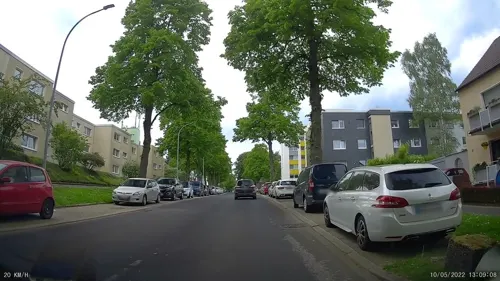
Bavaria Alm
Restaurant · Burger, German, Seafood · 2.1 km
188 Holsterhauser Straße, Herne
Mo-Th 11:00-23:00, Fr 11:00-24:00, Sa 09:00-24:00, Su 09:00-23:00
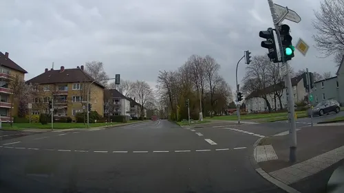
Piato
Restaurant · Greek · 3.5 km
2b Dietrich-Benking-Straße, Bochum
Mo-Tu 17:00-22:00; Th-Sa 17:00-22:00
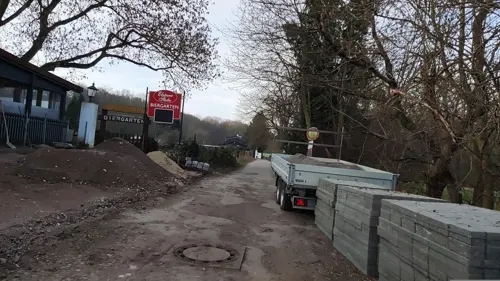
Pizza Olivano
Restaurant · Mediterranean, Pizza, Pasta, Italian · 0.9 km
60 Altenhöfener Straße, Herne
Tu-Fr 11:30-14:00,17:30-21:30; Sa,Su,PH 13:00-21:30


Restaurant Elsässer Stube
Restaurant · French · 1.7 km
156 Wiescherstraße, Herne
Mo off; Tu-Fr 17:00-23:00; Sa-Su 11:00-23:00
Rosmarino
Restaurant · Italian
7 Berliner Platz, Herne
Tu-Th 11:30-14:45,17:30-22:00; Fr-Sa 11:30-14:45,17:00-23:00; Mo...
217 more on the map.
History
Herne (ancient Haranni) was a tiny village until the 19th century. When the mining of coal (and possibly ore) and the production of coke (the fuel processed from the harvested coal) and steel began, the villages of the Ruhr area had an influx of people, mostly from the east of Germany.
Herne is located on the direct axis between Bochum to the south and Recklinghausen to the north, with Münster in the north, Gelsenkirchen to the west, and Castrop-Rauxel and Dortmund to the east. The physical border between Herne and Recklinghausen is the bridge at the Bochumer Strasse across the Rhine–Herne Canal. A little further north of the canal flows the Emscher river, with the former abundance of wild horses that were caught in the Emscher Valley (Emschertal), then sold and/or traded at the yearly horse market at Crange, which later developed into the "Cranger Kirmes". After World War II, Herne was known as "Die Goldene Stadt" ("The Golden City") because of the comparatively limited damage suffered during World War II.
From the History section of Herne, North Rhine-Westphalia on Wikipedia, under CC BY-SA 4.0.
Where to stay12
Churches and places of worship47
Sankt Dreifaltigkeit
Church · Catholic · 3.8 km
62 Börsinghauser Straße, Herne
Shopping71
Gas and EV charging29
Schools, colleges and libraries53
Healthcare25
Map of Herne
250 places. The map loads OpenStreetMap tiles when you open it.
Getting there and nearby towns
Flughafen Essen-Mülheim (ESS) is the nearest airport with scheduled flights listed in OpenStreetMap, 25 km away.
- Recklinghausen 9 km north, about 9 min by car
- Oberhausen 26 km west, about 26 min by car
- Wuppertal 32 km south, about 32 min by car
- Remscheid 40 km south, about 40 min by car
- Solingen 42 km south, about 42 min by car
- Moers 42 km west, about 42 min by car
- Hamm 44 km east, about 44 min by car
- Krefeld 52 km southwest, about 52 min by car
- Neuss 53 km southwest, about 53 min by car
- Münster 55 km northeast, about 55 min by car
Drive times are estimates from straight-line distance, not routes.
Local news
Headlines from INDB.
Reviews, tips and questions
Loading what members have shared...
Sources and licences
- GeoNames (CC BY 4.0): population, coordinates, regions and time zone
- Mapillary (see each image): photos
- OpenStreetMap contributors (ODbL 1.0): places, airports, map data
- Wikidata (CC0 1.0): elevation, founding date, time zone, website, landmarks and historic places
- Wikimedia Commons (see each image): photos
- Wikipedia (CC BY-SA 4.0): overview and history text
Photo credits
- Herne, Blick auf Europaplatz mit Kreuzkirche, Mbdortmund, GFDL 1.2
- Church of Bonifatius at Herne south side, Arnoldius, CC BY-SA 3.0
- Church of Bonifatius at Herne front side, Arnoldius, CC BY-SA 3.0
- Herne Kreuzkirche, Arnoldius, CC BY-SA 3.0
- Glockenstraße 15, 44623 Herne, Baudenkmal, Arnoldius, CC BY-SA 4.0
- Herne Schulstraße 22, Arnoldius, CC BY-SA 3.0
- Church of Bonifatius at Herne Bonifatius, Arnoldius, CC BY-SA 3.0
- Robin Alexander In Herne, Arnoldius, CC BY-SA 4.0
- Herne-City-IMG 1474, Mbdortmund, GFDL 1.2
- Herne Mont-Cenis-Straße 7, Arnoldius, CC BY-SA 3.0
- Herne-IMG 1476, Mbdortmund, GFDL 1.2
- Herne-IMG 2304, Mbdortmund, GFDL 1.2
- Herne-IMG 1475, Mbdortmund, GFDL 1.2
- Herne-IMG 2305, Mbdortmund, GFDL 1.2
- Herne Gedenktafel Bahnhofstraße, Knochen, CC BY-SA 3.0
- Stolpersteine in Herne Frieda Neugarten, Arnoldius, CC BY-SA 4.0
- Stolpersteine in Herne Samuel Neugarten, Arnoldius, CC BY-SA 4.0
- Herne Bahnhofstraße 27-29a, Arnoldius, CC BY-SA 4.0
- Statue of Bonifatius in Herne, Arnoldius, CC BY-SA 3.0
- DITIB Merkez Moschee Mont-Cenis-Str. 17 Herne-1635-LR, User:Creosoph, CC BY-SA 4.0
- Herne Bahnhofstraße, Unknown Unknown, Public domain
- Church tower of Bonifatiuskirche at Herne, Arnoldius, CC BY-SA 3.0
- Herne cemetery Behrenspark 02, Arnoldius, CC BY-SA 3.0
- Herne Hermann-Loens-Straße 18 01, Arnoldius, CC BY-SA 3.0
- Herne Tollmann-Brunnen, Arnoldius, CC BY-SA 4.0
- Herne, Bahnhofstraße, Detlef Gräfingholt, CC BY-SA 3.0 de
- Herne cemetery Behrenspark 01, Arnoldius, CC BY-SA 3.0
- Herne Hermann-Loens-Straße 01, Arnoldius, CC BY-SA 3.0
- Herne Schaeferstraße 8 door, Arnoldius, CC BY-SA 3.0
- Herne Schaeferstr 7 - 01, Arnoldius, CC BY-SA 3.0
- Herne Glockenstraße, Arnoldius, CC BY-SA 3.0
- Herne-Europaplatz-IMG 2309, Mbdortmund, GFDL 1.2
- Herne Hermann-Loens-Straße 23, Arnoldius, CC BY-SA 3.0
- Herne Hermann-Loens-Straße 23 door, Arnoldius, CC BY-SA 3.0
- Zille2 Herne, Alraunenstern, CC BY-SA 4.0
- Herne Schaeferstraße 8, Arnoldius, CC BY-SA 3.0
- Herne Schulstraße 01, Arnoldius, CC BY-SA 3.0
- Herne Hermann-Löns-Straße 46, Arnoldius, CC BY-SA 3.0
- Herne Hermann-Loens-Straße 23 02, Arnoldius, CC BY-SA 3.0
- Herne Hermann-Loens-Straße 29 & 29 A, Arnoldius, CC BY-SA 3.0
- Herne Mondpalast Autostitch, The original uploader was Stahlkocher at German Wikipedia ., CC BY-SA 3.0
- Bergbaumuseum Sommer 2013, Christian Nawrot, CC BY-SA 3.0
- Gelsenkirchen - Zoom - Afrika - African Queen 06 ies, Frank Vincentz, CC BY-SA 3.0
- Bochum Technische Fachhochschule Georg Agricola, Unknown author, CC BY-SA 3.0
- Herne Westring 213, Arnoldius, CC BY-SA 3.0
- Herne Martin-Opitz-Bibliothek, Arnoldius, CC BY-SA 4.0
- Herne-Europaplatz-IMG 2290, Mbdortmund, GFDL 1.2
- Herne Haranni-Gymnasium 02, Arnoldius, CC BY-SA 3.0
- Herne St Joseph 02, Arnoldius, CC BY-SA 3.0
- Herne - Straße des Bohrhammers - Flottmann 03 ies, Frank Vincentz, CC BY-SA 3.0
- Gysenberg 01, Arnoldius, CC BY-SA 3.0
- Gysenbergpark 2, Arnold Paul, CC BY-SA 2.5
- Hiberniaschule Herne, Arnoldius, CC BY-SA 3.0
- Church Herz-Jesu Kirche at Herne, Arnoldius, CC BY-SA 3.0
- Herne Westfalia Stadion, The original uploader was Stahlkocher at German Wikipedia ., CC BY-SA 3.0
- Recklinghausen - Uferstraße - Umspannwerk 19 ies, Frank Vincentz, CC BY-SA 3.0
- KUZ Willi-Pohlmann-Platz, Alraunenstern, CC BY-SA 4.0
- Herne LWL Museum Schaedelkult 2012, Arnoldius, CC BY-SA 3.0
- Castle Struenkede west wing, Arnoldius, CC BY-SA 3.0
- Herne Trinity church 01, Arnoldius, CC BY-SA 3.0
- Herne church St Peter und Paul, Arnoldius, CC BY-SA 3.0
- Tippelsberg Bochum rp1010100, Sinus, CC BY 3.0
- Herne Otto-Hahn-Gymnasium, Arnoldius, CC BY-SA 4.0
- Bochum Erlöserkirche, Pelz, CC BY-SA 3.0
- Herne NSG Vossnacken 02, Arnoldius, CC BY-SA 3.0
- Herne Villa Forell, Arnoldius, CC BY-SA 4.0
- Pestalozzi Gymnasium (Herne) entrance, Arnoldius, CC BY-SA 4.0
- Herne Wananas, Arnoldius, CC BY-SA 4.0
- Herne Spielplatz im Volkspark, Arnoldius, CC BY-SA 4.0
- Herne Bismarckstraße 98 ev Kirche 01, Arnoldius, CC BY-SA 3.0
- Mont Cenis Kaiser-Wilhelm-Turm 1, Arnold Paul, CC BY-SA 2.5
- Herne Wiescherstraße 184 02, Arnoldius, CC BY-SA 3.0
- Recklinghausen Monument Nr 095 Lutherkirche West, W.Strickling, CC BY-SA 4.0
- Riemke Trinitatiskirche, Jenskoch1985, CC BY-SA 4.0
- Hofsteder Weiher 2017, Erzhuebi, CC BY-SA 4.0
- Bochum (Tippelsberg) 07 ies, Frank Vincentz, CC BY-SA 3.0
- Herne Marienhospital entrance, Arnold Paul, CC BY-SA 2.5
- Street-level photo, t_hartung, CC BY-SA 4.0
- Street-level photo, t_hartung, CC BY-SA 4.0
- Street-level photo, geogladbecker, CC BY-SA 4.0
- Street-level photo, geogladbecker, CC BY-SA 4.0
- Street-level photo, geogladbecker, CC BY-SA 4.0
- Street-level photo, t_hartung, CC BY-SA 4.0
- Street-level photo, t_hartung, CC BY-SA 4.0
- Street-level photo, bravewaffle, CC BY-SA 4.0
- Street-level photo, bravewaffle, CC BY-SA 4.0
- Street-level photo, changchun1, CC BY-SA 4.0
- Street-level photo, geogladbecker, CC BY-SA 4.0
- Street-level photo, geogladbecker, CC BY-SA 4.0
- Street-level photo, klaus100000, CC BY-SA 4.0
- Street-level photo, t_hartung, CC BY-SA 4.0
- Street-level photo, t_hartung, CC BY-SA 4.0
- Street-level photo, t_hartung, CC BY-SA 4.0
- Street-level photo, t_hartung, CC BY-SA 4.0
- Street-level photo, t_hartung, CC BY-SA 4.0
- Street-level photo, t_hartung, CC BY-SA 4.0
- Street-level photo, t_hartung, CC BY-SA 4.0
- Street-level photo, geogladbecker, CC BY-SA 4.0
- Street-level photo, t_hartung, CC BY-SA 4.0
- Street-level photo, bravewaffle, CC BY-SA 4.0
- Street-level photo, t_hartung, CC BY-SA 4.0
- Street-level photo, bravewaffle, CC BY-SA 4.0
- Street-level photo, klaus100000, CC BY-SA 4.0


Page built November 8, 2026. Spotted a mistake? Tell us or suggest a place.