


Why visit Moers
Townapedia lists 115 museums and landmarks, 35 parks and trails, 196 places to eat, 15 places to stay and 17 attractions in and around town.
Highlights include Paschenhof, Schlosstheater Moers, Das Geleucht and Grafschafter Museum im Moerser Schloss.
Weather in Moers
Forecast from MET Norway (CC BY 4.0). Full forecast
About Moers
Moers (German pronunciation: [ˈmœʁs] ; older form: Mörs; Dutch: Murse, Murs or Meurs) is a German city on the western bank of the Rhine, close to Duisburg. Moers belongs to the district of Wesel.
From the Wikipedia article Moers (this version), under CC BY-SA 4.0.
Things to do17

Paschenhof
Farm and orchard · 3.3 km
Milch und viele Produkte von Erzeugern aus der Region kaufen an den Verkaufsautomaten
52 Paschenweg, Neukirchen-Vluyn
24/7

Schwafheimer Hofladen
Farm and orchard · 4.0 km
Lebensmittel aus der Region
81 Dorfstraße, Moers
Tu-Th 09:00-13:00,15:00-18:00; Fr 09:00-18:00; Sa 08:30-13:00

Brücke der Solidarität
Bridge · 8.5 km
Bridge across the Rhine in Duisburg, Germany

Die Säule
Cinema and theater · 9.2 km
Die Säule is a theatre in Duisburg, North Rhine-Westphalia, Germany.

Duisburg-Hochfeld Railway Bridge
Bridge · 9.3 km
Railway bridge in Germany


Rhine Orange
Monument and historic site · 6.2 km
Sculpture erected in Duisburg-Neuenkamp in 1992


Theater am Marientor
Cinema and theater · 9.0 km
Theatre in Duisburg, Germany

Theater Duisburg
Cinema and theater · 9.8 km
Opera house in Duisburg, one of the venues of the Deutsche Oper am Rhein

5 more on the map.
Museums and landmarks115

Das Geleucht
Monument and historic site · 3.1 km
Das grösste Montankunstwerk der Welt
Apr-Oct: Th-We,Sa-Su 14:00-18:00; Nov-Mar: Sa-Su 13:00-16:00
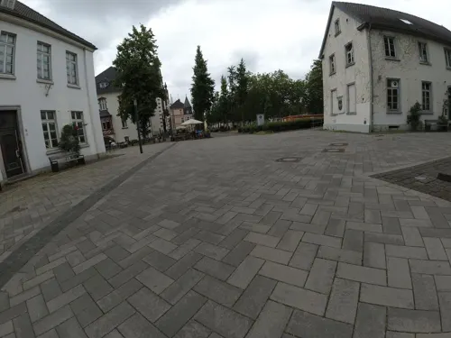
Grafschafter Museum im Moerser Schloss
Museum · 0.7 km
9 Kastell, Moers
Tu-Fr 10:00-18:00, Sa-Su 11:00-18:00

Moerser Schloss
Monument and historic site · 0.7 km
Kern quadratischen Turm aus Tuffstein auf ringförmigen Hügel, mit ca. 3 m starken und 12 m hohen Ringmauer aus wiederverwerteten,...


Port of Duisburg
Monument and historic site · 8.8 km
Largest inlandport in the World


Golda Chaim geb. Teiltelbaum
Monument and historic site
Zwei Stolpersteine, verlegt am 27. Mai 2013
Moritz Chaim
Monument and historic site
Zwei Stolpersteine, verlegt am 27. Mai 2013

103 more on the map.
Parks, trails and playgrounds35





Abenteuerspielplatz Tempoli
Playground · 4.5 km
"Wir bieten auf unserem Platz einen naturnahen und vielfältigen Spiel- und Erfahrungsraum. Euch erwartet unser Spielplatzbereich, die...
107 Ehrenstraße, Duisburg


23 more on the map.
Restaurants and cafes196

Autentico
Restaurant · Kalabrien, German, Niederrheinisch
3 Hanns-Dieter-Hüsch-Platz, Moers
Tu-Sa 12:00-22:00; Su 12:00-21:00
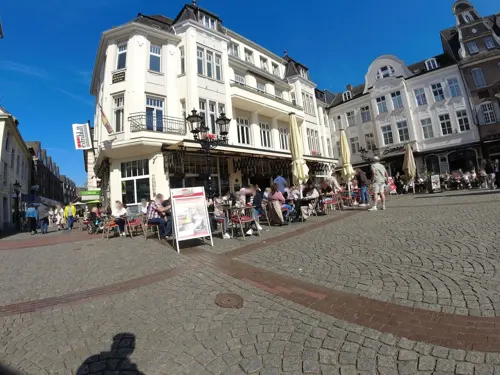
Clubrestaurant „Mamma Mia im TCA“
Restaurant · Italian · 2.4 km
2 Am Sportpark, Moers
Summer: Mo-Su 11:00-23:00 || Winter: Mo-Fr 16:00-23:00; Sa-Su...
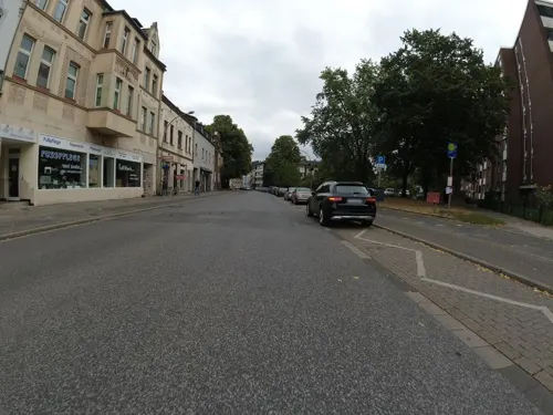
Corfu
Restaurant · Greek · 3.8 km
173 Kirchstraße, Duisburg
Tu-Th 17:00-21:30; Fr-Sa 17:00-22:30; Su 12:00-21:00; Su...
Grafschafter Wirtshaus
Restaurant · German, Local · 0.6 km
5 Kastell
Mo-Sa 09:00-23:00; Su,PH 09:30-23:00
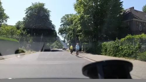
Jule's Restaurant
Restaurant · International · 3.9 km
9 Krefelder Straße, Neukirchen-Vluyn
Mo-Su 18:00-22:15
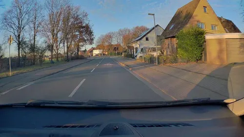
Jägerhof Holderberg
Restaurant · German · 3.9 km
150 Holderberger Straße, Moers
Mo-Fr 17:00-24:00; Sa,Su,PH 11:30-24:00
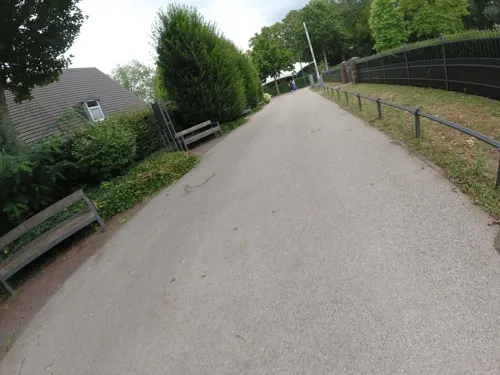
La Maremma
Restaurant · Italian
8b Nordring, Moers
Tu-Th 12:00-15:00,18:00-22:00, Fr-Sa 12:00-15:00, Fr,Sa...
Liesen Eiche
Restaurant · Balkan, International, German · 2.5 km
412 Römerstraße, Moers
Mo-Fr 12:00-14:00,17:00-23:00; Sa-Su 12:00-23:00
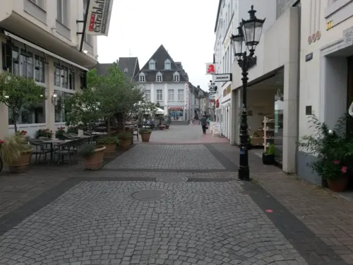
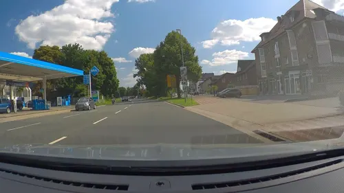


New Paradiso
Restaurant · Italian · 2.2 km
455 Römerstraße, Moers
Tu-Fr 12:00-22:00; Sa,Su 13:00-22:00
184 more on the map.
History
Known earliest from 1186, the county of Moers was an independent principality within the Holy Roman Empire.
During the Eighty Years' War it was alternately captured by Spanish and Dutch troops, as it bordered the Upper Quarter of Guelders. During the war it finally fell to Maurice of Orange. As it was separated from the Dutch Republic by Spanish Upper Guelders it did not become an integral part of the Republic, though Dutch troops were stationed there.
After the death of William III of Orange in 1702, Moers was inherited by the king of Prussia. All Dutch troops and civil servants were expelled.
In 1795 it was annexed by France. At the Congress of Vienna, in 1815 it was returned to Prussia and in 1871 it became part of the German Empire.
A target of the Oil Campaign of World War II, the Steinkohlenbergwerke (English: coal mine) Rheinpreussen synthetic oil plant in Moers, was partially dismantled post-war.
From the History section of Moers on Wikipedia, under CC BY-SA 4.0.
Where to stay15
Churches and places of worship37
Sankt Peter in den Haesen
Church · Catholic · 4.1 km
100 Friedhofsallee, Duisburg
Christusgemeinde - Ev. Freie Gemeinde
Church · Evangelisch-Freikirchlich · 3.9 km
13 Gartenstraße, Neukirchen-Vluyn
Shopping63
Gas and EV charging33
Schnellladestation ALDI Süd Uerdinger Straße Moers
EV charging · 0.9 km
67 Uerdinger Straße, Moers
Schools, colleges and libraries51
Gymnasium in den Filder Benden Städt. Gymnasium für Jungen und Mädchen
School · 1.5 km
43 Zahnstraße, Moers
Baerler Waldschule Städt. Evangelische Grundschule
School · Evangelical · 4.7 km
3h Waldstraße, Duisburg
Erich Kästner-Schule Förderschule des Kreises Wesel (Teilstandort Moers)
School · 1.2 km
23 Königsberger Straße, Moers
Healthcare30
Map of Moers
250 places. The map loads OpenStreetMap tiles when you open it.
Getting there and nearby towns
Düsseldorf Airport (DUS) is the nearest airport with scheduled flights listed in OpenStreetMap, 21 km away.
- Neukirchen-Vluyn 6 km west, about 6 min by car
- Duisburg 9 km east, about 9 min by car
- Oberhausen 16 km east, about 16 min by car
- Neuss 29 km south, about 29 min by car
- Wuppertal 42 km southeast, about 42 min by car
- Recklinghausen 43 km northeast, about 43 min by car
- Solingen 44 km southeast, about 44 min by car
- Remscheid 49 km southeast, about 49 min by car
- Köln 62 km south, about 1 h by car
- Münster 89 km northeast, about 1 h 30 min by car
Drive times are estimates from straight-line distance, not routes.
Local news
Headlines from INDB.
Reviews, tips and questions
Loading what members have shared...
Sources and licences
- GeoNames (CC BY 4.0): population, coordinates, regions and time zone
- Mapillary (see each image): photos
- OpenStreetMap contributors (ODbL 1.0): places, airports, map data
- Wikidata (CC0 1.0): elevation, founding date, time zone, website, landmarks and historic places
- Wikimedia Commons (see each image): photos
- Wikipedia (CC BY-SA 4.0): overview and history text
Photo credits
- LF 16-12, LZ 4, Moers, kaʁstn Disk / Cat, Public domain
- Moers, 2010-12 CN-II, Hanns-Dieter-Hüsch-Bildungszentrum, kaʁstn Disk / Cat, CC BY-SA 3.0 de
- DLK 23-12 Moers, kaʁstn Disk / Cat, Public domain
- Rüstwagen 1, LZ 3, Moers, kaʁstn Disk / Cat, Public domain
- Moers, 2010-12 CN-I, Hanns-Dieter-Hüsch-Bildungszentrum, kaʁstn Disk / Cat, CC BY-SA 3.0 de
- Dieter Nuhr, Moers 2011, CN-01, kaʁstn Disk / Cat, CC BY-SA 3.0 de
- Moers-Grafschafterin mit ihren Werbern, Dat doris, CC BY-SA 4.0
- Stadt Park moers, Jkhasani, CC BY-SA 3.0
- Moers, Sparkasse am Niederrhein, 2012-04 CN-01, kaʁstn Disk / Cat, CC BY-SA 3.0 de
- Moers, Friedhofskapelle Rheinberger Straße, 2012-08 CN-01, kaʁstn Disk / Cat, CC BY-SA 3.0 de
- Moers, Haagstraße, Brücke, 2012-08 CN-01, kaʁstn Disk / Cat, CC BY-SA 3.0 de
- Amtsgericht Moers - panoramio, giggel, CC BY 3.0
- Detail Fassade Haus am Altmarkt Moers, Matthias Nonnenmacher, CC BY-SA 4.0
- Motorradparkplatz Moers Hans-Albeck-Platz, Gmbo 2013, CC0
- Motorradparkplatz Moers Neumarkt P9, Gmbo 2013, CC0
- Moers, Altmarkt, CN-II, kaʁstn Disk / Cat, CC BY-SA 3.0
- Moers, Altmarkt, CN-III, kaʁstn Disk / Cat, CC BY-SA 3.0
- Moers, Altmarkt, CN-I, kaʁstn Disk / Cat, CC BY-SA 3.0
- Moers, 2010-12 CN-I, Altmarkt, kaʁstn Disk / Cat, CC BY-SA 3.0 de
- Moers, 2010-12 CN-II, Altmarkt, kaʁstn Disk / Cat, CC BY-SA 3.0 de
- Moers, 2010-12 CN-II, Altmarkt pagebanner, kaʁstn Disk / Cat, CC BY-SA 3.0 de
- Moers, Altmarkt 1, 2014-01 CN-01, kaʁstn Disk / Cat, CC BY-SA 3.0 de
- Moers Amtsgericht, A.Savin, CC BY-SA 3.0
- Moers, Altes Hafthaus, 2012-08 CN-01, kaʁstn Disk / Cat, CC BY-SA 3.0 de
- Motorradparkplatz Moers Mühlenstraße P1, Gmbo 2013, CC0
- Moers, Neumarkt, CN-II, kaʁstn Disk / Cat, CC BY-SA 3.0 de
- Moers, Peschkenhaus, 2011-09 CN-02, kaʁstn Disk / Cat, CC BY-SA 3.0 de
- Moerser Kirmes 2010 CN-XIV, kaʁstn Disk / Cat, CC BY-SA 3.0 de
- Duisburg Bruecke der Solidaritaet, User AlterVista on de.wikipedia, CC BY-SA 3.0
- Die Säule, Goldstraße in Duisburg, 2003, BlackIceNRW, CC BY-SA 3.0
- Duisburg, Hochfelder Eisenbahnbrücke, 2011-01 CN-01, kaʁstn Disk / Cat, CC BY-SA 3.0 de
- Haus-Knipp-Eisenbahnbrücke, Raimond Spekking, CC BY-SA 4.0
- Duisburg - Am Bört - Rheinorange 07 ies, Frank Vincentz, CC BY-SA 3.0
- Duisburg - Schwanentorbrücke 1, Raimond Spekking, CC BY-SA 4.0
- The theatre at the Marientor ("Maria's Gate") in Duisburg, NordhornerII, CC BY-SA 4.0
- Stadttheater Duisburg 2008 (2851), Raimond Spekking, CC BY-SA 4.0
- Duisburg, Museum der Deutschen Binnenschifffahrt, 2015-04 CN-01, kaʁstn – Steffen Schmitz, CC BY-SA 4.0
- Duisburg wilh lehmbruck museum außen, Hans Peter Schaefer , http://www.reserv-a-rt.de, CC BY-SA 3.0
- Kueppersmuehle Innenhafen Duisburg, NatiSythen, CC BY-SA 3.0
- Duisburg - Dammstraße - Vinckekanal - Pegel (Friedrich-Ebert-Brücke) 01 ies, Frank Vincentz, CC BY-SA 3.0
- Kloster Kamp - Abteikirche - 2010, Avda, CC BY-SA 3.0
- Moers Adolfinum Altbau neu1, Lutz Hartmann, CC BY-SA 3.0
- Gymnasium Filder Benden, Luftbild, 2011-09, Schulprojekt Filder Benden ( talk ), CC BY-SA 3.0 de
- Halde Norddeutschland, Halde Rheinpreußen, kaʁstn Disk / Cat, CC BY-SA 3.0
- Moers, St. Josef, 2012-04 CN-01, kaʁstn Disk / Cat, CC BY-SA 3.0 de
- Moers EvangelischeKirche, Lutz Hartmann ( User:Luha ), CC BY-SA 3.0
- Moers, Schwafheim, Evangelische Kirche, 2020-05 CN-01, Steffen Schmitz ( more photos ), CC BY-SA 4.0
- Neukirchen-Vluyn, Neukirchen, Dorfkirche, 2015-05 CN-04, kaʁstn – Steffen Schmitz, CC BY-SA 4.0
- MO St Marien 2014, Lutz Hartmann, CC BY-SA 3.0
- St. Peter in den Haesen, Duisburg-Homberg, Thomas.bottrop, CC BY-SA 4.0
- Moers, Schloss, 2014-01 CN-01, kaʁstn Disk / Cat, CC BY-SA 3.0 de
- Moers, Schwafheimer Meer, 2012-08 CN-01, kaʁstn Disk / Cat, CC BY-SA 3.0 de
- Duisburg, Krähenbusch, 2020-05 CN-01, Steffen Schmitz ( more photos ), CC BY-SA 4.0
- Schlosstheatereingang 1688, Foto: Schlosstheater Moers, CC BY-SA 3.0
- Moers, Stolpersteine, Familie Chaim, Verlegung, 2013-05 CN-06, kaʁstn Disk / Cat, CC BY-SA 3.0 de
- Halde Norddeutschland, Hallenhaus 3, kaʁstn Disk / Cat, CC BY-SA 3.0
- Street-level photo, ralrei, CC BY-SA 4.0
- Street-level photo, rausk, CC BY-SA 4.0
- Street-level photo, rausk, CC BY-SA 4.0
- Street-level photo, poxonline, CC BY-SA 4.0
- Street-level photo, ralrei, CC BY-SA 4.0
- Street-level photo, rausk, CC BY-SA 4.0
- Street-level photo, ralrei, CC BY-SA 4.0
- Street-level photo, poxonline, CC BY-SA 4.0
- Street-level photo, poxonline, CC BY-SA 4.0
- Street-level photo, ralrei, CC BY-SA 4.0
- Street-level photo, poxonline, CC BY-SA 4.0
- Street-level photo, SteppHahn, CC BY-SA 4.0
- Street-level photo, SteppHahn, CC BY-SA 4.0
- Street-level photo, poxonline, CC BY-SA 4.0
- Street-level photo, rausk, CC BY-SA 4.0
- Street-level photo, rausk, CC BY-SA 4.0
- Street-level photo, toho, CC BY-SA 4.0
- Street-level photo, poxonline, CC BY-SA 4.0
- Street-level photo, ralrei, CC BY-SA 4.0
- Street-level photo, poxonline, CC BY-SA 4.0
- Street-level photo, ralrei, CC BY-SA 4.0
- Street-level photo, saschahaberkorn, CC BY-SA 4.0
- Street-level photo, poxonline, CC BY-SA 4.0


Page built November 8, 2026. Spotted a mistake? Tell us or suggest a place.