


Isernhagen Farster Bauerschaft, Germany
Farster Bauerschaft
Isernhagen Farster Bauerschaft is a town of 22,601 people in Lower Saxony, Germany.
Why visit Isernhagen Farster Bauerschaft
Townapedia lists 4 museums and landmarks, 7 parks and trails, 34 places to eat, 1 place to stay and 1 attraction in and around town.
Highlights include Biohof Hemme & Spirituosen H. Könecke & Sohn, Steinkreuze and Parksee Lohne.
Weather in Isernhagen Farster Bauerschaft
Forecast from MET Norway (CC BY 4.0). Full forecast
Things to do1
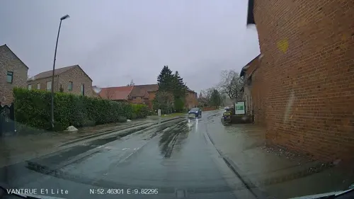
Biohof Hemme & Spirituosen H. Könecke & Sohn
Farm and orchard · 1.6 km
40 Dorfstraße, Isernhagen
Tu 09:30-12:00; Th 09:30-12:00,14:30-18:00; Fr...
Museums and landmarks4



Parks, trails and playgrounds7





Restaurants and cafes34

Vatter
Bakery · 2.6 km
7 Hannoversche Straße, Burgwedel
Mo-Fr 06:30-17:00; Sa 06:30-13:00; Su 06:30-16:00
Ole Deele
Restaurant · 2.3 km
14 Heinrich-Wöhler-Straße, Burgwedel
Tu-Sa 18:00-22:00


22 more on the map.
Where to stay1
Churches and places of worship4
Shopping10
Gas and EV charging6
Schools, colleges and libraries7
Healthcare2
Map of Isernhagen Farster Bauerschaft
76 places. The map loads OpenStreetMap tiles when you open it.
Getting there and nearby towns
Hannover Airport (HAJ) is the nearest airport with scheduled flights listed in OpenStreetMap, 11 km away.
- Langenhagen 8 km southwest, about 8 min by car
- Hannover 13 km southwest, about 13 min by car
- Lehrte 14 km southeast, about 14 min by car
- Ahlem 16 km southwest, about 16 min by car
- Laatzen 18 km south, about 18 min by car
- Seelze 19 km southwest, about 19 min by car
- Wettbergen 19 km southwest, about 19 min by car
- Sehnde 19 km southeast, about 19 min by car
- Hambühren 20 km northeast, about 20 min by car
- Ronnenberg 21 km southwest, about 21 min by car
Drive times are estimates from straight-line distance, not routes.
Local news
Headlines from INDB.
Reviews, tips and questions
Loading what members have shared...
Sources and licences
- GeoNames (CC BY 4.0): population, coordinates, regions and time zone
- Mapillary (see each image): photos
- OpenStreetMap contributors (ODbL 1.0): places, airports, map data
- Wikidata (CC0 1.0): elevation, founding date, time zone, website
- Wikimedia Commons (see each image): photos
Photo credits
- Anhöhe der Farster Bauerschaft, losch, Attribution
- Parksee Lohne in Isernhagen IMG 4122, Losch, CC BY-SA 3.0
- Von-Alten-Straße 15 (Bibliothek), Gerd Fahrenhorst, CC BY 4.0
- St.Petri-Kirche Großburgwedel (Burgwedel) IMG 3590, losch, CC BY-SA 3.0
- St. Marienkirche Isernhagen KB, Losch at German Wikipedia, Attribution
- Hauptstraße 38, 6, Farster Bauerschaft, Isernhagen, Region Hannover, GeorgDerReisende, CC BY-SA 4.0
- Fachwerk an der Hauptstraße 38 der Farster Bauerschaft (Isernhagen) IMG 3308, Losch, CC BY-SA 3.0
- Farster Bauerschaft (Isernhagen) IMG 3309, losch, CC BY-SA 3.0
- Farster Bauerschaft (Isernhagen) IMG 3310, losch, CC BY-SA 3.0
- Farster Bauerschaft (Isernhagen) IMG 3312, losch, CC BY-SA 3.0
- Farster Bauerschaft (Isernhagen) IMG 3308, losch, CC BY-SA 3.0
- Hauptstraße 38, 4, Farster Bauerschaft, Isernhagen, Region Hannover, GeorgDerReisende, CC BY-SA 4.0
- Hauptstraße 38b, 1, Farster Bauerschaft, Isernhagen, Region Hannover, GeorgDerReisende, CC BY-SA 4.0
- Isernhagen, Tiefe Trift 4, Puusterke, CC BY-SA 4.0
- Isernhagen, Hauptstraße 52, Puusterke, CC BY-SA 4.0
- Isernhagen, Hauptstraße 54, Puusterke, CC BY-SA 4.0
- Isernhagen, Hauptstraße 32, Puusterke, CC BY-SA 4.0
- Hauptstraße, 1, Farster Bauerschaft, Isernhagen, Region Hannover, GeorgDerReisende, CC BY-SA 4.0
- Isernhagen, Hauptstraße 56, Puusterke, CC BY-SA 4.0
- Hauptstraße 54, 4, Farster Bauerschaft, Isernhagen, Region Hannover, GeorgDerReisende, CC BY-SA 4.0
- LSG Obere Wietze, 1, Farster Bauerschaft, Isernhagen, Region Hannover, GeorgDerReisende, CC BY-SA 4.0
- Hauptstraße 56a, 1, Farster Bauerschaft, Isernhagen, Region Hannover, GeorgDerReisende, CC BY-SA 4.0
- Bushaltestelle Heidehof, 1, Farster Bauerschaft, Isernhagen, Region Hannover, GeorgDerReisende, CC BY-SA 4.0
- Hauptstraße 89, 1, Farster Bauerschaft, Isernhagen, Region Hannover, GeorgDerReisende, CC BY-SA 4.0
- Bushaltestelle Heidehof, 2, Farster Bauerschaft, Isernhagen, Region Hannover, GeorgDerReisende, CC BY-SA 4.0
- Hauptstraße 66, 4, Farster Bauerschaft, Isernhagen, Region Hannover, GeorgDerReisende, CC BY-SA 4.0
- Isernhagen, Hauptstraße 20, Puusterke, CC BY-SA 4.0
- Hauptstraße 68, 1, Farster Bauerschaft, Isernhagen, Region Hannover, GeorgDerReisende, CC BY-SA 4.0
- Hauptstraße 27, 1, Farster Bauerschaft, Isernhagen, Region Hannover, GeorgDerReisende, CC BY-SA 4.0
- Isernhagen, Hauptstraße 68 (Isernhagenhof), Puusterke, CC BY-SA 4.0
- Isernhagen, Hauptstraße 16a, Puusterke, CC BY-SA 4.0
- Hauptstraße 16, 5, Farster Bauerschaft, Isernhagen, Region Hannover, GeorgDerReisende, CC BY-SA 4.0
- Hauptstraße 16, 4, Farster Bauerschaft, Isernhagen, Region Hannover, GeorgDerReisende, CC BY-SA 4.0
- Hauptstraße 16, 1, Farster Bauerschaft, Isernhagen, Region Hannover, GeorgDerReisende, CC BY-SA 4.0
- Isernhagen, Hauptstraße 72, Puusterke, CC BY-SA 4.0
- LSG Hahle, 3, Farster Bauerschaft, Isernhagen, Region Hannover, GeorgDerReisende, CC BY-SA 4.0
- Auf der Heide, 8, Farster Bauerschaft, Isernhagen, Region Hannover, GeorgDerReisende, CC BY-SA 4.0
- Hauptstraße 8, 1, Farster Bauerschaft, Isernhagen, Region Hannover, GeorgDerReisende, CC BY-SA 4.0
- Hauptstraße 74, 6, Farster Bauerschaft, Isernhagen, Region Hannover, GeorgDerReisende, CC BY-SA 4.0
- Hauptstraße 74, 4, Farster Bauerschaft, Isernhagen, Region Hannover, GeorgDerReisende, CC BY-SA 4.0
- Isernhagen Steinkreuze I-IV, Radler59, CC BY-SA 3.0
- Street-level photo, Langfahrer, CC BY-SA 4.0
- Street-level photo, Hightower-, CC BY-SA 4.0
- Street-level photo, hotteliene, CC BY-SA 4.0
- Street-level photo, hotteliene, CC BY-SA 4.0
- Street-level photo, hotteliene, CC BY-SA 4.0
- Street-level photo, Langfahrer, CC BY-SA 4.0
- Street-level photo, peewee32, CC BY-SA 4.0
- Street-level photo, live, CC BY-SA 4.0
- Street-level photo, Langfahrer, CC BY-SA 4.0
- Street-level photo, peewee32, CC BY-SA 4.0
- Street-level photo, Hightower-, CC BY-SA 4.0
- Street-level photo, skjall, CC BY-SA 4.0
- Street-level photo, hotteliene, CC BY-SA 4.0
- Street-level photo, live, CC BY-SA 4.0
- Street-level photo, live, CC BY-SA 4.0
- Street-level photo, zoegglmeyr, CC BY-SA 4.0
- Street-level photo, Langfahrer, CC BY-SA 4.0
- Street-level photo, hotteliene, CC BY-SA 4.0
- Street-level photo, Hightower-, CC BY-SA 4.0
- Street-level photo, cageythree, CC BY-SA 4.0
- Street-level photo, skjall, CC BY-SA 4.0
- Street-level photo, hotteliene, CC BY-SA 4.0
- Street-level photo, Langfahrer, CC BY-SA 4.0
- Street-level photo, hotteliene, CC BY-SA 4.0
- Street-level photo, hotteliene, CC BY-SA 4.0
- Street-level photo, live, CC BY-SA 4.0
- Street-level photo, live, CC BY-SA 4.0
- Street-level photo, hotteliene, CC BY-SA 4.0


Page built November 8, 2026. Spotted a mistake? Tell us or suggest a place.