


Why visit Sehnde
Townapedia lists 54 museums and landmarks, 39 parks and trails, 129 places to eat, 23 places to stay and 12 attractions in and around town.
Highlights include Das Andere Kino e.V., Meyer's Hof, Hanover Tramway Museum and Museumsstellwerk Lpf.
Weather in Sehnde
Forecast from MET Norway (CC BY 4.0). Full forecast
About Sehnde
Sehnde (German pronunciation: [ˈzeːndə] ) is a town in Lower Saxony, Germany. It is located approximately 15 kilometres southeast of Hanover.
From the Wikipedia article Sehnde (this version), under CC BY-SA 4.0.
Things to do12


Weber's kleiner Hofladen
Farm and orchard · 4.2 km
22 Ferdinand-Wahrendorff-Straße, Sehnde
Mo-Su 06:00-21:00


Museums and landmarks54





Hannoversches Fernmeldemuseum
Museum · 4.4 km
2 Am Straßenbahnmuseum, Sehnde
https://www.fernmeldeclub.de/offen.html
Norddeutsches Museum für HiFi- und Studiotechnik
Museum · 4.4 km
2 Am Straßenbahnmuseum, Sehnde
https://hifimuseumnord.de/besucherinfos/


Kirchenanlage und Stümpelhof
Monument and historic site · 7.7 km
Ensemble um die Kirchenanlage und die große Hofanlage. Erstmals erwähnt im 9. Jahrundert
42 more on the map.
Parks, trails and playgrounds39



Maschplatz Bilm
Park · 4.7 km
Platzordnung: - Nutzungszeiten 9 - 20 Uhr - Gesonderte Zeiten / Veranstaltungen in Absprache mit dem Ortsrat Bilm - Müll ist durch den...
Maschdamm, Sehnde
Mo-Su 09:00-20:00


YC Sehnde
Marina and boat launch · 1.0 km
Yachthafen Yacht Club Sehnde. Im Innenhafen bis ca. 8m Länge und 1,3m Wassertiefe (Achtung es gibt ein Hubtor in der Hafeneinfahrt). An...




Ballspielfläche Hilda-Rempel-Straße
Playground · 6.0 km
Nutzungszeiten: - Montag bis Samstag 08:00 - 21:00 Uhr - Sonn- und Feiertage 08:00 - 13:00 Uhr und 15:00 - 21:00 Uhr
27 more on the map.
Restaurants and cafes129

Restaurant VillaMare - Mediterrane Küche
Restaurant · Italian, Mediterranean
Lieben Sie die italienische Küche, frische Antipasti, knusprige Steinofenpizza oder hausgemachte Pasta? Im Restaurant Villa Mare...
39 Breite Straße, Sehnde
We-Fr 17:00-22:00; Sa 12:00-23:00; Su 12:00-15:30
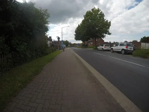
Bei Vassi
Restaurant · Greek · 2.7 km
37 Rethener Straße, Sehnde
Tu-Sa 17:30-23:30; Su 12:00-14:30,17:30-23:30
Kleifeldstuben
Restaurant · German · 6.5 km
15 Im Kleifeld, Lehrte
Mo-Fr 16:00-23:00; Sa-Su 10:00-22:00
Seeterrassen
Restaurant · German · 8.4 km
90 Steinstraße, Lehrte
We-Sa 12:00-21:00; Mo,Tu off; Su 10:00-18:00
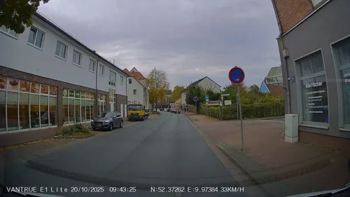
Balkenholl
Cafe · Bakery · 6.5 km
10 Ahltener Straße, Lehrte
Mo-Fr 06:30-18:00; Sa 06:30-14:00; Su 07:30-12:00
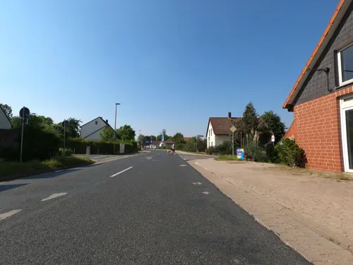
Bei Ania
Restaurant · Greek · 6.6 km
19a Gleidinger Straße, Laatzen
We-Th 16:30-21:00; Fr-Sa 16:30-22:00; Su 16:00-20:30; Mo-Tu off
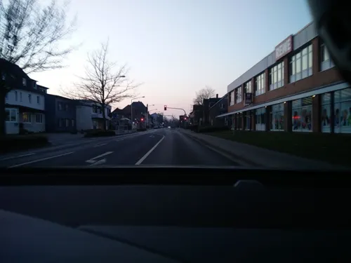



Kuckucksnest
Cafe · Coffee Shop · 2.7 km
1 Wahre-Dorffstraße, Sehnde
Mo-Fr 08:00-16:30, Tu-Th 08:00-14:00, Sa 09:00-12:00
117 more on the map.
History
Sehnde was formed in 1974 by combining fifteen autonomous villages which belonged to three different districts: Bilm, Bolzum, Dolgen, Evern, Gretenberg, Haimar, Höver, Ilten, Klein Lobke, Müllingen, Rethmar, Sehnde, Wassel, Wehmingen, and Wirringen. Sehnde received its town charter in 1997.
The whole area was agricultural for centuries, until large salt and potash deposits were discovered at the end of the 19th century. Several potash mines were dug, the first at Gustavshall in Hohenfels in 1896. During the 20th century, Sehnde and Ilten were the chief beneficiaries of the mines, until the last one was closed in 1995. Since the 1950s, most of the area has been transformed into dormitory villages, while jobs have concentrated in Hannover. In 2005, small one-family houses dominate large parts of Sehnde and its villages.
From the History section of Sehnde on Wikipedia, under CC BY-SA 4.0.
Where to stay23
Churches and places of worship52
Shopping36
Gas and EV charging18
Schools, colleges and libraries22
Albert-Schweitzer-Schule (Grundschule + Unterstufe des Gymnasiums)
School · 7.2 km
3 Schlesische Straße, Lehrte
Healthcare19
KRH-Regionales Gesundheitszentrum/Standort Lehrte
Clinic and pharmacy · 7.4 km
22 Manskestraße, Lehrte
Map of Sehnde
250 places. The map loads OpenStreetMap tiles when you open it.
Getting there and nearby towns
Hannover Airport (HAJ) is the nearest airport with scheduled flights listed in OpenStreetMap, 26 km away.
- Hannover 17 km west, about 17 min by car
- Hildesheim 18 km south, about 18 min by car
- Wettbergen 19 km west, about 19 min by car
- Ahlem 22 km west, about 22 min by car
- Wennigsen 27 km west, about 27 min by car
- Vechelde 28 km east, about 28 min by car
- Wendeburg 29 km east, about 29 min by car
- Springe 31 km west, about 31 min by car
- Salzgitter 35 km southeast, about 35 min by car
- Braunschweig 38 km east, about 38 min by car
Drive times are estimates from straight-line distance, not routes.
Local news
Headlines from INDB.
Reviews, tips and questions
Loading what members have shared...
Sources and licences
- GeoNames (CC BY 4.0): population, coordinates, regions and time zone
- Mapillary (see each image): photos
- OpenStreetMap contributors (ODbL 1.0): places, airports, map data
- Wikidata (CC0 1.0): elevation, founding date, time zone, website, landmarks and historic places
- Wikimedia Commons (see each image): photos
- Wikipedia (CC BY-SA 4.0): overview and history text
Photo credits
- Sehnde Rathaus, Rabanus Flavus, Public domain
- Volksbank in Sehnde, Mittelstraße, Foto 1, Gerd Fahrenhorst, CC BY 4.0
- Volksbank in Sehnde, Mittelstraße, Foto 2, Gerd Fahrenhorst, CC BY 4.0
- Rathaus Sehnde 2021-11, Gerd Fahrenhorst, CC BY 4.0
- Sehnde, Marktplatz, Gerd Fahrenhorst, CC BY 4.0
- Rathaus Sehnde, Detail, Gerd Fahrenhorst, CC BY 4.0
- Nordstraße 19, Stadtwerke Sehnde, Gerd Fahrenhorst, CC BY 4.0
- Sehnde 2026 - Chinarestaurant Hong-Kong - Ente - by-RaBoe 001, Raboe001, CC BY-SA 3.0 de
- Sehnde Bahnhof, bus, Christo, CC0
- Moltkestraße 14 in Sehnde, Gerd Fahrenhorst, CC BY 4.0
- Moltkestraße 10 und 12 in Sehnde, Gerd Fahrenhorst, CC BY 4.0
- Moltkestraße 8 und 6 in Sehnde, Gerd Fahrenhorst, CC BY 4.0
- Moltkestraße 6 und 8 in Sehnde, Gerd Fahrenhorst, CC BY 4.0
- Moltkestraße 2 und 4 in Sehnde, Gerd Fahrenhorst, CC BY 4.0
- Sehnde, Lagerhallen, Gerd Fahrenhorst, CC BY 4.0
- Lagerhalle Moltkestraße in Sehnde, Gerd Fahrenhorst, CC BY 4.0
- Bismarckstraße 14 und 12 in Sehnde, Gerd Fahrenhorst, CC BY 4.0
- Bismarckstraße 5 in Sehnde, Gerd Fahrenhorst, CC BY 4.0
- Sehnde, Lagerhalle, Gerd Fahrenhorst, CC BY 4.0
- Sehnde, S-bahn, S3, Christo, CC0
- Sehnde, S-bahn, S3, 2, Christo, CC0
- Bismarckstraße 8 und 10 in Sehnde, Gerd Fahrenhorst, CC BY 4.0
- Bismarckstraße 6 und 4 in Sehnde, Gerd Fahrenhorst, CC BY 4.0
- Bismarckstraße 3 in Sehnde, Gerd Fahrenhorst, CC BY 4.0
- Sehnde, Kaliberg, Gerd Fahrenhorst, CC BY 4.0
- Bismarckstraße 4 in Sehnde, Gerd Fahrenhorst, CC BY 4.0
- Bismarckstraße 2 in Sehnde, Gerd Fahrenhorst, CC BY 4.0
- Strassenbahnmuseum Hannover Panorama, AxelHH, CC BY-SA 3.0
- Lehrter Museumsstellwerk LPF, Hover dam, CC BY 3.0
- Naturschutzgebiet Hahnenkamp 02, Puusterke, CC BY-SA 4.0
- Regional-Museum Sehnde Eingang, Axel Hindemith, CC BY-SA 4.0
- NSG Himmelreich, Gerd Fahrenhorst, CC BY 4.0
- St.-Bernward-Kirche Lehrte, Hydro, CC BY-SA 3.0
- Sehnde, KGS, Rabanus Flavus, CC0
- Schloss Rethmar 2013, Axel Hindemith, CC BY 3.0
- Josefbolzum1, Rabanus Flavus, Public domain
- St Maria Sehnde 1, Matthias Feige, Public domain
- Algermissen St Matthaeus West, Rabanus Flavus, Public domain
- Waetzumer-tonkuhle9196-Pano, Herbert Weber, Hildesheim, CC BY-SA 4.0
- Försterstein im Bockmerholz bei Wülferode (Hannover) 19. Jh, Thomas Fries, CC BY-SA 3.0 de
- Gaim Waldweg, Axel Hindemith, CC BY 3.0
- Delmer Berg, Den man tau, CC BY-SA 4.0
- Haimar Kirche, Rabanus Flavus, Public domain
- Kapelle Ahlten 1, Hydro, CC BY-SA 3.0
- St.-Nicolai-Kirche in Ingeln-Oesselse (Laatzen) IMG 9296, Losch, CC BY-SA 3.0
- Nikolauskirche Lehrte (1), Hydro, CC BY-SA 4.0
- Evern ev, Rabanus Flavus, Public domain
- Bolzum St Nikolai, Rabanus Flavus, Public domain
- Gefallenendenkmal Wassel 1, Gerd Fahrenhorst, CC BY 4.0
- Bockmerholzstraße 4 in Wülferode (Hannover) IMG 1820 2, Losch, CC BY-SA 3.0
- Street-level photo, Langfahrer, CC BY-SA 4.0
- Street-level photo, mfa, CC BY-SA 4.0
- Street-level photo, cageythree, CC BY-SA 4.0
- Street-level photo, Langfahrer, CC BY-SA 4.0
- Street-level photo, Hightower-, CC BY-SA 4.0
- Street-level photo, bierti, CC BY-SA 4.0
- Street-level photo, Langfahrer, CC BY-SA 4.0
- Street-level photo, cageythree, CC BY-SA 4.0
- Street-level photo, peewee32, CC BY-SA 4.0
- Street-level photo, hotteliene, CC BY-SA 4.0
- Street-level photo, skjall, CC BY-SA 4.0
- Street-level photo, cageythree, CC BY-SA 4.0
- Street-level photo, Hightower-, CC BY-SA 4.0
- Street-level photo, skjall, CC BY-SA 4.0
- Street-level photo, skjall, CC BY-SA 4.0
- Street-level photo, hotteliene, CC BY-SA 4.0
- Street-level photo, bierti, CC BY-SA 4.0
- Street-level photo, skjall, CC BY-SA 4.0


Page built November 8, 2026. Spotted a mistake? Tell us or suggest a place.