


Why visit Lehrte
Townapedia lists 75 museums and landmarks, 56 parks and trails, 208 places to eat, 22 places to stay and 15 attractions in and around town.
Highlights include Neue Schauburg, Das Andere Kino e.V., KulturWerkStadt and Schleuse Anderten.
Weather in Lehrte
Forecast from MET Norway (CC BY 4.0). Full forecast
About Lehrte
Lehrte (German pronunciation: [ˈleːɐ̯tə] ) is a town in the district of Hanover, in Lower Saxony, Germany. It is situated approximately 17 km east of Hanover. In the 19th century Lehrte was the most important railway junction in the former Kingdom of Hanover. As of the 21st century, it has a population of 43,000.
From the Wikipedia article Lehrte (this version), under CC BY-SA 4.0.
Photos of Lehrte


Things to do15



Weber's kleiner Hofladen
Farm and orchard · 4.1 km
22 Ferdinand-Wahrendorff-Straße, Sehnde
Mo-Su 06:00-21:00

3 more on the map.
Museums and landmarks75


Schleuse Anderten
Monument and historic site · 7.9 km
24/7



63 more on the map.
Parks, trails and playgrounds56




Maschplatz Bilm
Park · 6.1 km
Platzordnung: - Nutzungszeiten 9 - 20 Uhr - Gesonderte Zeiten / Veranstaltungen in Absprache mit dem Ortsrat Bilm - Müll ist durch den...
Maschdamm, Sehnde
Mo-Su 09:00-20:00

YC Sehnde
Marina and boat launch · 7.3 km
Yachthafen Yacht Club Sehnde. Im Innenhafen bis ca. 8m Länge und 1,3m Wassertiefe (Achtung es gibt ein Hubtor in der Hafeneinfahrt). An...

44 more on the map.
Restaurants and cafes208
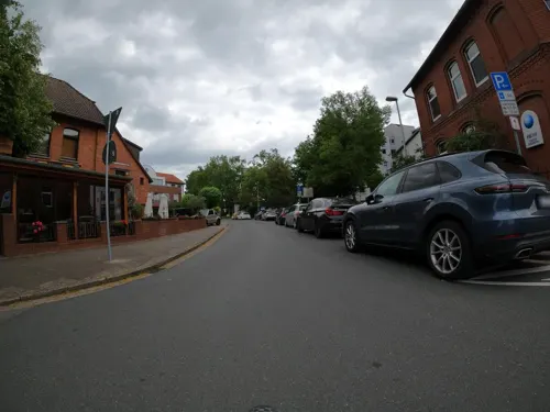
Alioli
Restaurant · Spanish · 8.2 km
1 Ostergrube, Hannover
Mo off; Tu-Fr 17:00-24:00; Sa-Su,PH 12:00-24:00
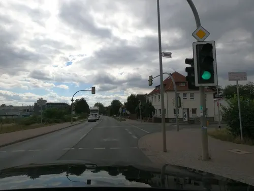
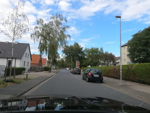
Bei Ranko
Restaurant · Balkan · 8.8 km
48 Waldstraße, Hannover
We-Sa 17:00-22:00; Su,PH 11:30-14:30,17:00-21:00
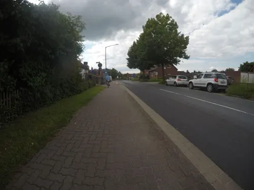
Bei Vassi
Restaurant · Greek · 6.7 km
37 Rethener Straße, Sehnde
Tu-Sa 17:30-23:30; Su 12:00-14:30,17:30-23:30
Café Engelke
Bakery · Coffee Shop · 8.8 km
3 Waldstraße, Hannover
Mo-Fr 06:00-18:00; Sa 06:00-17:00; Su,PH 08:00-17:00
Ischia
Restaurant · Italian · 8.8 km
2 Hannoversche Straße, Hannover
Mo, We-Su 12:00-15:00, 18:00-22:00; Tu off
La Castagna
Restaurant · Italian · 8.8 km
11 Hannoversche Straße, Hannover
Mo-Sa 12:00-15:00,17:00-22:30; Su,PH 16:00-22:00

Restaurant VillaMare - Mediterrane Küche
Restaurant · Italian, Mediterranean · 6.7 km
Lieben Sie die italienische Küche, frische Antipasti, knusprige Steinofenpizza oder hausgemachte Pasta? Im Restaurant Villa Mare...
39 Breite Straße, Sehnde
We-Fr 17:00-22:00; Sa 12:00-23:00; Su 12:00-15:30
4Cooks
Restaurant · Regional · 6.2 km
7 Peiner Straße, Sehnde
We-Sa 17:00-21:00; Su 11:30-15:00,17:00-22:00
Kleifeldstuben
Restaurant · German · 4.9 km
15 Im Kleifeld, Lehrte
Mo-Fr 16:00-23:00; Sa-Su 10:00-22:00
196 more on the map.
History
The first documented history of the area was in 1147 and shows that, what is now known as Lehrte, was a relatively small farming village. Up to the year 1352, when the church, now known as Nikolauskirche, was built; the local farming residents attended Sunday church services in the village of Steinwedel.
At this time, Lehrte lay in the historical region known as the Großen Freien which literally translates to the big free and lay far from major transit and traffic routes.
From the History section of Lehrte on Wikipedia, under CC BY-SA 4.0.
More about Lehrte
Economy
Lehrte lay fairly dormant until 1843, when work began on the Hanover–Brunswick railway, linking Lehrte with both towns. In the following year, work began on building lines to Celle (1845), Hildesheim (1846) and Berlin (1871).
When work on the railway line commenced, Lehrte had 755 inhabitants; 60 years later the population had increased approximately ten times. In 1898 the area of Lehrte was granted municipal rights and formally recognised as a town.
With the railway well and truly established, industry grew within Lehrte, including clay works, a mineral fertilizer works, a cement factory, canned goods and a sugar factory in 1883 which, until 2002, dominated the centre of the town. The cement factory was created in 1881 by Hermann Manske with other limited partners and was the second factory of the cement industry in the Hanover region.
In 1910 the cement factory was shut down. In 1911 a cattle market was established and Lehrte became one of the most important places for cattle trade and shipment in Northern Germany. In 1912, mining began on the potash reserves in the area. The Lehrter Bahnhof (Lehrte Station) in Berlin is named after Lehrte. It was opened in 1871 as the terminus of the line linking Berlin with Lehrte and Hannover, which later became Germany's most important east–west main line.
From the Wikipedia article Lehrte, under CC BY-SA 4.0.
Notable people from Lehrte
 Lukas RiegerGerman singerPhoto: Frank Schwichtenberg, CC BY-SA 4.0
- Kurt HirschfeldGerman-Jewish Dramaturg and Theater Director (1902-1964)
- Heinrich SchmidtNazi politician (1902-1960)
Born in Lehrte, according to Wikidata (CC0). Each name links to its Wikipedia article.
Where to stay22
Churches and places of worship51
Shopping53
Gas and EV charging29
Schools, colleges and libraries36
Healthcare28
Apotheke im Gesundheitszentrum
Clinic and pharmacy · 8.7 km
1 Norderneystraße, Burgdorf
Map of Lehrte
250 places. The map loads OpenStreetMap tiles when you open it.
Getting there and nearby towns
Hannover Airport (HAJ) is the nearest airport with scheduled flights listed in OpenStreetMap, 23 km away.
- Sehnde 6 km south, about 6 min by car
- Burgdorf 8 km north, about 8 min by car
- Arpke 8 km east, about 8 min by car
- Heideviertel 11 km west, about 11 min by car
- Lahe 12 km northwest, about 12 min by car
- Bothfeld 13 km west, about 13 min by car
- Algermissen 13 km south, about 13 min by car
- Laatzen 14 km southwest, about 14 min by car
- Isernhagen Farster Bauerschaft 14 km northwest, about 14 min by car
- Hannover 17 km west, about 17 min by car
Drive times are estimates from straight-line distance, not routes.
Towns near Lehrte


Keep exploring
Local news
Headlines from INDB.
Reviews, tips and questions
Loading what members have shared...
Sources and licences
- GeoNames (CC BY 4.0): population, coordinates, regions and time zone
- Mapillary (see each image): photos
- OpenStreetMap contributors (ODbL 1.0): places, airports, map data
- Wikidata (CC0 1.0): elevation, founding date, time zone, website, landmarks and historic places
- Wikimedia Commons (see each image): photos
- Wikipedia (CC BY-SA 4.0): overview and history text
Photo credits
- Rathaus Lehrte (01), Hydro, CC BY-SA 4.0
- An der Masch 2 Schule Lehrte, Clemensfranz, CC BY-SA 3.0
- Denkmal Befreiungskriege, Lehrte, An der Masch, Clemensfranz, CC BY-SA 3.0
- Matthäuskirche Lehrte 02, Hydro, CC BY-SA 4.0
- Kriegsopferdenkmal Lehrte An der Masch (3), Hydro, CC BY-SA 4.0
- Matthäuskirche Lehrte, Clemensfranz, CC BY-SA 3.0
- An der Masch 4 Schule Lehrte, Clemensfranz, CC BY-SA 3.0
- Kriegerdenkmal Lehrte Befreiungskriege, Hydro, CC BY-SA 4.0
- Kriegsopferdenkmal Lehrte An der Masch (2), Hydro, CC BY-SA 4.0
- An der Masch Kriegerdenkmal Lehrte, Clemensfranz, CC BY-SA 3.0
- Kriegsopferdenkmal Lehrte An der Masch (1), Hydro, CC BY-SA 4.0
- Lehrte, An der Marsch 4, 2018-09-16 10.45.40, Hover dam, CC BY 3.0
- Grundschule I Lehrte, Hydro, CC BY-SA 4.0
- Lehrte, An der Masch 4, Erinnerungstafel, 2018-09-16 10.43.16, Hover dam, CC BY 3.0
- Lehrte, An der Masch 1, Matthäuskirche, Erinnerungstafel, 2018-09-16 10.46.10., Hover dam, CC BY 3.0
- Lehrte, An der Masch 2, Erinnerungstafel, 2018-09-16 10.42.46, Hover dam, CC BY 3.0
- 20111126 Selimiye-Camii Moschee Lehrte 002, Hover dam, CC BY-SA 3.0
- Lehrte, An der Masch 2, 2018-09-16 10.47.08, Hover dam, CC BY 3.0
- 20111126 Selimiye-Camii Moschee Lehrte 003, Hover dam, CC BY-SA 3.0
- 20111126 Selimiye-Camii Moschee Lehrte 004, Hover dam, CC BY-SA 3.0
- Lehrte, Marktstraße 19, 2018-09-16 10.50.46, Hover dam, CC BY 3.0
- 20111126 Selimiye-Camii Moschee Lehrte 001, Hover dam, CC BY-SA 3.0
- Lehrte, Sedanplatz 2, 2018-09-16 10.40.26, Hover dam, CC BY 3.0
- Sedanplatz 2 Lehrte, Clemensfranz, CC BY-SA 3.0
- Lehrte, Marktstraße 39 A, 2018-09-16 10.53.48, Hover dam, CC BY 3.0
- Lehrte, Sedanplatz 4, 2018-09-16 10.40.46, Hover dam, CC BY 3.0
- Rathaus Lehrte (02), Hydro, CC BY-SA 4.0
- Lehrte, Der Brink, Erinnerungstafel, 2018-09-16 11.04.18, Hover dam, CC BY 3.0
- Lehrte, Hagenstraße 6, 2018-09-16 11.30.02, Hover dam, CC BY 3.0
- Lehrte, Osterstraße 20, 2018-09-16 11.00.02, Hover dam, CC BY 3.0
- Lehrte, Marktstraße 4, 2018-09-16 10.36.26, Hover dam, CC BY 3.0
- Pfarrhaus Am Lindenberg 5, Lehrte, Hydro, CC BY-SA 4.0
- Lehrte, Hagenstraße 5, 2018-09-16 10.58.18, Hover dam, CC BY 3.0
- Lehrte, Marktstraße 2, 2018-09-16 10.36.46, Hover dam, CC BY 3.0
- Lehrte - Rathausplatz 1 - Rathaus - 2014-02-22 08.20.01, Hover dam, CC BY 3.0
- Lehrte - Rathausplatz 1 - Rathaus - 2013-03-16 17.16.08, Hover dam, CC BY 3.0
- Bücherschrank, 1, Lehrte, Region Hannover, GeorgDerReisende, CC BY-SA 4.0
- Lehrte, Alte Bahnhofstraße 10, 2018-08-12 09.45.06, Hover dam, CC BY 3.0
- Lehrte, Am Rathaus 3, 2018-08-17 12.50.55, Hover dam, CC BY 3.0
- FFH-Gebiet "Altwarmbüchener Moor" (3525-331) 03, Puusterke, CC BY-SA 4.0
- Heessel Rekonstruktion, AxelHH, Public domain
- Lehrter Museumsstellwerk LPF, Hover dam, CC BY 3.0
- Naturschutzgebiet Hahnenkamp 02, Puusterke, CC BY-SA 4.0
- Regional-Museum Sehnde Eingang, Axel Hindemith, CC BY-SA 4.0
- St.-Bernward-Kirche Lehrte, Hydro, CC BY-SA 3.0
- Sehnde, KGS, Rabanus Flavus, CC0
- Schloss Rethmar 2013, Axel Hindemith, CC BY 3.0
- Hannover-Anderten Martinskirche, Rabanus Flavus, CC0
- St Maria Sehnde 1, Matthias Feige, Public domain
- Burgdorf St Pankratius Sued, Andreasdz ; shifted by Rabanus Flavus, GFDL
- Burgdorfer Synagoge, Puusterke, CC BY-SA 4.0
- Hämelerwald Eichen, Axel Hindemith, Public domain
- Haimar Kirche, Rabanus Flavus, Public domain
- Kirche Steinwedel (6), Hydro, CC BY-SA 4.0
- Nikolauskirche Lehrte (1), Hydro, CC BY-SA 4.0
- Pestalozzischule I und Kardinal-Galen-Schule (Hannover) (15), Klaaschwotzer, CC BY-SA 4.0
- Paula-Nordhoff-Straße (Hannover) (14), Klaaschwotzer, CC BY-SA 4.0
- Evern ev, Rabanus Flavus, Public domain
- Schachtschleuse Anderten, Matthias104a, CC BY-SA 3.0
- Baudenkmal Hannover Denkmal Ostergrube, Franz Kalowski, CC BY-SA 4.0
- Gefallenendenkmal Wassel 1, Gerd Fahrenhorst, CC BY 4.0
- Kran MUKAG in Misburg, Gerd Fahrenhorst, CC BY 3.0
- 2021-02-25 Stolperstein Anton Macioszyk 01, Bärbel Miemietz, CC BY-SA 4.0
- 2016-07-17 Kurze Straße 8, Hannover Misburg, ehemals Standort Spritzenhaus, wo Anton Macioszyk 1933 zu Tode geprügelt wurde, Gedenktafel, Bernd Schwabe, CC BY-SA 4.0
- Am Bache Hannover Anderten Spielplatz an Stelle des ehemaligen Dorfteiches, Bernd Schwabe in Hannover, CC BY-SA 3.0
- Spielplatz Deimeweg in Hannover-Anderten 2, Nortix08, CC BY-SA 4.0
- Misburg - Kolumbarium Hl. Herz Jesu - 1, Misburg3014, CC BY-SA 4.0
- St. Johannis-Kirche in Misburg (Hannover) IMG 4027, Losch, CC BY-SA 3.0
- Neue Schauburg - panoramio, j.e.c, CC BY-SA 3.0
- Street-level photo, Langfahrer, CC BY-SA 4.0
- Street-level photo, Langfahrer, CC BY-SA 4.0
- Street-level photo, mfa, CC BY-SA 4.0
- Street-level photo, skjall, CC BY-SA 4.0
- Street-level photo, Langfahrer, CC BY-SA 4.0
- Street-level photo, Langfahrer, CC BY-SA 4.0
- Street-level photo, HalLi, CC BY-SA 4.0
- Street-level photo, Langfahrer, CC BY-SA 4.0
- Street-level photo, Langfahrer, CC BY-SA 4.0
- Street-level photo, Hightower-, CC BY-SA 4.0
- Street-level photo, Hightower-, CC BY-SA 4.0
- Street-level photo, Langfahrer, CC BY-SA 4.0
- Street-level photo, skjall, CC BY-SA 4.0
- Street-level photo, snowdiver, CC BY-SA 4.0
- Street-level photo, skjall, CC BY-SA 4.0
- Street-level photo, snowdiver, CC BY-SA 4.0
- Street-level photo, peewee32, CC BY-SA 4.0
- Street-level photo, Hightower-, CC BY-SA 4.0
- Street-level photo, peewee32, CC BY-SA 4.0
- Street-level photo, snowdiver, CC BY-SA 4.0
- Street-level photo, Hightower-, CC BY-SA 4.0
- Street-level photo, Langfahrer, CC BY-SA 4.0
- Street-level photo, bierti, CC BY-SA 4.0


Page built November 9, 2026. Spotted a mistake? Tell us or suggest a place.