


Why visit Wedel
Townapedia lists 44 museums and landmarks, 64 parks and trails, 124 places to eat, 16 places to stay and 21 attractions in and around town.
Highlights include Blankenese Low Lighthouse, Oberfeuer Tinsdal, Ernst Barlach Museum and Aurora.
Weather in Wedel
Forecast from MET Norway (CC BY 4.0). Full forecast
About Wedel
Wedel (German pronunciation: [ˈveːdl̩] ) is a town in the district of Pinneberg, in Schleswig-Holstein, in northern Germany. It is situated on the right bank of the Elbe, approximately 20 kilometres (12 mi) south of Elmshorn, and 17 kilometres (11 mi) west of Hamburg.
From the Wikipedia article Wedel (this version), under CC BY-SA 4.0.
Travel tips from other travellers: Wedel on Wikivoyage (CC BY-SA 4.0).
Photos of Wedel


Things to do21

Blankenese Low Lighthouse
Lighthouse · 7.1 km
Lighthouse in Hamburg, Germany



Obsthof Matthies
Farm and orchard · 4.6 km
31 Am Elbdeich, Jork
Mo-Fr 08:00-18:00; Sa,Su,PH 09:00-18:00


9 more on the map.
Museums and landmarks44


Wasserturm Möller-Wedel
Monument and historic site · 0.7 km
Wasserturm auf dem Gelände der Fa. Möller in Wedel


Hamburger Golf-Club Falkenstein
Monument and historic site · 5.2 km
59 In de Bargen, Hamburg
32 more on the map.
Parks, trails and playgrounds64





52 more on the map.
Restaurants and cafes124
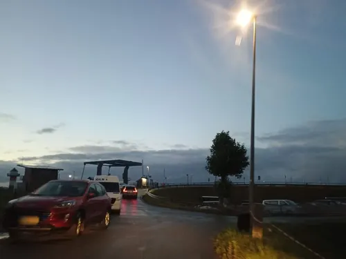
Hotel Restaurant Elb Blick
Restaurant · German · 4.5 km
40 Lühe, Jork
Tu-Sa 17:00-22:00; Su 12:00-14:30, 17:00-22:00
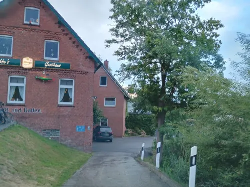
Garduong
Restaurant · Vietnamese · 0.8 km
31 Bahnhofstraße, Wedel
Mo-Th 11:30-21:00; Fr,Sa 12:00-21:30; Su,PH 12:00-21:00

Boca Restaurant & Bar
Restaurant · Italian · 4.4 km
420C Sackgasse Alte Sülldorfer Landstraße
We-Su 12:00-22:00
112 more on the map.
History
The first known mention of Wedel in a text is in a 1212 document naming the "brothers from Wedel" as witnesses. However, the mention is not definitive and it remains unclear whether a place of this name already existed elsewhere. Artifacts of pre- and early historical periods found here bear witness to early settlement at the site.
The name means "bank of water", identifying a place where a body of water must be crossed, in this case the "Wedeler Aue", a small brook which formed an obstacle on an important local trade route. The first clear and definitive reference to Wedel is in documents of the Count of Schauenburg, a member of the Lower Saxon aristocracy that ruled the area well into the 17th century. The castle of the Schauenburgs, built in 1311 and known as the Hatzburg, was located in Holm which is today a small village close to Wedel. That same year Adolf VI, Count of Schauenburg and Holstein-Pinneberg signed a peace treaty in which he promised the rulers of the city of Hamburg that there would be no harm coming from the Hatzburg. As the years went by the importance of the castle decreased and it fell into decay. The Schauenburgs moved later that century to the nearby city of Pinneberg. The castle itself stood until the beginning of the 18th century. Documents available from the first half of the 14th century make mention of a mill and church in Wedel.
Read more of the history
The ox market in Wedel developed into one of the most important marketplaces for cattle in northern Germany. Cattle dealers drove large trucks from all over Jutland to sell their livestock (especially oxen) here and their trade route became known as the Oxen Way. Early armies took advantage of the easy route carved by the merchants, and so it came to also be known as the Army Way.
The Roland statue of Wedel is a well known local monument which stands in the town marketplace. The figure of Roland became popular in many parts of Germany as a symbol of the growing independence of cities from the nobility. In Wedel, Roland symbolized justice in the market and it was traditional to hold sales negotiations or settle disputes under his watchful eye. The first Roland erected here around 1450 was probably a simple wooden statue. The Roland standing in the town today is believed to have been raised in 1558 after being commissioned by Count Otto IV of Schauenburg and Holstein-Pinneberg and is made of Bückeburg sandstone.
The principal trading area of the ox market was located just before the crossing of the River Elbe. The livestock were sold to buyers arriving from the west, as well as to dealers from Flanders. Up to 30,000 head of cattle would be traded in a springtime market that lasted several weeks. Wedel saw considerable conflict throughout the 17th century and the decline of the oxen trade began with the outbreak of the Thirty Years' War (1618–1648). The region was devastated by war and life was made difficult for the inhabitants of the region due to constant assault from outside. Detailed descriptions of the wartorn period are found in the writings of the poet, clergyman, and theologian Johann von Rist who was born in 1607 in Ottensen, today a suburb of Hamburg.
The well-educated theologian became pastor of the local church in 1635. In Wedel he found a place to resume his studies and to continue his contacts with prominent poets and scholars of the time. He wrote numerous works on common and religious themes, including poetry, plays, sermons, and essays about society and literature. Many of these were critical works that opposed the wars. Working with other prominent German poets of the time he helped create the Elbschwanenorden, a group that worked to maintain the integrity of the German language. On his passing in 1667 he left a significant literary legacy.
The last Schauenburger, Count Ernst, died in 1622 leaving rule of the region to the Danish King Christian IV. The 17th and 18th centuries here were marked by epidemics, devastating fires, and warfare. The plague struck the area several times and Wedel was razed by fire more than once.
In 1848, the large German population of Schleswig-Holstein, including Wedel, rebelled against Danish rule with the objective of joining the emerging German federation. In 1864, Prussian and Austrian troops invaded the region ending over two centuries of Danish rule.
The community flourished seeing the selection of a mayor, the establishment of schools, industrialization and the renewal of trade. The Johann Diedrich Moeller Company optics company (today Möller-Wedel International) was formed in 1864 and developed a specialization in ophthalmology and surgical microscopes. Trade in beer and Branntwein (distillates of wine) also flourished, and a tree nursery was established. In 1875, the town council requested the status of city for Wedel, which had a population of 1,669.
Industrialization continued in the region with the construction of a short-lived gunpowder factory in neighboring Schulau in 1877 that exploded and burned a year later. The construction of a rail link in 1883 contributed to the development of a sugar processing factory and the German Vacuum Company. The population grew steadily and a community of immigrant workers, primarily from Poland, developed. The young city grew culturally as well with the establishment of a public library and museum after the turn of the century.
By 1909 Wedel and Schulau had grown into one another and Schulau was amalgamated into Wedel. Development continued with the construction of a power plant and in 1930 a hospital was built. Like the rest of the country, the city was hard hit by the Depression. Several large firms collapsed: the sugar processor let go nearly 400 workers and overall unemployment was high with over 20 percent of the population living on public support.
From the History section of Wedel on Wikipedia, under CC BY-SA 4.0.
Notable people from Wedel
 Mathias RustGerman amateur aviator and activistPhoto: Udo Grimberg, CC BY-SA 3.0 de
 OceanaGerman singer of German–Martiniquen descentPhoto: Photographer: Nathan Pask /Copyright..., CC BY-SA 3.0
 Lennard KämnaGerman bicycle racerPhoto: Nicola, CC BY-SA 4.0
 Nina ChubaGerman singer and actressPhoto: Moiyeah, CC BY-SA 4.0
 Ryszard JarzembowskipoliticianPhoto: Sławomir Kaczorek, CC BY-SA 3.0 pl
 Martin BalasusGerman politician (born 1986)Photo: Fraktion SH Presse CDU, CC0
 Sebastian KnauerGerman musicianPhoto: Kristian Sickinger, CC BY-SA 4.0
- Ernst BarlachGerman expressionist sculptor, printmaker and writer (1870–1938)
- Hellmuth WalterGerman rocket scientist (1900–1980)
- Dennis GraboschGerman actor
- Philip AlbrechtGerman footballer
- Ingo FreyerGerman basketball player (born 1971)
Born in Wedel, according to Wikidata (CC0). Each name links to its Wikipedia article.
Where to stay16
Gästehaus Freiluftschule Wittenbergen
Motel and hotel · 4.2 km
110 Wittenbergener Weg
Churches and places of worship13
Neuapostolische Kirche Wedel
Church · New Apostolic · 1.1 km
27 Rissener Straße, Wedel
Shopping31
Gas and EV charging6
Schools, colleges and libraries24
Healthcare13
Map of Wedel
250 places. The map loads OpenStreetMap tiles when you open it.
Getting there and nearby towns
Hamburg Finkenwerder Airport (XFW) is the nearest airport with scheduled flights listed in OpenStreetMap, 10 km away.
- Jork 6 km south, about 6 min by car
- Sülldorf 7 km east, about 7 min by car
- Appen 9 km north, about 9 min by car
- Pinneberg 11 km northeast, about 11 min by car
- Halstenbek 11 km northeast, about 11 min by car
- Rellingen 11 km northeast, about 11 min by car
- Uetersen 12 km north, about 12 min by car
- Horneburg 12 km southwest, about 12 min by car
- Buxtehude 13 km south, about 13 min by car
- Tornesch 13 km north, about 13 min by car
Drive times are estimates from straight-line distance, not routes.
Towns near Wedel


Keep exploring
Local news
Headlines from INDB.
Reviews, tips and questions
Loading what members have shared...
Sources and licences
- GeoNames (CC BY 4.0): population, coordinates, regions and time zone
- Mapillary (see each image): photos
- OpenStreetMap contributors (ODbL 1.0): places, airports, map data
- Wikidata (CC0 1.0): elevation, founding date, time zone, website, landmarks and historic places
- Wikimedia Commons (see each image): photos
- Wikipedia (CC BY-SA 4.0): overview and history text
Photo credits
- Wedel Schulau, Frank-the-it-bear, CC BY-SA 4.0
- Wedel, die Immanuelkirche, Dguendel, CC BY 4.0
- Wedel, Germany - panoramio (3), hh oldman, CC BY 3.0
- Wedel, das Ernst-Barlach-Museum, Dguendel, CC BY 4.0
- Wedel, Germany - panoramio (2), hh oldman, CC BY 3.0
- Wedel, Bronzeskulptur "Wedeler Ochsenmarkt" von Egon Lissow, Dguendel, CC BY 4.0
- Schleswig-Holstein, Wedel, Naturdenkmal 07-14 NIK 2135, Nightflyer ( talk ) 08:06, 1 May 2015 (UTC), CC BY 3.0
- Wedel, das Hotel Freihof am Roland, Dguendel, CC BY 4.0
- Schleswig-Holstein, Wedel, Naturdenkmal 07-14 NIK 2139, Nightflyer ( talk ) 08:08, 1 May 2015 (UTC), CC BY 3.0
- 2 Rosskastanien in Wedel (2018-04-21 Naturdenkmal lfd. Nr. 07-14 im Kreis Pinneberg), Toni Wöhrl, CC BY-SA 4.0
- Wedel, Germany - panoramio, hh oldman, CC BY 3.0
- Wedel, der Roland, Dguendel, CC BY 4.0
- Wedel, Marktplatz, Roland und Immanuelkirche, Dguendel, CC BY 4.0
- Wedel, Germany - panoramio (1), hh oldman, CC BY 3.0
- Pinneberger Straße 1 (Wedel).ajb, Ajepbah, CC BY-SA 3.0
- Wedel, die Küsterstraße, Dguendel, CC BY 4.0
- Wedel, Haus Kirchenstraße 2, Dguendel, CC BY 4.0
- Wedel, Germany - panoramio (7), hh oldman, CC BY 3.0
- J.Rist war Pastor der Wedel Kirche von 1635-1667 - panoramio, hh oldman, CC BY 3.0
- Wedel, das Johann-Rist-Denkmal, Dguendel, CC BY 4.0
- Wedel, das Schillerdenkmal, Dguendel, CC BY 4.0
- Altstadtschule Wedel Innenhof, T0rsch w, CC0
- Kirche Wedel erstmals erwähnt 1314 - panoramio, hh oldman, CC BY 3.0
- Wedel Kirche u.Risthütte - panoramio, hh oldman, CC BY 3.0
- Altstadtschule Wedel Hofansicht, Arkmueller, CC BY-SA 4.0
- Schleswig-Holstein, Wedel, Stadtmuseum NIK 1256, Nightflyer, CC BY 4.0
- Schleswig-Holstein, Wedel, Stadtmuseum NIK 1233, Nightflyer, CC BY 4.0
- Altstadtschule Wedel Seitenansicht, Arkmueller, CC BY-SA 4.0
- Blankenese-Leuchtturm Unterfeuer (1), Dkvtig, CC BY-SA 4.0
- MFG 0749-Schnaakenmoor, Malte, CC BY 3.0
- Muehle-Borstel 01, Traumrune, CC BY-SA 3.0
- Holmer-sandberge-1010040-ko, Malte, CC BY 3.0
- Wittenbergen Heide 2, Corradox, CC BY-SA 4.0
- Batavia (ship, 1892) 04, Huhu Uet, CC BY 3.0
- Wedel Pi Küsterstraße 5 Stadtmuseum, Photographed by User:Bullenwächter, CC BY-SA 3.0
- Johanneskirche in Hamburg Rissen, Quarterquest, CC BY-SA 4.0
- Landhaus michaelsen 03, Dirtsc, CC BY-SA 4.0
- Elbe (Wedel).Watt.3.ajb (cropped), Ajepbah, CC BY-SA 3.0 de
- Lühne 2007 -Unterfeuer- by-RaBoe 002, Ra Boe, CC BY-SA 2.5
- Elbsaende2009, JoachimG at de.wikipedia, CC BY-SA 3.0
- Bossel Nicolaikark Sued, flamenc, CC BY-SA 3.0
- Ernst-Barlach-Schule Wedel Straßenansicht, Arkmueller, CC BY-SA 4.0
- Oberfeuer Tinsdal 02, Huhu Uet, CC BY 3.0
- Batavia (ship, 1892) 01, Huhu Uet, CC BY 3.0
- HH-Wittenbergen-Leuchtturm2, User Staro1 on de.wikipedia, CC BY-SA 3.0
- Hh-landhaus-michaelsen, Staro1 at de.wikipedia, CC BY-SA 3.0
- Denkmal für Friedrich Ebert in Wedel, Kreis Pinneberg, flamenc, CC BY-SA 3.0
- Stolperstein Rissener Landstraße 231 (Gerda Nagel) in Hamburg-Rissen, Hinnerk11, CC BY-SA 4.0
- Stolperstein Wülpensand 33 (Herbert Damkowski) in Hamburg-Rissen, Hinnerk11, CC BY-SA 4.0
- Wedel Wasserturm, Oberlausitzerin64, CC BY-SA 4.0
- Buttermoor-Butterbargsmoor 04, Huhu Uet, CC BY-SA 3.0
- Karte Neßsand-Hahnöfersand, NordNordWest, CC BY-SA 3.0
- Johanneskirche Hamburg-Rissen, Hinnerk11, CC BY-SA 3.0
- Asklepius Westklinikum Hamburg, Gerhard kemme, CC0
- AaIMG 1709 Wedel Ernst-Barlach-Museum im Abendlicht, Xocolatl, CC BY-SA 4.0
- Hamburg, Goßlers Park 1, Agrewe, CC BY-SA 3.0
- Hamburger Yachthafen - panoramio, Axel Schnell, CC BY-SA 3.0
- Die Badebucht - panoramio, hh oldman, CC BY 3.0
- Street-level photo, thetornado76, CC BY-SA 4.0
- Street-level photo, changchun1, CC BY-SA 4.0
- Street-level photo, thetornado76, CC BY-SA 4.0
- Street-level photo, rausk, CC BY-SA 4.0
- Street-level photo, tian, CC BY-SA 4.0
- Street-level photo, hotteliene, CC BY-SA 4.0
- Street-level photo, veloroute_hamburg, CC BY-SA 4.0
- Street-level photo, hotteliene, CC BY-SA 4.0
- Street-level photo, hotteliene, CC BY-SA 4.0
- Street-level photo, skaycle, CC BY-SA 4.0
- Street-level photo, veloroute_hamburg, CC BY-SA 4.0
- Street-level photo, tian, CC BY-SA 4.0
- Street-level photo, veloroute_hamburg, CC BY-SA 4.0
- Street-level photo, atze02, CC BY-SA 4.0
- Street-level photo, hotteliene, CC BY-SA 4.0
- Street-level photo, hotteliene, CC BY-SA 4.0
- Street-level photo, skaycle, CC BY-SA 4.0
- Street-level photo, veloroute_hamburg, CC BY-SA 4.0
- Street-level photo, skaycle, CC BY-SA 4.0
- Street-level photo, veloroute_hamburg, CC BY-SA 4.0
- Street-level photo, mcschrader, CC BY-SA 4.0
- Street-level photo, hotteliene, CC BY-SA 4.0
- Street-level photo, hotteliene, CC BY-SA 4.0
- Street-level photo, veloroute_hamburg, CC BY-SA 4.0
- Street-level photo, veloroute_hamburg, CC BY-SA 4.0
- Street-level photo, atze02, CC BY-SA 4.0
- Street-level photo, hotteliene, CC BY-SA 4.0
- Street-level photo, hotteliene, CC BY-SA 4.0


Page built November 9, 2026. Spotted a mistake? Tell us or suggest a place.