


Why visit Rellingen
Townapedia lists 15 museums and landmarks, 16 parks and trails, 104 places to eat, 11 places to stay and 2 attractions in and around town.
Highlights include Rellinger Hofladen, Stadtmuseum Pinneberg, Deutsches Baumschulmuseum and Born Park.
Weather in Rellingen
Forecast from MET Norway (CC BY 4.0). Full forecast
About Rellingen
Rellingen (German pronunciation: [ˈʁɛlɪŋən]) is a municipality in the district of Pinneberg, in Schleswig-Holstein, Germany. It is situated approximately 7 km east of Pinneberg, and 10 km northwest of Hamburg. Population as of December 31, 2007 is 13,746. The total land is 13.19 km2.
From the Wikipedia article Rellingen (this version), under CC BY-SA 4.0.
Things to do2

Rellinger Hofladen
Farm and orchard · 1.5 km
38 Pinneberger Straße, Rellingen
Mo-Fr 09:00-18:00; Sa 09:00-13:00

Museums and landmarks15

Stadtmuseum Pinneberg
Museum · 2.4 km
25 Dingstätte, Pinneberg
Tu,We,Fr 17:00-19:00; Th 10:00-12:00,15:00-17:00; Sa 11:00-13:00;...

Deutsches Baumschulmuseum
Museum · 1.2 km
29 Halstenbeker Straße, Pinneberg
Tu 16:00-19:00; May-Oct: Su 14:00-18:00; "appointment"

Pinneberger Wasserturm
Monument and historic site · 3.3 km
Stilllegung 1956, 1994 an Privateigentümer verkauft.
43 Peinerweg, Pinneberg


Ehrenmal für die Gefallenen des Ersten Weltkrieges
Monument and historic site · 2.1 km
1. Weltkrieg


3 more on the map.
Parks, trails and playgrounds16






4 more on the map.
Restaurants and cafes104

Montana
Restaurant · Burger, Fish, Salad, Steak House, Pasta · 3.6 km
Burger Steak und Fisch
188 Dockenhudener Chaussee
Mo off; Tu-Sa 17:00-22:00; Su 12:00-22:00
Bekun Restaurant
Restaurant · Sushi, Asian · 2.8 km
7-11 Elmshorner Straße, Pinneberg
Mo-Fr 11:30-15:00,16:30-22:00; Sa,Su 11:30-22:00
Bäckerei Schlüter
Cafe · Bakery With Café · 2.7 km
48 Dockenhudener Chaussee, Halstenbek
Mo-Fr 05:00-18:00; Sa 05:00-16:30; Su 07:30-16:30
Café Eis Stern
Cafe · Cake, Coffee Shop, Ice Cream · 1.8 km
47 Hauptstraße, Halstenbek
Mo-Su 09:00-22:00

Café Madeira
Cafe · Portuguese · 3.1 km
82 Elmshorner Straße, Pinneberg
Tu-Th 10:00-20:00; Fr-Sa 10:00-22:00; Su 10:00-18:00
Dolce Vita
Restaurant · Italian, Pizza · 1.8 km
3 Poststraße, Halstenbek
Mo-Fr 12:00-15:00,17:00-23:00; Sa 17:00-23:00; Su 12:00-22:00

Jannys Eis Café
Ice cream · Ice Cream · 2.6 km
43 Heinrich-Christiansen-Straße, Pinneberg
Mo-Su 11:00-19:00
Lust auf Sizilien
Restaurant · Italian · 3.1 km
12 Voßbarg, Pinneberg
Mo-Sa 17:00-22:00; Su 15:00-22:00
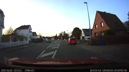
Marathon Grill
Restaurant · Greek · 1.2 km
55 Hallstraße, Rellingen
Mo off; Tu-Th 11:00-14:30,17:00-20:00; Fr-Sa 11:00-20:00; Su,PH 12:00-20:00
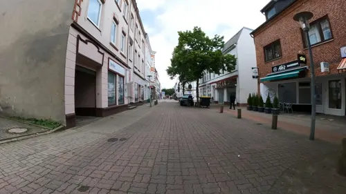


Okyaku
Restaurant · Sushi, Asian · 1.9 km
12 Schulstraße, Halstenbek
Tu-Fr 12:00-15:00,17:00-22:00; Sa-Su,PH 14:00-22:00; Mo off
92 more on the map.
Where to stay11
Churches and places of worship14
The Church of Jesus Christ of Latter-day Saints
Church · Mormon · 2.8 km
11 Saarlandstraße, Pinneberg
Shopping36
Gas and EV charging14
Schools, colleges and libraries24
Healthcare12
Map of Rellingen
248 places. The map loads OpenStreetMap tiles when you open it.
Getting there and nearby towns
Hamburg Airport (HAM) is the nearest airport with scheduled flights listed in OpenStreetMap, 10 km away.
- Tornesch 9 km northwest, about 9 min by car
- Wedel 11 km southwest, about 11 min by car
- Uetersen 12 km west, about 12 min by car
- Hamburg 16 km southeast, about 16 min by car
- Jork 16 km southwest, about 16 min by car
- Neu Wulmstorf 21 km south, about 21 min by car
- Buxtehude 22 km southwest, about 22 min by car
- Hansestadt Stade 24 km west, about 24 min by car
- Seevetal 29 km south, about 29 min by car
- Drochtersen 30 km west, about 30 min by car
Drive times are estimates from straight-line distance, not routes.
Local news
Headlines from INDB.
Reviews, tips and questions
Loading what members have shared...
Sources and licences
- GeoNames (CC BY 4.0): population, coordinates, regions and time zone
- Mapillary (see each image): photos
- OpenStreetMap contributors (ODbL 1.0): places, airports, map data
- Wikidata (CC0 1.0): elevation, founding date, time zone, website, landmarks and historic places
- Wikimedia Commons (see each image): photos
- Wikipedia (CC BY-SA 4.0): overview and history text
Photo credits
- Schleswig-Holstein, Rellingen, Naturdenkmal 11-06 NIK 3139, Nightflyer ( talk ) 21:19, 9 May 2015 (UTC), CC BY 3.0
- Rellingen Hauptstraße 46 2018, Uwe Barghaan, CC BY-SA 3.0
- Rellingen Brunnen1, An-d, CC BY-SA 3.0
- Rellingen Brunnen2, An-d, CC BY-SA 3.0
- Rellingen Ehmschen 1, An-d, CC BY-SA 3.0
- Rellingen Ehmschen 2-2, An-d, CC BY-SA 3.0
- Rellingen Ehmschen 2, An-d, CC BY-SA 3.0
- Rellingen Ehmschen 7, An-d, CC BY-SA 3.0
- Rellingen Ehmschen 7 Türdetail, An-d, CC BY-SA 3.0
- Rellingen Ehrenmal, An-d, CC BY-SA 3.0
- Schleswig-Holstein, Rellingen, Friedhof NIK 8356, Nightflyer, CC BY 4.0
- Schleswig-Holstein, Rellingen, Friedhof NIK 8354, Nightflyer, CC BY 4.0
- Schleswig-Holstein, Rellingen, Friedhof NIK 8350, Nightflyer, CC BY 4.0
- Schleswig-Holstein, Rellingen, Friedhof NIK 8349, Nightflyer, CC BY 4.0
- Schleswig-Holstein, Rellingen, Friedhof NIK 8347, Nightflyer, CC BY 4.0
- Schleswig-Holstein, Rellingen, Friedhof NIK 8345, Nightflyer, CC BY 4.0
- Schleswig-Holstein, Rellingen, Friedhof NIK 8340, Nightflyer, CC BY 4.0
- Schleswig-Holstein, Rellingen, Friedhof NIK 8341, Nightflyer, CC BY 4.0
- Schleswig-Holstein, Rellingen, Friedhof NIK 8343, Nightflyer, CC BY 4.0
- Bornpark (2) in HH-Osdorf, Pauli-Pirat, CC BY-SA 4.0
- Baumschulmuseum, Caspar Voght, CC BY-SA 4.0
- Pinneberg-drostei, Staro1, CC BY-SA 3.0
- Rellingen, PodracerHH 17:46, 21 August 2006 (UTC), CC BY-SA 3.0
- Pinneberg Lutherkirche, Uwe Barghaan, CC BY 3.0
- Pinneberg Heilig-Geist-Kirche, Uwe Barghaan, CC BY 3.0
- Christuskirche Pinneberg, Nihat Halici, CC BY-SA 2.5
- Pinneberg-stmichael, Bauermann, CC BY-SA 3.0
- Pinneberg Wasserturm-01, Radler59 ( talk ), CC BY-SA 4.0
- Stolperstein für Heinrich Boschen (Pinneberg), Christian Michelides, CC BY-SA 4.0
- Stolperstein für Heinrich Geick (Pinneberg), Christian Michelides, CC BY-SA 4.0
- Rellinger Kirche, Turm, PodracerHH 17:48, 21 August 2006 (UTC), CC BY-SA 3.0
- Bismarckdenkmal Elisenhöhe, Unknown author Unknown author, Public domain
- Rellinger Kirche - Turm mit romanischen Mauerteilen, An-d, CC BY-SA 3.0
- Rellinger Kirche - Zugang im Osten, An-d, CC BY-SA 3.0
- Rellinger Kirche - Orgelbank, An-d, CC BY-SA 3.0
- Rellinger Kirche - Weltladen, An-d, CC BY-SA 3.0
- Rellinger Kirche - Unterbau eines Fresko aus der Laterne, An-d, CC BY-SA 3.0
- Rellinger Kirche - Kreuz, An-d, CC BY-SA 3.0
- Rellinger Kirche - Tauffünte, An-d, CC BY-SA 3.0
- Rellinger Kirche - Blick von der Kanzel, An-d, CC BY-SA 3.0
- Stadtmuseum Pinneberg und Brunnen, hh oldman, CC BY 3.0
- Street-level photo, mcschrader, CC BY-SA 4.0
- Street-level photo, mcschrader, CC BY-SA 4.0
- Street-level photo, mcschrader, CC BY-SA 4.0
- Street-level photo, kevinq, CC BY-SA 4.0
- Street-level photo, veloroute_hamburg, CC BY-SA 4.0
- Street-level photo, veloroute_hamburg, CC BY-SA 4.0
- Street-level photo, veloroute_hamburg, CC BY-SA 4.0
- Street-level photo, veloroute_hamburg, CC BY-SA 4.0
- Street-level photo, veloroute_hamburg, CC BY-SA 4.0
- Street-level photo, veloroute_hamburg, CC BY-SA 4.0
- Street-level photo, veloroute_hamburg, CC BY-SA 4.0
- Street-level photo, rausk, CC BY-SA 4.0
- Street-level photo, kevinq, CC BY-SA 4.0
- Street-level photo, kevinq, CC BY-SA 4.0
- Street-level photo, cougarius, CC BY-SA 4.0
- Street-level photo, veloroute_hamburg, CC BY-SA 4.0
- Street-level photo, kevinq, CC BY-SA 4.0
- Street-level photo, kevinq, CC BY-SA 4.0
- Street-level photo, kevinq, CC BY-SA 4.0
- Street-level photo, TKrz, CC BY-SA 4.0
- Street-level photo, kevinq, CC BY-SA 4.0
- Street-level photo, kevinq, CC BY-SA 4.0
- Street-level photo, veloroute_hamburg, CC BY-SA 4.0
- Street-level photo, mcschrader, CC BY-SA 4.0
- Street-level photo, mcschrader, CC BY-SA 4.0


Page built November 8, 2026. Spotted a mistake? Tell us or suggest a place.