


Kavelstorf, Germany
Kavelstorf is a town of 1,179 people in Mecklenburg-Vorpommern, Germany.
Why visit Kavelstorf
Townapedia lists 3 museums and landmarks, 3 parks and trails, 6 places to eat and 2 attractions in and around town.
Highlights include Gutshaus Reez, Kösterbeck and Unteres Warnowland.
Weather in Kavelstorf
Forecast from MET Norway (CC BY 4.0). Full forecast
About Kavelstorf
Kavelstorf is a village and a former municipality in the district of Rostock, in Mecklenburg-Vorpommern, Germany. Since 7 June 2009, it has been part of the Dummerstorf municipality. Before this, it was part of the Warnow-Ost Amt.
From the Wikipedia article Kavelstorf (this version), under CC BY-SA 4.0.
Photos of Kavelstorf


Things to do2

Museums and landmarks3

Gutshaus Reez
Monument and historic site · 3.0 km
1 Rittergut Reez, Dummerstorf

Gutshaus Groß Viegeln
Monument and historic site · 4.0 km
1 Gut Groß Viegeln, Dummerstorf
Parks, trails and playgrounds3

Kösterbeck
Park · 5.8 km
Nature reserve in Mecklenburg-Vorpommern, Germany

Restaurants and cafes6
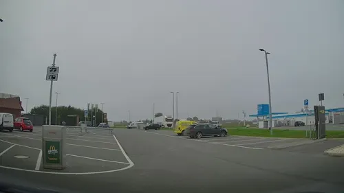
McDonald's
Fast food · Burger · 3.0 km
Gewerbepark Ostsee, Dummerstorf
Mo-Su, PH 08:00-24:00



History
On 1 July 1950, the previously independent municipality of Griebnitz was incorporated. From 1987 to 1989, a secret depot was located in Kavelstorf, where Internationale Messtechnik Import-Export GmbH (IMES), a subsidiary of the Commercial Coordination sector, stored weapons of war intended for export.
From the History section of Kavelstorf on Wikipedia, under CC BY-SA 4.0.
More about Kavelstorf
Geography
Kavelstorf is situated ten kilometers southeast of Rostock, between the lower Warnow river and its tributaries, the Kösterbeck and the Zarnow. Parts of the valleys of these three waterways are designated as nature reserves.
From the Wikipedia article Kavelstorf, under CC BY-SA 4.0.
Churches and places of worship2
Shopping2
Gas and EV charging5
EnBW HyperNetz Ladestation
EV charging · 3.0 km
5 Manfreed-Roth-Strasse, Dummerstorf
Schools, colleges and libraries2
Healthcare1
Map of Kavelstorf
26 places. The map loads OpenStreetMap tiles when you open it.
Getting there and nearby towns
Rostock-Laage Airport (RLG) is the nearest airport with scheduled flights listed in OpenStreetMap, 11 km away.
- Rostock 10 km north, about 10 min by car
- Bad Doberan 22 km northwest, about 22 min by car
- Güstrow 23 km south, about 23 min by car
- Ribnitz-Damgarten 31 km northeast, about 31 min by car
- Wismar 50 km west, about 50 min by car
- Demmin 56 km east, about 56 min by car
- Grimmen 56 km east, about 56 min by car
- Waren 63 km southeast, about 1 h by car
- Schwerin 66 km southwest, about 1 h by car
- Stralsund 67 km northeast, about 1 h by car
Drive times are estimates from straight-line distance, not routes.
Towns near Kavelstorf


Keep exploring
Local news
Headlines from INDB.
Reviews, tips and questions
Loading what members have shared...
Sources and licences
- GeoNames (CC BY 4.0): population, coordinates, regions and time zone
- Mapillary (see each image): photos
- OpenStreetMap contributors (ODbL 1.0): places, airports, map data
- Wikidata (CC0 1.0): elevation, founding date, time zone, website, landmarks and historic places
- Wikimedia Commons (see each image): photos
- Wikipedia (CC BY-SA 4.0): overview and history text
Photo credits
- Bahnhof Kavelstorf2, An-d, CC BY-SA 3.0
- Kirche Kavelstorf, Schiwago, CC BY 2.5
- Kavelstorf Kirche von Süden, An-d, CC BY-SA 3.0
- Kavelstorf Bahnhof 2012-08-19 027, Niteshift ( talk ), CC BY-SA 3.0
- Kavelstorf Bahnhof 2012-08-19 023, Niteshift ( talk ), CC BY-SA 3.0
- Kavelstorf Bahnhof Toiletten 2012-08-19 028, Niteshift ( talk ), CC BY-SA 3.0
- Kavelstorf Bahnhof 2012-08-19 026, Niteshift ( talk ), CC BY-SA 3.0
- Kavelstorf Bahnhof 2012-08-19 016, Niteshift ( talk ), CC BY-SA 3.0
- Kavelstorf Bahnhof 2012-08-19 021, Niteshift ( talk ), CC BY-SA 3.0
- Kavelstorf Bahnhof 2012-08-19 015, Niteshift ( talk ), CC BY-SA 3.0
- Kavelstorf Bahnhof 2012-08-19 022, Niteshift ( talk ), CC BY-SA 3.0
- Bahnhof Kavelstorf1, An-d, CC BY-SA 3.0
- Rails at railway station Kavelstorf, Fieberthermometer, CC0
- Bahnhof Kavelstorf3, An-d, CC BY-SA 3.0
- Kavelstorf Friedenseiche, An-d, CC BY-SA 3.0
- Kavelstorf Kriegerdenkmal 1914-1918, An-d, CC BY-SA 3.0
- Kavelstorf Kriegerdenkmal 1870-1871, An-d, CC BY-SA 3.0
- Church in Kavelstorf IMG 1912, Kresspahl, CC BY-SA 4.0
- Kavelstorf Rostocker Straße 36, An-d, CC BY-SA 3.0
- Kavelstorf Kirche von Nordosten, An-d, CC BY-SA 3.0
- Church in Kavelstorf IMG 1908, Kresspahl, CC BY-SA 4.0
- Church in Kavelstorf IMG 1909, Kresspahl, CC BY-SA 4.0
- Church in Kavelstorf IMG 1910, Kresspahl, CC BY-SA 4.0
- Church in Kavelstorf IMG 1906, Kresspahl, CC BY-SA 4.0
- Church in Kavelstorf IMG 1907, Kresspahl, CC BY-SA 4.0
- Church in Kavelstorf IMG 1897, Kresspahl, CC BY-SA 4.0
- Church in Kavelstorf IMG 1898, Kresspahl, CC BY-SA 4.0
- Church in Kavelstorf IMG 1900, Kresspahl, CC BY-SA 4.0
- Amsberg plaque in Kavelstorf Church, Kresspahl, CC BY-SA 4.0
- Church in Kavelstorf IMG 1901, Kresspahl, CC BY-SA 4.0
- Church in Kavelstorf IMG 1903, Kresspahl, CC BY-SA 4.0
- Church in Kavelstorf IMG 1904, Kresspahl, CC BY-SA 4.0
- Church in Kavelstorf IMG 1902, Kresspahl, CC BY-SA 4.0
- Church in Kavelstorf IMG 1894, Kresspahl, CC BY-SA 4.0
- Church in Kavelstorf IMG 1892, Kresspahl, CC BY-SA 4.0
- Kavelstorf An der Kirche 1, An-d, CC BY-SA 3.0
- Church in Kavelstorf IMG 1895, Kresspahl, CC BY-SA 4.0
- Kavelstorf Kirche von Südwesten, An-d, CC BY-SA 3.0
- Church in Kavelstorf IMG 1896, Kresspahl, CC BY-SA 4.0
- Kavelstorf An der Kirche 2, An-d, CC BY-SA 3.0
- Koesterbeck54, Patrice77, CC BY-SA 3.0
- Reez Herrenhaus von Norden, An-d, CC BY-SA 3.0
- Blick vom bhf poelschow, Patrice77, CC BY-SA 3.0
- Street-level photo, LordOslo, CC BY-SA 4.0
- Street-level photo, LordOslo, CC BY-SA 4.0
- Street-level photo, hendel, CC BY-SA 4.0
- Street-level photo, LordOslo, CC BY-SA 4.0
- Street-level photo, LordOslo, CC BY-SA 4.0
- Street-level photo, hendel, CC BY-SA 4.0


Page built November 9, 2026. Spotted a mistake? Tell us or suggest a place.