


Demmin, Germany
Demmin is a town of 12,495 people in Mecklenburg-Vorpommern, Germany, founded in 1201.
Why visit Demmin
Townapedia lists 17 museums and landmarks, 18 parks and trails, 31 places to eat, 8 places to stay and 10 attractions in and around town.
Highlights include Waldbühne Demmin, Ulanendenkmal, Zeiss-Planetarium mit Sternwarte Demmin and Peene Marina.
Weather in Demmin
Forecast from MET Norway (CC BY 4.0). Full forecast
About Demmin
Demmin (German pronunciation: [dɛˈmiːn] ) is a town in the Mecklenburgische Seenplatte district, Mecklenburg-Western Pomerania, in north-eastern Germany. It was the capital of the former district of Demmin.
From the Wikipedia article Demmin (this version), under CC BY-SA 4.0.
Things to do10


Museums and landmarks17


Zeiss-Planetarium mit Sternwarte Demmin
Monument and historic site · 1.5 km
Alter Wasserturm von Demmin, wird jetzt als Planetarium und Sternwarte genutzt.
1b An den Tannen, Demmin
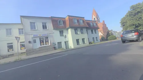

Haus Demmin
Monument and historic site · 0.9 km
2 Husar-Schulz-Weg, Demmin


Platz der Erinnerung
Monument and historic site
Gedenkort für den Massensuizid von Frauen und Kindern Ende April / Anfang Mai 1945
2 Eichholz, Demmin
24/7


5 more on the map.
Parks, trails and playgrounds18





Naturerlebnisbad *Biberburg*
Sports field and stadium · 0.6 km
3a Nordsackgasse, Demmin

6 more on the map.
Restaurants and cafes31

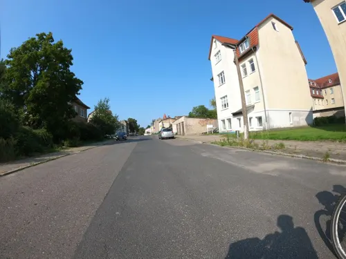

China Restaurant
Restaurant · Chinese · 2.1 km
8 Jarmener Straße, Demmin
Tu-Su 11:30-14:30,17:30-21:30
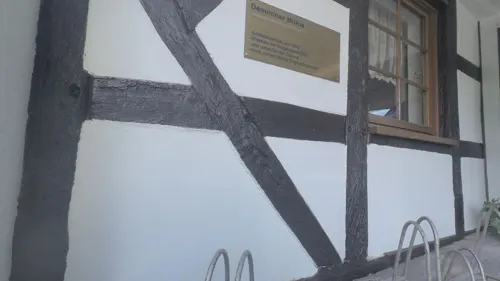

Stadt-Konditorei & Cafe Corsten
Bakery · 0.6 km
8 Clara-Zetkin-Straße, Demmin
Tu-Fr 07:00-18:00; Sa-Su 07:00-17:00


19 more on the map.
Where to stay8
Churches and places of worship7
Shopping13
Gas and EV charging4
Schools, colleges and libraries9
Healthcare7
Map of Demmin
124 places. The map loads OpenStreetMap tiles when you open it.
Getting there and nearby towns
Flughafen Neubrandenburg-Trollenhagen (FNB) is the nearest airport with scheduled flights listed in OpenStreetMap, 38 km away.
- Grimmen 23 km north, about 23 min by car
- Universitäts- und Hansestadt Greifswald 32 km northeast, about 32 min by car
- Neubrandenburg 42 km south, about 42 min by car
- Stralsund 45 km north, about 45 min by car
- Waren 49 km southwest, about 49 min by car
- Wolgast 51 km east, about 51 min by car
- Ribnitz-Damgarten 53 km northwest, about 53 min by car
- Güstrow 58 km west, about 58 min by car
- Rostock 62 km west, about 1 h by car
- Neustrelitz 61 km south, about 1 h by car
Drive times are estimates from straight-line distance, not routes.
Local news
Headlines from INDB.
Reviews, tips and questions
Loading what members have shared...
Sources and licences
- GeoNames (CC BY 4.0): population, coordinates, regions and time zone
- Mapillary (see each image): photos
- OpenStreetMap contributors (ODbL 1.0): places, airports, map data
- Wikidata (CC0 1.0): elevation, founding date, time zone, website
- Wikimedia Commons (see each image): photos
- Wikipedia (CC BY-SA 4.0): overview and history text
Photo credits
- Hansestadt Demmin - Stadtkirche St. Bartholomaei - 8627933380, onnola, CC BY-SA 2.0
- Burgruine (Demmin), Justin Gödke, CC BY-SA 4.0
- Demmin Marktplatz Rathaus und St Bartholomaei 2026, SchlurcherBot, CC BY-SA 4.0
- Demmin Rathaus Südseite, Erell, CC BY-SA 3.0
- Rathaus Demmin, Chpagenkopf, CC BY-SA 3.0
- Hansestadt Demmin - Stadtkirche St. Bartholomaei - 8650470539, onnola, CC BY-SA 2.0
- Hansestadt Demmin - Stadtkirche St. Bartholomaei - 8653665579, onnola, CC BY-SA 2.0
- Hansestadt Demmin - Stadtkirche St. Bartholomaei - 8639917312, onnola, CC BY-SA 2.0
- Hansestadt Demmin - Stadtkirche St. Bartholomaei - 8627935490, onnola, CC BY-SA 2.0
- Hansestadt Demmin - Stadtkirche St. Bartholomaei - 8626833231, onnola, CC BY-SA 2.0
- Hansestadt Demmin - Stadtkirche St. Bartholomaei - 8638811569, onnola, CC BY-SA 2.0
- Hansestadt Demmin - Stadtkirche St. Bartholomaei - 8650473321, onnola, CC BY-SA 2.0
- Hansestadt Demmin - Stadtkirche St. Bartholomaei - 8531928531, onnola, CC BY-SA 2.0
- Hansestadt Demmin - Stadtkirche St. Bartholomaei - 8627937366, onnola, CC BY-SA 2.0
- Hansestadt Demmin - Stadtkirche St. Bartholomaei - 8638815801, onnola, CC BY-SA 2.0
- Hansestadt Demmin - Stadtkirche St. Bartholomaei - 8502981548, onnola, CC BY-SA 2.0
- Hansestadt Demmin - Stadtkirche St. Bartholomaei - 8651574826, onnola, CC BY-SA 2.0
- Hansestadt Demmin - Stadtkirche St. Bartholomaei - 8651573046, onnola, CC BY-SA 2.0
- Hansestadt Demmin - Stadtkirche St. Bartholomaei - 8639918302, onnola, CC BY-SA 2.0
- Hansestadt Demmin - Stadtkirche St. Bartholomaei - 8638816805, onnola, CC BY-SA 2.0
- Hansestadt Demmin - Stadtkirche St. Bartholomaei - 8653666563, onnola, CC BY-SA 2.0
- Hansestadt Demmin - Stadtkirche St. Bartholomaei - 8651570040, onnola, CC BY-SA 2.0
- Hansestadt Demmin - Stadtkirche St. Bartholomaei - 8631927396, onnola, CC BY-SA 2.0
- Hansestadt Demmin - Stadtkirche St. Bartholomaei - 8627939788, onnola, CC BY-SA 2.0
- Hansestadt Demmin - Stadtkirche St. Bartholomaei - 8627944412, onnola, CC BY-SA 2.0
- Hansestadt Demmin - Stadtkirche St. Bartholomaei - 8630818755, onnola, CC BY-SA 2.0
- Hansestadt Demmin - Stadtkirche St. Bartholomaei - 8631929532, onnola, CC BY-SA 2.0
- Hansestadt Demmin - Stadtkirche St. Bartholomaei - 8631922556, onnola, CC BY-SA 2.0
- Speicher Demmin, Chpagenkopf, CC BY-SA 3.0
- Peene-in-Demmin-26-VIII-2007-07, Botaurus, Public domain
- Demmin Rote Schule Südwest, Erell, CC BY-SA 3.0
- Fritz-Reuter-Schule (Demmin), Justin Gödke, CC BY-SA 4.0
- Haus Demmin nördliche Vorburg, Erell, CC BY-SA 3.0
- Haus Demmin Herrenhaus Rückseite 2010, Erell, CC BY-SA 3.0
- Haus Demmin Burg Ostseite 2014-02-17, Erell, CC BY-SA 3.0
- BurgwallDemminVorwerk, RonnyKrüger, CC0
- Sanzkow LK Demmin Kirche Nordwest, Erell, CC BY-SA 3.0
- Demmin-Kirche-2011, Peter Schmelzle, CC BY-SA 3.0
- Demmin Goethe-Gymnasium Südwest, Erell, CC BY-SA 3.0
- Wotenick Sankt-Nikolai-Kirche Nordseite, Erell, CC BY-SA 3.0
- Demmin Ulanendenkmal 03, Erell, CC BY-SA 3.0
- Demmin Wasserturm 2011-09-12, Erell, CC BY-SA 3.0
- Quitzerow Turmhügel Nord, Erell, CC BY-SA 3.0
- Ernst-Barlach-Platz Demmin 2021-09-09 01, Leonhard Lenz, CC0
- Demmin Luisentor Feldseite, Erell, CC BY-SA 3.0
- Demmin Pulverturm Nordseite, Erell, CC BY-SA 4.0
- Demmin Kirche Maria Rosenkranzkönigin Nordost, Erell, CC BY-SA 3.0
- Demmin-Marienhain, Peter Schmelzle, CC BY-SA 3.0
- Street-level photo, mkw, CC BY-SA 4.0
- Street-level photo, masterofnoroad, CC BY-SA 4.0
- Street-level photo, britiger, CC BY-SA 4.0
- Street-level photo, masterofnoroad, CC BY-SA 4.0
- Street-level photo, britiger, CC BY-SA 4.0
- Street-level photo, masterofnoroad, CC BY-SA 4.0
- Street-level photo, britiger, CC BY-SA 4.0


Page built November 8, 2026. Spotted a mistake? Tell us or suggest a place.