


Stralsund, Germany
Stralsund is a town of 58,976 people in Mecklenburg-Vorpommern, Germany, founded in 1234.
Why visit Stralsund
Townapedia lists 89 museums and landmarks, 29 parks and trails, 199 places to eat, 48 places to stay and 16 attractions in and around town.
Highlights include Zoo Stralsund, Großes Haus Stralsund, Nautineum Stralsund and Ozeaneum.
Weather in Stralsund
Forecast from MET Norway (CC BY 4.0). Full forecast
About Stralsund
Stralsund (German: [ˈʃtʁaːlzʊnt] ; Swedish: Strålsund), officially the Hanseatic City of Stralsund (German: Hansestadt Stralsund), is the fifth-largest city in the northeastern German state of Mecklenburg-Western Pomerania after Rostock, Schwerin, Neubrandenburg and Greifswald, and the second-largest city in the Pomeranian part of the state. It is located on the southern coast of the Strelasund, a sound of the Baltic Sea separating the island of Rügen from the Pomeranian mainland.
From the Wikipedia article Stralsund (this version), under CC BY-SA 4.0.
Travel tips from other travellers: Stralsund on Wikivoyage (CC BY-SA 4.0).
Photos of Stralsund


Things to do16

Zoo Stralsund
Zoo and aquarium · 2.2 km
57a Barther Straße, Stralsund
Mar PH,Mo-Su 09:00-17:00; Apr-Sep PH,Mo-Su 09:00-18:30; Oct...

Stralsund Theatre
Cinema and theater · 1.0 km
Theatre in Stralsund, Germany


Obstgut Eggert
Farm and orchard · 4.7 km
Stralsunder Obstgut "Am Borgwallsee" Eggert GbR
2 Am Obstgut, Lüssow


4 more on the map.
Museums and landmarks89

Nautineum Stralsund
Museum · 2.3 km
Sonderausstellungen und Unterwasserlabor "Helgoland" nur über Treppe erreichbar, WC, ebenerdiger Zugang mit Schwingtür
30 Zum Kleinen Dänholm, Stralsund
Jun-Sep: 10:00-18:00; May: 10:00-17:00; Oct: 10:00-17:00; Nov-Apr: off

Ozeaneum
Museum · 1.2 km
Aquarium in Stralsund, Germany
11 Hafenstraße, Stralsund
Sep-Jun 09:30-17:00; Jul-Aug 09:30-19:00; Dec 24 off; Dec 31 09:30-15:00

Maritime Museum
Museum
14-20 Katharinenberg, Stralsund
Sep-Jun Mo-Su 09:30-17:00; Jul-Aug Mo-Su 09:30-19:00; Dec 31...


Hafen- und Seemannsamt
Monument and historic site · 1.3 km
50 Hafenstraße, Stralsund


77 more on the map.
Parks, trails and playgrounds29


Stadion der Freundschaft
Sports field and stadium · 0.9 km
13a Frankendamm, Stralsund



HanseDom Stralsund
Sports field and stadium · 2.7 km
18-20 Grünhufer Bogen, Stralsund
Mo-Su 09:30-22:00; Fr,Sa 09:30-23:00

Hanse Dom
Sports field and stadium · 2.7 km
18-20 Grünhufer Bogen, Stralsund
Su-Mo 09:30-22:00; Fr,Sa 09:30-23:00
Wassersportverein 'Am Fischergraben' e. V.
Marina and boat launch · 3.2 km
22 Selliner Weg, Stralsund
Wassersportzentrum Dänholm-Nord
Marina and boat launch · 1.8 km
17 more on the map.
Restaurants and cafes199

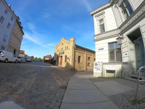
Kaffee Monopol
Cafe · Coffee Shop · 0.9 km
55 Mühlenstraße, Stralsund
Tu-Fr 10:00-18:00; Sa 10:00-13:00

Alte Bäckerei
Restaurant · Bistro, Bakery · 0.7 km
90 Heilgeiststraße, Stralsund
Mo-Fr 08:00-18:00; Sa 09:00-16:00
Croque & Salate
Restaurant · Bistro, Sandwich · 0.9 km
10 Mühlenstraße, Stralsund
Mo-Sa 11:00-21:30; Su 14:00-21:30
Fischrestaurant Zur Kogge
Restaurant · Fish, Regional
26 Tribseer Straße, Stralsund
We-Mo 11:30-21:30; Tu off

187 more on the map.
History
In the Middle Ages, the Stralsund area formed part of the Principality of Rügen, a Danish vassal principality ruled by a local West Slavic dynasty. The village had a ferry to the island of Rügen. In 1168, following the siege of Arkona, the Principality of Rügen became part of Kingdom of Denmark.
In the course of German Ostsiedlung, many German settlers, gentry and merchants were invited to settle in the principality, and they eventually populated the Strale settlement. Merchants from other countries as well as locals were attracted to the area and made up one third of the settlement's population. The Danish navy used the isle as well. When the settlement had grown to town size, prince Wizlaw I of Rügen granted Lübeck law to "our town Stralow" in 1234, although a significant settlement had existed long before the formal founding. In 1240, when the prince gave additional land to the town, he called it Stralesund.
Read more of the history
The success of the settlement challenged the powerful Free City of Lübeck, which burnt Stralsund down in 1249. Afterwards the town was rebuilt with a massive town wall having 11 town gates and 30 watchtowers. The Neustadt, a town-like suburb, had merged with Stralsund by 1361. Schadegard, a nearby twin city to Stralsund also founded by Wizlaw I, though not granted German law, served as the principal stronghold and enclosed a fort. It was given up and torn down by 1269 under pressure from the Stralsund Bürger.
In 1293 Stralsund became a member of the Hanseatic League. A total of 300 ships flying the flag of Stralsund cruised the Baltic Sea in the 14th century. In 1325 the Principality of Rügen became part of the Duchy of Pomerania, Stralsund however maintained considerable independence.
In the 17th century opposing forces in the Thirty Years' War fought over Stralsund. In the Battle of Stralsund (1628), the Imperial (Catholic) forces commanded by Albrecht von Wallenstein besieged the city after the council refused to accept the Capitulation of Franzburg of November 1627. Stralsund resisted with Danish and Swedish support. The Swedish garrison in Stralsund was the first on German soil in history. With the Treaty of Stettin (1630), the city became one of two major Swedish forts in the Duchy of Pomerania, alongside Stettin (now Szczecin, Poland).
After the war, the Peace of Westphalia (1648) and the Treaty of Stettin (1653) made Stralsund part of Swedish Pomerania. Lost to Brandenburg in the Battle of Stralsund (1678), it reverted to Sweden in the Treaty of Saint-Germain-en-Laye (1679). In the Great Northern War in 1715 Charles XII led the defence of Stralsund for a year against the united European armies. Stralsund remained under Swedish control until the Battle of Stralsund (1807), when Napoleon Bonaparte's army occupied it. Seized by Ferdinand von Schill's freikorps in 1809, it subsequently reverted to French control, with Schill killed in action. With the Congress of Vienna (1815), Stralsund became part of the Kingdom of Prussia, within the Province of Pomerania, and served as the seat of a government region that largely corresponded to the former Swedish Pomerania.
Following the First World War Stralsund suffered the same sort of political unrest and unemployment that afflicted much of Germany. In May 1919 Stralsund workers clashed with police, and martial law was declared. In the early 1920s the Independent Social Democratic Party (USPD) became the strongest party in Stralsund, but its political fortunes waned rapidly, and in September 1922 it reunited with the Social Democratic Party (SPD). The Stralsunder Zeitung was published as a local newspaper in Stralsund.
In the national parliamentary election of May 1924, the conservative German National People's Party (DNVP) polled 8,547 votes in Stralsund, the SPD 3,534, the Communists 1,825 and the German People's Party (DVP) of Foreign Minister Gustav Stresemann 1,417. However, in keeping with national trends, Hitler's National Socialists made rapid gains in the late 1920s, and by the time of the last free national election in July 1932 the Nazis polled twice as many votes in Stralsund as the SPD.
During the Nazi period (1933–1945), Stralsund's military installations expanded, and a naval training base opened on the nearby island of Dänholm. In World War II the city was subjected to repeated Allied bombing. Attacks by the U.S. Army Air Forces in 1944 killed some 800 Stralsunders and destroyed an estimated 8,000 dwellings. The 354th Rifle Division of the Red Army occupied Stralsund on 28 April 1945 – 10 days before the end of the war in Europe. Approximately half its population had fled.
During the period of the German Democratic Republic (GDR), Stralsund saw the construction of numerous Plattenbau prefabricated apartment blocks. Its economic life centered on the now state-owned shipyard, which largely focussed on building ships for the Soviet Union.
After German reunification in 1990, the city's historic old town was thoroughly restored, and Communist-era apartment blocks were renovated and upgraded. In 2002 the old towns of Stralsund and Wismar, some 120 km to the west, were listed as UNESCO World Heritage Sites. Stralsund's shipyard was privatized, and thereafter specialized in constructing container ships.
From the History section of Stralsund on Wikipedia, under CC BY-SA 4.0.
More about Stralsund
Geography
Stralsund is located in Mecklenburg-Vorpommern, a state in Western Pomerania region, Germany. in the state of Mecklenburg-Vorpommern. It is separated from Rügen to the southwest by the Strelasund, which empties into the Baltic Sea.
Average annual precipitation is 656 mm (25.8 inches), putting Stralsund within the lowest third of all such values in Germany. The driest month is February, the wettest July, with relatively little variation throughout the year.
The city lies on the sound of Strelasund, a strait of the Baltic Sea. Its geographic proximity to the island of Rügen, whose only fixed link to the mainland, the Strelasund Crossing, runs between Stralsund and the village of Altefähr, has given Stralsund the sobriquet "Gateway to the Island of Rügen" (Tor zur Insel Rügen). Stralsund is located close to the Western Pomerania Lagoon Area National Park.
Stralsund's city borough includes municipal forest and three municipal ponds (the Knieperteich, Frankenteich and Moorteich. The three ponds and the Strelasund lend the Old Town, the original settlement site and historic centre of the city, a protected island ambience. The highest point of the city is the Galgenberg ("Gallows Hill") on its western approaches.
Arts and culture
The historic Stralsund old town island is a UNESCO World Heritage Site. It features many valuable remnants of the Hanseatic time, Brick Gothic, renaissance, baroque, historicist and Jugendstil buildings.
The heart of the old town is the Alter Markt Square ("Old Market"), with the Gothic city hall (13th century). Behind the city hall soars the imposing St. Nicholas' Church, built in 1270–1360. The square is surrounded by houses from different periods, including the Gothic Wulflamhaus (a 14th-century patrician house, today a restaurant), and the Baroque Commandantenhus of 1751, the old headquarters of the Swedish military commander.
Saint James' Church, built in mid-14th century. It was destroyed several times, e.g. by Wallenstein and in World War II.
Saint Mary's Church, built in 1383–1473 in Gothic style, is the largest church in Stralsund, and from 1625 to 1647 it was the world's tallest structure. Its octagonal tower (104 meters high) offers a panorama view of Stralsund and the neighboring islands of Rügen and Hiddensee.
St. John's Abbey (Franciscan monastery built in 1254) is one of the oldest buildings in the city.
Stralsund is the port of registry for the former German Reichsmarine Navy Sail Training ship "Gorch Fock" 1. It is now a floating museum.
Education
The Fachhochschule Stralsund is a University of Applied Sciences with a modern campus, north of the old town at the Strelasund. It has around 2,500 students and is among the best ranked public universities in Germany in various fields, especially in economics. Other university departments are Mechanical Engineering, Electrical Engineering and Information Technology. The FH Stralsund also offers international study programs, such as Leisure and Tourism Management and Baltic Management Studies (international business management).
From the Wikipedia article Stralsund, under CC BY-SA 4.0.
Notable people from Stralsund
 Carl Wilhelm ScheeleSwedish German chemist who discovered oxygenPhoto: Johann Gottfried Scheffner, PDM-owner
 Nadja UhlGerman actressPhoto: Superbass, CC BY-SA 4.0
 Dietmar BartschGerman politicianPhoto: Sandro Halank, Wikimedia Commons, CC BY-SA 4.0
 Nicodemus Tessin the ElderSwedish architect (1615–1681)Photo: Unknown author Unknown author, Public domain
 Christian Ehrenfried WeigelGerman scientist (1748-1831)Photo: Wilhelm Titel, Public domain
- Hermann BurmeisterGerman Argentine zoologist, entomologist, herpetologist, and botanist (1807–1892)
- Carl Gustav RehnskiöldSwedish field marshal (1651-1722)
- Philip Johan von StrahlenbergSwedish officer and geographer
- Carl Friedrich von LedebourGerman botanist (1786-1851)
- Gustav Karl Wilhelm Hermann KarstenGerman botanist (1817–1908)
- Wilhelm Ferdinand ErichsonGerman entomologist and physician (1809–1848)
- Jürgen BrähmerGerman boxer
Born in Stralsund, according to Wikidata (CC0). Each name links to its Wikipedia article.
Where to stay48
Churches and places of worship20
Evangelisch-Freikirchliche Gemeinde Stralsund (Baptisten)
Church · Baptist · 1.1 km
11 Fährstraße, Stralsund
St.-Nikolai-Kirche
Church · Lutheran · 0.9 km
2 Auf dem St. Nikolaikirchhof, Stralsund
Auferstehungskirche Stralsund
Church · Lutheran · 2.8 km
35 Lindenallee, Stralsund
Kloster zum Heiligen Geist
Church · Lutheran · 1.1 km
49 Wasserstraße, Stralsund
Lutherkirche
Church · Lutheran · 1.4 km
87 Alte Richtenberger Straße, Stralsund
Adventgemeinde Stralsund
Church · Seventh Day Adventist · 0.9 km
39 Alte Richtenberger Straße, Stralsund
Shopping74
Gas and EV charging16
Schools, colleges and libraries30
Berufsschule - Abteilung Wirtschaft und Verwaltung
School · 2.3 km
125 Heinrich-Heine-Ring, Stralsund
Healthcare22
Map of Stralsund
250 places. The map loads OpenStreetMap tiles when you open it.
Getting there and nearby towns
Flugplatz Rügen (GTI) is the nearest airport with scheduled flights listed in OpenStreetMap, 18 km away.
- Grimmen 22 km south, about 22 min by car
- Bergen auf Rügen 26 km northeast, about 26 min by car
- Universitäts- und Hansestadt Greifswald 32 km southeast, about 32 min by car
- Ribnitz-Damgarten 41 km west, about 41 min by car
- Sassnitz 43 km northeast, about 43 min by car
- Demmin 45 km south, about 45 min by car
- Wolgast 53 km southeast, about 53 min by car
- Anklam 64 km southeast, about 1 h by car
- Rostock 66 km west, about 1 h by car
- Neubrandenburg 84 km south, about 1 h 30 min by car
Drive times are estimates from straight-line distance, not routes.
Towns near Stralsund


Keep exploring
Local news
Headlines from INDB.
Reviews, tips and questions
Loading what members have shared...
Sources and licences
- GeoNames (CC BY 4.0): population, coordinates, regions and time zone
- Mapillary (see each image): photos
- OpenStreetMap contributors (ODbL 1.0): places, airports, map data
- Wikidata (CC0 1.0): elevation, founding date, time zone, website, landmarks and historic places
- Wikimedia Commons (see each image): photos
- Wikipedia (CC BY-SA 4.0): overview and history text
Photo credits
- 20-07-06-Stralsund-Innenstadt-RalfR-100-0613, Ralf Roletschek, CC BY-SA 1.0 fi
- Knieperteich Stralsund 2021-09-17 01, Leonhard Lenz, CC0
- Mercedes O530G Citaro II, -98, Nahverkehr Stralsund GmbH (27767371146), Janusz Jakubowski from Warsaw, Poland, CC BY 2.0
- Die Eule auf Kurzbesuch in Stralsund, August 2022 (2) 06, AmWasser, CC BY-SA 3.0
- Die Eule auf Kurzbesuch in Stralsund, August 2022 (2) 07, AmWasser, CC BY-SA 3.0
- Stralsund, Germany - panoramio (3), malicious_spoon, CC BY-SA 3.0
- Betriebsgesellschaft Younior-Hotel Stralsund (27989121130), Janusz Jakubowski from Warsaw, Poland, CC BY 2.0
- MB O530G Citaro New, -2103, Nahverkehr Stralsund GmbH (27801985275), Janusz Jakubowski from Warsaw, Poland, CC BY 2.0
- Mercedes O530 Citaro, -18, Nahverkehr Stralsund GmbH (27767394206), Janusz Jakubowski from Warsaw, Poland, CC BY 2.0
- MB O530G Citaro New, -2103, Nahverkehr Stralsund GmbH (28166496102), Janusz Jakubowski from Warsaw, Poland, CC BY 2.0
- Mercedes O530 Citaro, -18, Nahverkehr Stralsund GmbH (28235979406), Janusz Jakubowski from Warsaw, Poland, CC BY 2.0
- Stralsund (27989121290), Janusz Jakubowski from Warsaw, Poland, CC BY 2.0
- Die Eule auf Kurzbesuch in Stralsund, August 2022 (2) 08, AmWasser, CC BY-SA 3.0
- Tribseer Straße 1 Stralsund 2021-09-17 01, Leonhard Lenz, CC0
- Stralsund - Stadt am Wasser (Stralsund - city on the water) - geo.hlipp.de - 4081, Udo und Joan Fugel on geo.hlipp.de, CC BY-SA 2.0
- Stralsund - Old city (28166495892), Janusz Jakubowski from Warsaw, Poland, CC BY 2.0
- Tribseer Straße 6, Stralsund, ubahnverleih, CC0
- Tribseer Straße 6, Stralsund (2), ubahnverleih, CC0
- Die Eule auf Kurzbesuch in Stralsund, August 2022 (2) 05, AmWasser, CC BY-SA 3.0
- Wasserkran und Dampflokachse, Stralsund, 2019 (01), Bahnfrend, CC BY-SA 4.0
- Stralsund central station lub 2026-02-07 img04 night, Lukas Beck, CC BY 4.0
- Stralsund central station lub 2026-02-07 img07 night, Lukas Beck, CC BY 4.0
- L06 281 Bf Stralsund Hbf, 442 508, Falk2, CC BY-SA 4.0
- Stralsund central station lub 2026-02-07 img06 night, Lukas Beck, CC BY 4.0
- L06 282 Bf Stralsund Hbf, 147 010, Falk2, CC BY-SA 4.0
- Stralsund central station lub 2026-02-07 img05 night, Lukas Beck, CC BY 4.0
- Tribseer Straße 8, Stralsund, ubahnverleih, CC0
- Stralsund central station lub 2026-02-07 img08 night, Lukas Beck, CC BY 4.0
- L06 283 Bf Stralsund Hbf, 442 008, Falk2, CC BY-SA 4.0
- Hauptbahnhof Stralsund, Lukas Beck, CC BY-SA 4.0
- Stralsund, am Hafen (2013-07-11), by Klugschnacker in Wikipedia (129), User:Klugschnacker, CC BY-SA 3.0
- Stralsund St Nikolai, Darkone ( talk · contribs ), CC BY-SA 2.0
- Stralsund, Theater (2012-04-06) 1, by Klugschnacker in Wikipedia, Klugschnacker, CC BY-SA 3.0
- Stralsund Deutsches Meeresmuseum (01), Norbert Kaiser, CC BY-SA 3.0
- Stralsund Marienkirche 2006, Darkone, CC BY-SA 2.5
- Gorch Fock (ship, 1933), Stralsund, 2019 (01), Bahnfrend, CC BY-SA 4.0
- Stralsund, Auferstehungskirche (2008-04-14), Klugschnacker, CC BY-SA 3.0
- Stralsund, Stadion der Freundschaft (2007-06-11), Klugschnacker, CC BY-SA 3.0
- Hochschule Stralsund, Schlufke, CC BY-SA 4.0
- Stralsund, Fährwall 19, Hansa-Gymnasium (2012-03-04), by Klugschnacker in Wikipedia, Klugschnacker, CC BY-SA 3.0
- Stralsund Heilgeistkirche, Darkone ( talk · contribs ), CC BY-SA 2.0
- Parow, Gutshaus (2008-04-27), Klugschnacker, CC BY-SA 3.0
- Stralsund Nautineum Dänholm, Darkone ( talk · contribs ), CC BY-SA 2.5
- Stralsund, Lotsenhaus (2011-02-15), Klugschnacker, CC BY-SA 3.0
- Stralsund, Lutherkirche, Ansicht, Klugschnacker, CC BY-SA 3.0
- Stralsund, Marinemuseum, Freifläche (2007-06-03), de:Benutzer:Klugschnacker, CC BY-SA 2.5
- Stralsund, Krankenhaus West, Haus (2013-07-27) 3, by Klugschnacker in Wikipedia, User:Klugschnacker, CC BY-SA 3.0
- Stralsund, Fährstraße 11 (2012-03-11), by Klugschnacker in Wikipedia, Klugschnacker, CC BY-SA 3.0
- Stralsund, Fährstraße 17, Ecke Fährwall (2012-03-11), by Klugschnacker in Wikipedia, Klugschnacker, CC BY-SA 3.0
- Stralsund, Fährstraße 26 (2012-03-11), by Klugschnacker in Wikipedia, Klugschnacker, CC BY-SA 3.0
- Stralsund, Marienstraße, Apollonienkapelle (2012-05-12), by Klugschnacker in Wikipedia, Klugschnacker, CC BY-SA 3.0
- Stralsund, Badenstraße 44 (2012-03-18), by Klugschnacker in Wikipedia, Klugschnacker, CC BY-SA 3.0
- Museumshaus, Stralsund, Rudolf H. Boettcher, CC BY-SA 4.0
- Pension Villa Beer, Stralsund, JoachimKohler-HB, CC BY-SA 4.0
- Stralsund, Krankenhaus am Sund (2023-06-05) 02, Nikolai Maria Jakobi, CC BY-SA 4.0
- Altefähr, der Hafen, Dguendel, CC BY 3.0
- Groß Kedingshagen, Schloss, Klugschnacker, CC BY-SA 3.0
- Gorch Fock I Stralsund 09-2006, Darkone, CC BY-SA 2.5
- Spielgeräte vom Spielplatz beim Wohngebiet östlich der Parower Chaussee 2023-11-24, Strubbl, CC BY-SA 4.0
- Katholische Kirche Stralsund (2007-09-09), de:Benutzer:Klugschnacker, CC BY-SA 3.0
- Stralsund, Tierpark, Ackerbürgerhaus (2007-02-16), de:Benutzer:Klugschnacker, CC BY-SA 2.5
- St Nikolai Altefaehr Schiff imgp7760, Smial, CC BY-SA 2.0 de
- Dänholm, Rügenbrücke, Rauenstein, Public domain
- Klettergerüst Kinderspielplatz Amanda-Weber-Ring Stralsund Bild 1 2024-08-26, Strubbl, CC BY-SA 4.0
- Street-level photo, jacobbraeutigam, CC BY-SA 4.0
- Street-level photo, strubbl, CC BY-SA 4.0
- Street-level photo, strubbl, CC BY-SA 4.0
- Street-level photo, strubbl, CC BY-SA 4.0
- Street-level photo, strubbl, CC BY-SA 4.0
- Street-level photo, hajak, CC BY-SA 4.0
- Street-level photo, strubbl, CC BY-SA 4.0
- Street-level photo, strubbl, CC BY-SA 4.0
- Street-level photo, hajak, CC BY-SA 4.0
- Street-level photo, hajak, CC BY-SA 4.0
- Street-level photo, jlorenz86, CC BY-SA 4.0
- Street-level photo, strubbl, CC BY-SA 4.0
- Street-level photo, strubbl, CC BY-SA 4.0
- Street-level photo, strubbl, CC BY-SA 4.0
- Street-level photo, britiger, CC BY-SA 4.0
- Street-level photo, strubbl, CC BY-SA 4.0
- Street-level photo, jacobbraeutigam, CC BY-SA 4.0
- Street-level photo, strubbl, CC BY-SA 4.0
- Street-level photo, jlorenz86, CC BY-SA 4.0
- Street-level photo, strubbl, CC BY-SA 4.0
- Street-level photo, strubbl, CC BY-SA 4.0
- Street-level photo, strubbl, CC BY-SA 4.0
- Street-level photo, britiger, CC BY-SA 4.0


Page built November 9, 2026. Spotted a mistake? Tell us or suggest a place.