


Lemsahl-Mellingstedt, Germany
Lemsahl-Mellingstedt is a town of 6,554 people in Hamburg, Germany.
Why visit Lemsahl-Mellingstedt
Townapedia lists 37 museums and landmarks, 10 parks and trails, 39 places to eat, 4 places to stay and 2 attractions in and around town.
Highlights include Hof Lemsahl, Nahverkehrsmuseum Kleinbahnhof Wohldorf, KZ Sasel and Wittmoor.
Weather in Lemsahl-Mellingstedt
Forecast from MET Norway (CC BY 4.0). Full forecast
About Lemsahl-Mellingstedt
Lemsahl-Mellingstedt (German pronunciation: [ˈlɛmzaːl ˈmɛlɪŋʃtɛt] ) is a quarter of Hamburg, Germany, in the borough Wandsbek. The population was over 6900 in 2020.
From the Wikipedia article Lemsahl-Mellingstedt (this version), under CC BY-SA 4.0.
Things to do2


Museums and landmarks37


KZ Sasel
Monument and historic site · 2.9 km
Behauener Naturstein mit einer abgeflachten Seite und o.g. Text in Dt. Sprache, sowie einer stilisierten menschlichen Figur, welche die...


Mahnmal für die Opfer des KZ-Außenlagers Sasel
Monument and historic site · 2.8 km
Zwei Steinstelen auf einer Steinplatte, nördlich und südlich des Weges hinter der Kirche. Die südliche ist (durch den Künstler)...

Gedenkstätte KZ Wittmoor
Monument and historic site · 2.4 km
Naturstein mit einer eingelassenen Metalltafel mit o.g. Text in Dt. Sprache. Der Stein befindet sich im Zentrum einer kleinen...

Gedenktafel KZ Wittmoor
Monument and historic site · 3.1 km
Kleine Metalltafel in eine Steinstele eingelassen mit Text in Dt. Sprache.
KZ Wittmoor
Monument and historic site · 1.8 km
Behauener Naturstein, auf einer Seite abgeflacht, mit o.g. Text in Dt. Sprache.

KZ-Außenlager Sasel
Monument and historic site · 2.8 km
Zwei aufgeständerte Metalltafeln mit o.g. Dt. Text. Two raised metal plaques in German language: Information on camp, victims, and...
The Sasel Satellite Camp
Monument and historic site · 2.9 km
Zwei aufgeständerte Metalltafeln, Text in Dt. (li.) & Eng. (re.). (Das verlinkte Foto zeigt die Anlage noch ohne Eng. Tafel.) Two raised...

25 more on the map.
Parks, trails and playgrounds10






Restaurants and cafes39

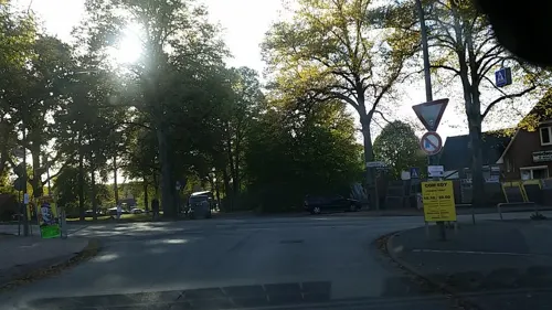
Tapiro D'Oro
Restaurant · Italian · 2.8 km
Zufahrt und Parken vom Wohldorfer Damm
1 Bergstedter Markt, Hamburg
Mo off; Tu-Su 12:00-22:00
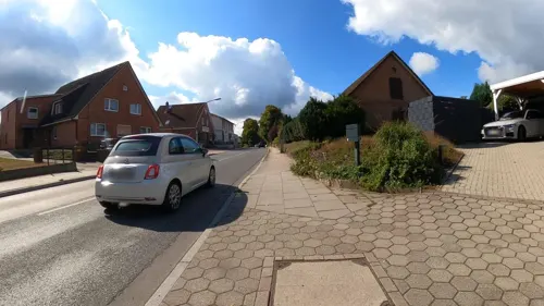
Duvenstedter Eiscafé
Cafe · Cake, Breakfast, Coffee Shop, Ice Cream · 2.1 km
8 Poppenbütteler Chaussee, Hamburg
Mo-Su 09:00-19:00
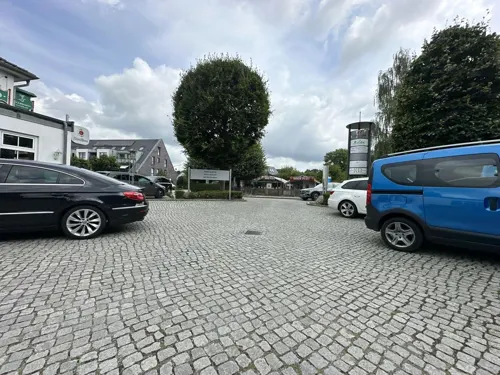
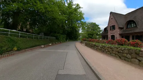
Krögers Kastanie
Restaurant · German · 2.1 km
14 Specksaalredder, Hamburg
Mo-Tu,Th-Sa 16:00-21:00; Su 12:00-14:30,16:00-21:00
Lenz
Restaurant · German · 2.1 km
3 Poppenbütteler Chaussee, Hamburg
Mo 12:00-14:30,17:30-21:00; Th 12:00-14:30,17:30-21:00; Fr-Su...
Quellenhof
Restaurant · Regional · 1.5 km
126 Rodenbeker Straße, Hamburg
We-Fr 12:00-22:00; Sa,Su 11:00-22:00
Toscanello
Restaurant · Italian · 1.3 km
118 Lemsahler Landstraße, Hamburg
Mo-Sa 16:00-22:00; Su 12:00-22:00
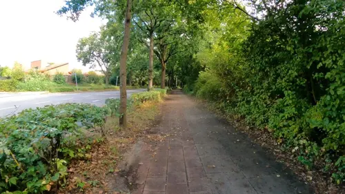
Trattoria Mondello
Restaurant · Italian · 2.9 km
1 Kramer-Kray-Weg, Hamburg
Mo off; Tu-Sa 12:00-15:00,18:00-22:00; Su 12:00-21:00
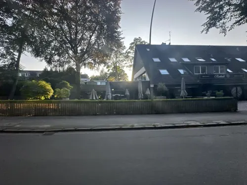


Cafe Reinhardt - Bäckerei, Konditorei
Bakery · 2.8 km
37 Poppenbüttler Hauptstraße, Hamburg
Mo-Sa 06:00-18:00; PH,Su 08:00-18:00
27 more on the map.
Where to stay4
Churches and places of worship6
Shopping9
Gas and EV charging4
Schools, colleges and libraries7
Healthcare4
Bergstedter Markt-Apotheke
Clinic and pharmacy · 2.7 km
15 Bergstedter Markt, Hamburg
Map of Lemsahl-Mellingstedt
122 places. The map loads OpenStreetMap tiles when you open it.
Getting there and nearby towns
Hamburg Airport (HAM) is the nearest airport with scheduled flights listed in OpenStreetMap, 10 km away.
- Norderstedt 7 km west, about 7 min by car
- Ahrensburg 9 km east, about 9 min by car
- Bargteheide 12 km east, about 12 min by car
- Quickborn 13 km west, about 13 min by car
- Barsbüttel 14 km south, about 14 min by car
- Hamburg 17 km southwest, about 17 min by car
- Kaltenkirchen 18 km northwest, about 18 min by car
- Halstenbek 18 km west, about 18 min by car
- Glinde 18 km southeast, about 18 min by car
- Rellingen 18 km west, about 18 min by car
Drive times are estimates from straight-line distance, not routes.
Local news
Headlines from INDB.
Reviews, tips and questions
Loading what members have shared...
Sources and licences
- GeoNames (CC BY 4.0): population, coordinates, regions and time zone
- Mapillary (see each image): photos
- OpenStreetMap contributors (ODbL 1.0): places, airports, map data
- Wikidata (CC0 1.0): elevation, founding date, time zone, website
- Wikimedia Commons (see each image): photos
- Wikipedia (CC BY-SA 4.0): overview and history text
Photo credits
- Mellingburger Schleuse Obere Brücke 1, NordNordWest, CC BY-SA 3.0 de
- Lemsahler Dorfstraße 23 (Hamburg-Lemsahl-Mellingstedt).1.27010.ajb, Ajepbah, CC BY-SA 3.0 de
- Lemsahler Dorfstraße 23 (Hamburg-Lemsahl-Mellingstedt).2.27010.ajb, Ajepbah, CC BY-SA 3.0 de
- Dorfkern Lemsahl (Hamburg-Lemsahl-Mellingstedt).1.31083.ajb, Ajepbah, CC BY-SA 3.0 de
- Lemsahler Dorfstraße 23 (Hamburg-Lemsahl-Mellingstedt).3.27010.ajb, Ajepbah, CC BY-SA 3.0 de
- Schleswig-Holstein-Gedenkstein Lemsahler Dorfplatz (Hamburg-Lemsahl-Mellingstedt), Ajepbah, CC BY-SA 3.0
- Lemsahler Dorfstraße 26 (Hamburg-Lemsahl-Mellingstedt).1.27005.ajb, Ajepbah, CC BY-SA 3.0 de
- Dorfkern Lemsahl (Hamburg-Lemsahl-Mellingstedt).2.31083.ajb, Ajepbah, CC BY-SA 3.0 de
- Lemsahler Dorfstraße 26 (Hamburg-Lemsahl-Mellingstedt).2.27005.ajb, Ajepbah, CC BY-SA 3.0 de
- Lemsahler Dorfstraße 28 (Hamburg-Lemsahl-Mellingstedt).2.27009.ajb, Ajepbah, CC BY-SA 3.0 de
- Lemsahler Dorfstraße 22 (Hamburg-Lemsahl-Mellingstedt).27008.ajb, Ajepbah, CC BY-SA 3.0 de
- Redderbarg 8 (Hamburg-Lemsahl-Mellingstedt).27007.ajb, Ajepbah, CC BY-SA 3.0 de
- Lemsahler Dorfstraße 28 (Hamburg-Lemsahl-Mellingstedt).1.27009.ajb, Ajepbah, CC BY-SA 3.0 de
- Jubilate-Kirche (Hamburg-Lemsahl-Mellingstedt), Ajepbah, CC BY-SA 3.0
- Rettungswache Hamburg-Lemsahl-Mellingstedt.ajb, Ajepbah, CC BY-SA 3.0
- Alte Mühle 34 Mühlengebäude4, Vitavia, CC BY-SA 4.0
- Kirche Hamburg-Bergstedt.1.ajb, Ajepbah, CC BY-SA 3.0
- Berdenbek - Landschop, flamenc, CC BY-SA 3.0
- Haingraben Tal, Vitavia, CC BY-SA 4.0
- KZ Wittmoor, Gedenkstein Fuchsmoorweg (Norderstedt-Glashütte) 02, Ajepbah, CC BY-SA 3.0
- Gedenkstätte KZ-Außenlager Sasel (Hamburg-Sasel).1.ajb, Ajepbah, CC BY-SA 3.0 de
- Gymnasium Ohlstedt (Hamburg-Wohldorf-Ohlstedt).ajb, Ajepbah, CC BY-SA 3.0
- Kleinbahnmuseum Wohldorf (Hamburg-Wohldorf-Ohlstedt).1.23100.ajb, Ajepbah, CC BY-SA 3.0 de
- Freiluftschule Wohldorf 02, Sebastian Koppehel, CC BY 4.0
- Schule am Walde (Hamburg-Wohldorf-Ohlstedt).1.25444.ajb, Ajepbah, CC BY-SA 3.0 de
- Schule Redderbarg in Hamburg-Lemsahl-Mellingstedt (1), Minderbinder, CC BY-SA 4.0
- Cantate-Kirche in Hamburg-Duvenstedt, Minderbinder, CC BY-SA 4.0
- Wohldorf-ohlstedt matth claudius kirche 14, Dirtsc, CC BY-SA 4.0
- Dorothea Gatzenmeyer - Lottbeker Weg 13 (Hamburg-Wohldorf-Ohlstedt).Stolperstein.nnw, NordNordWest, CC BY-SA 3.0 de
- Louis Gatzenmeyer - Lottbeker Weg 13 (Hamburg-Wohldorf-Ohlstedt).Stolperstein.nnw, NordNordWest, CC BY-SA 3.0 de
- Erinnern Mahnmal Sasel - panoramio, hh oldman, CC BY 3.0
- KZ Wittmoor, Gedenktafel Segeberger Chaussee 310 (Norderstedt-Glashütte), Ajepbah, CC BY-SA 3.0
- Mahnmal SaselOpfer BergstedtKirchhof2, Vitavia, CC BY-SA 4.0
- Carl Schrader – Baben de Möhl (Hamburg-Bergstedt).Stolperstein.1.ajb, Ajepbah, CC BY-SA 3.0 de
- Wittmoor in Froehjohrstiet, flamenc, CC BY-SA 3.0
- AlteMuehle-Saselbek, Bahnmoeller, CC BY 3.0
- Gedenkstein KZ-Außenlager Sasel, Ajepbah, CC BY-SA 3.0
- Nahverkehrsmuseum Kleinbahnhof Wohldorf EckeVorne, DomenikaBo, CC BY-SA 4.0
- Hohenbuchenpark (Hamburg-Poppenbüttel).Gedenktafel Andrzej Szablewski.1.ajb, Ajepbah, CC BY-SA 3.0 de
- Haselknick 22 (Hamburg-Wohldorf-Ohlstedt), Ajepbah, CC BY-SA 3.0
- Street-level photo, tian, CC BY-SA 4.0
- Street-level photo, quickness805, CC BY-SA 4.0
- Street-level photo, veloroute_hamburg, CC BY-SA 4.0
- Street-level photo, veloroute_hamburg, CC BY-SA 4.0
- Street-level photo, veloroute_hamburg, CC BY-SA 4.0
- Street-level photo, veloroute_hamburg, CC BY-SA 4.0
- Street-level photo, quickness805, CC BY-SA 4.0
- Street-level photo, veloroute_hamburg, CC BY-SA 4.0
- Street-level photo, quickness805, CC BY-SA 4.0
- Street-level photo, veloroute_hamburg, CC BY-SA 4.0
- Street-level photo, DruideBizeps, CC BY-SA 4.0
- Street-level photo, quickness805, CC BY-SA 4.0
- Street-level photo, quickness805, CC BY-SA 4.0
- Street-level photo, quickness805, CC BY-SA 4.0
- Street-level photo, quickness805, CC BY-SA 4.0
- Street-level photo, veloroute_hamburg, CC BY-SA 4.0
- Street-level photo, DruideBizeps, CC BY-SA 4.0
- Street-level photo, DruideBizeps, CC BY-SA 4.0
- Street-level photo, veloroute_hamburg, CC BY-SA 4.0
- Street-level photo, veloroute_hamburg, CC BY-SA 4.0
- Street-level photo, veloroute_hamburg, CC BY-SA 4.0
- Street-level photo, veloroute_hamburg, CC BY-SA 4.0
- Street-level photo, veloroute_hamburg, CC BY-SA 4.0
- Street-level photo, quickness805, CC BY-SA 4.0
- Street-level photo, mjay, CC BY-SA 4.0
- Street-level photo, veloroute_hamburg, CC BY-SA 4.0


Page built November 9, 2026. Spotted a mistake? Tell us or suggest a place.