


Why visit Mössingen
Townapedia lists 21 museums and landmarks, 35 parks and trails, 107 places to eat, 9 places to stay and 28 attractions in and around town.
Highlights include Lichtspiele Mössingen, Bioland Lindenhof, Holzschnitt-Museum Klaus Herzer and Kulturscheune Mössingen.
Weather in Mössingen
Forecast from MET Norway (CC BY 4.0). Full forecast
About Mössingen
Mössingen (German pronunciation: [ˈmœsɪŋən] ) is a town in the district of Tübingen, in Baden-Württemberg, Germany. It is situated north of the Swabian Jura, about 13 km south of Tübingen.
From the Wikipedia article Mössingen (this version), under CC BY-SA 4.0.
Things to do28



Theater Lindenhof
Cinema and theater · 8.7 km
Building in Burladingen, Tübingen Government Region, Bade-Württemberg, Germany
Biolandhof Möck
Farm and orchard · 3.7 km
1, Mössingen
Tu-Fr 09:00-12:00,16:00-18:30; Sa 09:00-14:00
Imkerei Honigunde
Farm and orchard · 4.0 km
34 Untergasse, Mössingen
Mo-Fr 09:00-18:00; Sa 09:00-14:00
Öschbachtalhof
Farm and orchard · 4.5 km
1, Mössingen
Mo,Su off; Tu,Th 10:00-13:00,16:00-19:00; We,Fr 16:00-19:00; Sa...



16 more on the map.
Museums and landmarks21

Holzschnitt-Museum Klaus Herzer
Museum · 4.2 km
Information und (Gruppen-)Anmeldung bei der Ortschaftsverwaltung Öschingen: siehe Telefon-/Faxnummer
1 Obergasse, Mössingen
Su 14:00-17:00; Dec 15-Jan 15 closed || "Gruppen ganzjährig auf Anmeldung"




Burgruine Andeck
Monument and historic site · 3.6 km
Nur noch wenige Reste der Burg vorhanden
9 more on the map.
Parks, trails and playgrounds35


Freibad Mössingen
Sports field and stadium · 1.4 km
4 Freibadstraße, Mössingen
May-Aug Mo-Fr 06:30-20:00; May-Aug Sa-Su,PH 08:00-20:00; Sep Mo-Fr...



Rosenpark
Park · 1.7 km
Das Gelände des Rosenparks wurde bis 1994 als Kreismülldeponie genutzt. Hier wurde ungetrennter Müll auf einem großen Müllberg...
Tu,Th,Sa,Su,PH 17:00-19:00; Su,PH 10:00-12:00; May-Jun || "not at rain"

23 more on the map.
Restaurants and cafes107

Bäckstage
Restaurant · International · 1.4 km
3 Ludwigstraße, Mössingen
Mo-Th 09:00-23:00; Fr-Sa 09:00-01:00; Su 09:00-23:00
12 Mann
Restaurant · Italian · 5.6 km
4 Gerstlaich, Bodelshausen
Tu-Fr 11:30-14:30,17:00-23:00; Sa-Su 11:00-23:00
Cremolato
Restaurant · Italian
34 Breitestraße, Mössingen
Tu-Fr 11:30-14:00, 17:00-21:00; Sa 11:30-21:00; Su,PH 10:00-21:00; Mo off
Dolce Vita
Restaurant · Italian · 4.9 km
33 Wilhelm-Herter-Straße, Dußlingen
We-Mo 11:00-14:00,17:00-23:00; Tu off
Engel
Restaurant · Greek · 4.8 km
11 Kreuzstraße, Mössingen
Tu-Sa 17:00-24:00; Sa 10:00-14:00,17:00-22:00; Mo closed "Ruhetag"
Gasthaus Schwanen
Restaurant · Regional · 3.2 km
28 Hauptstraße, Nehren
We-Fr 16:30-22:00; Sa 15:30-22:00; Su,PH 11:00-14:00,17:30-22:00; Mo,Tu off
Gasthof zum Ochsen
Restaurant · Regional · 0.7 km
73 Falltorstraße, Mössingen
Th-Mo 11:00-14:00, 17:00-22:00; Tu 11:00-14:00
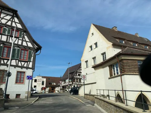
Kultur-Cafe "Chamäleon"
Cafe · Coffee Shop · 0.7 km
3/1 Brunnenstraße, Mössingen
We 14:00-22:00; Su 14:00-18:00
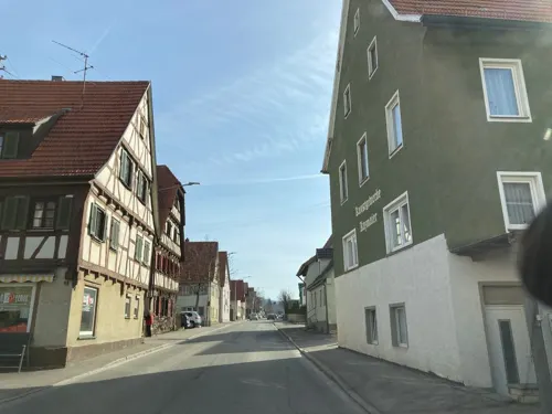
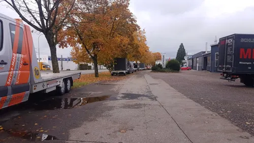
Namaste India
Restaurant · Indian · 0.9 km
18 Ofterdinger Straße, Mössingen
Mo-Fr 11:30-14:30,17:30-23:00; Sa,Su 11:00-23:00
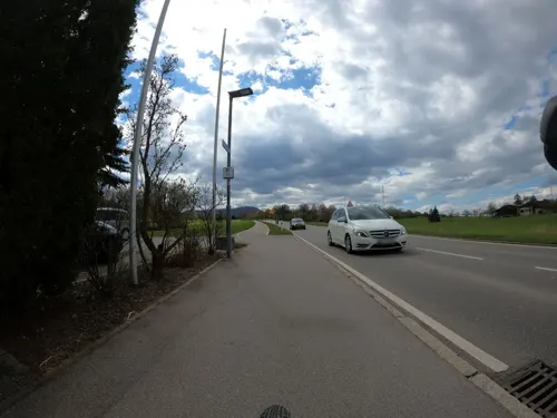
Nehrener Hof
Restaurant · German, Burger · 2.2 km
57 Bahnhofstraße, Nehren
Mo-Su,PH 11:30-14:00,17:00-21:00


95 more on the map.
History
Mössingen is first mentioned in a document of Lorsch Abbey ("in pago Alemannorum in Messinger marca") from the year 774. Until the early 15th century Mössingen belonged to the Counts of Zollern. After a dispute between Count Friedrich XII. and the Lords of Ow Mössingen was looted and burned in the early 15th century. Consequently, the Mössingen cemetery was attached with a high Wall and a defensive tower. 1415 pledged Count Friedrich von Zollern Mössingen to Count Eberhard von Württemberg. After protracted negotiations with the Count of Zollern, Mössingen came in 1441 finally to the Duchy of Württemberg. In 1534, Ulrich of Württemberg introduced the Reformation. As a result of the Thirty Years' War, the war of succession and the Revolutionary Wars took place and caused serious economic damage. An emigration swell in the late 18th to the early 19th century to Poland, Transylvania and America weakened the site further.
Mössingen found widespread attention on 31 January 1933, as the location of the sole workers' uprising in Germany against the seizure of power by Adolf Hitler. The Mössingen general strike, led by members of the Communist Party of Germany, led to 80 arrests.
Through population growth, immigration profits by expellees and foreign and resettled Russia German, the economic upturn from 1950 reached the region. A commuter town, Bästenhardt, was built.
From the History section of Mössingen on Wikipedia, under CC BY-SA 4.0.
Where to stay9
Churches and places of worship27
Ev. Peter- und Paul-Kirche
Church · Protestant · 0.7 km
2 Brunnenstraße, Mössingen
Evangelische Bergkirche (St. Cyriacus- und Pancratius-Kirche)
Church · Protestant · 4.7 km
Shopping33
Gas and EV charging11
Schools, colleges and libraries26
Healthcare11
Gesundheitszentrum Bad Sebastiansweiler
Hospital · 3.1 km
26 Hechinger Straße, Mössingen
Map of Mössingen
250 places. The map loads OpenStreetMap tiles when you open it.
Getting there and nearby towns
Manfred Rommel Airport Stuttgart (STR) is the nearest airport with scheduled flights listed in OpenStreetMap, 34 km away.
- Tübingen 13 km north, about 13 min by car
- Reutlingen 15 km northeast, about 15 min by car
- Pfullingen 14 km northeast, about 14 min by car
- Weil im Schönbuch 24 km north, about 24 min by car
- Bad Urach 27 km east, about 27 min by car
- Schönaich 28 km north, about 28 min by car
- Nagold 29 km northwest, about 29 min by car
- Sindelfingen 33 km north, about 33 min by car
- Nürtingen 32 km northeast, about 32 min by car
- Sulz am Neckar 31 km west, about 31 min by car
Drive times are estimates from straight-line distance, not routes.
Local news
Headlines from INDB.
Reviews, tips and questions
Loading what members have shared...
Sources and licences
- GeoNames (CC BY 4.0): population, coordinates, regions and time zone
- Mapillary (see each image): photos
- OpenStreetMap contributors (ODbL 1.0): places, airports, map data
- Wikidata (CC0 1.0): elevation, founding date, time zone, website, landmarks and historic places
- Wikimedia Commons (see each image): photos
- Wikipedia (CC BY-SA 4.0): overview and history text
Photo credits
- Kreisverkehr der Blumenstadt Mössingen, UnreifeKirsche, CC BY-SA 3.0
- Karl-Jaggy-Straße - Mössingen, Reutlingendorf, CC BY-SA 4.0
- Jakob-Stotz-Platz - Mössingen, Reutlingendorf, CC BY-SA 4.0
- Mössingen, Neue Pausa 01 Tonnenhalle, Vux, CC BY-SA 3.0
- Mössingen, Neue Pausa 02, Vux, CC BY-SA 3.0
- Mössingen Sulzgasse 15 (1), Windharp, CC BY-SA 4.0
- Mössingen Sulzgasse 15 (2), Windharp, CC BY-SA 4.0
- Mössingen Falltorstraße 20+22 (2), Windharp, CC BY-SA 4.0
- Mössingen Falltorstraße 20+22 (1), Windharp, CC BY-SA 4.0
- Mössingen Hirschgasse 1 (1), Windharp, CC BY-SA 4.0
- Mössingen Falltorstraße 24 (2), Windharp, CC BY-SA 4.0
- Mössingen Hirschgasse 1 (2), Windharp, CC BY-SA 4.0
- Mössingen Hirschgasse 1 (3), Windharp, CC BY-SA 4.0
- Mössingen altes E-Werk, Vux, CC BY-SA 3.0
- Mössingen Hirschgasse 13 (2), Windharp, CC BY-SA 4.0
- Mössingen Hirschgasse 13 (3), Windharp, CC BY-SA 4.0
- Mössingen Falltorstraße 24 (1), Windharp, CC BY-SA 4.0
- Mössingen Hirschgasse 13 (1), Windharp, CC BY-SA 4.0
- Hirschgasse - Mössingen, Reutlingendorf, CC BY-SA 4.0
- Mössingen Hirschgasse 13 Schild Historische Messerschmiede, Windharp, CC BY-SA 4.0
- Mössingen Karrengasse 4 (1), Windharp, CC BY-SA 4.0
- Mössingen Karrengasse 4 (2), Windharp, CC BY-SA 4.0
- 2018-09-28 Brunnen Fritzenrain Mössingen, Crazy1880, CC BY-SA 4.0
- Mössingen Karrengasse 4 (3), Windharp, CC BY-SA 4.0
- Mössingen Karrengasse 4 (5), Windharp, CC BY-SA 4.0
- Mössingen Karrengasse 4 (4), Windharp, CC BY-SA 4.0
- Mössingen Neues Rathaus 1, Benutzer:Michael Fiegle, CC BY-SA 3.0
- Am Steinlachstrand in Mössingen, Olga Ernst, CC BY-SA 4.0
- Am Steinlachstrand, Mössingen, Olga Ernst, CC BY-SA 4.0
- Mössingen Grabenstraße 29 (1), Windharp, CC BY-SA 4.0
- Mössingen Grabenstraße 29 (2), Windharp, CC BY-SA 4.0
- 2016-08-04 Brunnen Falltorstraße Mössingen, Crazy1880, CC BY-SA 4.0
- Mössingen Lange Straße 29+31 (3), Windharp, CC BY-SA 4.0
- Flügelsignale, Bahnhof Mössingen, Olga Ernst, CC BY-SA 4.0
- Theater Lindenhof, Zollernalb, CC BY-SA 4.0
- NSG Altwiesen img8888, Vux, CC BY-SA 4.0
- Belsener Kapelle, The original uploader was Michael Fiegle at German Wikipedia ., CC BY-SA 3.0
- Farrenberg von Talheim, UnreifeKirsche, CC BY-SA 3.0
- Dreifuerstenstein, Ramessos, Public domain
- Mössingen Schulzentrum Firstwald 3, Windharp, CC BY-SA 4.0
- Filsenberg von Talheim, UnreifeKirsche, CC BY-SA 3.0
- Gomaringer Schloss, No machine-readable author provided. Weitbrecht assumed (based on copyright claims)., Public domain
- Colchicum autumnale auf Beurener Heide (Hechingen)4, Corinna Müller, CC BY-SA 3.0
- NSG Oeschenbachtal, Friedi13, CC0
- Mössinger Bergrutsch - Unterhang 1, Kreuzschnabel, CC BY-SA 3.0
- NSG Bei der Olgahoehe, Friedi13, CC0
- Holzschnitt-Museum, Klara Midinet, CC BY-SA 4.0
- 2018-09-27 Frontansicht Peter und Paulskirche, Crazy1880, CC BY-SA 4.0
- Mössingen Kulturscheune 1, Windharp, CC BY-SA 4.0
- Peterskirche Dußlingen 01, Zollernalb, CC BY-SA 4.0
- Gomaringen, Evangelische Kirche, Karsten Ratzke, CC0
- Martin-Luther-Kirche Mössingen, Bonjour35, CC BY-SA 4.0
- Evangelische Veitskirche in Nehren - panoramio, qwesy qwesy, CC BY 3.0
- Dußlingen St. Paulus Front, Windharp, CC BY-SA 4.0
- Lichtspiele Mössingen, Olga Ernst, CC BY-SA 4.0
- Street-level photo, tasmaniadevil, CC BY-SA 4.0
- Street-level photo, plexi32, CC BY-SA 4.0
- Street-level photo, tasmaniadevil, CC BY-SA 4.0
- Street-level photo, tasmaniadevil, CC BY-SA 4.0
- Street-level photo, tasmaniadevil, CC BY-SA 4.0
- Street-level photo, tasmaniadevil, CC BY-SA 4.0
- Street-level photo, changchun1, CC BY-SA 4.0
- Street-level photo, plexi32, CC BY-SA 4.0
- Street-level photo, tasmaniadevil, CC BY-SA 4.0
- Street-level photo, tasmaniadevil, CC BY-SA 4.0
- Street-level photo, tasmaniadevil, CC BY-SA 4.0
- Street-level photo, tasmaniadevil, CC BY-SA 4.0
- Street-level photo, eliasp, CC BY-SA 4.0
- Street-level photo, eliasp, CC BY-SA 4.0
- Street-level photo, tasmaniadevil, CC BY-SA 4.0
- Street-level photo, eliasp, CC BY-SA 4.0
- Street-level photo, tasmaniadevil, CC BY-SA 4.0
- Street-level photo, msdess, CC BY-SA 4.0
- Street-level photo, changchun1, CC BY-SA 4.0
- Street-level photo, tasmaniadevil, CC BY-SA 4.0
- Street-level photo, changchun1, CC BY-SA 4.0
- Street-level photo, tasmaniadevil, CC BY-SA 4.0
- Street-level photo, chuck, CC BY-SA 4.0
- Street-level photo, tasmaniadevil, CC BY-SA 4.0
- Street-level photo, tasmaniadevil, CC BY-SA 4.0
- Street-level photo, tasmaniadevil, CC BY-SA 4.0
- Street-level photo, tasmaniadevil, CC BY-SA 4.0


Page built November 8, 2026. Spotted a mistake? Tell us or suggest a place.