


Why visit Neuruppin
Townapedia lists 81 museums and landmarks, 53 parks and trails, 145 places to eat, 35 places to stay and 18 attractions in and around town.
Highlights include Tierpark Kunsterspring, Ölmühle Katerbow, Kulturkirche and Brandenburg-Preußen-Museum.
Weather in Neuruppin
Forecast from MET Norway (CC BY 4.0). Full forecast
About Neuruppin
Neuruppin (German: [nɔʏʁʊˈpiːn] , lit. 'New Ruppin', in contrast to "Old Ruppin"; North Brandenburgisch: Reppin) is a town in Brandenburg, Germany, the administrative seat of Ostprignitz-Ruppin district. It is the birthplace of the novelist Theodor Fontane (1819–1898) and therefore also referred to as Fontanestadt. A garrison town since 1688 and largely rebuilt in a Neoclassical style after a devastating fire in 1787, Neuruppin has the reputation of being "the most Prussian of all Prussian towns".
From the Wikipedia article Neuruppin (this version), under CC BY-SA 4.0.
Photos of Neuruppin


Things to do18
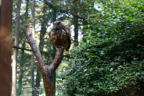
Tierpark Kunsterspring
Zoo and aquarium · 11.3 km
Tierpark der Fontanestadt Neuruppin
4 Kunsterspring, Neuruppin
Apr-Sep: 09:00-19:00; Oct-Mar: 09:00-17:00

Ölmühle Katerbow
Farm and orchard · 12.0 km
29 Dorfstraße, Temnitzquell
Fr 14:00-20:00; Sa 11:00-18:00
Treskower Hofladen
Farm and orchard · 4.5 km
12 Nauener Straße, Neuruppin
Tu-Su 09:00-18:00

Vogelpark Lindow
Zoo and aquarium · 13.3 km
20 Straße des Friedens, Lindow (Mark)


6 more on the map.
Museums and landmarks81


Brandenburg-Preußen-Museum
Museum · 9.8 km
7a Eichenallee, Fehrbellin
Apr-Oct Tu-Su 10:00-18:00; Nov-Mar Tu-Su 10:00-16:00


Herrenhaus Gut Gentzrode
Monument and historic site · 5.6 km
Herrenhaus Gut Gentzrode, Gentzrode 1 in Neuruppin OT Gentzrode
1 Gentzrode, Neuruppin

Apollo Tempel
Monument and historic site
Apollotempel im Tempelgarten, Präsidentenstraße 64 in Neuruppin

Karl-Friedrich Schinkel
Monument and historic site
Denkmal für Karl Friedrich Schinkel, Kirchplatz in Neuruppin

Puppenhaus
Monument and historic site · 13.2 km
16 Straße des Friedens, Lindow (Mark)


Theodor Fontane
Monument and historic site · 0.8 km
Denkmal Theodor Fontane, Fontaneplatz in Neuruppin

Zietenschloss
Monument and historic site · 9.6 km
Zietenschloss, Am Schloß 1 in Fehrbellin OT Wustrau
69 more on the map.
Parks, trails and playgrounds53

Kletterzentrum
Sports field and stadium · 0.6 km
Wasserturm (Umnutzung zum Kletterturm), Puschinstraße in Neuruppin
Mo 18:00-19:00, Tu 17:30-19:30, We 17:00-18:00, Th 17:00-19:00, Fr...



Boat-City Neuruppin
Marina and boat launch · 2.0 km
BunBo - das Bungalowboot / Standort Lindow
Marina and boat launch · 12.9 km


Erlebnisbad
Sports field and stadium · 1.4 km
Mo-Fr 14:00-18:00; Tu off; Sa,Su,PH 09:00-21:00
41 more on the map.
Restaurants and cafes145
Zur Kastanie
Restaurant · Regional · 8.4 km
Unser Hotel verfügt über 7 Doppel - und 2 Einzelzimmer. Eine Aufbettung ist in 2 Doppel - und einem Einzelzimmer möglich. Für unsere...
22 Lange Straße, Neuruppin
Apr-Oct: Mo-Tu 17:00+, Th-Su 11:00+, Nov-Mar: Mo-Tu 17:00+, Fr-Su 11:00+
Alte Fischerhütte
Restaurant · Regional · 10.6 km
7 Zur Zugbrücke, Fehrbellin
Mo-Su 11:00-22:00; Oct-Apr Mo-Fr 17:00-22:00; Oct-Apr Sa-Su 11:00-22:00
Loc House
Restaurant · German · 13.5 km
10 Bahnhofstraße, Fehrbellin
Tu-Th 16:30-22:00; Fr-Su 11:30-22:00

Altes Kasino
Restaurant · German, Regional · 0.9 km
11-12 An der Seepromenade, Neuruppin
"ab 1.10.23 auf Vorreservierung"
Agra Fort
Restaurant · Indian
3 Karl-Marx-Straße, Neuruppin
Su 12:00-21:00; Tu-Sa 11:00-14:30,17:00-22:00
Gasthaus am Sonnenufer
Restaurant · Regional · 1.9 km
17 Zum Schwanenufer, Neuruppin
Tu-Su 09:00-23:00
Herr Fenske
Restaurant · Fine Dining · 0.9 km
24 An der Seepromenade, Neuruppin
Tu 17:30-23:00, We-Sa 14:30-23:00
133 more on the map.
History
The prehistoric settlement of the country ranges from the Middle Stone Age through the younger Bronze Age with first Germanic, later Slavic settlements (in the old town area - including "Neuer Markt" - and in the surrounding countryside) on the shores of Lake Ruppin. In late Slavic times, this area was settled by the Zamzizi tribe, whose center was probably the Slawenburg Ruppin on the island of Poggenwerder near Alt Ruppin. After the Wendish Crusade in 1147 and the conquest of the land by the German nobility, around 1200 on the Amtswerder, a peninsula next to the island of Poggenwerder, the Ruppin Castle (also Planenburg) was built as a large lowland castle and political center of the Lordship of Ruppin. In the northern foreland a market settlement with Nikolai church developed, east of it and beyond the Rhin the Kietz: the town (Olden Ruppyn) Alt Ruppin had arisen.
Southwest of the castle town, the settlement of today's Neuruppin with Nikolaikirche (St. Nicholas' Church) and a street market was established at the beginning of the 13th century, keeping the name Ruppin.
Read more of the history
The then (Neu-)Ruppin was a planned town foundation of the counts of Lindow-Ruppin, a collateral line of the Arnsteins, who resided in Alt Ruppin. The first documentary mention dates back to 1238. An expansion of the original Marktsiedlung Alt Ruppin, towards the present-day city of Neuruppin, probably took place before the foundation of the Dominican monastery in 1246 as the first settlement of the order between the Elbe and Oder rivers by the first prior Wichmann von Arnstein. The granting of the Stendal town charter took place on March 9, 1256, by Günther von Arnstein. The city was fortified in the 13th century by palisades and a rampart-ditch system, later it was fortified by walls and rampart-ditches; 24 "Wiekhäuser" and two high towers reinforced the city wall. In addition, there were three gates, the Altruppiner/Rheinsberger Tor in the north, the Berliner/Bechliner Tor in the south and the Seetor in the east. The complete walled enclosure occurred at the latest towards the end of the 15th century.
Neuruppin's oldest part was an elongated Anger, accompanied by two parallel streets between the southern and northern city gates, in the south on it the oldest church of Neuruppin (St. Nikolai). The main street of Neuruppin was pavement since the middle of the 16th century. Across Neuruppin, from the northwest toward the lake, ran the Klappgraben, coming from the Ruppiner Mesche, to supply the city with service water and for drainage, which was partially filled in 1537 and renewed as an open canal in Schinkelstraße after the city fire of 1787.
In the Middle Ages, Neuruppin was one of the larger northeastern German cities. Preserved from this period are, among other things, parts of the city wall, parts of the monastery church of St. Trinitatis (1246), St. George's Chapel (1362), the leprosorium (1490) with the St. Lazarus Chapel consecrated in 1491, as well as remains of the lake district. The medieval city had a nearly square ground plan of about 700 m × 700 m, which blunts conspicuously at the eastern corner. The east-southeast side borders on the Ruppiner Lake.
In 1512, to celebrate a peace treaty, Elector Joachim I organized a three-day jousting tournament in Neuruppin. After the extinction of the Counts of Lindow-Ruppin in 1524, Neuruppin came to the Elector Joachim I as a settled fief. The Thirty Years' War also devastated Neuruppin. In the course of the Reformation, the monastery property fell to the elector around 1540. In 1564, he donated the monastery to the city. During this time, a legend depicted in the monastery church about a mouse chasing a rat, which is interpreted as a sign that the church would remain Lutheran in the future.
A Latin school was first documented in Neuruppin in 1365, which at times had supra-regional importance. Its history is well documented since 1477. In 1777 Philipp Julius Lieberkühn and Johann Stuve took over the school administration and reformed the school in the Basedowsche Sense, which received general attention.
In 1688 Neuruppin became one of the first garrison towns in Brandenburg. It was here that Crown Prince Frederick was imprisoned from 1732 to 1740 after his unsuccessful escape attempt and subsequent imprisonment in Küstrin. Holder of the Regiment on Foot Crown Prince. During this time, Bernhard Feldmann city physicist. His transcripts of historically interesting council records are considered the most important collection of sources on early town history, as the original records were destroyed in the town fire of 1787. At times the number of soldiers and civilian troop members was 1500 out of 3500 inhabitants. Neuruppin only lost this status with the withdrawal of the Group of Soviet Forces in Germany.
After 1685, French Huguenots settled there. From 1740 the organ builder Gottlieb Scholtze had his workshop in Neuruppin, who among other things built the organ in Rheinsberg.
A break in the development of the town was the wildfire of Sunday, August 26, 1787. The fire broke out in a barn filled with grain at the Bechliner Tor in the afternoon and spread rapidly. Only two narrow areas on the eastern and western edges of the city remained. A total of 401 bourgeois houses, 159 outbuildings and outhouses, 228 stables and 38 barns, the parish church of St. Mary, the town hall, the Reformed church, and the Prince's Palace were destroyed. Property damage was estimated at nearly 600,000 talers. The Fire Fund replaced about 220,000 thalers, a special church collection yielded 60,000 thalers, and the Prussian Government provided 130,000 thalers of funding for the reconstruction of the city. In total, the state spent over one million thalers in the following years.
From the History section of Neuruppin on Wikipedia, under CC BY-SA 4.0.
More about Neuruppin
Geography
Neuruppin is one of the largest cities in Germany in terms of area. The city of Neuruppin, 60 km (37 mi) northwest of Berlin in the district of Ostprignitz-Ruppin (Ruppin Switzerland), consists in the south of the districts located on the shores of Ruppiner See, which is crossed by the Rhin River, including the actual core city of Neuruppin and Alt Ruppin. In the north, it stretches up to the Rheinsberg Lake Region and the border with Mecklenburg-Vorpommern. It is part of the Stechlin-Ruppiner Land Nature Park and is connected to the Wittstock-Ruppiner Heide, which was partly used for military purposes as the Wittstock military training area.
After several annexations in 1993, Neuruppin today is one of Germany's largest municipalities by area. The following districts and residential areas belong to Neuruppin since the annexations in 1993.
From the Wikipedia article Neuruppin, under CC BY-SA 4.0.
Notable people from Neuruppin
 Theodor FontaneGerman novelist and poet (1819–1898)Photo: Carl Breitbach, Public domain
 Karl Friedrich SchinkelPrussian architect, city planner and painter (1781–1841)Photo: Carl Joseph Begas, Public domain
 Hermann HothGerman general (1885-1971)Photo: Office of Military Government for..., Public domain
 Tatjana HüfnerlugerPhoto: Sandro Halank , Wikimedia Commons, CC BY-SA 4.0
 Eva StrittmatterGerman poet (1930-2011)Photo: Rengha Rodewill, CC BY-SA 4.0
 Ferdinand von QuastPrussian World War I generalPhoto: Emil Bieber, Public domain
 Ralf BüchnerEast German gymnastPhoto: Bernd Settnik, CC BY-SA 3.0 de
 Fritz BaadeGerman politician and economist (1893-1974)Photo: Magnussen, Friedrich (1914-1987), CC BY-SA 3.0 de
 Hans BettembourgSwedish weightlifterPhoto: Swedish Olympic Committee, Public domain
- Uwe HohnGerman track and field athlete
- Ferdinand von BredowGerman general (1884–1934)
- Carl GroßmannGerman serial killer
Born in Neuruppin, according to Wikidata (CC0). Each name links to its Wikipedia article.
Where to stay35
Churches and places of worship35
Dorfkirche Langen
Church · Protestant · 9.7 km
70 Dorfstraße, Fehrbellin
Dorfkirche Protzen
Church · Protestant · 11.1 km
68 Dorfstraße, Fehrbellin
Shopping36
Gas and EV charging16
Schools, colleges and libraries27
Healthcare17
Lindow Apotheke
Clinic and pharmacy · 13.4 km
2 Rheinsberger Straße, Lindow (Mark)
Map of Neuruppin
250 places. The map loads OpenStreetMap tiles when you open it.
Getting there and nearby towns
Müritz Airpark (REB) is the nearest airport with scheduled flights listed in OpenStreetMap, 42 km away.
- Fehrbellin 13 km south, about 13 min by car
- Rheinsberg 20 km north, about 20 min by car
- Kremmen 24 km southeast, about 24 min by car
- Gransee 25 km east, about 25 min by car
- Kyritz 27 km west, about 27 min by car
- Oranienburg 36 km southeast, about 36 min by car
- Nauen 36 km south, about 36 min by car
- Zehdenick 36 km east, about 36 min by car
- Leegebruch 35 km southeast, about 35 min by car
- Velten 37 km southeast, about 37 min by car
Drive times are estimates from straight-line distance, not routes.
Towns near Neuruppin


Keep exploring
Local news
Headlines from INDB.
Reviews, tips and questions
Loading what members have shared...
Sources and licences
- GeoNames (CC BY 4.0): population, coordinates, regions and time zone
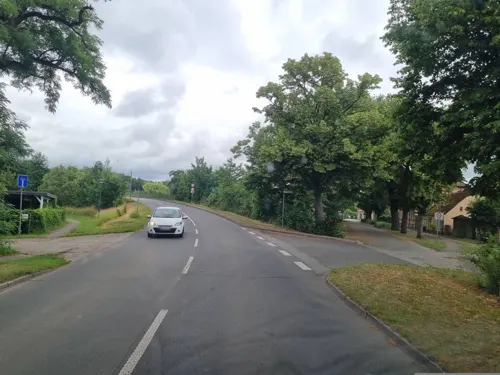
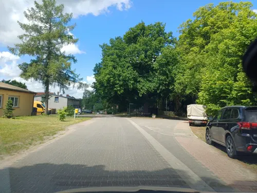
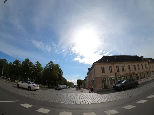
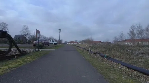
- Mapillary (see each image): photos
- OpenStreetMap contributors (ODbL 1.0): places, airports, map data
- Openverse (see each image): photos
- Wikidata (CC0 1.0): elevation, founding date, time zone, website, landmarks and historic places
- Wikimedia Commons (see each image): photos
- Wikipedia (CC BY-SA 4.0): overview and history text
Photo credits
- Neuruppin Heinrich-Heine-Straße 9, Florian Schäffer, CC BY-SA 3.0
- Neuruppin Heinrich-Heine-Straße 9 Eingang, Florian Schäffer, CC BY-SA 3.0
- Neuruppin Heinrich-Heine-Straße 8 Wohnhaus mit Einfriedung 2, Florian Schäffer, CC BY-SA 3.0
- Neuruppin Heinrich-Heine-Straße 8 Wohnhaus mit Einfriedung 1, Florian Schäffer, CC BY-SA 3.0
- Neuruppin Heinrich-Heine-Straße 7 Wohnhaus mit Einfriedung 1, Florian Schäffer, CC BY-SA 3.0
- Neuruppin Heinrich-Heine-Straße 7 Wohnhaus mit Einfriedung 2, Florian Schäffer, CC BY-SA 3.0
- Neuruppin Heinrich-Heine-Straße 6, Florian Schäffer, CC BY-SA 3.0
- Neuruppin Schinkelstraße 23 Feuerwehrgebaeude, Radler59 ( talk ), CC BY-SA 4.0
- Neuruppin Schinkelstraße 23 Feuerwehrgebaeude Fassade-02, Radler59 ( talk ), CC BY-SA 4.0
- Neuruppin Schinkelstraße 23 Feuerwehrgebaeude Fassade-01, Radler59 ( talk ), CC BY-SA 4.0
- Neuruppin Schinkelstraße 23 Feuerwehrgebaeude Fassade-03, Radler59 ( talk ), CC BY-SA 4.0
- Neuruppin Heinrich-Heine-Straße 6 Ecke Fontanestraße, Florian Schäffer, CC BY-SA 3.0
- Neuruppin Schinkelstraße 23-24 Feuerwehrgebäude Hauptwache, Florian Schäffer, CC BY-SA 3.0
- Neuruppin Schinkelstraße 23 Feuerwehrgebäude Fassade 1, Florian Schäffer, CC BY-SA 3.0
- Neuruppin Schinkelstraße 23 Feuerwehrgebäude Fassade 4, Florian Schäffer, CC BY-SA 3.0
- Neuruppin Schinkelstraße 23 Feuerwehrgebäude Fassade 2, Florian Schäffer, CC BY-SA 3.0
- Neuruppin Schinkelstraße 23 Feuerwehrgebäude Fassade 3, Florian Schäffer, CC BY-SA 3.0
- Neuruppin Fontanestraße 11 Villa 1, Florian Schäffer, CC BY-SA 3.0
- Neuruppin Fontanestraße 11 Villa 2, Florian Schäffer, CC BY-SA 3.0
- Neuruppin Fontanestraße 3 Villa mit Einfriedung, Florian Schäffer, CC BY-SA 3.0
- Neuruppin Wallstraße 5, Florian Schäffer, CC BY-SA 3.0
- Neuruppin Bahnhofstraße 17 Verwaltungsgebäude, Florian Schäffer, CC BY-SA 3.0
- Neuruppin Virchowstraße 33-34 Mietwohnhaus mit Nebengebäude 03, Florian Schäffer, CC BY-SA 3.0
- Neuruppin Virchowstraße 33-34 Mietwohnhaus mit Nebengebäude 02, Florian Schäffer, CC BY-SA 3.0
- Neuruppin Virchowstraße 33-34 Mietwohnhaus mit Nebengebäude 01, Florian Schäffer, CC BY-SA 3.0
- Neuruppin Gerhart-Hauptmann-Straße 11 Villa, Florian Schäffer, CC BY-SA 3.0
- Neuruppin Heinrich-Heine-Straße Nummer 4, Florian Schäffer, CC BY-SA 3.0
- Neuruppin August-Bebel-Straße 9 Wohnhaus, Florian Schäffer, CC BY-SA 3.0
- Neuruppin Schinkelstraße 1 Wohn- und Geschäftshaus, Florian Schäffer, CC BY-SA 3.0
- Neuruppin Tempelgarten Tor Umfassungsmauer, Radler59 ( talk ), CC BY-SA 4.0
- Tempelgarten Neuruppin 2021 12, Clemensfranz, CC BY-SA 4.0
- Neuruppin - Bebel-Strasse - geo.hlipp.de - 39720, Colin Smith on geo.hlipp.de, CC BY-SA 2.0
- August-Bebel-Straße 51 Neuruppin, Clemensfranz, CC BY-SA 3.0
- Tempelgarten Neuruppin 2021 13, Clemensfranz, CC BY-SA 4.0
- Tempelgarten Neuruppin 2021 11, Clemensfranz, CC BY-SA 4.0
- Gentzrode Herrenhaus und Kornspeicher, User:ONAR, CC BY-SA 3.0
- BrandenburgPreussenMuseum, MrsMyer at German Wikipedia, CC BY-SA 3.0
- Hauptgebäude Ruppiner Kliniken, gregor rom, CC BY-SA 4.0
- Eingang von Westen, Beck Berlin, CC BY-SA 4.0
- Fontane-Neuruppin-JMUnger, Jörg M. Unger, CC BY-SA 3.0
- Lindow Mark Wasserturm, Oberlausitzerin64, CC BY-SA 4.0
- Dorfkirche Gnewikow 2018 SE, Hans G. Oberlack, CC BY-SA 4.0
- Stoeffin church, Doris Antony , Berlin, CC BY-SA 3.0
- Siechenkapelle St Laurentius (Neuruppin)1, Chris06, CC0
- Fehrbellin, Stadtkirche -- 2017 -- 7432, Dietmar Rabich, CC BY-SA 4.0
- Straße des Friedens 33 Lindow Mark, Clemensfranz, CC BY-SA 3.0
- Dorfkirche Protzen 2019 SSE, Hans G. Oberlack, CC BY-SA 4.0
- Straße des Friedens 16 Lindow Mark, Clemensfranz, CC BY-SA 3.0
- Mittelstraße 34 Lindow Mark, Clemensfranz, CC BY-SA 3.0
- Neuruppin Pfarrkirche St. Marien-01, Radler59 ( talk ), CC BY-SA 4.0
- Gentzrode Herrenhaus-06, Radler59 ( talk ), CC BY-SA 4.0
- Neuruppin Tempelgarten Apollotempel-03, Radler59 ( talk ), CC BY-SA 4.0
- Neuruppin Schinkeldenkmal-01, Radler59 ( talk ), CC BY-SA 4.0
- Neuruppin Fontane Denkmal, Radler59 ( talk ), CC BY-SA 4.0
- Wustrau Schloss-01, Radler59 ( talk ), CC BY-SA 4.0
- Neuruppin Wasserturm, Radler59 ( talk ), CC BY-SA 4.0
- Lindow (Mark) Pfarrkirche, Radler59 ( talk ), CC BY-SA 4.0
- Neuruppin St. Trinitatis-02, Radler59 ( talk ), CC BY-SA 4.0
- Langen church, Doris Antony , Berlin, CC BY-SA 4.0
- Alt Ruppin Pfarrkirche St. Nikolai, Radler59 ( talk ), CC BY-SA 4.0
- Neuruppin Wichmannstrasse 17, Radler59 ( talk ), CC BY-SA 4.0
- Wmstendenitz2013, Andreas Neumann, CC BY 3.0
- Neuruppin Fontane Therme lub 2025-06-30, Lukas Beck, CC BY 4.0
- Tierpark Kunsterspring, Sørn, CC BY-SA 2.0
- Street-level photo, macsico, CC BY-SA 4.0
- Street-level photo, atpl_pilot, CC BY-SA 4.0
- Street-level photo, nrpoprfoto, CC BY-SA 4.0
- Street-level photo, atpl_pilot, CC BY-SA 4.0
- Street-level photo, dsmm, CC BY-SA 4.0
- Street-level photo, wentus, CC BY-SA 4.0
- Street-level photo, dsmm, CC BY-SA 4.0
- Street-level photo, dsmm, CC BY-SA 4.0
- Street-level photo, britiger, CC BY-SA 4.0
- Street-level photo, dsmm, CC BY-SA 4.0
- Street-level photo, macsico, CC BY-SA 4.0
- Street-level photo, macsico, CC BY-SA 4.0
- Street-level photo, lehestener, CC BY-SA 4.0
- Street-level photo, macsico, CC BY-SA 4.0
- Street-level photo, macsico, CC BY-SA 4.0
- Street-level photo, atpl_pilot, CC BY-SA 4.0
- Street-level photo, nrpoprfoto, CC BY-SA 4.0
- Street-level photo, nrpoprfoto, CC BY-SA 4.0
- Street-level photo, atpl_pilot, CC BY-SA 4.0
- Street-level photo, dsmm, CC BY-SA 4.0
- Street-level photo, dsmm, CC BY-SA 4.0


Page built November 9, 2026. Spotted a mistake? Tell us or suggest a place.