


Why visit Oranienburg
Townapedia lists 114 museums and landmarks, 51 parks and trails, 201 places to eat, 22 places to stay and 16 attractions in and around town.
Highlights include Tier-, Freizeit- und Saurierpark Germendorf, Filmpalast Oranienburg, Memorial Sachsenhausen and Schloss Oranienburg.
Weather in Oranienburg
Forecast from MET Norway (CC BY 4.0). Full forecast
About Oranienburg
Oranienburg (German: [oˈʁaːniənˌbʊʁk] ) is a town in Brandenburg, Germany. It is the capital of the district of Oberhavel.
From the Wikipedia article Oranienburg (this version), under CC BY-SA 4.0.
Travel tips from other travellers: Oranienburg on Wikivoyage (CC BY-SA 4.0).
Photos of Oranienburg


Things to do16

Tier-, Freizeit- und Saurierpark Germendorf
Zoo and aquarium · 6.4 km
1a An den Waldseen, Oranienburg
09:00-19:00


4 more on the map.
Museums and landmarks114


Wasserturm
Monument and historic site · 8.0 km
5B Summter Straße, Hohen Neuendorf

Dr. Curt Eckstein
Monument and historic site · 3.8 km
Stolperstein für Dr. Curt Eckstein
9 Fasanenweg, Hohen Neuendorf


Schlossmuseum
Museum · 1.3 km
1 Schloßplatz, Oranienburg
Apr-Oct Tu-Su 10:00-17:30, Nov-Mar Tu-Su 10:00-16:00, Mo closed
102 more on the map.
Parks, trails and playgrounds51

Schlosspark Oranienburg
Park · 1.7 km
1 Schlossplatz, Oranienburg
Apr-Oct 09:00-18:00; Nov-Mar 09:00-16:00



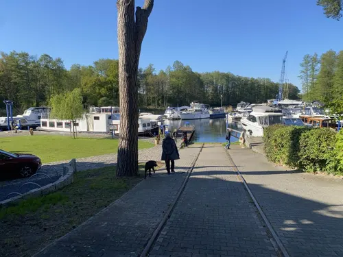
Wassersportzentrum Oranienburg
Marina and boat launch · 0.8 km

39 more on the map.
Restaurants and cafes201
Bella Vista
Restaurant · Italian · 7.2 km
21 Saumweg, Birkenwerder
Mo-Fr 14:00-23:00; Sa-Su 12:00-23:00
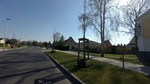
Feldschlösschen Weimann
Restaurant · International · 7.3 km
49 Bergstraße, Velten
We-Fr 17:00-21:30; Sa,Su 11:30-21:00
Gasthof zum Dorfkrug
Restaurant · Regional · 7.7 km
2 Remontehof, Oberkrämer
Mo-Fr 17:00-22:00; Sa-Su 12:00-22:00
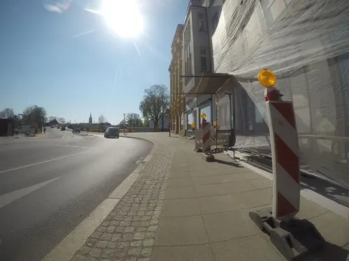
Geisha
Restaurant · Sushi, Thai, Vietnamese · 1.2 km
6 Bernauer Straße, Oranienburg
Mo-Th 11:00-22:00; Fr,Sa 11:00-23:00; Su,PH 11:00-22:00
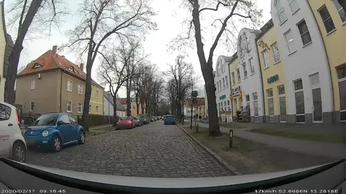
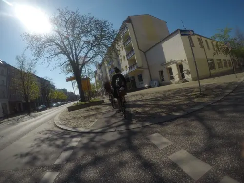
Kioko Sushi GmbH
Restaurant · Asian · 1.1 km
48 Bernauer Straße, Oranienburg
Su-Th 11:00-22:00; Fr-Sa 11:00-23:00
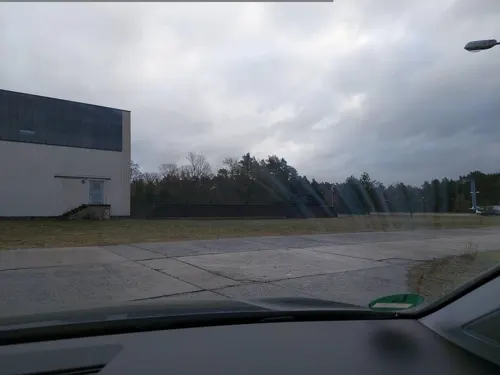
Nachbarschaftstreff Lehnitz
Cafe · Regional, Mitmachküche · 1.5 km
Nachbarschaftstreff Lehnitz der gemeinnützigen PuRgGmbH, Aufgang 2, Etage 2
9H Mühlenbecker Weg, Oranienburg
Mo-Fr 09:00-17:00

Com Viet - Vietnamesisches Restaurant & Sushibar
Restaurant · Vietnamese · 7.1 km
9 Clara-Zetkin-Straße, Birkenwerder
Mo-Sa 11:00-22:00
189 more on the map.
History
Originally named Bötzow, the town of Oranienburg dates from the 12th century and was first mentioned in 1216. Margrave Albert the Bear (ruled 1157–1170) allegedly ordered the construction of a castle on the banks of the Havel. Around the castle stood a settlement of traders and craftsmen.
In 1646, Friedrich Wilhelm I of Brandenburg married Louise Henriette of Orange-Nassau (German: Oranien-Nassau). She was so attracted by the town of Bötzow that her husband presented the entire region to her. The princess ordered the construction of a new castle in the Dutch style and called it Oranienburg or Schloss Oranienburg. In 1653 the town of Bötzow was renamed Oranienburg.
Silvio Gesell, the founder of Freiwirtschaft ("free economy"), lived in Oranienburg between 1911 and 1915, publishing his magazine, Der Physiocrat. He returned to the town in 1927 and lived there until his death in 1930. The town remained a center of the "free economy" movement until the Nazi régime outlawed it in 1933, and many of Gesell's followers ended up as prisoners in the town's concentration camp.
Read more of the history
The Oranienburg concentration camp (established in March 1933) was among the earliest of the Nazis concentration camps. In 1936, the Sachsenhausen concentration camp on the outskirts of Oranienburg replaced it; there 200,000 people were interned over the nine years that the Nazis operated it. Approximately 22,000 people died at the camp before the liberation of the camp by the Soviet Red Army in 1945. Thereafter the site reopened in August 1945 as "Soviet Special Camp 7". A further 12,000 people (mostly Nazis not awaiting trial) died under the Soviets before the Special Camp closed in 1950. Their remains were not discovered until the 1990s.
Oranienburg became the center of Nazi Germany's nuclear-energy project because it was the location of the Auergesellschaft Oranienburg Plant, Germany's uranium production facility; the town also had an armaments hub, aircraft plant, and railway junction, all of military importance. According to military historian Antony Beevor, Stalin's desire to acquire the nuclear facility motivated him to launch the Battle for Berlin of April–May 1945. It has been claimed that the pre-emptive destruction of these nuclear facilities by the USAAF Eighth Air Force on 15 March 1945 aimed to prevent them from falling into Soviet hands.
On 23 April 1945, during the Battle of Berlin, troops of the 1st Belorussian Front of the Red Army captured Oranienburg.
Between 1949 and 1990, Oranienburg was part of the German Democratic Republic (East Germany).
Due to its heavy bombing, Oranienburg is the "most dangerous town in Germany"; it is the only town in Germany which pursues a systematic search for unexploded ordnance (UXO) based on postwar aerial photos and magnetic or radar underground measurements for metal. By 2017 about 200 had been disposed of, and 350 to 400 were estimated to remain. It is estimated that the search and disposal will continue throughout the rest of the century. In one case 12,000 residents had to be evacuated. The federal government does not finance the removal of foreign UXO.
From the History section of Oranienburg on Wikipedia, under CC BY-SA 4.0.
Notable people from Oranienburg
 Carl Gustav HempelGerman philosopher (1905–1997)Photo: User:Thiagovscoelho, Public domain
 Alexander WalkeGerman association football playerPhoto: Werner100359, CC BY-SA 4.0
 Friedrich DülonGerman flautist (1769-1826)Photo: Johann Friedrich Tielker / After..., Public domain
 Björn TielebeinGerman politician (born 1983)Photo: Ferran Cornellà, CC BY-SA 4.0
- Walther BotheGerman physicist, mathematician and chemist (1891–1957)
- W. Michael Blumenthalformer U.S. Secretary of the Treasury
- Bernd EichwurzelEast German rower
- Eta Harich-SchneiderGerman pianist and musicologist (1894–1986)
- Marcus MlynikowskiGerman footballer
- Otto Heinrich BoecklerGerman journalist, writer and politician
- Kurt MüllerSwiss field hockey player
Born in Oranienburg, according to Wikidata (CC0). Each name links to its Wikipedia article.
Where to stay22
Churches and places of worship29
Dorfkirche Hohen Neuendorf
Church · Protestant · 8.8 km
40 Berliner Straße, Hohen Neuendorf
Dorfkirche Wensickendorf
Church · Protestant · 8.4 km
7 Zehlendorfer Chaussee, Oranienburg
Evangelisch-methodistische Kirche
Church · United Methodist · 1.3 km
26 Julius-Leber-Straße, Oranienburg
Neuapostolische Kirche Oranienburg
Church · New Apostolic · 1.2 km
43 Erzbergerstraße, Oranienburg
Shopping56
Gas and EV charging18
Schools, colleges and libraries41
Healthcare27
Map of Oranienburg
250 places. The map loads OpenStreetMap tiles when you open it.
Getting there and nearby towns
Berlin Brandenburg Airport "Willy Brandt" (BER) is the nearest airport with scheduled flights listed in OpenStreetMap, 46 km away.
- Leegebruch 5 km southwest, about 5 min by car
- Hohen Neuendorf 8 km south, about 8 min by car
- Velten 8 km southwest, about 8 min by car
- Hennigsdorf 13 km south, about 13 min by car
- Wandlitz 14 km east, about 14 min by car
- Kremmen 15 km west, about 15 min by car
- Falkensee 23 km southwest, about 23 min by car
- Bernau bei Berlin 24 km east, about 24 min by car
- Brieselang 25 km southwest, about 25 min by car
- Berlin 27 km southeast, about 27 min by car
Drive times are estimates from straight-line distance, not routes.
Towns near Oranienburg


Keep exploring
Local news
Headlines from INDB.
Reviews, tips and questions
Loading what members have shared...
Sources and licences
- GeoNames (CC BY 4.0): population, coordinates, regions and time zone
- Mapillary (see each image): photos
- OpenStreetMap contributors (ODbL 1.0): places, airports, map data
- Wikidata (CC0 1.0): elevation, founding date, time zone, website, landmarks and historic places
- Wikimedia Commons (see each image): photos
- Wikipedia (CC BY-SA 4.0): overview and history text
Photo credits
- Takeda Oranienburg, Tim Schulz, CC BY-SA 4.0
- Bahnanlage Oranienburg, User:RobertParzer13, CC BY-SA 3.0
- Zug Nach Oranienburg (Train to Oranienburg) - geo.hlipp.de - 34827, Colin Smith on geo.hlipp.de, CC BY-SA 2.0
- Turm Oranienburg 2021-09-01 01, Leonhard Lenz, CC0
- Skulptur André-Pican-Str (Oranienburg) Elefant&Stücke Nillies&20223, OTFW , Berlin, CC BY-SA 3.0
- Skulptur André-Pican-Str (Oranienburg) Elefant&Stücke Nillies&20224, OTFW , Berlin, CC BY-SA 3.0
- Skulptur André-Pican-Str (Oranienburg) Elefant&Stücke Nillies&2022, OTFW , Berlin, CC BY-SA 3.0
- Skulptur André-Pican-Str (Oranienburg) Elefant&Stücke Nillies&20225, OTFW , Berlin, CC BY-SA 3.0
- Skulptur André-Pican-Str (Oranienburg) Elefant&Stücke Nillies&20226, OTFW , Berlin, CC BY-SA 3.0
- Skulptur André-Pican-Str (Oranienburg) Elefant&Stücke Nillies&20222, OTFW , Berlin, CC BY-SA 3.0
- Oranienburg Wasserturm-02, Radler59 ( talk ), CC BY-SA 4.0
- Oranienburg Wasserturm-01, Radler59 ( talk ), CC BY-SA 4.0
- Bike parking at Oranienburg train station 2021-09-01 01, Leonhard Lenz, CC0
- Bike parking at Oranienburg train station 2021-09-01 02, Leonhard Lenz, CC0
- Bike parking at Oranienburg train station 2021-09-01 03, Leonhard Lenz, CC0
- Berlin S-Bahn Bhf Oranienburg (S01 0014), Michael.F.H.Barth, CC BY-SA 4.0
- Oranienburg Wasserturm 1, Oberlausitzerin64, CC BY-SA 4.0
- Oranienburg Wasserturm-03, Radler59 ( talk ), CC BY-SA 4.0
- 28.01.95 Oranienburg 143869 (54290397986), Phil Richards from London, UK, CC BY-SA 2.0
- Heidelberger Straße Oranienburg 2021-09-01 01, Leonhard Lenz, CC0
- Oranienburg - geo.hlipp.de - 30549, Colin Smith on geo.hlipp.de, CC BY-SA 2.0
- Berlin S-Bahn Bhf Oranienburg (S01 0010), Michael.F.H.Barth, CC BY-SA 4.0
- Bhf Oranienburg (Oranienburg Railway Station) - geo.hlipp.de - 30551, Colin Smith on geo.hlipp.de, CC BY-SA 2.0
- Oranienburg- Bahnhof Oranienburg-Fahrradabstellanlage, Funkruf, CC BY-SA 3.0
- Oranienburg - Bahnhofsplatz (Station Square) - geo.hlipp.de - 30550, Colin Smith on geo.hlipp.de, CC BY-SA 2.0
- Getreidespeicher Oranienburg 2020 SE 1, Hans G. Oberlack, CC BY-SA 4.0
- Getreidespeicher Oranienburg 2020 SE 2, Hans G. Oberlack, CC BY-SA 4.0
- Post Oranienburg, Michael Richmann, CC BY-SA 4.0
- Getreidespeicher Oranienburg 2020 ENE, Hans G. Oberlack, CC BY-SA 4.0
- Berlin-Frohnau Ludwig-Lesser-Park, Assenmacher, CC BY-SA 3.0
- Sachsenhausen 2 - Flickr - GregTheBusker, Greg Schechter from San Francisco, USA, CC BY 2.0
- Oranienburg Castle, Kds11, CC BY-SA 3.0
- Waldgrundschule gebaeude b, JeHoMi, Public domain
- Grundschule niederheide 1, Havelbaude, CC BY-SA 3.0
- Louise-Henriette-Gymnasium Oranienburg, Werner Buzan, CC BY-SA 4.0
- Hohen Neuendorf water tower, Doris Antony , Berlin, CC BY-SA 3.0
- ChurchBorgsdorf20140615, Majara_ut, CC BY-SA 3.0
- Velten church 2016 S, Hans G. Oberlack, CC BY-SA 4.0
- Realschule Velten, Max-78, CC BY-SA 3.0
- Nassenheide church, Doris Antony , Berlin, CC BY-SA 4.0
- Aerial image of Schlosspark Oranienburg (view from the south), Carsten Steger, CC BY-SA 4.0
- Methodist church Oranienburg 2016 NW 01, Hans G. Oberlack, CC BY-SA 4.0
- Museum Sowjetisches Speziallager (Soviet Special Camp Museum) - geo.hlipp.de - 2963, de:User:K.schaetze (Original-Upload), CC BY-SA 2.0
- Oranienburg Schloss Hauptfassade, Manfred Brückels, CC BY-SA 3.0
- Ofen- und Keramikmuseum Velten, Max-78, CC BY-SA 3.0
- Hohen Neuendorf Wasserturm, Oberlausitzerin64, CC BY-SA 4.0
- Stolperstein für Dr. Curt Eckstein (Hohen Neuendorf), Christian Michelides, CC BY-SA 4.0
- Sachsenhausen (Oranienburg) church 2016 NE, Hans G. Oberlack, CC BY-SA 4.0
- St. Nicolai Kirche Oranienburg (19861574953), GillyBerlin from Berlin, Germany, CC BY 2.0
- Wensickendorf church, Doris Antony , Berlin, CC BY-SA 3.0
- Dorfkirche Pinnow (Hohen Neuendorf) 2016 NW, Hans G. Oberlack, CC BY-SA 4.0
- Hohen Neuendorf Dorfkirche, Matthias Wiegandt, CC BY-SA 4.0
- Spinosaurus Tierpark Germendorf, Doc Strangepork, CC BY-SA 3.0
- Kirche Karmel St. Teresa, Feldarbeit, CC BY-SA 4.0
- Street-level photo, Ameba, CC BY-SA 4.0
- Street-level photo, kartonage, CC BY-SA 4.0
- Street-level photo, moenk, CC BY-SA 4.0
- Street-level photo, kartonage, CC BY-SA 4.0
- Street-level photo, Langfahrer, CC BY-SA 4.0
- Street-level photo, canadarunner, CC BY-SA 4.0
- Street-level photo, DBSEV_SBB, CC BY-SA 4.0
- Street-level photo, carlheinz, CC BY-SA 4.0
- Street-level photo, A-Kue, CC BY-SA 4.0
- Street-level photo, moenk, CC BY-SA 4.0
- Street-level photo, reneklatt, CC BY-SA 4.0
- Street-level photo, atpl_pilot, CC BY-SA 4.0
- Street-level photo, ruhr11, CC BY-SA 4.0
- Street-level photo, kartonage, CC BY-SA 4.0
- Street-level photo, kartonage, CC BY-SA 4.0
- Street-level photo, moenk, CC BY-SA 4.0
- Street-level photo, Ameba, CC BY-SA 4.0
- Street-level photo, carlheinz, CC BY-SA 4.0
- Street-level photo, kartonage, CC BY-SA 4.0
- Street-level photo, kartonage, CC BY-SA 4.0
- Street-level photo, A-Kue, CC BY-SA 4.0
- Street-level photo, kartonage, CC BY-SA 4.0
- Street-level photo, mar_k83, CC BY-SA 4.0
- Street-level photo, mar_k83, CC BY-SA 4.0
- Street-level photo, stefanhrt, CC BY-SA 4.0


Page built November 9, 2026. Spotted a mistake? Tell us or suggest a place.