


Why visit Ochsenfurt
Townapedia lists 34 museums and landmarks, 9 parks and trails, 42 places to eat, 8 places to stay and 2 attractions in and around town.
Highlights include Casblanca Kino & Kneipe, Trachtenmuseum, Unteres Tor and Maintalhang Kleinochsenfurter Berg.
Weather in Ochsenfurt
Forecast from MET Norway (CC BY 4.0). Full forecast
About Ochsenfurt
Ochsenfurt station is a railway station in the municipality of Ochsenfurt, located in the district of Würzburg in Lower Franconia, Germany.
From the Wikipedia article Ochsenfurt station (this version), under CC BY-SA 4.0.
Things to do2


Museums and landmarks34


Unteres Tor
Monument and historic site
Auch Bollwerk genannt, Stadttor, dreigeschossiger Satteldachbau mit Fachwerkobergeschossen, westlichem Zwerchhauserker und östlichem...
16 Vorhof, Ochsenfurt


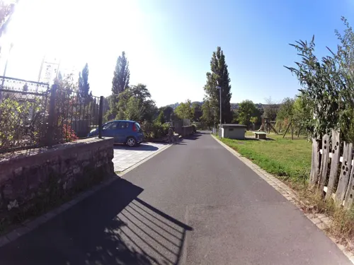

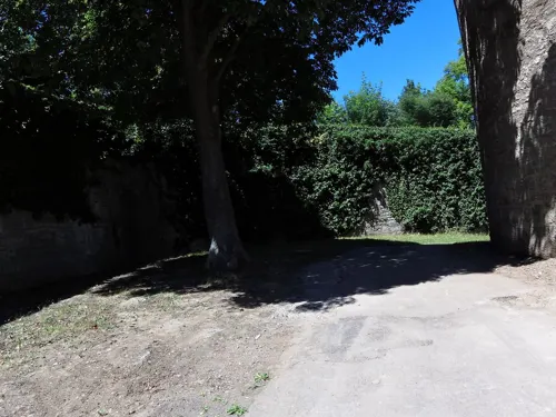
Dicker Turm
Monument and historic site
Wie mappen? Zeichne eine Linie Linienzug entlang der Stadtmauer. Für breite Mauern kann auch die Fläche Fläche oder Gebiet des Bauwerks...
Kellereistraße, Ochsenfurt
Nikolausturm
Monument and historic site
Innen an der südwestlichen Ecke der Stadtbefestigung, schlanker Rundturm mit Zeltdach
Kellereistraße, Ochsenfurt

Klingentor
Monument and historic site
Torturm, fünfgeschossiger, quadratischer Massivbau mit Glockendach, leicht vorkragendem Obergeschoss und rundbogiger Tordurchfahrt


Oberes Tor
Monument and historic site
Torturm,fünfgeschossiger Rechteckturm mit leicht vorkragendem Obergeschoss, Glockendach und rundbogiger Tordurchfahrt
22 more on the map.
Parks, trails and playgrounds9


Mitmachgarten
Park
Öffentlicher Lehr-, Schau-, und Mitmachgarten für klimaresiliente Bepflanzung und Sensorik. Der Garten ist für Veranstaltungen nutzbar.

Seglerjungenschaft Nürnberg e.V.
Marina and boat launch · 1.1 km
Main-km 270,1 LU; Strom/Wasser, Dusche/WC, Slipway

Restaurants and cafes42

Weinbistro Frickenhausen
Cafe · German, Regional, Wine · 2.4 km
Pizza, Flamkuchen, sometimes Burger; outdoor service until 18:00
13 Hauptstraße, Frickenhausen a.Main
Apr-Oct: Mo-Sa 12:00-22:00; Apr-Oct: Su 13:00-22:00


bei Luu
Restaurant · Thai
5/7 Hauptstraße, Ochsenfurt
We,Th,Fr 11:30-14:30,17:30-23:00; Tu,Sa 17:30-23:00; Su,PH...
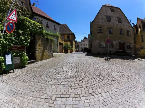
Bäckerei Stephan
Bakery · 2.4 km
1 Valentin-Zang-Straße, Frickenhausen a.Main
Mo,Sa 06:00-12:00; Tu-Fr 06:00-18:00; Su off

Der Bäcker SCHECKENBACH
Bakery
2 Kolpingstraße, Ochsenfurt
Mo,Sa 06:30-13:00; Tu-Fr 06:30-17:30; Su 08:00-13:00; PH 08:00-13:00
Johanns Brauhaus
Restaurant · German
11 Badgasse, Ochsenfurt
Mo,We 17:00-24:00; Sa 15:00-24:00; Su 15:00-24:00


30 more on the map.
Where to stay8
Churches and places of worship18
Maria Schnee
Church · Roman Catholic · 1.3 km
1 Maria-Schnee-Platz, Ochsenfurt
Ev.-Freikirchl. Gemeinde Ochsenfurt
Church · Protestant
8 Dr.-Martin-Luther-Straße, Ochsenfurt
Jehovas Zeugen Ochsenfurt
Church · Jehovahs Witness · 1.1 km
42 Tückelhäuser Straße, Ochsenfurt
Kapuzinerkirche St. Maria
Church · Catholic · 0.7 km
16a Uffenheimer Straße, Ochsenfurt
Neuapostolische Kirche
Church · New Apostolic · 1.3 km
66 Lindhardstraße, Ochsenfurt
Shopping16
Gas and EV charging7
Schools, colleges and libraries6
ehemalige Verbandsschule Eibelstadt / Frickenhausen
School · 2.3 km
17 Geheusteige, Frickenhausen a.Main
Healthcare7
Map of Ochsenfurt
149 places. The map loads OpenStreetMap tiles when you open it.
Getting there and nearby towns
Verkehrslandeplatz Giebelstadt (GHF) is the nearest airport with scheduled flights listed in OpenStreetMap, 7 km away.
- Würzburg 16 km northwest, about 16 min by car
- Veitshöchheim 23 km northwest, about 23 min by car
- Lauda-Königshofen 28 km southwest, about 28 min by car
- Bad Mergentheim 28 km southwest, about 28 min by car
- Tauberbischofsheim 29 km west, about 29 min by car
- Rothenburg ob der Tauber 33 km south, about 33 min by car
- Werneck 35 km north, about 35 min by car
- Wertheim 41 km west, about 41 min by car
- Schweinfurt 44 km north, about 44 min by car
- Künzelsau 51 km southwest, about 51 min by car
Drive times are estimates from straight-line distance, not routes.
Local news
Headlines from INDB.
Reviews, tips and questions
Loading what members have shared...
Sources and licences
- GeoNames (CC BY 4.0): population, coordinates, regions and time zone
- Mapillary (see each image): photos
- OpenStreetMap contributors (ODbL 1.0): places, airports, map data
- Wikidata (CC0 1.0): elevation, founding date, time zone, website
- Wikimedia Commons (see each image): photos
- Wikipedia (CC BY-SA 4.0): overview and history text
Photo credits
- Bahnhof Ochsenfurt Einzelfahrt, V200 001, Public domain
- Ochsenfurt, Kellereistraße 7 20251104 001, Georg Karl Ell, CC BY-SA 4.0
- Ochsenfurt, Kellereistraße 7 20251104 002, Georg Karl Ell, CC BY-SA 4.0
- Ochsenfurt, Kellereistraße 11 20251104 001, Georg Karl Ell, CC BY-SA 4.0
- Ochsenfurt, Kellereistraße 11 20251104 003, Georg Karl Ell, CC BY-SA 4.0
- Ochsenfurt, Kellereistraße 13 20251104 003, Georg Karl Ell, CC BY-SA 4.0
- Ochsenfurt, Kellereistraße 13 20251104 002, Georg Karl Ell, CC BY-SA 4.0
- Ochsenfurt, Kellereistraße 13 20251104 001, Georg Karl Ell, CC BY-SA 4.0
- Ochsenfurt, westliches Ende der Hauptstraße, das Klingentor, Dguendel, CC BY 4.0
- In Ochsenfurt - wo sonst? - geo.hlipp.de - 14025, Udo und Joan Fugel on geo.hlipp.de, CC BY-SA 2.0
- Frickenhausen, Joachimsturm-002, Tilman2007, CC BY-SA 3.0
- Frickenhausen, Maintor-003, Tilman2007, CC BY-SA 3.0
- Hauptstraße 17 Frickenhausen am Main 20210306 002, Tilman2007, CC BY-SA 4.0
- Ochsenfurt Wagstraße 4a Casablanca, Photo: Andreas Praefcke, Public domain
- St. Andreas-bjs110504-01, Bjs, CC BY-SA 3.0
- Kreuzkirche bjs110504-03, Bjs, CC BY-SA 3.0
- Kreuzigungsgruppe-bjs110504-02, Bjs, CC BY-SA 3.0
- Kleinochsenfurt, Maria-Schnee-Platz 1, Kirche Maria Schnee Ochsenfurt 20210306 003, Tilman2007, CC BY-SA 4.0
- Ochsenfurt, Spitalgasse 13-001, Tilman2007, CC BY-SA 3.0
- St. Maria im Schnee 7281, Creosoph, CC0
- Mapillary (ZXStreetview) 2026-06-04 12H24M09S000 (1374745377929613 at kGcsRIyeU9aBbT7vw4XZDp), ZXStreetview, CC BY-SA 4.0
- Mapillary (ZXStreetview) 2026-06-04 12H24M08S000 (1335318087945649 at kGcsRIyeU9aBbT7vw4XZDp), ZXStreetview, CC BY-SA 4.0
- Mapillary (ZXStreetview) 2026-06-04 12H24M10S000 (1364179742253006 at kGcsRIyeU9aBbT7vw4XZDp), ZXStreetview, CC BY-SA 4.0
- Mapillary (ZXStreetview) 2026-06-04 12H24M07S000 (1025621666480094 at kGcsRIyeU9aBbT7vw4XZDp), ZXStreetview, CC BY-SA 4.0
- Mapillary (ZXStreetview) 2026-06-04 12H24M11S000 (1152236203782713 at kGcsRIyeU9aBbT7vw4XZDp), ZXStreetview, CC BY-SA 4.0
- Mapillary (ZXStreetview) 2026-06-04 12H24M06S000 (942725612158239 at kGcsRIyeU9aBbT7vw4XZDp), ZXStreetview, CC BY-SA 4.0
- Mapillary (ZXStreetview) 2026-06-04 12H24M12S000 (1018851437735517 at kGcsRIyeU9aBbT7vw4XZDp), ZXStreetview, CC BY-SA 4.0
- Mapillary (ZXStreetview) 2026-06-04 12H24M05S000 (2807473619651015 at kGcsRIyeU9aBbT7vw4XZDp), ZXStreetview, CC BY-SA 4.0
- Mapillary (ZXStreetview) 2026-06-04 12H24M13S000 (36491519197160601 at kGcsRIyeU9aBbT7vw4XZDp), ZXStreetview, CC BY-SA 4.0
- Mapillary (ZXStreetview) 2026-06-04 12H24M04S000 (1075443465073207 at kGcsRIyeU9aBbT7vw4XZDp), ZXStreetview, CC BY-SA 4.0
- Mapillary (ZXStreetview) 2026-06-04 12H24M04S000 (2831925143808331 at kGcsRIyeU9aBbT7vw4XZDp), ZXStreetview, CC BY-SA 4.0
- Mapillary (ZXStreetview) 2026-06-04 12H24M14S000 (2044260779504257 at kGcsRIyeU9aBbT7vw4XZDp), ZXStreetview, CC BY-SA 4.0
- Mapillary (ZXStreetview) 2026-06-04 12H24M03S000 (909694038811114 at kGcsRIyeU9aBbT7vw4XZDp), ZXStreetview, CC BY-SA 4.0
- Stadtmauer - panoramio (12), Immanuel Giel, CC BY 3.0
- Mapillary (ZXStreetview) 2026-06-04 12H24M15S000 (1515225116152647 at kGcsRIyeU9aBbT7vw4XZDp), ZXStreetview, CC BY-SA 4.0
- Mapillary (ZXStreetview) 2026-06-04 12H24M02S000 (1331859755722850 at kGcsRIyeU9aBbT7vw4XZDp), ZXStreetview, CC BY-SA 4.0
- Mapillary (ZXStreetview) 2026-06-04 12H24M01S000 (2025680921369623 at kGcsRIyeU9aBbT7vw4XZDp), ZXStreetview, CC BY-SA 4.0
- Mapillary (ZXStreetview) 2026-06-04 12H24M16S000 (1340417954181741 at kGcsRIyeU9aBbT7vw4XZDp), ZXStreetview, CC BY-SA 4.0
- Mapillary (ZXStreetview) 2026-06-04 12H24M01S000 (1661348605156506 at kGcsRIyeU9aBbT7vw4XZDp), ZXStreetview, CC BY-SA 4.0
- Mapillary (ZXStreetview) 2026-06-04 12H24M18S000 (869448259563615 at kGcsRIyeU9aBbT7vw4XZDp), ZXStreetview, CC BY-SA 4.0
- Ochsenfurt, das Klingentor DmD-6-79-170-51 foto7 2016-08-07 10.51, Michielverbeek, CC BY-SA 4.0
- Ochsenfurt-Hohestadt Baudenkmal D-6-79-170-320 Bildstock Lohweg 2 0728, Creosoph, CC0
- Ochsenfurt, straatzicht die Hauptstrasse-Zwinger met das Oberes Tor DmD-6-79-170-93 foto8 2016-08-07 10.33, Michielverbeek, CC BY-SA 4.0
- Street-level photo, zoegglmeyr1, CC BY-SA 4.0
- Street-level photo, zoegglmeyr, CC BY-SA 4.0
- Street-level photo, zoegglmeyr, CC BY-SA 4.0
- Street-level photo, zoegglmeyr, CC BY-SA 4.0
- Street-level photo, zoegglmeyr1, CC BY-SA 4.0
- Street-level photo, zoegglmeyr, CC BY-SA 4.0
- Street-level photo, zoegglmeyr, CC BY-SA 4.0
- Street-level photo, zoegglmeyr1, CC BY-SA 4.0
- Street-level photo, zoegglmeyr1, CC BY-SA 4.0
- Street-level photo, zoegglmeyr1, CC BY-SA 4.0
- Street-level photo, zoegglmeyr1, CC BY-SA 4.0
- Street-level photo, zoegglmeyr, CC BY-SA 4.0
- Street-level photo, zoegglmeyr1, CC BY-SA 4.0
- Street-level photo, zoegglmeyr, CC BY-SA 4.0
- Street-level photo, ramap, CC BY-SA 4.0
- Street-level photo, zoegglmeyr1, CC BY-SA 4.0
- Street-level photo, zoegglmeyr1, CC BY-SA 4.0
- Street-level photo, zoegglmeyr1, CC BY-SA 4.0


Page built November 8, 2026. Spotted a mistake? Tell us or suggest a place.