


Bad Mergentheim, Germany
Bad Mergentheim is a town of 22,472 people in Baden-Wurttemberg, Germany.
Why visit Bad Mergentheim
Townapedia lists 199 museums and landmarks, 45 parks and trails, 131 places to eat, 26 places to stay and 26 attractions in and around town.
Highlights include Wildpark Bad Mergentheim, Bad Mergentheim, Deutschordensmuseum and Tauberphilharmonie.
Weather in Bad Mergentheim
Forecast from MET Norway (CC BY 4.0). Full forecast
About Bad Mergentheim
Bad Mergentheim (German: [baːt ˈmɛʁɡn̩thaɪm] ; Mergentheim until 1926; East Franconian: Märchedol) is a town in the Main-Tauber-Kreis district in the German state of Baden-Württemberg. It has a population of around 23,000. An officially recognized spa town since 1926, Bad Mergentheim is also known as the headquarters of the Teutonic Order from 1526 until 1809.
From the Wikipedia article Bad Mergentheim (this version), under CC BY-SA 4.0.
Travel tips from other travellers: Bad Mergentheim on Wikivoyage (CC BY-SA 4.0).
Things to do26

Wildpark Bad Mergentheim
Zoo and aquarium · 2.9 km
Sa,Su,PH 10:30-17:00

Bad Mergentheim
Monument and historic site
Municipality in Main-Tauber-Kreis, Baden-Württemberg, Germany





14 more on the map.
Museums and landmarks199

Deutschordensmuseum
Museum
16 Schloss, Bad Mergentheim
Apr-Oct We-Su 10:30-17:00; Jan-Mar, Nov, Dec We-Sa 14:00-17:00;...

Tauberphilharmonie
Museum · 8.9 km
19 August-Laukhuff-Straße, Weikersheim
unknown "Öffnungszeiten auf der Internetseite"


Unterschüpfer Wasserschloss
Monument and historic site · 6.6 km
15 Unterschüpfer Straße


Weikersheim Palace
Museum · 8.9 km
Palace in Weikersheim, Baden-Württemberg. Germany

187 more on the map.
Parks, trails and playgrounds45




33 more on the map.
Restaurants and cafes131
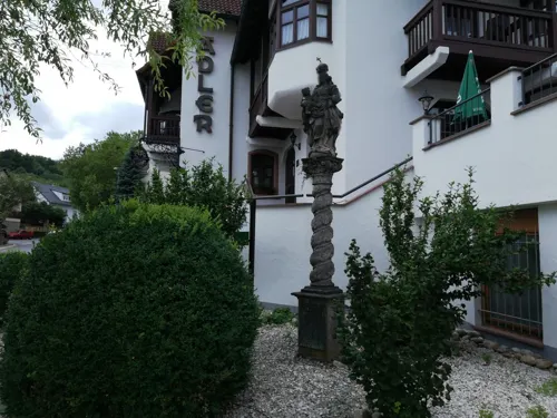
Adler
Restaurant · Regional · 7.9 km
24 Weinstraße, Lauda-Königshofen
Mo-Fr 16:00-23:00; Sa, Su 11:00-23:00

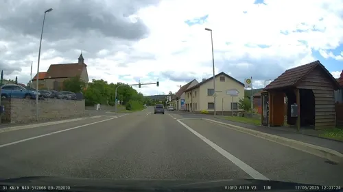
Edelfinger Hof
Restaurant · Regional, German · 2.7 km
14 Landstraße, Bad Mergentheim
11:30-14:00,17:00-21:30

Flair Hotel Weinstube Lochner
Restaurant · Regional · 4.8 km
39 Hauptstraße, Bad Mergentheim
12:00-14:00,18:00-21:30; Mo off
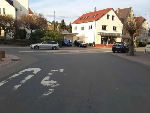

Gasthaus zur Rose
Restaurant · German · 6.6 km
9 Turmbergstraße, Lauda-Königshofen
Mo-We 16:30+; Sa 11:30-14:00, 16:30+; Su 11:30-14:30; Th,Fr off
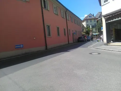
MANA LISA
Restaurant · Regional · 7.3 km
38 Am Hummelacker, Lauda-Königshofen
Summer: Mo-Su 18:00-22:00; Winter: Mo-Sa 18:00-22:00
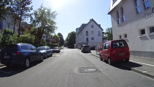
Restaurant DasSchaffers
Restaurant · Regional, German, Breakfast, Fish, European, Brunch, Western
3 Edelfinger Straße, Bad Mergentheim
Mo-Sa 17:00-23:00
Restaurant am Golfplatz Bad Mergentheim
Restaurant · International, Regional · 1.9 km
36 Erlenbachtalstraße, Igersheim
Mo-Su 10:00-22:00
SV Vereinsheim, Gaststätte
Restaurant · Regional · 4.5 km
5 Unterer Wasen, Bad Mergentheim
Tu-Su 10:00-23:00


119 more on the map.
History
Mergentheim is mentioned in chronicles as early as 1058, as the residence of the family of the counts of Hohenlohe. The brothers Andreas, Heinrich and Friedrich von Hohenlohe joined the Deutscher Orden (Teutonic Order) in 1219 and gave their two castles near Mergentheim to the order. One was abandoned, the other became the seat of the local Komtur (commander) of the order.
Following the Order's conquest of East Prussia and part of Livland in the 1230s, in 1309 the Grand Master of the order moved to the Marienburg. In 1340 Mergentheim was awarded town privileges. It rapidly became the most important of the eleven commanderies of the Teutonic Order. The Deutschmeister, highest ranking member inside the Holy Roman Empire (to which Prussia did not belong), moved his seat to Mergentheim in 1525 after his castle at Hornberg/Neckar had been destroyed by peasants. That same year, Grand Master Albrecht von Zollern-Brandenburg resigned his position, left the order, introduced Reformation, married and – supported by his liege lord the King of Poland – turned the order's eastern territories into a temporal duchy. The rulers of the order in Germany, now styling themselves Hoch- und Deutschmeister, then made Mergentheim the order's new headquarters and expanded the castle into a palatial residence.
From the History section of Bad Mergentheim on Wikipedia, under CC BY-SA 4.0.
Where to stay26
Churches and places of worship56
Evangelische Kirche
Church · Lutheran · 3.1 km
5 Alte Schulstraße, Bad Mergentheim
Kulturkirche Unterschüpf
Church · Lutheran · 6.6 km
13B Tottenheimer Straße, Boxberg
Mariä Krönung
Church · Roman Catholic · 5.7 km
30 Grünewaldstraße, Bad Mergentheim
Shopping32
Gas and EV charging13
Schools, colleges and libraries15
Healthcare20
Map of Bad Mergentheim
250 places. The map loads OpenStreetMap tiles when you open it.
Getting there and nearby towns
Verkehrslandeplatz Giebelstadt (GHF) is the nearest airport with scheduled flights listed in OpenStreetMap, 22 km away.
- Tauberbischofsheim 17 km northwest, about 17 min by car
- Künzelsau 24 km south, about 24 min by car
- Walldürn 31 km west, about 31 min by car
- Würzburg 36 km north, about 36 min by car
- Wertheim 35 km northwest, about 35 min by car
- Öhringen 38 km southwest, about 38 min by car
- Schwäbisch Hall 42 km south, about 42 min by car
- Bretzfeld 42 km southwest, about 42 min by car
- Crailsheim 45 km southeast, about 45 min by car
- Mosbach 48 km west, about 48 min by car
Drive times are estimates from straight-line distance, not routes.
Local news
Headlines from INDB.
Reviews, tips and questions
Loading what members have shared...
Sources and licences
- GeoNames (CC BY 4.0): population, coordinates, regions and time zone
- Mapillary (see each image): photos
- OpenStreetMap contributors (ODbL 1.0): places, airports, map data
- Wikidata (CC0 1.0): elevation, founding date, time zone, website, landmarks and historic places
- Wikimedia Commons (see each image): photos
- Wikipedia (CC BY-SA 4.0): overview and history text
Photo credits
- Härterichsstraße 1 Bad Mergentheim 20230104 0158, Tilman2007, CC BY-SA 4.0
- Gänsmarkt 11 (Bad Mergentheim) 02, Schorle, CC BY-SA 4.0
- Bad Mergentheim, Härterichstraße 1 20170707 001, Tilman2007, CC BY-SA 4.0
- Nonnengasse 5 Bad Mergentheim 20230104 0164, Tilman2007, CC BY-SA 4.0
- Gänsmarkt 11 Bad Mergentheim 20230104 0151, Tilman2007, CC BY-SA 4.0
- Gänsmarkt 11 Bad Mergentheim 20230104 0152, Tilman2007, CC BY-SA 4.0
- Nonnengasse 5 Bad Mergentheim 20230104 0163, Tilman2007, CC BY-SA 4.0
- Gänsmarkt 11 Bad Mergentheim 20230104 0153, Tilman2007, CC BY-SA 4.0
- Bad Mergentheim, Nonnengasse 5 20170707 001, Tilman2007, CC BY-SA 4.0
- Bad Mergentheim- Platz und Turm der Schlosskirche - LABW - Staatsarchiv Freiburg W 134 Nr. 061408b, Willy Pragher, CC BY 4.0
- Nonnengasse 1 Bad Mergentheim 20230104 0162, Tilman2007, CC BY-SA 4.0
- Gänsmarkt 11 (Bad Mergentheim) 04, Schorle, CC BY-SA 4.0
- Kiliansbrunnen Bad Mergentheim 2025-06-17, Hubert Berberich ( HubiB ), CC BY 4.0
- Blaue Stunde in Bad Mergentheim. 06, Holger Uwe Schmitt, CC BY-SA 4.0
- Gänsmarkt, Kiliansbrunnen Bad Mergentheim 20230104 0149, Tilman2007, CC BY-SA 4.0
- Johanniterhof 1 Bad Mergentheim 20230104 0145, Tilman2007, CC BY-SA 4.0
- Nonnengasse 15 Bad Mergentheim 20230104 0165, Tilman2007, CC BY-SA 4.0
- Bad Mergentheim, Gänsmarkt, Brunnen 20170707 001, Tilman2007, CC BY-SA 4.0
- Bad Mergentheim- Platz und Turm der Schlosskirche - LABW - Staatsarchiv Freiburg W 134 Nr. 061408a, Willy Pragher, CC BY 4.0
- Blaue Stunde in Bad Mergentheim. 05, Holger Uwe Schmitt, CC BY-SA 4.0
- MGH-Marktplatz Zwillingshäuser 2019-06-03, Hubert Berberich ( HubiB ), CC BY-SA 3.0
- Schloss und Park Weikersheim, Schorle, CC BY-SA 3.0
- Wildparkeingang MGH, Schorle, CC BY-SA 3.0
- Aschaffenburger Altar, Mitteltafel: Maria mit Kind (Stuppacher-Madonna), Matthias Grünewald, Public domain
- Aerial image of Schloss Mergentheim (view from the southwest), Carsten Steger, CC BY-SA 4.0
- DZM-Herbst Haupteingang 2011-10, Melli Sugar, CC BY-SA 3.0
- Deutschordensmuseum 06, Immanuel Giel, CC BY-SA 4.0
- 199404Unterschuepf1, AnRo0002, CC0
- Caritas Mergentheim Eingang, Schorle, CC BY-SA 4.0
- Bad Mergentheim 2010 003, Klaus Graf, CC BY-SA 3.0
- Herbstlicher Spaziergang durch die Becksteiner Weingärten. 13, Holger Uwe Schmitt, CC BY-SA 4.0
- Bad Mergentheim aus der Vogelperspektive. Würth, hoch über der Stadt, Holger Uwe Schmitt, CC BY-SA 4.0
- Jakobsweg Main-Taubertal zwischen Markelsheim und Weikersheim 01, Triplec85, CC0
- NSG Mehlberg, H. Beierstettel, CC BY-SA 4.0
- 2016-12-28 Bad Mergentheim - 1, Triplec85, CC0
- Terrassenfreibad Lauda Öffentliches Schwimmbad - 1, Triplec85, CC BY 4.0
- Walterstal (Lauda-Königshofen) 04, Triplec85, CC BY-SA 4.0
- Naturschutzgebiet Ringelstaler-Weinhalde - 3, Triplec85, CC0
- NSG Kailstadt-Mühlhelde, H. Beierstettel, CC BY-SA 4.0
- Blick über Sachsenflur zum Naturschutzgebiet Hohenberg 05, Triplec85, CC BY-SA 4.0
- NSG Altenberg 2011, H. Beierstettel, CC BY-SA 4.0
- Naturschutzgebiet, Neuhaus, Schild, Karsten Ratzke, CC0
- Tauberphilharmonie Eröffnung 01, Schorle, CC BY-SA 4.0
- Sport-, Freizeit- und Schulzentrum Unterbalbach 12, Triplec85, CC0
- DHBW Bad Mergentheim Schloss 2020, Hubert Berberich ( HubiB ), CC BY 3.0
- Wohnmobilstellplatz Bad Mergentheim, Hubert Berberich ( HubiB ), CC BY-SA 3.0
- Spaziergang durch Bad Mergentheim. 23, Holger Uwe Schmitt, CC BY-SA 4.0
- Bad Mergentheim, St. Wolfgangs Kapelle, Honigtopf23, CC BY-SA 4.0
- Klinik Hohenlohe MGH, Hubert Berberich ( HubiB ), CC BY-SA 3.0
- Bad Mergentheim, Marktplatz 1, von Süden 20170707 001, Tilman2007, CC BY-SA 4.0
- Das Bad Mergentheimer Deutschordensschloss. 01, Holger Uwe Schmitt, CC BY-SA 4.0
- Schloss Unterschüpf. 01, Holger Uwe Schmitt, CC BY-SA 4.0
- Schloss Sachsenflur, Holger Uwe Schmitt, CC BY-SA 4.0
- Wartturm Weikersheim 130609, BerndH, CC BY-SA 3.0
- Bad Mergentheim, Marktplatz 12 20170707 001, Tilman2007, CC BY-SA 4.0
- 2010-05-23 Bad Mergentheim, Schlosskirche (12), Rensi, Public domain
- Edelfingen Evangelische Kirche, Schorle, CC BY-SA 3.0
- Evangelische Kirche Unterschüpf 03, MJ200506, CC0
- Main-Tauber-Kreis Bad Mergentheim Stuppach Kirche Mariä Krönung4, MSeses, CC BY-SA 4.0
- St. Aegidius Harthausen (Igersheim) mit Friedhof 2009, HfrancH ( Diskussion ) / HfrancH at German Wikipedia, CC BY-SA 3.0
- Elpersheim Pfarrkirche 01, Schorle, CC BY-SA 3.0 de
- Kapelle Maria Immaculata 04, Schorle, CC BY-SA 4.0
- Hofstetten bei Lauda-Königshofen 01, Triplec85, CC BY-SA 4.0
- Unterschüpf - 4, Triplec85, CC BY 4.0
- Bad Mergentheim, Gänsmarkt 3 20170707 001, Tilman2007, CC BY-SA 4.0
- Bad Mergentheim, Marktplatz 14 20170707 001, Tilman2007, CC BY-SA 4.0
- Bad Mergentheim, Marktplatz 17 20170707 001, Tilman2007, CC BY-SA 4.0
- Kopernikus-Realschule Bad Mergentheim, FelixmaxYT, CC0
- Landappbw 1022536 1822 Burg Neuhaus Igersheim, Stefan Gerl, CC0
- Flair Hotel Weinstube Lochner, Markelsheim - geo-en.hlipp.de - 12944, Mike Pennington, CC BY-SA 2.0
- Street-level photo, burgerwolfgang, CC BY-SA 4.0
- Street-level photo, bernd_niemann, CC BY-SA 4.0
- Street-level photo, ramap, CC BY-SA 4.0
- Street-level photo, tim3003, CC BY-SA 4.0
- Street-level photo, changchun1, CC BY-SA 4.0
- Street-level photo, changchun1, CC BY-SA 4.0
- Street-level photo, bufonto, CC BY-SA 4.0
- Street-level photo, bernd_niemann, CC BY-SA 4.0
- Street-level photo, tweedy, CC BY-SA 4.0
- Street-level photo, kreuzschnabel, CC BY-SA 4.0
- Street-level photo, nickth, CC BY-SA 4.0
- Street-level photo, burgerwolfgang, CC BY-SA 4.0
- Street-level photo, ramap, CC BY-SA 4.0
- Street-level photo, changchun1, CC BY-SA 4.0
- Street-level photo, bernd_niemann, CC BY-SA 4.0
- Street-level photo, changchun1, CC BY-SA 4.0
- Street-level photo, tim3003, CC BY-SA 4.0
- Street-level photo, tim3003, CC BY-SA 4.0


Page built November 8, 2026. Spotted a mistake? Tell us or suggest a place.