


Why visit Regenstauf
Townapedia lists 51 museums and landmarks, 12 parks and trails, 86 places to eat, 7 places to stay and 23 attractions in and around town.
Highlights include Nibelungen Bridge, Spargelhof Weilhammer, Schloss Ramspau and Schloss Spindlhof.
Weather in Regenstauf
Forecast from MET Norway (CC BY 4.0). Full forecast
About Regenstauf
Regenstauf is a municipality in the district of Regensburg, in Bavaria, Germany. It is situated on the river Regen, 12 km north of Regensburg.
From the Wikipedia article Regenstauf (this version), under CC BY-SA 4.0.
Things to do23

Nibelungen Bridge
Bridge · 11.1 km
Road structure in Regensburg, Germany


Stone Bridge
Bridge · 11.2 km
12th-century bridge across the Danube in Regensburg, Germany


11 more on the map.
Museums and landmarks51


Schloss Spindlhof
Monument and historic site · 1.3 km
23 Spindlhofstraße, Regenstauf

Castra Regina
Monument and historic site · 11.4 km
Roman legionary fortress at the site of modern Regensburg, Germany

Donaustauf Castle
Monument and historic site · 11.4 km
Building in Donaustauf, Upper Palatinate, Germany

Museum der Bayerischen Geschichte
Museum · 11.3 km
History museum in Regensburg, Germany





39 more on the map.
Parks, trails and playgrounds12


Restaurants and cafes86

Pizzeria Pielmühle
Restaurant · Italian · 7.2 km
24 Regendorfer Straße, Lappersdorf
Mo 17:00-23:00;We-Sa 17:00-23:00; Su 11:30-14:00,17:00-23:00
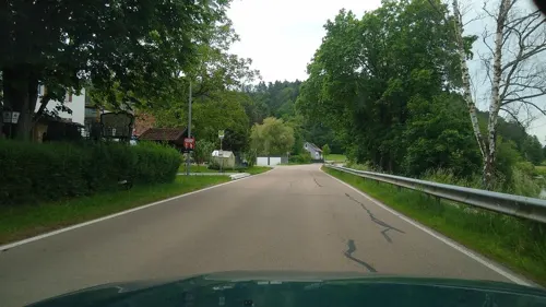
CHASKA Regenstauf
Restaurant · Indian · 7.4 km
5 Alte Regenstraße
Sa,Su 12:00-22:00; Mo-Fr 11:00-14:00,17:00-22:00
Eichmühle
Restaurant · Bavarian · 0.9 km
1 Zur Mühle, Regenstauf
Tu-Fr 17:00-01:00, Sa 14:00-01:00, Su 11:00-01:00
El Greco
Restaurant · Greek · 1.0 km
1 Schwandorfer Straße, Regenstauf
Su 11:00-14:00, 17:30-21:30; Tu-Sa 17:30-21:30
Hotel-Restaurant Götzfried
Restaurant · Regional · 7.9 km
1 Wutzlhofen, Regensburg
Mo-Sa 18:00-23:00; Su 12:00-21:00
Korfu
Restaurant · Greek · 8.5 km
31 Regensburger Straße, Lappersdorf
Tu-Sa 19:00-22:00; Su 11:30-14:00,19:00-22:00
La Pineta
Restaurant · Italian · 8.3 km
1 Regensburger Straße, Lappersdorf
Tu-Sa 17:00-23:00; Su 11:00-14:00,17:00-22:00

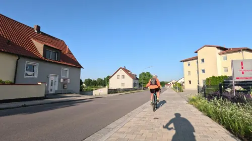


Pizzaland Esposito
Restaurant · Italian · 1.0 km
3a Diesenbacher Straße
Fr-Su 16:00-22:00; Tu-Th 10:30-14:00, 17:00-21:00
74 more on the map.
Where to stay7
Churches and places of worship39
Mariä Himmelfahrt
Church · Roman Catholic · 8.4 km
2 Kirchberg, Lappersdorf
Maria Himmelfahrt
Church · Roman Catholic · 6.5 km
7 Grünthaler Straße, Wenzenbach
St. Ägidius
Church · Roman Catholic · 7.6 km
13 Pfarrstraße, Lappersdorf
St. Laurentius
Church · Roman Catholic · 6.5 km
3 Kirchplatz, Lappersdorf
St. Michael
Church · Roman Catholic · 7.5 km
10 Alte Regenstraße, Regenstauf
Shopping36
Gas and EV charging17
Schools, colleges and libraries20
Healthcare8
Map of Regenstauf
250 places. The map loads OpenStreetMap tiles when you open it.
Getting there and nearby towns
Flugplatz Straubing-Wallmühle (RBM) is the nearest airport with scheduled flights listed in OpenStreetMap, 37 km away.
- Regensburg 12 km south, about 12 min by car
- Roding 29 km east, about 29 min by car
- Straubing 42 km southeast, about 42 min by car
- Sulzbach-Rosenberg 51 km northwest, about 51 min by car
- Ingolstadt 65 km southwest, about 1 h by car
- Wolnzach 68 km southwest, about 1 h 15 min by car
- Wendelstein 76 km west, about 1 h 15 min by car
- Röthenbach an der Pegnitz 76 km northwest, about 1 h 15 min by car
- Roth 77 km west, about 1 h 15 min by car
- Nuremberg 85 km northwest, about 1 h 30 min by car
Drive times are estimates from straight-line distance, not routes.
Local news
Headlines from INDB.
Reviews, tips and questions
Loading what members have shared...
Sources and licences
- GeoNames (CC BY 4.0): population, coordinates, regions and time zone
- Mapillary (see each image): photos
- OpenStreetMap contributors (ODbL 1.0): places, airports, map data
- Wikidata (CC0 1.0): elevation, founding date, time zone, website, landmarks and historic places
- Wikimedia Commons (see each image): photos
- Wikipedia (CC BY-SA 4.0): overview and history text
Photo credits
- Regenstauf Innenstadt, No machine-readable author provided. Startaq assumed (based on copyright claims)., CC BY 2.5
- Regenstauf - panoramio (1), Hans100, CC BY 3.0
- Regenstauf, Bavière - panoramio, Kobzarius, CC BY 3.0
- Un regard sur la Seconde guerre à la chapelle de Regenstauf - panoramio, Kobzarius, CC BY 3.0
- Regenstauf - panoramio, Hans100, CC BY 3.0
- Regenstauf - panoramio (2), Hans100, CC BY 3.0
- Säulengang der Walhalla bei Regenstauf (8008657870), Heribert Pohl --- Thanks for half a million clicks! from Germering bei München, Bayern, CC BY-SA 2.0
- St. Jacobus Regenstauf, Clemensfranz, CC BY-SA 4.0
- Ruhmeshalle Walhalla bei Regenstaufen (8008652725), Heribert Pohl --- Thanks for half a million clicks! from Germering bei München, Bayern, CC BY-SA 2.0
- Regenstauf Townhall, Startaq, CC BY-SA 3.0
- Regenstauf Beobachtungsturm 2, Sioz2k6, CC BY-SA 3.0
- Der Regen in Regenstauf, High Contrast, CC BY 3.0 de
- Regenstauf mit Aussichtsturm am Schlossberg - panoramio, planola, CC BY 3.0
- Regensburg - panoramio (73), Hans100, CC BY 3.0
- Regensburg - Steinerne Bruecke ohne Dom, Hytrion at German Wikipedia, CC BY-SA 3.0
- Legionslager Castra Regina, Burkhard Mücke, CC BY-SA 4.0
- Burg bei Donaustauf 3, Bkmd, Public domain
- Museum der Bayerischen Geschichte Regensburg, Burkhard Mücke, CC BY-SA 4.0
- 00 2273 Regensburger Dom, W. Bulach, CC BY-SA 4.0
- Ruine Forstenberg, Rainer Strobel, CC BY-SA 3.0
- Schloss Karlstein-1, luckyprof, CC BY-SA 3.0
- Schloss Ramspau mit Garten, FVL, CC BY-SA 3.0
- Spindlhof, Smardis, CC BY-SA 3.0
- Altes Schloss Maxhuette-Haidhof Leonberg, Rainer Strobel, CC BY-SA 3.0
- Schloss Pirkensee 02, Helmlechner, CC0
- Loretokirche in Kürn, MagnusBB, CC0
- Heilige Dreifaltigkeit Regendorf 2014, Johanning, CC BY-SA 4.0
- Schloss Regendorf 2014, Johanning, CC BY-SA 4.0
- Schloss Schönberg (Wenzenbach), Johanning, CC BY-SA 3.0
- Irlbach Mariä Himmelfahrt, H.Helmlechner, CC BY-SA 4.0
- Kapelle zum Gegeißelten Heiland Thanhausen 2014, Johanning, CC BY-SA 4.0
- Heilinghausen (Wallfahrtskirche St. Michae-1l), luckyprof, CC BY-SA 3.0
- Ramspau - St. Laurentius 2012, Johanning, CC BY-SA 3.0
- 13.06.18 Lorenzen St.Laurentius, Gehsport-sepp ( Diskussion ), CC BY-SA 4.0
- Pirkensee, Christ König (02), Subbass1, CC BY-SA 4.0
- Schloss Pirkensee 05, Helmlechner, CC0
- Schloss Pirkensee 01, Helmlechner, CC0
- St. Ägidius Hainsacker, Helmlechner, CC0
- Heilinghausen (Wallfahrtskirche St. Michael-2), luckyprof, CC BY-SA 3.0
- Lappersdorf - panoramio (2), Hans100, CC BY 3.0
- Zeitlberg Sunset - panoramio, M a ✗, CC BY 3.0
- Street-level photo, rnissl, CC BY-SA 4.0
- Street-level photo, wegavision, CC BY-SA 4.0
- Street-level photo, toaskoas, CC BY-SA 4.0
- Street-level photo, rnissl, CC BY-SA 4.0
- Street-level photo, rnissl, CC BY-SA 4.0
- Street-level photo, rnissl, CC BY-SA 4.0
- Street-level photo, ramap, CC BY-SA 4.0
- Street-level photo, ledermann, CC BY-SA 4.0


Page built November 8, 2026. Spotted a mistake? Tell us or suggest a place.